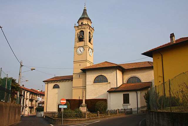
Анджера (Angera, Angera)
.svg)
- коммуна Италии
 Hiking in Анджера
Angera, located on the shores of Lake Maggiore in Northern Italy, offers a range of hiking options that cater to different levels of experience. The area is known for its beautiful landscapes, scenic views of the lake and surrounding mountains, and charming historical features. Here are some highlights of hiking in Angera:
Trails
-
Sentiero del Monte Corno: This trail leads you through lush forests and provides stunning panoramic views of Lake Maggiore and the surrounding valleys. It’s a moderate hike and can be completed in about 2 to 3 hours.
-
Via delle Genti: This is a longer route that combines portions of ancient paths used for trade and communication. It offers a deeper insight into the local culture and history while providing excellent views.
-
Rocca di Angera: The hike up to the Rocca (fortress) is a popular choice. The path is well-marked and leads to a historical site offering breathtaking views of the lake and surrounding area. The fortress itself is worth exploring for its historical significance and beautiful architecture.
Scenic Views and Nature
- The trails around Angera typically feature diverse flora and fauna. Depending on the season, hikers can enjoy wildflowers in spring, vibrant autumn leaves, and the tranquil beauty of the lake.
- Birdwatchers will appreciate the chance to spot various species, especially around the wetlands and woodlands.
Accessibility
- Many trails in and around Angera are easily accessible, with marked paths and established signs. Most trails vary in difficulty, making them suitable for both beginners and seasoned hikers.
- Ensure you have appropriate footwear and water, as some trails can get steep and rugged.
Tips
- Check local weather conditions before heading out, as weather can change quickly in mountainous areas.
- Always carry a map or a GPS device, especially if you're hiking on less-traveled paths.
- Consider visiting in the off-peak months (like late spring or early fall) to avoid larger crowds and enjoy a quieter experience.
Nearby Attractions
- After your hike, you can visit the charming town of Angera itself, where you’ll find cafes and gelaterias to relax and enjoy local cuisine, or explore the ancient castle that overlooks the lake.
Hiking in Angera is a rewarding experience, combining natural beauty, history, and the serenity of Lake Maggiore. Always follow local guidelines and respect the environment while enjoying your hike!
- Страна:

- Почтовый код: 21021
- Телефонный код: 0331
- Код автомобильного номера: VA
- Координаты: 45° 46' 0" N, 8° 35' 0" E


- GPS треки (wikiloc): [Ссылка]
- Высота над уровнем моря: 193 м m
- Площадь: 17.72 кв.км
- Население: 5583
- Веб сайт: http://www.comune.angera.va.it/
- Википедия русская: wiki(ru)
- Википедия английская: wiki(en)
- Википедия национальная: wiki(it)
- Хранилище Wikidata: Wikidata: Q40817
- Галерея изображений в википедии: [Ссылка]
- Катеория в википедии: [Ссылка]
- код Freebase: [/m/0fqksc]
- код GeoNames: Альт: [6540566]
- код VIAF: Альт: [131419844]
- ID отношения в OpenStreetMap: [45991]
- код темы Quora: [Angera]
- UN/LOCODE: [ITAGE]
- код Цифрового атласа Римской империи: [16523]
- код ISTAT: 012003
- кадастровый код Италии: A290
Граничит с регионами:

Арона
- коммуна Италии
Hiking in Арона
Arona, located on the western shore of Lake Maggiore in the Piedmont region of Italy, offers a variety of hiking opportunities that showcase the stunning natural beauty and diverse landscapes of the area. Here are some highlights and tips for hiking around Arona:...
- Страна:
- Почтовый код: 28041
- Телефонный код: 0322
- Код автомобильного номера: NO
- Координаты: 45° 45' 25" N, 8° 33' 36" E
- GPS треки (wikiloc): [Ссылка]
- Высота над уровнем моря: 212 м m
- Площадь: 15.17 кв.км
- Население: 13966
- Веб сайт: [Ссылка]

Дормеллетто
- Коммуна в Италии, располагается в регионе Пьемонт, подчиняется административному центру Новара.
Hiking in Дормеллетто
Dormelletto is a charming town located near Lake Maggiore in the Piedmont region of northern Italy. While it may not be as well-known as some other hiking destinations, it offers beautiful landscapes and access to several trails that can be enjoyed by hikers of various skill levels....
- Страна:
- Почтовый код: 28040
- Телефонный код: 0322
- Код автомобильного номера: NO
- Координаты: 45° 44' 0" N, 8° 34' 0" E
- GPS треки (wikiloc): [Ссылка]
- Высота над уровнем моря: 236 м m
- Площадь: 7.25 кв.км
- Население: 2600
- Веб сайт: [Ссылка]

Мейна
- коммуна Италии
Hiking in Мейна
Meina is a charming town located on the western shore of Lake Maggiore in Italy, known for its picturesque landscapes and beautiful lakeside views. While Meina itself is relatively small, it offers access to some excellent hiking experiences in the surrounding areas, making it a great destination for outdoor enthusiasts. Here are some aspects of hiking in and around Meina:...
- Страна:
- Почтовый код: 28046
- Телефонный код: 0322
- Код автомобильного номера: NO
- Координаты: 45° 47' 28" N, 8° 32' 15" E
- GPS треки (wikiloc): [Ссылка]
- Высота над уровнем моря: 214 м m
- Площадь: 7.54 кв.км
- Население: 2484
- Веб сайт: [Ссылка]


Тайно
- коммуна в провинции Варезе, регион Ломбардия, Италия
Hiking in Тайно
Taino, located in the Lombardy region of Italy, is a charming village nestled near Lake Maggiore. The area is surrounded by beautiful natural landscapes, making it a great destination for hiking enthusiasts. Here are some highlights and tips for hiking in and around Taino:...
- Страна:
- Почтовый код: 21020
- Телефонный код: 0331
- Код автомобильного номера: VA
- Координаты: 45° 46' 0" N, 8° 37' 0" E
- GPS треки (wikiloc): [Ссылка]
- Высота над уровнем моря: 262 м m
- Площадь: 7 кв.км
- Население: 3697
- Веб сайт: [Ссылка]

Ранко
- коммуна Италии
Hiking in Ранко
Ranco, located in the Lombardy region of Italy, is a charming small town on the shores of Lake Maggiore. The scenic beauty of the area, combined with its mild climate, makes it an attractive destination for hikers and outdoor enthusiasts....
- Страна:
- Почтовый код: 21020
- Телефонный код: 0331
- Код автомобильного номера: VA
- Координаты: 45° 48' 0" N, 8° 34' 0" E
- GPS треки (wikiloc): [Ссылка]
- Высота над уровнем моря: 214 м m
- Площадь: 6.76 кв.км
- Население: 1289
- Веб сайт: [Ссылка]


Кадреццате
- коммуна Италии
Hiking in Кадреццате
Cadrezzate, located in the province of Varese in Italy, offers a charming environment for hiking enthusiasts. It's close to the beautiful natural landscapes of the Cuvio Valley and the nearby lakes. Here are some highlights and considerations for hiking in this area:...
- Страна:
- Почтовый код: 21020
- Телефонный код: 0331
- Код автомобильного номера: VA
- Координаты: 45° 47' 52" N, 8° 38' 37" E
- GPS треки (wikiloc): [Ссылка]
- Высота над уровнем моря: 281 м m
- Площадь: 4.73 кв.км
- Население: 1842
- Веб сайт: [Ссылка]


Испра
- коммуна Италии
Hiking in Испра
Ispra is a charming town located by Lake Maggiore in the Lombardy region of northern Italy. It offers a variety of hiking opportunities for outdoor enthusiasts of all experience levels. Here are some highlights and tips for hiking in and around Ispra:...
- Страна:
- Почтовый код: 21027
- Телефонный код: 0332
- Код автомобильного номера: VA
- Координаты: 45° 49' 0" N, 8° 37' 0" E
- GPS треки (wikiloc): [Ссылка]
- Высота над уровнем моря: 220 м m
- Площадь: 15.91 кв.км
- Население: 5276
- Веб сайт: [Ссылка]


Сесто-Календе
- коммуна Италии
Hiking in Сесто-Календе
Sesto Calende is a charming town located in the province of Varese, in the Lombardy region of Italy. It's situated near the shores of Lake Maggiore and along the Ticino River, making it a beautiful destination for outdoor enthusiasts, particularly hikers. Here are some highlights about hiking in and around Sesto Calende:...
- Страна:
- Почтовый код: 21018
- Телефонный код: 0331
- Код автомобильного номера: VA
- Координаты: 45° 44' 0" N, 8° 38' 0" E
- GPS треки (wikiloc): [Ссылка]
- Высота над уровнем моря: 198 м m
- Площадь: 25.04 кв.км
- Население: 11141
- Веб сайт: [Ссылка]