Arbouans (Arbouans)

- коммуна во Франции
 Hiking in Arbouans
Arbouans is a small region near Montbéliard in France, known for its picturesque landscapes and scenic trails. While specific hiking trails in Arbouans may not be widely documented, the surrounding region offers appealing options for outdoor enthusiasts.
Hiking in Arbouans and Surrounding Areas
-
Natural Scenery: The area is characterized by rolling hills, forests, and beautiful views. You can enjoy the serene landscapes and possibly spot various wildlife along the trails.
-
Local Trails: Look for local walking paths and forest trails that may not be officially marked but are well-trodden by locals. These can provide a great way to explore the rural and natural charm of the area.
-
Nearby Parks: If you’re looking for more structured hiking options, consider visiting nearby parks and nature reserves. For instance, the nearby Parc Naturel Régional des Ballons des Vosges offers extensive hiking trails with varying difficulty levels.
-
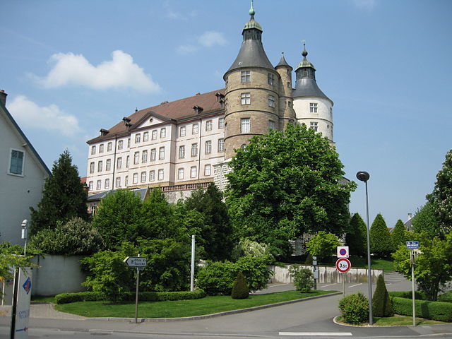
Cultural Nearby Attractions: Combine your hike with a visit to cultural sites or historical areas, such as the nearby city of Montbéliard, which is known for its castle and charming old town.
-
Preparation: As with any hiking, make sure to prepare adequately. Bring enough water, wear appropriate gear, and consider the weather conditions.
-
Local Guides: It might also be a good idea to check for local hiking groups or guides who can offer insights on the best trails and hidden gems in the region.
Tips for a Successful Hiking Experience
- Map and Navigation: Always carry a physical map or a reliable GPS device, as mobile connectivity can be spotty in some rural areas.
- Safety: Let someone know your hiking plans and estimated return time. Hike with a buddy if possible.
- Leave No Trace: Be respectful of nature by following the Leave No Trace principles.
Enjoy your hiking adventures in Arbouans! If you have specific trails or experiences you're curious about, feel free to ask!
- Страна:

- Почтовый код: 25400
- Координаты: 47° 29' 26" N, 6° 48' 37" E


- GPS треки (wikiloc): [Ссылка]
- Площадь: 1.32 кв.км
- Население: 943
- Википедия английская: wiki(en)
- Википедия национальная: wiki(fr)
- Хранилище Wikidata: Wikidata: Q630613
- Катеория в википедии: [Ссылка]
- код Freebase: [/m/03mgbml]
- код Freebase: [/m/03mgbml]
- код GeoNames: Альт: [6447811]
- код GeoNames: Альт: [6447811]
- номер SIREN: [212500201]
- номер SIREN: [212500201]
- код BNF: [15252246k]
- код BNF: [15252246k]
- код VIAF: Альт: [245810793]
- код VIAF: Альт: [245810793]
- код муниципалитета INSEE: 25020
- код муниципалитета INSEE: 25020
Граничит с регионами:

Монбельяр
- коммуна во Франции
Hiking in Монбельяр
Montbéliard, a picturesque town located in the Bourgogne-Franche-Comté region of eastern France, offers various hiking opportunities that allow you to explore the beautiful landscapes and rich history of the area....
- Страна:
- Почтовый код: 25200
- Координаты: 47° 30' 35" N, 6° 47' 54" E
- GPS треки (wikiloc): [Ссылка]
- Высота над уровнем моря: 337 м m
- Площадь: 15.01 кв.км
- Население: 25336
- Веб сайт: [Ссылка]


Voujeaucourt
- коммуна во Франции
Hiking in Voujeaucourt
Voujeaucourt is a small commune located in the Doubs department in the Bourgogne-Franche-Comté region of eastern France. While it may not be as widely known as some larger hiking destinations, the surrounding areas offer opportunities for outdoor activities, including hiking....
- Страна:
- Почтовый код: 25420
- Координаты: 47° 28' 32" N, 6° 46' 28" E
- GPS треки (wikiloc): [Ссылка]
- Площадь: 9.45 кв.км
- Население: 3320
- Веб сайт: [Ссылка]