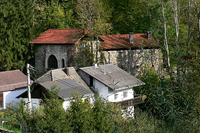
Арнрайт (Arnreit, Arnreit)
- коммуна в федеральной земле Верхняя Австрия, Австрия
 Hiking in Арнрайт
Arnreit is a picturesque village nestled in the Mühlviertel region of Upper Austria, known for its beautiful landscapes and diverse hiking opportunities. Here's an overview to help you make the most of your hiking experience in Arnreit:
Hiking Trails
-
Local Trails: There are various well-marked hiking trails around Arnreit that cater to different skill levels. You can enjoy serene walks along the village outskirts or more challenging routes that take you through dense forests and up into the hills.
-
Mühlviertel Trail: This long-distance trail passes through scenic areas of the Mühlviertel, including sections near Arnreit. It's a great option for experienced hikers looking for a longer trek.
-
Nature Experiences: The surrounding area offers various trails with opportunities to immerse yourself in nature, spot local wildlife, or enjoy the flora. Look for trails that lead to viewpoints for picturesque vistas of the surrounding countryside.
Key Attractions
- Scenic Views: Many trails will lead you to high points where you can enjoy panoramic views of the region. Don’t forget your camera!
- Local Flora and Fauna: Depending on the time of year, you may encounter a variety of wildflowers, trees, and wildlife along the trails.
Tips for Hiking in Arnreit
- Weather Considerations: Always check the weather forecast before embarking on your hike. The Mühlviertel can experience rapid weather changes.
- Proper Gear: Invest in good hiking boots and weather-appropriate clothing. Bring enough water and snacks.
- Trail Maps: Make sure to obtain a local hiking map or use a GPS device to stay on track.
- Respect Nature: Stay on marked trails, and be mindful of the environment. Carry out any trash and avoid disturbing wildlife.
Local Amenities
After a day of hiking, you can find cozy places in Arnreit to relax and recharge, such as local cafés or restaurants that serve regional specialties.
Hiking in Arnreit offers a wonderful escape into nature and a chance to experience the beauty of Upper Austria. Enjoy your adventure!
- Страна:

- Почтовый код: 4122
- Телефонный код: 07282
- Код автомобильного номера: RO
- Координаты: 48° 31' 33" N, 13° 59' 45" E


- GPS треки (wikiloc): [Ссылка]
- Высота над уровнем моря: 604 м m
- Площадь: 20 кв.км
- Население: 1154
- Веб сайт: http://www.arnreit.at/
- Википедия русская: wiki(ru)
- Википедия английская: wiki(en)
- Википедия национальная: wiki(de)
- Хранилище Wikidata: Wikidata: Q693673
- Катеория в википедии: [Ссылка]
- код Freebase: [/m/03gv96h]
- код GeoNames: Альт: [7872103]
- код VIAF: Альт: [139095802]
- код GND: Альт: [4363506-4]
- код австрийского муниципалитета: [41305]
Граничит с регионами:
Rohrbach-Berg
Hiking in Rohrbach-Berg
Rohrbach-Berg, located in Upper Austria, offers a variety of hiking opportunities that showcase the region’s natural beauty, lush landscapes, and scenic views. Here are some highlights and tips for hiking in this area:...
- Страна:
- Почтовый код: 4150
- Телефонный код: 07289
- Код автомобильного номера: RO
- Координаты: 48° 34' 24" N, 13° 59' 30" E
- GPS треки (wikiloc): [Ссылка]
- Высота над уровнем моря: 605 м m
- Площадь: 37.9 кв.км
- Население: 5134
- Веб сайт: [Ссылка]


Альтенфельден
- ярмарочная коммуна в федеральной земле Верхняя Австрия, Австрия
Hiking in Альтенфельден
Altenfelden, located in Austria, is a picturesque destination that offers a variety of hiking opportunities for outdoor enthusiasts. The area is characterized by its beautiful landscapes, rolling hills, and lush forests, making it a great location for both casual walkers and seasoned hikers....
- Страна:
- Почтовый код: 4121
- Телефонный код: 07282
- Код автомобильного номера: RO
- Координаты: 48° 29' 10" N, 13° 58' 8" E
- GPS треки (wikiloc): [Ссылка]
- Высота над уровнем моря: 598 м m
- Площадь: 26.33 кв.км
- Население: 2219
- Веб сайт: [Ссылка]

Зарлайнсбах
Hiking in Зарлайнсбах
Sarleinsbach is a picturesque village located in the Mühlviertel region of Upper Austria, known for its stunning natural landscapes and excellent hiking opportunities. Here are some highlights about hiking in and around Sarleinsbach:...
- Страна:
- Почтовый код: 4152
- Телефонный код: 07283
- Код автомобильного номера: RO
- Координаты: 48° 32' 50" N, 13° 54' 19" E
- GPS треки (wikiloc): [Ссылка]
- Высота над уровнем моря: 561 м m
- Площадь: 37 кв.км
- Население: 2284
- Веб сайт: [Ссылка]

Ауберг
- коммуна в федеральной земле Верхняя Австрия, Австрия
Hiking in Ауберг
Auberg, also known as Aubergine in some contexts, is not a widely recognized hiking destination based on the information available up to October 2023. However, if you meant a different location or a specific trail, I can provide some general hiking tips and what to look for in a good hiking destination....
- Страна:
- Почтовый код: 4171
- Телефонный код: 07282
- Код автомобильного номера: RO
- Координаты: 48° 32' 40" N, 14° 3' 12" E
- GPS треки (wikiloc): [Ссылка]
- Высота над уровнем моря: 595 м m
- Площадь: 13 кв.км
- Население: 551
- Веб сайт: [Ссылка]

Нойфельден
Hiking in Нойфельден
Neufelden, located in the beautiful region of Upper Austria, offers a variety of hiking opportunities amidst scenic landscapes, rolling hills, and lush forests. Here are some highlights and tips for hiking in and around Neufelden:...
- Страна:
- Почтовый код: 4120
- Телефонный код: 07282
- Код автомобильного номера: RO
- Координаты: 48° 29' 3" N, 14° 0' 7" E
- GPS треки (wikiloc): [Ссылка]
- Высота над уровнем моря: 517 м m
- Площадь: 10 кв.км
- Население: 1276
- Веб сайт: [Ссылка]

Хёрбих
- коммуна в федеральной земле Верхняя Австрия, Австрия
Hiking in Хёрбих
Hörbich is a lovely destination for hiking enthusiasts, located in the picturesque Bavarian region of Germany. It's known for its scenic landscapes, dense forests, and beautiful trails that cater to various skill levels. Here are some highlights about hiking in Hörbich:...
- Страна:
- Почтовый код: 4132
- Телефонный код: 07286
- Код автомобильного номера: RO
- Координаты: 48° 31' 6" N, 13° 54' 54" E
- GPS треки (wikiloc): [Ссылка]
- Высота над уровнем моря: 570 м m
- Площадь: 11 кв.км
- Население: 420
- Веб сайт: [Ссылка]