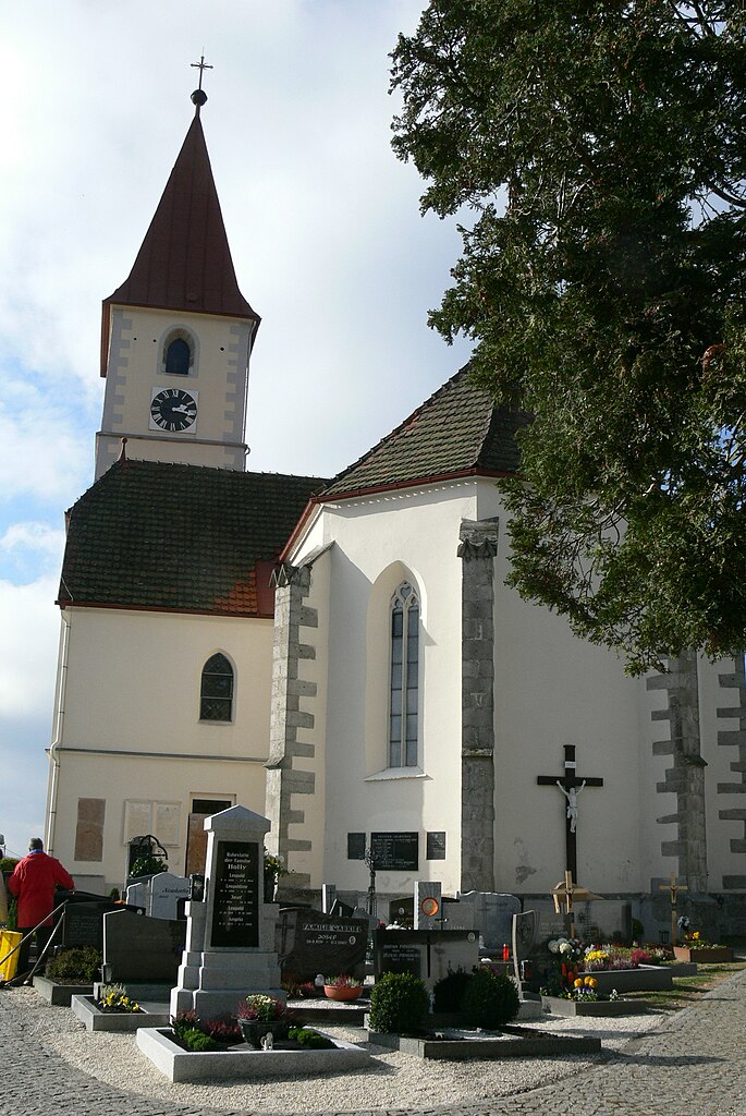
Нойфельден (Neufelden, Neufelden)
 Hiking in Нойфельден
Neufelden, located in the beautiful region of Upper Austria, offers a variety of hiking opportunities amidst scenic landscapes, rolling hills, and lush forests. Here are some highlights and tips for hiking in and around Neufelden:
Popular Trails
-
Donausteig Trail: This long-distance trail follows the Danube River and includes segments that pass through the Neufelden area. You can enjoy stunning views of the river as well as charming villages along the way.
-
Local Forest Trails: There are numerous trails through the local forests and countryside that are well-marked and perfect for day hikes. These trails often provide opportunities to see local wildlife and various flora.
-
Bilderbuchweg: This themed trail is great for families and provides educational stops along the way. It’s a gentle hike that is suitable for all ages.
Scenic Highlights
- Panoramic Views: Many trails in this region offer breathtaking views of the scenic landscapes of the Mühlviertel region and the nearby Alps on a clear day.
- Natural Features: Keep an eye out for local wildlife, picturesque streams, and charming pastures.
Tips for Hiking in Neufelden
- Season: Spring and autumn are particularly wonderful for hiking, with pleasant temperatures and beautiful natural colors. Summers can be warm, while winters can be cold, so be prepared for snowy conditions if you hike during winter months.
- Gear: Wear sturdy hiking boots and dress in layers to accommodate changing weather conditions. Always carry enough water and snacks.
- Navigation: Make sure to have a map or download a hiking app to help you navigate the trails, as some paths may not be well-marked.
- Respect Nature: Always follow Leave No Trace principles to preserve the natural environment.
Local Amenities
After a day of hiking, you can explore local accommodations, enjoy regional cuisine in nearby restaurants, or relax at a local café. Neufelden is relatively quiet, making it a peaceful retreat after a day on the trails.
Enjoy your hiking adventure in Neufelden! Always check local resources for updated trail information and any possible restrictions before heading out.
- Страна:

- Почтовый код: 4120
- Телефонный код: 07282
- Код автомобильного номера: RO
- Координаты: 48° 29' 3" N, 14° 0' 7" E


- GPS треки (wikiloc): [Ссылка]
- Высота над уровнем моря: 517 м m
- Площадь: 10 кв.км
- Население: 1276
- Веб сайт: http://www.neufelden.at/
- Википедия русская: wiki(ru)
- Википедия английская: wiki(en)
- Википедия национальная: wiki(de)
- Хранилище Wikidata: Wikidata: Q693606
- Катеория в википедии: [Ссылка]
- код Freebase: [/m/03gvb2z]
- код GeoNames: Альт: [7873198]
- код VIAF: Альт: [247379180]
- идентификатор местоположения ArchINFORM: [10626]
- код австрийского муниципалитета: [41321]
Граничит с регионами:
Клайнцелль
- коммуна в федеральной земле Верхняя Австрия, Австрия
Hiking in Клайнцелль
Kleinzell im Mühlkreis is a charming village in Austria, surrounded by beautiful landscapes ideal for hiking enthusiasts. The region offers a variety of trails that cater to different skill levels, making it a fantastic destination for both beginners and experienced hikers....
- Страна:
- Почтовый код: 4115
- Телефонный код: 07282
- Код автомобильного номера: RO
- Координаты: 48° 27' 24" N, 13° 59' 45" E
- GPS треки (wikiloc): [Ссылка]
- Высота над уровнем моря: 548 м m
- Площадь: 16 кв.км
- Население: 1546
- Веб сайт: [Ссылка]


Альтенфельден
- ярмарочная коммуна в федеральной земле Верхняя Австрия, Австрия
Hiking in Альтенфельден
Altenfelden, located in Austria, is a picturesque destination that offers a variety of hiking opportunities for outdoor enthusiasts. The area is characterized by its beautiful landscapes, rolling hills, and lush forests, making it a great location for both casual walkers and seasoned hikers....
- Страна:
- Почтовый код: 4121
- Телефонный код: 07282
- Код автомобильного номера: RO
- Координаты: 48° 29' 10" N, 13° 58' 8" E
- GPS треки (wikiloc): [Ссылка]
- Высота над уровнем моря: 598 м m
- Площадь: 26.33 кв.км
- Население: 2219
- Веб сайт: [Ссылка]

Ауберг
- коммуна в федеральной земле Верхняя Австрия, Австрия
Hiking in Ауберг
Auberg, also known as Aubergine in some contexts, is not a widely recognized hiking destination based on the information available up to October 2023. However, if you meant a different location or a specific trail, I can provide some general hiking tips and what to look for in a good hiking destination....
- Страна:
- Почтовый код: 4171
- Телефонный код: 07282
- Код автомобильного номера: RO
- Координаты: 48° 32' 40" N, 14° 3' 12" E
- GPS треки (wikiloc): [Ссылка]
- Высота над уровнем моря: 595 м m
- Площадь: 13 кв.км
- Население: 551
- Веб сайт: [Ссылка]

Санкт-Ульрих
Hiking in Санкт-Ульрих
Sankt Ulrich im Mühlkreis, located in the Mühlviertel region of Austria, is a fantastic destination for hiking enthusiasts. Nestled amidst rolling hills and beautiful landscapes, it offers a variety of trails suitable for different skill levels, from leisurely walks to more challenging hikes....
- Страна:
- Почтовый код: 4116
- Телефонный код: 07282
- Код автомобильного номера: RO
- Координаты: 48° 28' 23" N, 14° 2' 54" E
- GPS треки (wikiloc): [Ссылка]
- Высота над уровнем моря: 622 м m
- Площадь: 16 кв.км
- Население: 633
- Веб сайт: [Ссылка]

Санкт-Петер-на-Вимберге
Hiking in Санкт-Петер-на-Вимберге
Sankt Peter am Wimberg is a picturesque village located in the Mühlviertel region of Austria. It's an excellent starting point for various hiking adventures, offering a mix of serene landscapes, lush forests, and beautiful views of the surrounding countryside....
- Страна:
- Почтовый код: 4171
- Телефонный код: 07282
- Код автомобильного номера: RO
- Координаты: 48° 30' 10" N, 14° 5' 12" E
- GPS треки (wikiloc): [Ссылка]
- Высота над уровнем моря: 668 м m
- Площадь: 23 кв.км
- Население: 1770
- Веб сайт: [Ссылка]

Арнрайт
- коммуна в федеральной земле Верхняя Австрия, Австрия
Hiking in Арнрайт
Arnreit is a picturesque village nestled in the Mühlviertel region of Upper Austria, known for its beautiful landscapes and diverse hiking opportunities. Here's an overview to help you make the most of your hiking experience in Arnreit:...
- Страна:
- Почтовый код: 4122
- Телефонный код: 07282
- Код автомобильного номера: RO
- Координаты: 48° 31' 33" N, 13° 59' 45" E
- GPS треки (wikiloc): [Ссылка]
- Высота над уровнем моря: 604 м m
- Площадь: 20 кв.км
- Население: 1154
- Веб сайт: [Ссылка]