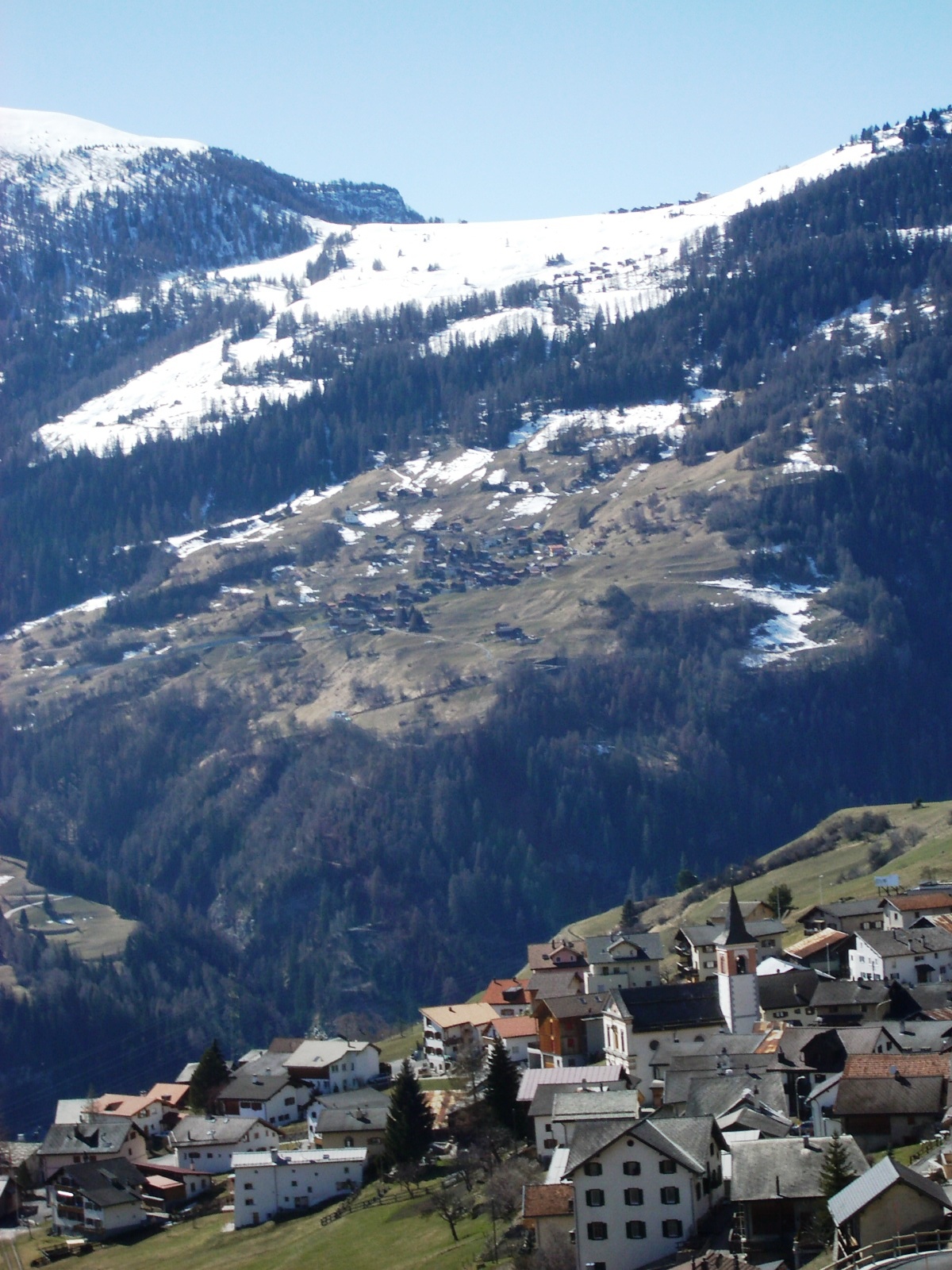
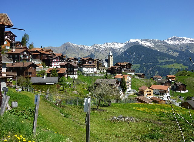
Ароза (Arosa, Arosa)

 Hiking in Ароза
Arosa is a beautiful alpine resort located in Switzerland, renowned for its stunning landscapes, diverse trails, and welcoming atmosphere for hikers of all skill levels. Here’s an overview of hiking in Arosa:
Hiking Trails
Arosa offers a wide range of hiking trails, from easy walks to more challenging treks. Here are some popular routes:
-
Arosa Scenic Trail: This is an easy to moderate trail that offers panoramic views of the surrounding mountains and valleys. It's perfect for families and those looking for a relaxed hike.
-
Tschuggen Mountain: A hike up to Tschuggen provides breathtaking views and a chance to enjoy the alpine flora. The restaurant at the top offers a great place to rest and refuel.
-
Hornli Trail: This trail is more challenging and offers stunning views of the Arosa landscape. It’s ideal for experienced hikers looking for a rewarding experience.
-
Lake Arosa (Arosa See): A lovely, flat trail around the lake allowing for a leisurely hike with beautiful reflections of the mountains in the water. Perfect for a picturesque picnic spot.
-
The Arosa Adventure Trail (Arosa Erlebnispfad): This interactive trail is great for families, featuring various sensory stations that educate hikers about nature.
Trail Difficulty
The trails in Arosa vary in difficulty, so it’s important to choose one that matches your fitness level and experience. Starting with easier trails can build confidence before tackling more challenging ones. Always check trail conditions, especially early in the season when snow may still be present.
Best Time to Hike
The best time for hiking in Arosa is during the summer months, from late June to mid-September, when the trails are generally clear of snow and the weather is milder. However, fall also offers beautiful foliage and fewer crowds.
Preparation and Safety
-
Gear: Proper hiking boots, weather-appropriate attire, a map or GPS device, and a water bottle are essential. Consider trekking poles if you are tackling steeper trails.
-
Weather: The weather can be unpredictable in the mountains. Always check the forecast before heading out and be prepared for sudden changes.
-
Maps and Signage: Trails are well-marked, but always carry a map, especially for longer hikes. Some trails may not have cellular reception.
-
Respect Nature: Stay on marked trails, stick to designated campgrounds if you're staying overnight, and practice Leave No Trace principles.
Accessibility
Arosa is accessible by train and bus, with various stops around the village. Many trails begin right from the town center, making it convenient to start your hike.
Local Amenities
After a long hike, you can enjoy the local cuisine in one of Arosa’s restaurants, relax at wellness centers, or explore the charming village.
Overall, hiking in Arosa is a fantastic experience, offering breathtaking views and a chance to immerse yourself in the natural beauty of the Swiss Alps. Enjoy your adventure!
- Страна:

- Почтовый код: 7050
- Телефонный код: 081
- Код автомобильного номера: GR
- Координаты: 46° 46' 0" N, 9° 40' 1" E


- GPS треки (wikiloc): [Ссылка]
- Высота над уровнем моря: 2003 м m
- Площадь: 42.53 кв.км
- Население: 3185
- Веб сайт: https://www.gemeindearosa.ch/
- Википедия русская: wiki(ru)
- Википедия английская: wiki(en)
- Википедия национальная: wiki(de)
- Хранилище Wikidata: Wikidata: Q63954
- Катеория в википедии: [Ссылка]
- код Freebase: [/m/0643ch]
- код GeoNames: Альт: [7285102]
- код VIAF: Альт: [127927150]
- ID отношения в OpenStreetMap: [1684041]
- код GND: Альт: [4079837-9]
- идентификатор местоположения ArchINFORM: [3949]
- код LCNAF: Альт: [n86098790]
- место в MusicBrainz: [63a09691-408f-4a6f-ae76-179dfbafdc78]
- код темы Quora: [Arosa]
- идентификатор HDS: [1587]
- код в Большой российской энциклопедии онлайн: [1831279]
- код швейцарского муниципалитета: [3921]
- LIR: [53]
Граничит с регионами:


Альваной
Hiking in Альваной
Alvaneu is a picturesque village in the Swiss canton of Graubünden, known for its stunning natural landscapes and outdoor activities, including hiking. The area offers a variety of trails suitable for different skill levels, making it ideal for both beginners and experienced hikers. Here are some highlights of hiking in Alvaneu:...
- Страна:
- Почтовый код: 7492
- Телефонный код: 081
- Код автомобильного номера: GR
- Координаты: 46° 40' 59" N, 9° 38' 59" E
- GPS треки (wikiloc): [Ссылка]
- Высота над уровнем моря: 1181 м m
- Площадь: 35.68 кв.км
- Веб сайт: [Ссылка]


Енац
Hiking in Енац
Jenaz is a charming village located in the Prättigau region of the Swiss Alps, known for its stunning natural beauty and excellent hiking opportunities. The area offers a variety of trails suitable for different skill levels, from easy walks to more challenging hikes....
- Страна:
- Почтовый код: 7233
- Телефонный код: 081
- Код автомобильного номера: GR
- Координаты: 46° 54' 23" N, 9° 42' 7" E
- GPS треки (wikiloc): [Ссылка]
- Высота над уровнем моря: 1469 м m
- Площадь: 25.91 кв.км
- Население: 1161
- Веб сайт: [Ссылка]


Фидерис
Hiking in Фидерис
Fideris is a picturesque village located in the canton of Graubünden in Switzerland. It's a great base for hiking enthusiasts due to its diverse trails and stunning alpine scenery. Here’s what you need to know about hiking in and around Fideris:...
- Страна:
- Почтовый код: 7235
- Телефонный код: 081
- Код автомобильного номера: GR
- Координаты: 46° 53' 12" N, 9° 44' 22" E
- GPS треки (wikiloc): [Ссылка]
- Высота над уровнем моря: 1653 м m
- Площадь: 25.36 кв.км
- Население: 598
- Веб сайт: [Ссылка]

Вац
- коммуна в кантоне Граубюнден (Швейцария)
Hiking in Вац
Vaz Obervaz, also known simply as Vaz, is a charming municipality located in the Grisons (Graubünden) region of Switzerland. It's a great destination for hiking enthusiasts due to its stunning landscapes, diverse trails, and access to the surrounding mountains....
- Страна:
- Почтовый код: 7082
- Телефонный код: 081
- Код автомобильного номера: GR
- Координаты: 46° 42' 59" N, 9° 33' 0" E
- GPS треки (wikiloc): [Ссылка]
- Высота над уровнем моря: 1300 м m
- Площадь: 42.51 кв.км
- Население: 2630
- Веб сайт: [Ссылка]


Фурна
Hiking in Фурна
Furna, located in the Swiss region of Valais, is known for its stunning landscapes and beautiful hiking trails that offer diverse terrain, from gentle slopes to challenging elevations. Here are some key points about hiking in Furna:...
- Страна:
- Почтовый код: 7232
- Телефонный код: 081
- Код автомобильного номера: GR
- Координаты: 46° 55' 31" N, 9° 39' 49" E
- GPS треки (wikiloc): [Ссылка]
- Высота над уровнем моря: 1412 м m
- Площадь: 33.32 кв.км
- Население: 213
- Веб сайт: [Ссылка]


Контерс
Hiking in Контерс
Conters im Prättigau is a charming village located in the Graubünden region of Switzerland, surrounded by stunning natural landscapes and offering various hiking opportunities. Here are some key points to consider when planning your hiking adventure in and around Conters:...
- Страна:
- Почтовый код: 7241
- Телефонный код: 081
- Код автомобильного номера: GR
- Координаты: 46° 53' 59" N, 9° 47' 0" E
- GPS треки (wikiloc): [Ссылка]
- Высота над уровнем моря: 1110 м m
- Площадь: 18.40 кв.км
- Население: 225
- Веб сайт: [Ссылка]


Ланч-Ленц
Hiking in Ланч-Ленц
Lantsch-Lenz, a picturesque village in the Swiss Alps, offers a fantastic range of hiking opportunities for outdoor enthusiasts. Located in the canton of Graubünden, it is surrounded by stunning landscapes, including lush valleys, alpine meadows, and towering peaks, making it an ideal destination for hiking....
- Страна:
- Почтовый код: 7083
- Телефонный код: 081
- Код автомобильного номера: GR
- Координаты: 46° 42' 25" N, 9° 34' 46" E
- GPS треки (wikiloc): [Ссылка]
- Высота над уровнем моря: 2130 м m
- Площадь: 21.81 кв.км
- Население: 511
- Веб сайт: [Ссылка]

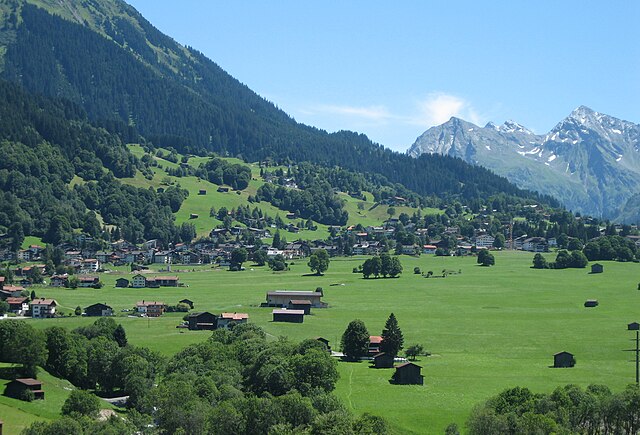
Давос
- швейцарская коммуна
Hiking in Давос
Davos, located in the Swiss Alps, is renowned for its stunning landscapes and extensive hiking trails, making it a popular destination for outdoor enthusiasts. Here are some key points to consider when hiking in Davos:...
- Страна:
- Почтовый код: 7272 Davos Clavadel; 7294 Davos Wiesen; 7278; 7277; 7276; 7270 Davos Platz; 7260 Davos Dorf; 7265 Davos Wolfgang
- Телефонный код: 081
- Код автомобильного номера: GR
- Координаты: 46° 48' 17" N, 9° 50' 14" E
- GPS треки (wikiloc): [Ссылка]
- Высота над уровнем моря: 1563 м m
- Площадь: 284 кв.км
- Население: 10937
- Веб сайт: [Ссылка]
Клостерс-Зернойс
Hiking in Клостерс-Зернойс
Klosters, located in the Swiss Alps near the popular ski resort of Davos, is a beautiful destination for hiking enthusiasts. Here’s an overview of what you can expect while hiking in this wonderful area:...
- Страна:
- Почтовый код: 7250
- Телефонный код: 081
- Код автомобильного номера: GR
- Координаты: 46° 53' 0" N, 9° 53' 0" E
- GPS треки (wikiloc): [Ссылка]
- Высота над уровнем моря: 1342 м m
- Площадь: 193.10 кв.км
- Население: 4437
- Веб сайт: [Ссылка]
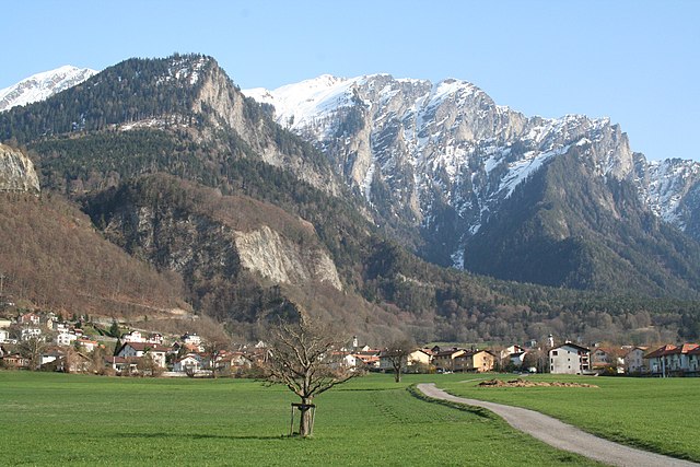

Триммис
Hiking in Триммис
Trimmis is a charming village located in the canton of Graubünden, Switzerland, known for its stunning landscapes and access to a variety of hiking trails. The area offers a range of hiking options that cater to different fitness levels and interests, from leisurely walks to more challenging mountain hikes....
- Страна:
- Почтовый код: 7203
- Телефонный код: 081
- Код автомобильного номера: GR
- Координаты: 46° 53' 43" N, 9° 35' 51" E
- GPS треки (wikiloc): [Ссылка]
- Высота над уровнем моря: 1580 м m
- Площадь: 42.87 кв.км
- Население: 3283
- Веб сайт: [Ссылка]

Tschiertschen-Praden
Hiking in Tschiertschen-Praden
Tschiertschen-Praden is a beautiful hiking destination located in the Graubünden region of Switzerland. It's known for its stunning landscapes, picturesque villages, and a variety of hiking trails suited for different skill levels. Here are some highlights of hiking in this area:...
- Страна:
- Почтовый код: 7063, 7064
- Телефонный код: 081
- Код автомобильного номера: GR
- Координаты: 46° 49' 0" N, 9° 36' 0" E
- GPS треки (wikiloc): [Ссылка]
- Высота над уровнем моря: 1350 м m
- Площадь: 27.74 кв.км
- Население: 318
- Веб сайт: [Ссылка]