
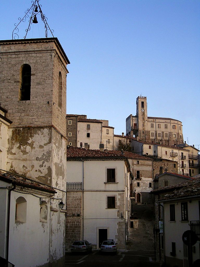
Ателета (Ateleta, Ateleta)
.svg)
- коммуна Италии
 Hiking in Ателета
Ateleta, a charming town in the Abruzzo region of Italy, offers beautiful hiking opportunities characterized by stunning landscapes, picturesque views, and diverse trails. The surrounding area is part of the larger Maiella National Park, which is known for its rich biodiversity, rugged mountain terrain, and scenic vistas.
Hiking Trails and Areas
-
Maiella National Park: The park is a highlight for hikers, featuring various trails suited for different skill levels. You can hike through beech forests, alpine meadows, and rocky terrains, with many paths leading to breathtaking viewpoints and historical sites.
-
Valle dell'Orfento: This valley offers a series of well-marked trails that lead through lush vegetation alongside the Orfento River. The hike provides opportunities for wildlife viewing and observing local flora.
-
Monte Amaro: For more adventurous hikers, the trail leading to Monte Amaro (the second highest peak in the Abruzzo region) offers challenging terrain and rewarding panoramic views from the summit.
-
Rocca Calascio: While not directly in Ateleta, this iconic castle ruins located a short drive away make for a fantastic day hike. The trail is rich in history and provides stunning views of the surrounding landscapes.
Tips for Hiking in Ateleta
-
Seasonal Considerations: The best time for hiking in this region is typically in the spring and early fall, when the weather is mild and the trails are less crowded. Summers can be hot, while winters may bring snow to higher elevations.
-
Trail Difficulty: Assess your own hiking experience and fitness level when selecting a trail. There are options ranging from easy walks to more strenuous hikes that may require equipment and preparation.
-
Local Wildlife: Be aware of the possibility of encountering wildlife, such as deer or various bird species. It's crucial to respect their habitat and observe from a distance.
-
Hydration and Supplies: Always carry sufficient water, snacks, and a first-aid kit. Some trails may not have amenities, so being self-sufficient is essential.
-
Map and Navigation: While many trails are marked, it's wise to carry a detailed map or use a GPS device. Services might be limited, so having a backup plan is advisable.
Enjoy your hiking adventure in Ateleta, and make sure to soak in the natural beauty that this stunning region of Italy has to offer!
- Страна:

- Почтовый код: 67030
- Телефонный код: 0864
- Код автомобильного номера: AQ
- Координаты: 41° 51' 16" N, 14° 11' 56" E


- GPS треки (wikiloc): [Ссылка]
- Высота над уровнем моря: 760 м m
- Площадь: 41.93 кв.км
- Население: 1156
- Веб сайт: http://www.comune.ateleta.aq.it/
- Википедия русская: wiki(ru)
- Википедия английская: wiki(en)
- Википедия национальная: wiki(it)
- Хранилище Wikidata: Wikidata: Q47110
- Галерея изображений в википедии: [Ссылка]
- Катеория в википедии: [Ссылка]
- код Freebase: [/m/0fg44f]
- код GeoNames: Альт: [6537426]
- ID отношения в OpenStreetMap: [41590]
- WOEID: [710407]
- Google Maps Customer ID: [14768792036705713050]
- код ISTAT: 066005
- кадастровый код Италии: A481
Граничит с регионами:
Кастель-дель-Джудиче
- коммуна Италии
Hiking in Кастель-дель-Джудиче
Castel del Giudice, located in the province of Isernia in the Molise region of Italy, is a picturesque village nestled in the Apennine Mountains. The area is known for its stunning landscapes, rich history, and outdoor recreational opportunities, making it an excellent destination for hiking enthusiasts....
- Страна:
- Почтовый код: 86080
- Телефонный код: 0865
- Код автомобильного номера: IS
- Координаты: 41° 51' 0" N, 14° 14' 0" E
- GPS треки (wikiloc): [Ссылка]
- Высота над уровнем моря: 800 м m
- Площадь: 14.81 кв.км
- Население: 324
- Веб сайт: [Ссылка]


Сан-Пьетро-Авеллана
- коммуна Италии
Hiking in Сан-Пьетро-Авеллана
San Pietro Avellana is a charming village located in the Molise region of Italy, surrounded by the scenic landscapes of the Apennines. The area offers numerous opportunities for hiking enthusiasts to explore its natural beauty, rich flora and fauna, and stunning views....
- Страна:
- Почтовый код: 86088
- Телефонный код: 0865
- Код автомобильного номера: IS
- Координаты: 41° 47' 31" N, 14° 10' 53" E
- GPS треки (wikiloc): [Ссылка]
- Высота над уровнем моря: 960 м m
- Площадь: 44.95 кв.км
- Население: 515
- Веб сайт: [Ссылка]


Пескокостанцо
- коммуна Италии
Hiking in Пескокостанцо
Pescocostanzo is a charming village located in the Abruzzo region of Italy, nestled in the Apennine Mountains. It is a fantastic destination for hikers, offering a mix of stunning landscapes, historical sites, and a range of trails suitable for different skill levels....
- Страна:
- Почтовый код: 67033
- Телефонный код: 0864
- Код автомобильного номера: AQ
- Координаты: 41° 53' 14" N, 14° 3' 59" E
- GPS треки (wikiloc): [Ссылка]
- Высота над уровнем моря: 1395 м m
- Площадь: 55.06 кв.км
- Население: 1090
- Веб сайт: [Ссылка]


Роккаразо
- коммуна Италии
Hiking in Роккаразо
Roccaraso is a charming destination in the Apennine Mountains, located in the Abruzzo region of central Italy. Famous for its ski resorts in winter, it's also a fantastic location for hiking during the warmer months. Here are some key points to consider if you’re planning a hiking adventure in Roccaraso:...
- Страна:
- Почтовый код: 67037
- Телефонный код: 0864
- Код автомобильного номера: AQ
- Координаты: 41° 50' 48" N, 14° 4' 43" E
- GPS треки (wikiloc): [Ссылка]
- Высота над уровнем моря: 1236 м m
- Площадь: 49.91 кв.км
- Население: 1702
- Веб сайт: [Ссылка]

Гамберале
- коммуна Италии
Hiking in Гамберале
Gamberale, a charming village located in the Abruzzo region of Italy, offers a fantastic hiking experience surrounded by stunning natural landscapes. The area is characterized by mountainous terrain, lush forests, and picturesque views, making it an excellent destination for outdoor enthusiasts....
- Страна:
- Почтовый код: 66040
- Телефонный код: 0872
- Код автомобильного номера: CH
- Координаты: 41° 54' 0" N, 14° 13' 0" E
- GPS треки (wikiloc): [Ссылка]
- Высота над уровнем моря: 1343 м m
- Площадь: 15.56 кв.км
- Население: 300
- Веб сайт: [Ссылка]


Палена
- коммуна Италии
Hiking in Палена
Palena, located in the Abruzzo region of Italy, is a hidden gem for hikers and nature enthusiasts. Nestled in the Majella National Park, it offers stunning landscapes, diverse flora and fauna, and a range of hiking trails suitable for all skill levels....
- Страна:
- Почтовый код: 66017
- Телефонный код: 0872
- Код автомобильного номера: CH
- Координаты: 41° 58' 54" N, 14° 8' 3" E
- GPS треки (wikiloc): [Ссылка]
- Высота над уровнем моря: 767 м m
- Площадь: 93.63 кв.км
- Население: 1332
- Веб сайт: [Ссылка]