Ора (Auer, Ora)
.svg)
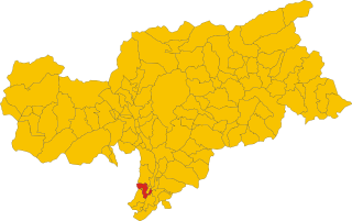
- коммуна в Италии, Трентино — Альто-Адидже, Больцано
 Hiking in Ора
Auer, a charming village in South Tyrol, Italy, offers a variety of hiking opportunities, making it an excellent destination for outdoor enthusiasts. Nestled in the picturesque landscape of the Dolomites, Auer is surrounded by beautiful mountains, vineyards, and apple orchards, providing a diverse range of hiking experiences.
Hiking Trails
-
Markus Trail: This well-marked path is suitable for hikers of all levels. It takes you through stunning vineyards and offers panoramic views of the surrounding valleys and mountains.
-
Pfatten Hiking Trail: A moderate trail that leads from Auer to the nearby Pfatten area, known for its beautiful landscapes and peaceful environment. This hike is particularly enjoyable during the autumn foliage.
-
Hiking on the Mendola: Just a short drive from Auer, the Mendola mountain offers numerous trails, from easy walks to more challenging hikes with stunning vistas of the surrounding region.
-
Bicycle Trails: While not strictly hiking, the area also features numerous cycling paths that allow you to explore the beautiful countryside and nearby towns, promoting a fun way to experience the scenery.
Best Time to Hike
The ideal time for hiking in Auer is between late spring and early autumn (May to September). During this period, the weather is pleasant, and the trails are accessible, with blooming flora providing scenic views.
Preparation Tips
- Gear Up: Wear appropriate hiking shoes, and consider using trekking poles for stability, especially on uneven terrains.
- Weather Check: Always check the weather forecast before heading out, as mountain weather can change quickly.
- Hydration and Snacks: Bring plenty of water and snacks, especially for longer hikes.
- Trail Maps: Familiarize yourself with the trail maps and signage in the area, or consider using a smartphone app for navigation.
Local Culture and Cuisine
After your hike, take some time to explore Auer's local culture. The town’s wine and cuisine are notable, specifically their South Tyrolean specialties. Enjoying a meal at a local tavern can be a delightful way to end your hiking day.
Conclusion
Auer, with its delightful trails and stunning landscapes, provides an excellent setting for hikers of all experience levels. Whether you're looking for a leisurely walk through vineyards or a challenging mountain hike, you'll find something to suit your needs in this beautiful region of South Tyrol.
- Страна:

- Почтовый код: 39040
- Телефонный код: 0471
- Код автомобильного номера: BZ
- Координаты: 46° 20' 49" N, 11° 17' 51" E


- GPS треки (wikiloc): [Ссылка]
- Высота над уровнем моря: 236 м m
- Площадь: 11.79 кв.км
- Население: 3795
- Веб сайт: http://www.comune.ora.bz.it/system/web/default.aspx?sprache=3
- Википедия русская: wiki(ru)
- Википедия английская: wiki(en)
- Википедия национальная: wiki(it)
- Хранилище Wikidata: Wikidata: Q433413
- Галерея изображений в википедии: [Ссылка]
- Катеория в википедии: [Ссылка]
- код Freebase: [/m/0g9hll]
- код GeoNames: Альт: [6535915]
- код VIAF: Альт: [141809013]
- ID отношения в OpenStreetMap: [47139]
- код GND: Альт: [4445759-5]
- место в MusicBrainz: [891349bf-1bef-4929-aee0-7f11ecd866a7]
- UN/LOCODE: [ITORA]
- код ISTAT: 021060
- кадастровый код Италии: G083
Граничит с регионами:


Альдино
- коммуна Италии
Hiking in Альдино
Aldein, located in the South Tyrol region of Northern Italy, is a wonderful destination for hiking enthusiasts. Nestled in the scenic mountains, it offers a variety of trails that cater to different skill levels, from leisurely walks to more challenging treks. Here are some highlights about hiking in Aldein:...
- Страна:
- Почтовый код: 39040
- Телефонный код: 0471
- Код автомобильного номера: BZ
- Координаты: 46° 22' 0" N, 11° 21' 0" E
- GPS треки (wikiloc): [Ссылка]
- Высота над уровнем моря: 1225 м m
- Площадь: 62.69 кв.км
- Население: 1664
- Веб сайт: [Ссылка]
Бронцоло
- коммуна Италии
Hiking in Бронцоло
Bronzolo, or Bronzolo in Italian, is a charming village located in South Tyrol, Italy. Nestled near the Adige River and surrounded by beautiful rolling hills and vineyards, it offers a fantastic experience for hiking enthusiasts. Here are some highlights about hiking in the Bronzolo area:...
- Страна:
- Почтовый код: 39051
- Телефонный код: 0471
- Код автомобильного номера: BZ
- Координаты: 46° 24' 0" N, 11° 19' 0" E
- GPS треки (wikiloc): [Ссылка]
- Высота над уровнем моря: 263 м m
- Площадь: 7.54 кв.км
- Население: 2798
- Веб сайт: [Ссылка]


Монтанья
- коммуна Италии
Hiking in Монтанья
Hiking in Montana offers some of the most stunning landscapes and diverse ecosystems in the United States. With its vast wilderness areas, national parks, and state parks, Montana is a hiker’s paradise. Here are some key highlights and considerations for hiking in Montana:...
- Страна:
- Почтовый код: 39040
- Телефонный код: 0471
- Код автомобильного номера: BZ
- Координаты: 46° 19' 49" N, 11° 18' 1" E
- GPS треки (wikiloc): [Ссылка]
- Высота над уровнем моря: 497 м m
- Площадь: 19.51 кв.км
- Население: 1684
- Веб сайт: [Ссылка]

Термено-сулла-Страда-дель-Вино
- коммуна в Италии
Hiking in Термено-сулла-Страда-дель-Вино
Tramin an der Weinstraße, also known as Termeno sulla Strada del Vino, is a picturesque village in South Tyrol, northern Italy, famous for its wine production and stunning landscapes. The area is surrounded by vineyards, rolling hills, and mountains, making it an excellent destination for hiking enthusiasts....
- Страна:
- Почтовый код: 39040
- Телефонный код: 0471
- Код автомобильного номера: BZ
- Координаты: 46° 20' 29" N, 11° 14' 32" E
- GPS треки (wikiloc): [Ссылка]
- Высота над уровнем моря: 276 м m
- Площадь: 19.44 кв.км
- Население: 3383
- Веб сайт: [Ссылка]


Вадена
- коммуна в Италии
Hiking in Вадена
Vadena, located in the South Tyrol region of northern Italy, is a lesser-known but beautiful area that offers a variety of hiking opportunities. Here’s an overview of what to expect when hiking in this region:...
- Страна:
- Почтовый код: 39051
- Телефонный код: 0471
- Код автомобильного номера: BZ
- Координаты: 46° 25' 0" N, 11° 18' 0" E
- GPS треки (wikiloc): [Ссылка]
- Высота над уровнем моря: 243 м m
- Площадь: 15.22 кв.км
- Население: 1015
- Веб сайт: [Ссылка]