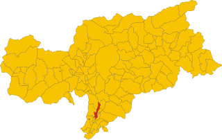
Бронцоло (Bronzolo, Bronzolo)
.svg)
- коммуна Италии
 Hiking in Бронцоло
Bronzolo, or Bronzolo in Italian, is a charming village located in South Tyrol, Italy. Nestled near the Adige River and surrounded by beautiful rolling hills and vineyards, it offers a fantastic experience for hiking enthusiasts. Here are some highlights about hiking in the Bronzolo area:
Scenic Trails
-
Vineyard Trails: The area around Bronzolo features well-maintained paths that wind through idyllic vineyards. These trails provide panoramic views of the surrounding mountains and valleys, making for a picturesque hiking experience.
-
Adige River Path: The path along the Adige River is suitable for both hikers and cyclists. It offers a flat terrain with beautiful views of the river and is perfect for a leisurely hike.
-
Mountain Trails: For those looking for a more challenging adventure, there are numerous trails leading into the surrounding foothills and mountains. These routes often provide stunning vistas and a chance to experience the natural beauty of the South Tyrol region.
Flora and Fauna
Bronzolo and its surrounding areas boast a rich diversity of flora and fauna. Hikers might encounter a variety of bird species, wildflowers, and even some local wildlife. This biodiversity adds to the charm of hiking in the region.
Accessibility
The trails around Bronzolo vary in difficulty, making them accessible to hikers of all skill levels. Whether you are a novice or an experienced hiker, you'll find routes that suit your needs.
Local Amenities
After a hike, you can enjoy local South Tyrolean cuisine in villages nearby, including traditional dishes such as speck and pasta. There are also local wines to taste, enhancing the overall hiking experience.
Best Time to Visit
The best time for hiking in Bronzolo is during the spring and fall months when the weather is mild and the scenery is particularly beautiful, with blooming flowers in spring and vibrant autumn colors.
Conclusion
Hiking in Bronzolo offers a delightful mix of nature, culture, and local cuisine. Be sure to prepare adequately, take plenty of water, wear suitable hiking shoes, and enjoy the stunning landscapes that South Tyrol has to offer! Always check local trail conditions and maps before embarking on your hike.
- Страна:

- Почтовый код: 39051
- Телефонный код: 0471
- Код автомобильного номера: BZ
- Координаты: 46° 24' 0" N, 11° 19' 0" E


- GPS треки (wikiloc): [Ссылка]
- Высота над уровнем моря: 263 м m
- Площадь: 7.54 кв.км
- Население: 2798
- Веб сайт: http://www.comune.bronzolo.bz.it
- Википедия русская: wiki(ru)
- Википедия английская: wiki(en)
- Википедия национальная: wiki(it)
- Хранилище Wikidata: Wikidata: Q376275
- Галерея изображений в википедии: [Ссылка]
- Катеория в википедии: [Ссылка]
- код Freebase: [/m/0g9fy0]
- код GeoNames: Альт: [6535954]
- код VIAF: Альт: [137203647]
- ID отношения в OpenStreetMap: [47173]
- код GND: Альт: [4528143-9]
- код LCNAF: Альт: [n80059472]
- WOEID: [711455]
- UN/LOCODE: [ITZDT]
- код ISTAT: 021012
- кадастровый код Италии: B203
Граничит с регионами:


Лайвес
- коммуна Италии
Hiking in Лайвес
Laives (or Leifers in German) is a small town located in the South Tyrol region of northern Italy. It's situated near the city of Bolzano, making it a great base for hikers interested in exploring the stunning scenery of the Dolomites and the surrounding alpine landscape....
- Страна:
- Почтовый код: 39055
- Телефонный код: 0471
- Код автомобильного номера: BZ
- Координаты: 46° 25' 39" N, 11° 20' 26" E
- GPS треки (wikiloc): [Ссылка]
- Высота над уровнем моря: 258 м m
- Площадь: 24.11 кв.км
- Население: 17954
- Веб сайт: [Ссылка]


Альдино
- коммуна Италии
Hiking in Альдино
Aldein, located in the South Tyrol region of Northern Italy, is a wonderful destination for hiking enthusiasts. Nestled in the scenic mountains, it offers a variety of trails that cater to different skill levels, from leisurely walks to more challenging treks. Here are some highlights about hiking in Aldein:...
- Страна:
- Почтовый код: 39040
- Телефонный код: 0471
- Код автомобильного номера: BZ
- Координаты: 46° 22' 0" N, 11° 21' 0" E
- GPS треки (wikiloc): [Ссылка]
- Высота над уровнем моря: 1225 м m
- Площадь: 62.69 кв.км
- Население: 1664
- Веб сайт: [Ссылка]


Нова-Поненте
- коммуна Италии
Hiking in Нова-Поненте
Deutschnofen, known as "Naz-Sciaves" in Italian, is a charming village located in the South Tyrol region of northern Italy. Nestled in the stunning Dolomites, it offers a variety of hiking opportunities for enthusiasts of all levels. Here are some highlights of hiking in this beautiful area:...
- Страна:
- Почтовый код: 39050
- Телефонный код: 0471
- Код автомобильного номера: BZ
- Координаты: 46° 24' 51" N, 11° 25' 31" E
- GPS треки (wikiloc): [Ссылка]
- Высота над уровнем моря: 1357 м m
- Площадь: 112.49 кв.км
- Население: 3917
- Веб сайт: [Ссылка]


Ора
- коммуна в Италии, Трентино — Альто-Адидже, Больцано
Hiking in Ора
Auer, a charming village in South Tyrol, Italy, offers a variety of hiking opportunities, making it an excellent destination for outdoor enthusiasts. Nestled in the picturesque landscape of the Dolomites, Auer is surrounded by beautiful mountains, vineyards, and apple orchards, providing a diverse range of hiking experiences....
- Страна:
- Почтовый код: 39040
- Телефонный код: 0471
- Код автомобильного номера: BZ
- Координаты: 46° 20' 49" N, 11° 17' 51" E
- GPS треки (wikiloc): [Ссылка]
- Высота над уровнем моря: 236 м m
- Площадь: 11.79 кв.км
- Население: 3795
- Веб сайт: [Ссылка]

Вадена
- коммуна в Италии
Hiking in Вадена
Vadena, located in the South Tyrol region of northern Italy, is a lesser-known but beautiful area that offers a variety of hiking opportunities. Here’s an overview of what to expect when hiking in this region:...
- Страна:
- Почтовый код: 39051
- Телефонный код: 0471
- Код автомобильного номера: BZ
- Координаты: 46° 25' 0" N, 11° 18' 0" E
- GPS треки (wikiloc): [Ссылка]
- Высота над уровнем моря: 243 м m
- Площадь: 15.22 кв.км
- Население: 1015
- Веб сайт: [Ссылка]