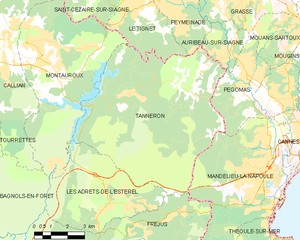
Орибо-сюр-Сьянь (Auribeau-sur-Siagne, Auribeau-sur-Siagne)

- коммуна в департаменте Приморские Альпы, регион Прованс — Альпы — Лазурный Берег, Франция
 Hiking in Орибо-сюр-Сьянь
Auribeau-sur-Siagne is a picturesque village located in the Alpes-Maritimes region of France, near the French Riviera. It's nestled in the hills and offers a variety of hiking opportunities that showcase its natural beauty and the surrounding landscape.
Hiking Trails
-
Local Trails: There are several marked trails around Auribeau-sur-Siagne that cater to different skill levels. These trails often take you through charming countryside, vineyards, and into the nearby hills, offering stunning views of the Siagne valley.
-
Sentier des Cistes: This is a popular hiking route that starts near the village and leads to scenic overlooks. The trail often features beautiful wildflowers and typical Mediterranean flora.
-
Hiking to Nearby Villages: Auribeau-sur-Siagne is close to other charming villages like Tanneron and Pégomas. You can plan hikes that connect these villages, providing a glimpse into the rich local culture and history.
-
Nature Reserves: The surrounding areas may include beautiful nature reserves where you can explore more rugged terrains and witness diverse wildlife. These areas often have additional trails and can provide a more immersive nature experience.
Tips for Hiking in Auribeau-sur-Siagne
-
Start Early: The weather can get warm, especially in the summer months, so starting your hike early will help you avoid the heat.
-
Bring Essentials: Always carry enough water, snacks, and sun protection. Good hiking boots are also recommended, as some trails can be rocky.
-
Check Trail Markers: Trails are generally well-marked, but it's wise to bring a map or a GPS device if you plan to explore more remote paths.
-
Respect the Environment: Ensure that you follow "Leave No Trace" principles, such as taking your trash back with you and staying on marked trails to protect the local ecosystem.
-
Local Advice: Don't hesitate to ask locals for recommendations on the best trails, or for any current conditions to be aware of.
Auribeau-sur-Siagne offers a tranquil hiking experience with beautiful scenery, making it a great destination for both novice and experienced hikers alike. Enjoy your adventure!
- Страна:

- Почтовый код: 06810
- Координаты: 43° 36' 3" N, 6° 54' 40" E


- GPS треки (wikiloc): [Ссылка]
- Площадь: 5.48 кв.км
- Население: 3219
- Веб сайт: http://www.auribeausursiagne.fr
- Википедия русская: wiki(ru)
- Википедия английская: wiki(en)
- Википедия национальная: wiki(fr)
- Хранилище Wikidata: Wikidata: Q640639
- Катеория в википедии: [Ссылка]
- код Freebase: [/m/03m4yzq]
- код Freebase: [/m/03m4yzq]
- код GeoNames: Альт: [3036022]
- код GeoNames: Альт: [3036022]
- номер SIREN: [210600078]
- номер SIREN: [210600078]
- код BNF: [120432952]
- код BNF: [120432952]
- код VIAF: Альт: [133804972]
- код VIAF: Альт: [133804972]
- код LCNAF: Альт: [n88262048]
- код LCNAF: Альт: [n88262048]
- код тезауруса PACTOLS: [pcrtlTZ6fc38bI]
- код тезауруса PACTOLS: [pcrtlTZ6fc38bI]
- код муниципалитета INSEE: 06007
- код муниципалитета INSEE: 06007
Граничит с регионами:


Грас
- коммуна в департаменте Приморские Альпы, регион Прованс — Альпы — Лазурный Берег, Франция
Hiking in Грас
Grasse, located in the Alpes-Maritimes department in the Provence-Alpes-Côte d'Azur region of France, is famous for its perfume industry and beautiful landscapes. Hiking in and around Grasse offers a range of trails, stunning views, and a chance to experience the rich natural and cultural heritage of the area....
- Страна:
- Почтовый код: 06520; 06130
- Координаты: 43° 39' 29" N, 6° 55' 31" E
- GPS треки (wikiloc): [Ссылка]
- Высота над уровнем моря: 333 м m
- Площадь: 44.44 кв.км
- Население: 50937
- Веб сайт: [Ссылка]

Пегома
- коммуна в департаменте Приморские Альпы, регион Прованс — Альпы — Лазурный Берег, Франция
Hiking in Пегома
Pégomas, a quaint commune located in the Alpes-Maritimes department in the French Riviera, offers a range of hiking opportunities that showcase its beautiful natural surroundings. Here are some key points to consider when hiking in the Pégomas area:...
- Страна:
- Почтовый код: 06580
- Координаты: 43° 35' 48" N, 6° 56' 0" E
- GPS треки (wikiloc): [Ссылка]
- Площадь: 11.28 кв.км
- Население: 7845
- Веб сайт: [Ссылка]

Пейменад
- коммуна в департаменте Приморские Альпы, регион Прованс — Альпы — Лазурный Берег, Франция
Hiking in Пейменад
Peymeinade, a charming village located in the Alpes-Maritimes region of France, is an excellent starting point for hiking enthusiasts. Nestled in the foothills of the picturesque Provencal countryside, it offers a variety of trails that cater to all skill levels....
- Страна:
- Почтовый код: 06530
- Координаты: 43° 38' 32" N, 6° 52' 33" E
- GPS треки (wikiloc): [Ссылка]
- Площадь: 9.76 кв.км
- Население: 8116
- Веб сайт: [Ссылка]

Таннерон
- коммуна во Франции
Hiking in Таннерон
Tanneron is a picturesque village located in the Alpes-Maritimes department in the Provence-Alpes-Côte d'Azur region of southeastern France. Known for its stunning natural landscapes, the area offers a variety of hiking opportunities that cater to different experience levels....
- Страна:
- Почтовый код: 83440
- Координаты: 43° 35' 26" N, 6° 52' 32" E
- GPS треки (wikiloc): [Ссылка]
- Площадь: 52.78 кв.км
- Население: 1572