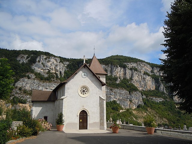
Ayn, Savoie (Ayn)

- коммуна во Франции
 Hiking in Ayn, Savoie
Ayn, located in the Savoie department of the Auvergne-Rhône-Alpes region in France, is surrounded by stunning natural beauty, making it an excellent destination for hiking enthusiasts. Here are some key points about hiking in and around Ayn:
Scenic Trails
-
Variety of Trails: The area offers a range of hiking trails suitable for all skill levels, from easy walks for beginners to challenging hikes for more experienced trekkers.
-
Natural Landscapes: Hikers can enjoy diverse landscapes, including forests, meadows, and mountain views. The proximity to the French Alps provides breathtaking vistas, especially in the spring and fall when the scenery is vibrant.
-
Col de la Cluse: This nearby pass offers various hiking routes, with access to panoramic viewpoints and the chance to see local wildlife.
Recommendations
-
Preparation: Always check the weather conditions before heading out, as they can change rapidly in mountainous areas. Carry a map or a GPS device, as some trails might not be well-marked.
-
Gear Up: Ensure you have appropriate hiking gear, including sturdy boots, plenty of water, snacks, and layered clothing to accommodate changing temperatures.
-
Local Advice: Consider stopping by local tourist information centers for updated trail maps and recommendations on the best current hikes.
Nearby Attractions
-
Lac du Bourget: Located not far from Ayn, this lake offers additional hiking opportunities around its shores, as well as water activities.
-
Regional Parks: The Bauges Regional Nature Park and the Chartreuse Mountains nearby also present fantastic hiking options and are worth exploring.
Best Season to Hike
- Spring and Fall: These seasons are generally the best times to hike in Ayn due to mild temperatures and minimal snow at lower elevations. Summer can be warm, while winter hiking is more suitable for experienced trekkers with proper winter gear.
Hiking in Ayn, Savoie is sure to provide unforgettable experiences with its natural beauty, thrilling trails, and peaceful surroundings. Enjoy your hikes!
- Страна:

- Почтовый код: 73470
- Координаты: 45° 34' 21" N, 5° 45' 3" E


- GPS треки (wikiloc): [Ссылка]
- Площадь: 7.44 кв.км
- Население: 359
- Википедия английская: wiki(en)
- Википедия национальная: wiki(fr)
- Хранилище Wikidata: Wikidata: Q614955
- Катеория в википедии: [Ссылка]
- код Freebase: [/m/03cb_qc]
- код Freebase: [/m/03cb_qc]
- код GeoNames: Альт: [6450970]
- код GeoNames: Альт: [6450970]
- номер SIREN: [217300276]
- номер SIREN: [217300276]
- код BNF: [15273963r]
- код BNF: [15273963r]
- код муниципалитета INSEE: 73027
- код муниципалитета INSEE: 73027
Граничит с регионами:

Рошфор
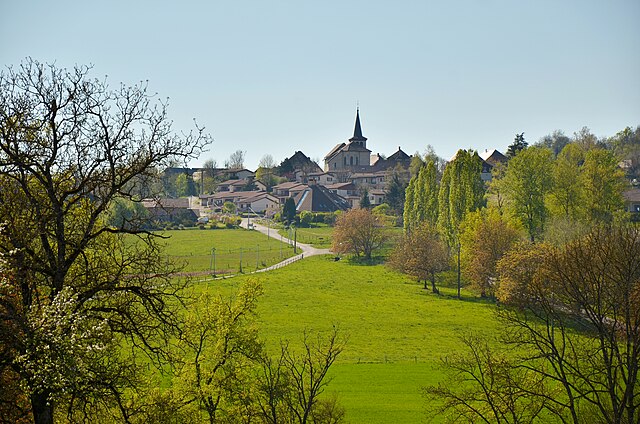
- коммуна во Франции
Hiking in Рошфор
Rochefort is a charming village located in the Savoie region of the French Alps, which is known for its stunning alpine scenery, beautiful landscapes, and fantastic hiking opportunities. Here are some highlights and tips for hiking in and around Rochefort:...
- Страна:
- Почтовый код: 73240
- Координаты: 45° 34' 56" N, 5° 43' 20" E
- GPS треки (wikiloc): [Ссылка]
- Площадь: 5.6 кв.км
- Население: 216


Novalaise
- коммуна во Франции
Hiking in Novalaise
Novalaise is a charming commune located in the Savoie department of the Auvergne-Rhône-Alpes region in southeastern France. Nestled between the picturesque shores of Lake Aiguebelette and the surrounding mountains, it presents excellent opportunities for hiking enthusiasts....
- Страна:
- Почтовый код: 73470
- Координаты: 45° 35' 40" N, 5° 46' 18" E
- GPS треки (wikiloc): [Ссылка]
- Площадь: 16.26 кв.км
- Население: 2067


Verel-de-Montbel
- коммуна во Франции
Hiking in Verel-de-Montbel
Verel-de-Montbel is a charming commune located in the Auvergne-Rhône-Alpes region of France, nestled at the edge of the Chartreuse Mountains. Hiking in this area offers a wonderful opportunity to explore scenic landscapes, diverse flora, and panoramic views of the surrounding mountains and lakes....
- Страна:
- Почтовый код: 73330
- Координаты: 45° 33' 33" N, 5° 43' 49" E
- GPS треки (wikiloc): [Ссылка]
- Площадь: 3.74 кв.км
- Население: 299

Dullin
- коммуна во Франции
Hiking in Dullin
Dullin, located in the Auvergne-Rhône-Alpes region of France, is a great destination for hiking enthusiasts. The area offers a variety of trails that cater to different skill levels, from gentle walks through picturesque landscapes to more challenging hikes that provide stunning views of the surrounding Alps....
- Страна:
- Почтовый код: 73610
- Координаты: 45° 33' 14" N, 5° 44' 41" E
- GPS треки (wikiloc): [Ссылка]
- Площадь: 5.31 кв.км
- Население: 409