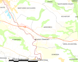
Ле-Понт-де-Бовуазьен (canton of Le Pont-de-Beauvoisin, canton du Pont-de-Beauvoisin)

- кантон Франции
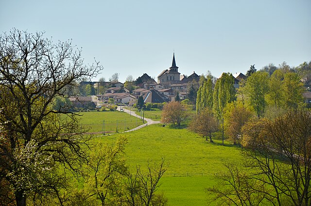
 Hiking in Ле-Понт-де-Бовуазьен
The Canton of Le Pont-de-Beauvoisin is located in the Savoie region of France, nestled between the Belledonne and Chartreuse mountain ranges. This area offers a variety of hiking opportunities, showcasing stunning landscapes, rich biodiversity, and charming small villages.
Hiking Trails
-
The Belledonne Massif: This range is nearby and features trails for all skill levels. You can find both challenging treks for experienced hikers and gentle walks suitable for families. The views of the surrounding valleys and peaks are spectacular.
-
Chartreuse Mountains: These mountains provide a variety of marked trails. You can hike through lush forests, visit hidden lakes, and explore mountain pastures. Popular routes often lead to panoramic viewpoints.
-
Le Cirque de Saint-Même: This natural amphitheater is a great spot for a hike. The trail through the cirque takes you past waterfalls and offers beautiful scenery, making it accessible for all levels.
-
La Dent de Crolles: A more challenging hike that rewards trekkers with breathtaking views at the summit. It's well-marked, but be prepared for steep sections and varying terrain.
Tips for Hiking in the Region
-
Seasonal Considerations: Late spring through early autumn is generally the best time for hiking in this region. Snow can persist in higher elevations well into June, and summer provides the warm temperatures ideal for walking.
-
Preparation: Always carry sufficient water, snacks, and a basic first-aid kit. Good hiking boots are essential, as trails may vary from well-trodden paths to rocky areas.
-
Wildlife: The area is rich in biodiversity, and you might see various wildlife, including deer and many bird species. Be respectful and maintain a safe distance from all wildlife.
-
Local Guides: If you’re unfamiliar with the area, consider hiring a local guide. They can provide insights into the geography, history, and flora and fauna of the region.
-
Map & Navigation: Make sure to have a detailed map or a GPS device. Trail markers can sometimes be sparse, so familiarity with your route is vital.
-
Respect Nature: As with all hiking, adhere to Leave No Trace principles. Stay on marked trails and avoid disturbing wildlife.
Hiking in the Canton of Le Pont-de-Beauvoisin promises a unique experience, with scenic views and a sense of adventure. Enjoy your time exploring this beautiful region!
- Страна:

- Столица: Пон-де-Бовуазен
- Координаты: 45° 32' 48" N, 5° 44' 42" E


- GPS треки (wikiloc): [Ссылка]
- Население: 20418
- Википедия русская: wiki(ru)
- Википедия английская: wiki(en)
- Википедия национальная: wiki(fr)
- Хранилище Wikidata: Wikidata: Q690919
Включает регионы:


Аост
Hiking in Аост
Aoste, located in the Isère department of the Auvergne-Rhône-Alpes region in France, is a charming town surrounded by beautiful mountain landscapes, making it a great destination for hiking enthusiasts. The area offers a variety of hiking trails suitable for different skill levels, from leisurely walks to more challenging treks....
- Страна:
- Почтовый код: 38490
- Координаты: 45° 35' 18" N, 5° 36' 32" E
- GPS треки (wikiloc): [Ссылка]
- Площадь: 9.82 кв.км
- Население: 2862
- Веб сайт: [Ссылка]


Лез-Абрет
- коммуна во Франции
Hiking in Лез-Абрет
Les Abrets is a charming commune located in the Isère department of the Auvergne-Rhône-Alpes region in southeastern France. The area is surrounded by beautiful landscapes, making it an attractive destination for hiking enthusiasts. Here are some highlights you can expect when hiking in Les Abrets:...
- Страна:
- Почтовый код: 38490
- Координаты: 45° 32' 13" N, 5° 35' 6" E
- GPS треки (wikiloc): [Ссылка]
- Площадь: 6.89 кв.км
- Население: 3445
- Веб сайт: [Ссылка]


Романьё
- коммуна во Франции
Hiking in Романьё
Romagnieu is a charming commune located in the Isère department in the Auvergne-Rhône-Alpes region of southeastern France. It’s known for its natural beauty and proximity to hiking opportunities in the surrounding area, particularly due to its location near the Chartreuse Mountains and the Vercors Regional Natural Park....
- Страна:
- Почтовый код: 38480
- Координаты: 45° 34' 12" N, 5° 38' 29" E
- GPS треки (wikiloc): [Ссылка]
- Площадь: 17.11 кв.км
- Население: 1560
- Веб сайт: [Ссылка]

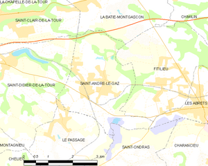
Сент-Андре-ле-Газ
- коммуна во Франции
Hiking in Сент-Андре-ле-Газ
Saint-André-le-Gaz, located in the Auvergne-Rhône-Alpes region of France, offers a delightful experience for hikers and outdoor enthusiasts. Nestled at the foothills of the Chartreuse Mountains and near the Rhône Valley, this area provides a range of trails suitable for various skill levels, from leisurely walks to more challenging hikes....
- Страна:
- Почтовый код: 38490
- Координаты: 45° 32' 56" N, 5° 32' 3" E
- GPS треки (wikiloc): [Ссылка]
- Площадь: 8.89 кв.км
- Население: 2783
- Веб сайт: [Ссылка]
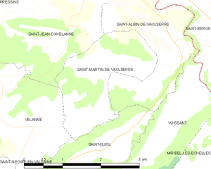
Сен-Мартен-де-Вольсерр
- коммуна во Франции
Hiking in Сен-Мартен-де-Вольсерр
Saint-Martin-de-Vaulserre is a charming commune located in the Isère department of the Auvergne-Rhône-Alpes region in southeastern France. The area offers various hiking opportunities that showcase the beautiful landscapes of the French Alps....
- Страна:
- Почтовый код: 38480
- Координаты: 45° 29' 39" N, 5° 40' 58" E
- GPS треки (wikiloc): [Ссылка]
- Площадь: 3.92 кв.км
- Население: 262
- Веб сайт: [Ссылка]


Сен-Жан-д'Авелан
- коммуна во Франции
Hiking in Сен-Жан-д'Авелан
Saint-Jean-d'Avelanne is a charming commune located in the Isère department of the Auvergne-Rhône-Alpes region in southeastern France. Surrounded by beautiful natural landscapes, it offers several opportunities for hiking and outdoor activities....
- Страна:
- Почтовый код: 38480
- Координаты: 45° 30' 25" N, 5° 40' 23" E
- GPS треки (wikiloc): [Ссылка]
- Площадь: 7.85 кв.км
- Население: 946
- Веб сайт: [Ссылка]
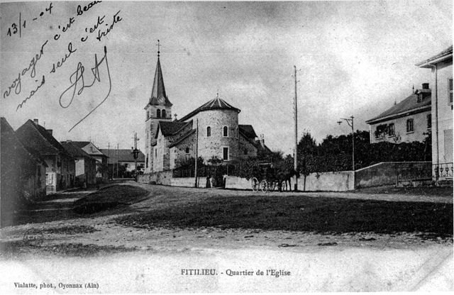

Фитильё
- коммуна во Франции
Hiking in Фитильё
Fitilieu is a charming village located in the Isère department of the Auvergne-Rhône-Alpes region in southeastern France. It’s a fantastic destination for hiking enthusiasts, offering a mix of picturesque landscapes, scenic trails, and opportunities to immerse yourself in nature....
- Страна:
- Почтовый код: 38490
- Координаты: 45° 32' 48" N, 5° 33' 42" E
- GPS треки (wikiloc): [Ссылка]
- Площадь: 10.01 кв.км
- Население: 1905
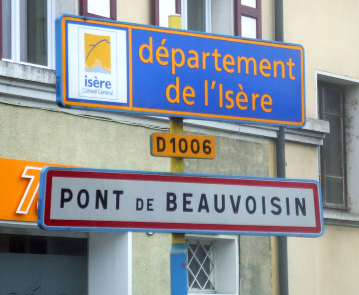

Пон-де-Бовуазен
- коммуна во Франции
Hiking in Пон-де-Бовуазен
Le Pont-de-Beauvoisin, located in the Isère department of France, is a charming small town that serves as a gateway to the beautiful landscapes of the Alps and the surrounding regions. Here are some highlights and tips for hiking in and around Le Pont-de-Beauvoisin:...
- Страна:
- Почтовый код: 38480
- Координаты: 45° 32' 4" N, 5° 39' 59" E
- GPS треки (wikiloc): [Ссылка]
- Площадь: 7.36 кв.км
- Население: 3574
- Веб сайт: [Ссылка]


Граньё
- коммуна во Франции
Hiking in Граньё
Granieu is a charming village nestled in the picturesque French Alps, making it a fantastic destination for hiking enthusiasts. Its location offers access to a variety of trails that cater to different skill levels, from gentle walks to challenging ascents. Here are some highlights for hiking in the Granieu area:...
- Страна:
- Почтовый код: 38490
- Координаты: 45° 35' 58" N, 5° 35' 19" E
- GPS треки (wikiloc): [Ссылка]
- Площадь: 3.73 кв.км
- Население: 482


Корбелен
- коммуна во Франции
Hiking in Корбелен
Corbelin is a charming village located in the Auvergne-Rhône-Alpes region of France, and it offers a variety of outdoor activities, including hiking. The area is known for its scenic landscapes, wooded hills, and proximity to natural reserves, making it an ideal spot for those who enjoy immersing themselves in nature....
- Страна:
- Почтовый код: 38630
- Координаты: 45° 36' 27" N, 5° 32' 41" E
- GPS треки (wikiloc): [Ссылка]
- Площадь: 12 кв.км
- Население: 2223
- Веб сайт: [Ссылка]


Domessin
- коммуна во Франции
Hiking in Domessin
Domessin is a quaint commune located in the Savoie department in the Auvergne-Rhône-Alpes region of southeastern France. Nestled at the foot of the Chartreuse Mountains, this area offers a variety of hiking opportunities that cater to different skill levels....
- Страна:
- Почтовый код: 73330
- Координаты: 45° 32' 25" N, 5° 42' 33" E
- GPS треки (wikiloc): [Ссылка]
- Площадь: 9.83 кв.км
- Население: 1839
- Веб сайт: [Ссылка]


Прессен
- коммуна во Франции
Hiking in Прессен
Pressins is a charming commune located in the Isère department of southeastern France. It's a lesser-known destination for hikers, but it offers access to beautiful landscapes typical of the French Alps and surrounding regions. Here are some key points to consider if you're planning a hiking trip in and around Pressins:...
- Страна:
- Почтовый код: 38480
- Координаты: 45° 31' 32" N, 5° 37' 38" E
- GPS треки (wikiloc): [Ссылка]
- Площадь: 10.1 кв.км
- Население: 1147
- Веб сайт: [Ссылка]


Saint-Béron
- коммуна во Франции
Hiking in Saint-Béron
Saint-Béron is a charming commune located in the Savoie department of the Auvergne-Rhône-Alpes region in southeastern France. It's nestled in the foothills of the French Alps, providing some beautiful hiking opportunities for outdoor enthusiasts....
- Страна:
- Почтовый код: 73520
- Координаты: 45° 30' 5" N, 5° 43' 45" E
- GPS треки (wikiloc): [Ссылка]
- Площадь: 8.66 кв.км
- Население: 1656

Belmont-Tramonet
- коммуна во Франции
Hiking in Belmont-Tramonet
Belmont-Tramonet is a picturesque municipality located in the Savoie region of France, nestled in the French Alps. It offers stunning views and a variety of hiking opportunities, making it a great destination for outdoor enthusiasts....
- Страна:
- Почтовый код: 73330
- Координаты: 45° 33' 34" N, 5° 40' 46" E
- GPS треки (wikiloc): [Ссылка]
- Площадь: 5.46 кв.км
- Население: 561

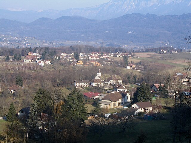
Saint-Alban-de-Montbel
- коммуна во Франции
Hiking in Saint-Alban-de-Montbel
Saint-Alban-de-Montbel is a picturesque village located near the shores of Lake Aiguebelette in the Savoie region of France. This area is rich in natural beauty, making it an excellent destination for hiking enthusiasts. Here are some aspects to consider if you're planning to hike in and around Saint-Alban-de-Montbel:...
- Страна:
- Почтовый код: 73610
- Координаты: 45° 33' 6" N, 5° 47' 0" E
- GPS треки (wikiloc): [Ссылка]
- Площадь: 4.55 кв.км
- Население: 622


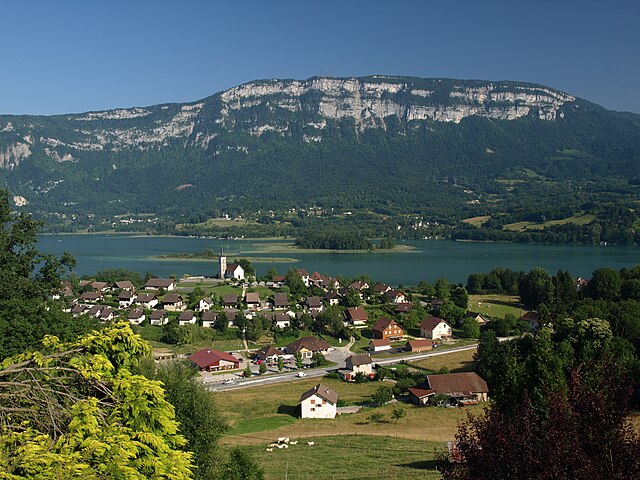
Эгбелет-ле-Лак
- коммуна во Франции
Hiking in Эгбелет-ле-Лак
Aiguebelette-le-Lac is a beautiful destination located in the Savoie region of France, known for its stunning lake—one of the cleanest in Europe—and surrounding natural landscapes, making it a fantastic spot for hiking enthusiasts....
- Страна:
- Почтовый код: 73610
- Координаты: 45° 32' 16" N, 5° 48' 54" E
- GPS треки (wikiloc): [Ссылка]
- Площадь: 7.91 кв.км
- Население: 243


Ла-Бати-Монгаскон
- коммуна во Франции
Hiking in Ла-Бати-Монгаскон
La Bâtie-Montgascon is a charming village located in the Auvergne-Rhône-Alpes region of France, near the foothills of the Alps. The area is rich with natural beauty and offers various hiking opportunities for outdoor enthusiasts....
- Страна:
- Почтовый код: 38110
- Координаты: 45° 34' 45" N, 5° 31' 41" E
- GPS треки (wikiloc): [Ссылка]
- Площадь: 8.43 кв.км
- Население: 1890
- Веб сайт: [Ссылка]


Nances
- коммуна во Франции
Hiking in Nances
Nances, often associated with scenic trails and beautiful landscapes, offers a variety of hiking opportunities for outdoor enthusiasts. Here’s a general guide to hiking in the Nances area, which you can adapt based on your specific location or preferences:...
- Страна:
- Почтовый код: 73470
- Координаты: 45° 35' 25" N, 5° 47' 48" E
- GPS треки (wikiloc): [Ссылка]
- Площадь: 9.9 кв.км
- Население: 451
- Веб сайт: [Ссылка]


Сент-Альбен-де-Вольсерр
- коммуна во Франции
Hiking in Сент-Альбен-де-Вольсерр
Saint-Albin-de-Vaulserre is a charming commune located in the Isère department in the Auvergne-Rhône-Alpes region of southeastern France. While it is not as well-known as other hiking destinations, it offers beautiful rural landscapes and access to outdoor activities that can be enjoyed by hikers of all levels....
- Страна:
- Почтовый код: 38480
- Координаты: 45° 30' 17" N, 5° 42' 9" E
- GPS треки (wikiloc): [Ссылка]
- Площадь: 4.99 кв.км
- Население: 400
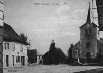

Шимьен
- коммуна во Франции
Hiking in Шимьен
Chimilin might refer to a specific region or area, but it doesn’t appear to be widely recognized as a hiking destination in available resources or discussions up to October 2023. However, if you are referring to a specific place known for hiking, such as Chimilin National Park or another similar-sounding location, please clarify....
- Страна:
- Почтовый код: 38490
- Координаты: 45° 34' 37" N, 5° 35' 58" E
- GPS треки (wikiloc): [Ссылка]
- Площадь: 9.66 кв.км
- Население: 1467
- Веб сайт: [Ссылка]


Ayn, Savoie
- коммуна во Франции
Hiking in Ayn, Savoie
Ayn, located in the Savoie department of the Auvergne-Rhône-Alpes region in France, is surrounded by stunning natural beauty, making it an excellent destination for hiking enthusiasts. Here are some key points about hiking in and around Ayn:...
- Страна:
- Почтовый код: 73470
- Координаты: 45° 34' 21" N, 5° 45' 3" E
- GPS треки (wikiloc): [Ссылка]
- Площадь: 7.44 кв.км
- Население: 359


Verel-de-Montbel
- коммуна во Франции
Hiking in Verel-de-Montbel
Verel-de-Montbel is a charming commune located in the Auvergne-Rhône-Alpes region of France, nestled at the edge of the Chartreuse Mountains. Hiking in this area offers a wonderful opportunity to explore scenic landscapes, diverse flora, and panoramic views of the surrounding mountains and lakes....
- Страна:
- Почтовый код: 73330
- Координаты: 45° 33' 33" N, 5° 43' 49" E
- GPS треки (wikiloc): [Ссылка]
- Площадь: 3.74 кв.км
- Население: 299


Пон-де-Бовуазен
Hiking in Пон-де-Бовуазен
Le Pont-de-Beauvoisin, located in the Savoie department of the Auvergne-Rhône-Alpes region in France, is a great spot for hiking enthusiasts. Nestled between the picturesque mountains and rolling hills, this area offers a variety of trails and scenic views....
- Страна:
- Почтовый код: 73330
- Координаты: 45° 32' 11" N, 5° 40' 21" E
- GPS треки (wikiloc): [Ссылка]
- Площадь: 1.83 кв.км
- Население: 2071
- Веб сайт: [Ссылка]


La Bridoire
- коммуна во Франции
Hiking in La Bridoire
La Bridoire is a charming commune located in the Savoie department of the Auvergne-Rhône-Alpes region in southeastern France. It is set in a scenic area that offers a variety of hiking opportunities amidst beautiful landscapes....
- Страна:
- Почтовый код: 73520
- Координаты: 45° 31' 34" N, 5° 44' 33" E
- GPS треки (wikiloc): [Ссылка]
- Площадь: 6.18 кв.км
- Население: 1238

Dullin
- коммуна во Франции
Hiking in Dullin
Dullin, located in the Auvergne-Rhône-Alpes region of France, is a great destination for hiking enthusiasts. The area offers a variety of trails that cater to different skill levels, from gentle walks through picturesque landscapes to more challenging hikes that provide stunning views of the surrounding Alps....
- Страна:
- Почтовый код: 73610
- Координаты: 45° 33' 14" N, 5° 44' 41" E
- GPS треки (wikiloc): [Ссылка]
- Площадь: 5.31 кв.км
- Население: 409

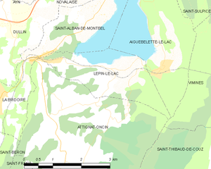
Lépin-le-Lac
- коммуна во Франции
Hiking in Lépin-le-Lac
Lépin-le-Lac, located in the idyllic Savoie region of the French Alps, offers an excellent opportunity for hiking enthusiasts seeking stunning landscapes and a mix of outdoor activities. Here’s a breakdown of what you can expect when hiking in this area:...
- Страна:
- Почтовый код: 73610
- Координаты: 45° 32' 7" N, 5° 47' 40" E
- GPS треки (wikiloc): [Ссылка]
- Площадь: 5.11 кв.км
- Население: 454