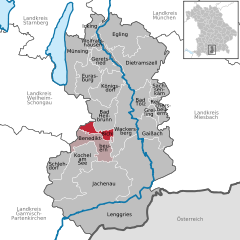
Бад-Хайльбрунн (Bad Heilbrunn, Bad Heilbrunn)

 Hiking in Бад-Хайльбрунн
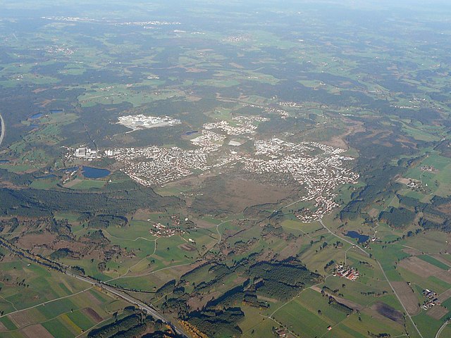
Bad Heilbrunn, located in Bavaria, Germany, is a picturesque destination for hiking enthusiasts. Nestled in the foothills of the Bavarian Alps, it offers a variety of hiking trails that cater to different skill levels, from leisurely strolls to more challenging treks.
Highlights of Hiking in Bad Heilbrunn:
-
Stunning Scenery: The region is characterized by beautiful landscapes, including forests, meadows, and views of the surrounding mountains. The trails offer a chance to immerse yourself in nature and enjoy panoramic vistas.
-
Diverse Trails: There are various marked hiking paths in and around Bad Heilbrunn. One popular option is the trail that leads to the nearby mountain of Hohenpeißenberg, which provides impressive views at the summit.
-
Well-Maintained Paths: The trails are generally well-marked and maintained, making it easy for hikers to navigate. Signposts along the routes provide information about the distance and estimated hiking times.
-
Nature and Wildlife: As you hike, you might encounter diverse flora and fauna, including local wildlife such as deer and various bird species. The region is great for nature lovers and photographers.
-
Cultural Experience: The area is steeped in history, and hiking can be a great way to explore local culture. You may find traditional Bavarian villages along your route, offering a chance to experience regional cuisine and hospitality.
-
Seasonal Hiking: Bad Heilbrunn is suitable for hiking year-round. In addition to summer hikes, the winter months can offer opportunities for snowshoeing or winter hiking.
Tips for Hiking in Bad Heilbrunn:
- Gear Up: Wear sturdy footwear and comfortable clothing suitable for the weather and terrain.
- Stay Hydrated: Bring plenty of water, especially on warmer days.
- Check the Weather: Conditions can change rapidly in mountainous areas, so it’s wise to check the forecast before heading out.
- Map and Navigation: While trails are marked, having a map or using a hiking app can help in planning routes and ensuring you don’t get lost.
- Respect Nature: Follow the Leave No Trace principles to protect the environment and preserve the beauty of the area for future hikers.
Whether you're a seasoned hiker or just looking for a peaceful walk in nature, Bad Heilbrunn offers a wonderful setting for outdoor activities. Enjoy your hiking experience!
- Страна:

- Почтовый код: 83670
- Телефонный код: 08046
- Координаты: 47° 45' 0" N, 11° 27' 0" E


- GPS треки (wikiloc): [Ссылка]
- Высота над уровнем моря: 682 м m
- Площадь: 40.32 кв.км
- Население: 3822
- Веб сайт: http://www.bad-heilbrunn.de/
- Википедия русская: wiki(ru)
- Википедия английская: wiki(en)
- Википедия национальная: wiki(de)
- Хранилище Wikidata: Wikidata: Q256278
- Катеория в википедии: [Ссылка]
- код Freebase: [/m/02q0ygf]
- код GeoNames: Альт: [2953443]
- ID отношения в OpenStreetMap: [935232]
- код GND: Альт: [4096106-0]
- идентификатор местоположения ArchINFORM: [13333]
- код Historical Gazetteer: [HEIUNNJN57RS]
- Bavarikon ID: [ODB_A00000949]
- идентификатор муниципалитетов в Германии: 09173111
Граничит с регионами:

Пенцберг
Hiking in Пенцберг
Penzberg, located in Bavaria, Germany, offers a variety of hiking opportunities that cater to different skill levels and preferences. The region is known for its stunning landscapes, which include rolling hills, forests, and panoramic views of the Alps. Here are some highlights and tips for hiking in Penzberg:...
- Страна:
- Почтовый код: 82377
- Телефонный код: 08856
- Код автомобильного номера: WM
- Координаты: 47° 45' 0" N, 11° 22' 0" E
- GPS треки (wikiloc): [Ссылка]
- Высота над уровнем моря: 596 м m
- Площадь: 25.73 кв.км
- Население: 12949
- Веб сайт: [Ссылка]

Бихль
Hiking in Бихль
Bichl is a small village located in Bavaria, Germany, near the beautiful landscape of the Alps. Hiking in this region offers a variety of trails that cater to different skill levels, from gentle walks to more challenging alpine routes. Here are some highlights regarding hiking in and around Bichl:...
- Страна:
- Почтовый код: 83673
- Телефонный код: 08857
- Координаты: 47° 43' 14" N, 11° 24' 43" E
- GPS треки (wikiloc): [Ссылка]
- Высота над уровнем моря: 625 м m
- Площадь: 13.92 кв.км
- Население: 1544
- Веб сайт: [Ссылка]