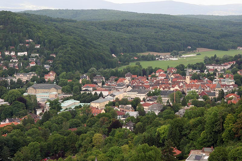
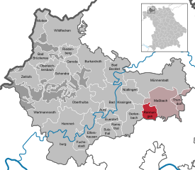
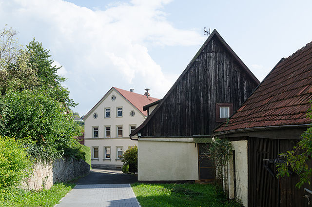
Бад-Киссинген (Bad Kissingen, Landkreis Bad Kissingen)

 Hiking in Бад-Киссинген
Bad Kissingen, located in Bavaria, Germany, is a beautiful spa town known for its healing mineral waters and lovely natural surroundings. The area's scenic landscapes make it an excellent destination for hiking enthusiasts. Here are some key points about hiking in Bad Kissingen:
Trails and Routes
-
Kissinger Weg: This is a popular hiking trail that offers stunning views of the surrounding countryside. It connects various points in and around Bad Kissingen, allowing hikers to explore the natural beauty of the region.
-
Wanderwege (Hiking Paths): The district has a well-maintained network of marked paths that cater to different skill levels. You can find easy strolls through picturesque gardens as well as more challenging trails that lead to elevated viewpoints.
-
Rundweg (Circular Trails): Many trails in the area are circular, making it easy to plan a hike and return to the starting point without needing to backtrack.
Points of Interest
- Burgruine Botenlauben: An old castle ruin located on a hill, which offers a nice hike and excellent views of Bad Kissingen.
- The Saale River: Trails along the river provide a tranquil atmosphere and access to various parks and greenery.
Best Times to Hike
The best times for hiking in Bad Kissingen are in the late spring and early autumn months when the weather is mild and the natural surroundings are vibrant. Summer can be hot, while winter hikes can be icy; appropriate gear is essential during colder months.
Facilities
The area has several facilities for hikers, including:
- Visitor Information Centers: These can provide maps, trail information, and insights into local flora and fauna.
- Rest Areas: Many trails have rest stops and benches where hikers can relax and enjoy their surroundings.
Tips for Hiking
- Footwear: Wear sturdy hiking boots with good grip, as some trails may be steep or uneven.
- Stay Hydrated: Bring enough water, especially during warmer months.
- Check Weather Conditions: Prepare for changes in weather, as conditions can shift quickly.
Overall, Bad Kissingen is a superb destination for hikers, offering a mix of beautiful landscapes, cultural heritage, and wellness experiences in its spa facilities. Whether you're a seasoned hiker or a casual walker, there's something for everyone to enjoy.
- Страна:

- Столица: Бад-Киссинген
- Код автомобильного номера: HAB; BRK; KG
- Координаты: 50° 15' 0" N, 10° 0' 0" E


- GPS треки (wikiloc): [Ссылка]
- Высота над уровнем моря: 330 м m
- Площадь: 1137.00 кв.км
- Население: 99022
- Веб сайт: http://www.landkreis-aschaffenburg.de/
- Википедия русская: wiki(ru)
- Википедия английская: wiki(en)
- Википедия национальная: wiki(de)
- Хранилище Wikidata: Wikidata: Q10466
- Катеория в википедии: [Ссылка]
- Карты в википедии: [Ссылка]
- код Freebase: [/m/01chlh]
- код GeoNames: Альт: [2953423]
- код VIAF: Альт: [239398882]
- ID отношения в OpenStreetMap: [62406]
- код GND: Альт: [4030877-7]
- идентификатор местоположения ArchINFORM: [2326]
- код LCNAF: Альт: [n94112686]
- код темы Quora: [Bad-Kissingen]
- код TGN: [7061059]
- Bavarikon ID: [ODB_A00000264]
- код NUTS: [DE265]
- код района Германии: 09672
Включает регионы:


Dreistelzer Forst
Hiking in Dreistelzer Forst
Dreistelzer Forst is a beautiful forested area located in Germany, known for its serene landscapes, diverse flora and fauna, and numerous trails suitable for hiking. Here are some key points to consider when hiking in Dreistelzer Forst:...
- Страна:
- Координаты: 50° 16' 37" N, 9° 46' 9" E
- GPS треки (wikiloc): [Ссылка]
Mottener Forst-Süd
Hiking in Mottener Forst-Süd
Mottener Forst-Süd is a beautiful area for hiking located in the region of Bavaria, Germany. It's part of the larger Mottener Forst forest, which offers a variety of trails through picturesque woods, rolling hills, and scenic landscapes....
- Страна:
- Координаты: 50° 21' 20" N, 9° 47' 10" E
- GPS треки (wikiloc): [Ссылка]
Forst Detter-Süd
Hiking in Forst Detter-Süd
Forst Detter-Süd is part of the larger Forst Detter area, which is known for its beautiful landscapes and hiking opportunities. Located in Germany, this area is characterized by lush forests, rolling hills, and diverse flora and fauna, making it ideal for outdoor enthusiasts....
- Страна:
- Координаты: 50° 12' 8" N, 9° 45' 42" E
- GPS треки (wikiloc): [Ссылка]
Geiersnest-Ost
Hiking in Geiersnest-Ost
Geiersnest-Ost is a stunning area for hiking, located in the central part of Germany, typically within the region of the Harz mountains. The region is known for its picturesque landscapes, diverse ecosystems, and well-marked hiking trails that cater to various skill levels....
- Страна:
- Координаты: 50° 14' 0" N, 9° 49' 46" E
- GPS треки (wikiloc): [Ссылка]
Geiersnest-West
Hiking in Geiersnest-West
Geiersnest-West is known for its stunning landscapes and diverse hiking opportunities. Located in a region typically characterized by scenic vistas, lush forests, and varying elevation, here's what you can expect when hiking in this area:...
- Страна:
- Координаты: 50° 14' 37" N, 9° 46' 59" E
- GPS треки (wikiloc): [Ссылка]
Römershager Forst-Ost
Hiking in Römershager Forst-Ost
Römershager Forst-Ost is part of a larger forested area in Germany, and it offers a variety of hiking opportunities amidst beautiful natural surroundings. While specific trails may not be widely documented online, this area typically features well-maintained paths suitable for different levels of hiker experience....
- Страна:
- Координаты: 50° 18' 40" N, 9° 50' 13" E
- GPS треки (wikiloc): [Ссылка]
Omerz und Roter Berg
Hiking in Omerz und Roter Berg
Omerz und Roter Berg, located in Germany, are popular destinations for hiking and outdoor activities. These areas offer a variety of trails that cater to different skill levels, making them accessible for both novice and experienced hikers....
- Страна:
- Координаты: 50° 11' 9" N, 9° 42' 27" E
- GPS треки (wikiloc): [Ссылка]
Römershager Forst-Nord
Hiking in Römershager Forst-Nord
Römershager Forst-Nord is a picturesque forest area located in Germany, known for its diverse landscapes and tranquility, making it an excellent destination for hiking enthusiasts. The forest features a variety of trails suitable for different skill levels, from easy strolls to more challenging hikes....
- Страна:
- Координаты: 50° 20' 3" N, 9° 47' 44" E
- GPS треки (wikiloc): [Ссылка]
Neuwirtshauser Forst
Hiking in Neuwirtshauser Forst
Neuwirtshauser Forst is a picturesque forest area located in Germany, typically known for its serene landscapes and varied hiking trails. It offers a great opportunity for both beginners and experienced hikers to explore nature. Here are some key points about hiking in Neuwirtshauser Forst:...
- Страна:
- Координаты: 50° 12' 31" N, 9° 48' 18" E
- GPS треки (wikiloc): [Ссылка]
Roßbacher Forst
Hiking in Roßbacher Forst
Roßbacher Forst, located in Germany, is a beautiful area for hiking, offering a mix of forested paths, scenic landscapes, and opportunities to experience nature. Here are some key points to keep in mind if you're planning to hike in this region:...
- Страна:
- Координаты: 50° 13' 13" N, 9° 41' 59" E
- GPS треки (wikiloc): [Ссылка]
Waldfensterer Forst
Hiking in Waldfensterer Forst
Waldfensterer Forst is a beautiful forested area located in Germany, known for its picturesque landscapes and diverse hiking opportunities. While specific trails and conditions may vary, here are some general aspects of hiking in Waldfensterer Forst:...
- Страна:
- Координаты: 50° 15' 26" N, 9° 56' 8" E
- GPS треки (wikiloc): [Ссылка]


Цайтлофс
Hiking in Цайтлофс
Zeitlofs is a quaint village located in the northern part of Bavaria, Germany. It's surrounded by picturesque landscapes, making it an excellent destination for hiking enthusiasts. The region offers a variety of trails that cater to different skill levels, from easy walks suitable for families to challenging hikes for more experienced trekkers....
- Страна:
- Почтовый код: 97799
- Телефонный код: 09746
- Код автомобильного номера: KG
- Координаты: 50° 16' 0" N, 9° 40' 0" E
- GPS треки (wikiloc): [Ссылка]
- Высота над уровнем моря: 242 м m
- Площадь: 40.11 кв.км
- Население: 2114
- Веб сайт: [Ссылка]
Kälberberg (Unterfranken)
Hiking in Kälberberg (Unterfranken)
Kälberberg, situated in the gemeindefreies Gebiet (unincorporated area) in Germany, offers a serene hiking experience for outdoor enthusiasts. Here are some key points to consider when planning your hike in this area:...
- Страна:
- Координаты: 50° 16' 11" N, 9° 40' 58" E
- GPS треки (wikiloc): [Ссылка]


Großer Auersberg
Hiking in Großer Auersberg
Großer Auersberg is a prominent peak located in the Ore Mountains (Erzgebirge) of Germany, nestled along the border with the Czech Republic. While it is in a gemeindefreies Gebiet (an area without local municipality), it offers a range of hiking opportunities for outdoor enthusiasts who wish to explore its scenic landscapes. Here are some highlights and tips for hiking in the Großer Auersberg area:...
- Страна:
- Координаты: 50° 22' 0" N, 9° 52' 0" E
- GPS треки (wikiloc): [Ссылка]


Хаммельбург
Hiking in Хаммельбург
Hammelburg, located in Bavaria, Germany, offers a variety of hiking opportunities that showcase the beautiful landscapes of the region. The area is known for its rolling hills, vineyards, and picturesque scenery, making it a great destination for outdoor enthusiasts....
- Страна:
- Почтовый код: 97762
- Телефонный код: 09732
- Координаты: 50° 7' 0" N, 9° 54' 0" E
- GPS треки (wikiloc): [Ссылка]
- Высота над уровнем моря: 182 м m
- Площадь: 128.89 кв.км
- Население: 11135
- Веб сайт: [Ссылка]


Эрленбах
- муниципалитет в Германии, Бавария
Hiking in Эрленбах
Oerlenbach, located in Bavaria, Germany, offers a range of hiking opportunities that allow enthusiasts to enjoy the beautiful natural landscapes of the region. Here are some highlights to consider for hiking in and around Oerlenbach:...
- Страна:
- Почтовый код: 97714
- Телефонный код: 09738; 09725
- Код автомобильного номера: KG
- Координаты: 50° 8' 59" N, 10° 7' 59" E
- GPS треки (wikiloc): [Ссылка]
- Высота над уровнем моря: 304 м m
- Площадь: 33.41 кв.км
- Население: 4660
- Веб сайт: [Ссылка]

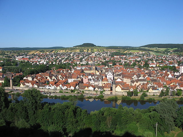
Бад-Киссинген
Hiking in Бад-Киссинген
Bad Kissingen, located in Bavaria, Germany, is a beautiful destination for hiking enthusiasts. Known for its historic spa town atmosphere, it offers a range of hiking trails that cater to various skill levels and preferences. Here are some highlights and tips for hiking in the area:...
- Страна:
- Почтовый код: 97688
- Телефонный код: 0971
- Код автомобильного номера: KG
- Координаты: 50° 12' 0" N, 10° 4' 0" E
- GPS треки (wikiloc): [Ссылка]
- Высота над уровнем моря: 220 м m
- Площадь: 69.42 кв.км
- Население: 21696
- Веб сайт: [Ссылка]


Буркардрот
Hiking in Буркардрот
Burkardroth is a small municipality located in Bavaria, Germany, which offers beautiful scenery and a variety of hiking opportunities for outdoor enthusiasts. The region is characterized by its lush forests, gentle hills, and picturesque landscapes. Here are some key aspects to consider when hiking in Burkardroth:...
- Страна:
- Почтовый код: 97705
- Телефонный код: 09734
- Код автомобильного номера: KG
- Координаты: 50° 16' 19" N, 9° 59' 22" E
- GPS треки (wikiloc): [Ссылка]
- Высота над уровнем моря: 304 м m
- Площадь: 69.11 кв.км
- Население: 7549
- Веб сайт: [Ссылка]


Бад-Боклет
Hiking in Бад-Боклет
Bad Bocklet is a charming spa town located in Bavaria, Germany, known for its therapeutic springs and beautiful natural surroundings. The area offers a variety of hiking opportunities that cater to different skill levels. Here are some highlights and tips for hiking in and around Bad Bocklet:...
- Страна:
- Почтовый код: 97708
- Телефонный код: 09708
- Код автомобильного номера: KG
- Координаты: 50° 16' 0" N, 10° 5' 0" E
- GPS треки (wikiloc): [Ссылка]
- Высота над уровнем моря: 230 м m
- Площадь: 36.20 кв.км
- Население: 3753
- Веб сайт: [Ссылка]


Нюдлинген
Hiking in Нюдлинген
Nüdlingen is a charming village in Bavaria, Germany, surrounded by beautiful landscapes that make it a great destination for hiking enthusiasts. The area features a mix of scenic trails, lush forests, and rolling hills, providing a variety of hiking experiences suitable for different skill levels....
- Страна:
- Почтовый код: 97720
- Телефонный код: 0971
- Код автомобильного номера: KG
- Координаты: 50° 13' 0" N, 10° 8' 0" E
- GPS треки (wikiloc): [Ссылка]
- Высота над уровнем моря: 256 м m
- Площадь: 26.34 кв.км
- Население: 3520
- Веб сайт: [Ссылка]
Моттен
Hiking in Моттен
Motten, a small municipality located in Bavaria, Germany, offers a range of hiking opportunities amidst picturesque landscapes and diverse natural environments. While the area is not as well-known as some of the larger national parks or tourist regions in Germany, it still provides options for hiking enthusiasts to explore....
- Страна:
- Почтовый код: 97786
- Телефонный код: 09748
- Код автомобильного номера: KG
- Координаты: 50° 24' 0" N, 9° 46' 0" E
- GPS треки (wikiloc): [Ссылка]
- Высота над уровнем моря: 420 м m
- Площадь: 23.80 кв.км
- Население: 1641
- Веб сайт: [Ссылка]


Масбах
Hiking in Масбах
Maßbach is a charming municipality located in Bavaria, Germany, and offers a variety of hiking opportunities for outdoor enthusiasts. The surrounding landscape features beautiful rolling hills, forests, and scenic views, making it an ideal spot for hiking....
- Страна:
- Почтовый код: 97711
- Телефонный код: 09735
- Код автомобильного номера: KG
- Координаты: 50° 11' 0" N, 10° 17' 0" E
- GPS треки (wikiloc): [Ссылка]
- Высота над уровнем моря: 284 м m
- Площадь: 59.31 кв.км
- Население: 4422
- Веб сайт: [Ссылка]


Эльферсхаузен
Hiking in Эльферсхаузен
Elfershausen, located in Bavaria, Germany, offers a variety of beautiful hiking opportunities for outdoor enthusiasts. The region is characterized by its scenic landscapes, rolling hills, and rich natural beauty, making it an excellent destination for hiking....
- Страна:
- Почтовый код: 97725
- Телефонный код: 09704
- Код автомобильного номера: KG
- Координаты: 50° 9' 0" N, 9° 58' 0" E
- GPS треки (wikiloc): [Ссылка]
- Высота над уровнем моря: 198 м m
- Площадь: 34.92 кв.км
- Население: 2877
- Веб сайт: [Ссылка]

Раннунген
Hiking in Раннунген
Rannungen is a small and scenic area in Germany, typically characterized by its natural landscapes and local trails. While it might not be as widely known as some of the larger hiking destinations, it offers a chance to explore beautiful surroundings in a quieter setting....
- Страна:
- Почтовый код: 97517
- Телефонный код: 09738
- Код автомобильного номера: KG
- Координаты: 50° 10' 0" N, 10° 12' 19" E
- GPS треки (wikiloc): [Ссылка]
- Высота над уровнем моря: 352 м m
- Площадь: 17.34 кв.км
- Население: 1117
- Веб сайт: [Ссылка]


Зульцталь
Hiking in Зульцталь
Sulzthal, located in Germany, provides a tranquil setting for hiking enthusiasts, with its picturesque landscapes, rolling hills, and scenic trails. While there's not an extensive range of well-known hiking routes specifically labeled under Sulzthal, its proximity to regional trails and natural attractions makes it an excellent base for exploring the surrounding areas....
- Страна:
- Почтовый код: 97717
- Телефонный код: 09704
- Код автомобильного номера: KG
- Координаты: 50° 8' 0" N, 10° 2' 0" E
- GPS треки (wikiloc): [Ссылка]
- Высота над уровнем моря: 254 м m
- Площадь: 15.06 кв.км
- Население: 859
- Веб сайт: [Ссылка]
Оберлайхтерсбах
Hiking in Оберлайхтерсбах
Oberleichtersbach, a small and picturesque village located in Bavaria, Germany, offers a range of hiking opportunities in a beautiful natural setting. The area is characterized by rolling hills, dense forests, and scenic landscapes, making it ideal for outdoor enthusiasts....
- Страна:
- Почтовый код: 97789
- Телефонный код: 09741
- Код автомобильного номера: KG
- Координаты: 50° 16' 29" N, 9° 48' 18" E
- GPS треки (wikiloc): [Ссылка]
- Высота над уровнем моря: 408 м m
- Площадь: 27.60 кв.км
- Население: 1787
- Веб сайт: [Ссылка]


Рамсталь
Hiking in Рамсталь
Ramsthal is a small village located in the Bavaria region of Germany, known for its scenic countryside and beautiful landscapes. While it may not be as famous as some larger hiking destinations, it offers a tranquil setting suitable for outdoor activities such as hiking....
- Страна:
- Почтовый код: 97729
- Телефонный код: 09704
- Код автомобильного номера: KG
- Координаты: 50° 8' 0" N, 10° 4' 0" E
- GPS треки (wikiloc): [Ссылка]
- Высота над уровнем моря: 252 м m
- Площадь: 10.42 кв.км
- Население: 1105
- Веб сайт: [Ссылка]


Фуксштадт
Hiking in Фуксштадт
Fuchsstadt, a small town in the Lower Franconia region of Bavaria, Germany, offers some lovely hiking opportunities in its surrounding nature, blending scenic views with historical elements. Here are some highlights and tips for hiking in and around Fuchsstadt:...
- Страна:
- Почтовый код: 97727
- Телефонный код: 09732
- Координаты: 50° 6' 0" N, 9° 56' 0" E
- GPS треки (wikiloc): [Ссылка]
- Высота над уровнем моря: 208 м m
- Площадь: 18.30 кв.км
- Население: 1446
- Веб сайт: [Ссылка]

Ойердорф
Hiking in Ойердорф
Euerdorf is a charming village located in Bavaria, Germany, known for its beautiful landscapes and outdoor recreational opportunities. Hiking in and around Euerdorf offers a variety of trails suitable for different skill levels, making it a great destination for both beginners and experienced hikers....
- Страна:
- Почтовый код: 97717
- Телефонный код: 09704
- Код автомобильного номера: KG
- Координаты: 50° 9' 0" N, 10° 2' 0" E
- GPS треки (wikiloc): [Ссылка]
- Высота над уровнем моря: 202 м m
- Площадь: 16.34 кв.км
- Население: 1553
- Веб сайт: [Ссылка]


Шондра
Hiking in Шондра
Schondra, located in Bavaria, Germany, is nestled in a picturesque region characterized by rolling hills, lush forests, and charming landscapes, making it an excellent destination for hiking enthusiasts....
- Страна:
- Почтовый код: 97795
- Телефонный код: 09747
- Код автомобильного номера: KG
- Координаты: 50° 16' 0" N, 9° 52' 0" E
- GPS треки (wikiloc): [Ссылка]
- Высота над уровнем моря: 432 м m
- Площадь: 28.61 кв.км
- Население: 1536
- Веб сайт: [Ссылка]


Бад-Брюккенау
Hiking in Бад-Брюккенау
Bad Brückenau, located in Bavaria, Germany, is an excellent hiking destination known for its scenic landscapes, rich history, and therapeutic thermal springs. Here are some highlights for hiking in Bad Brückenau:...
- Страна:
- Почтовый код: 97769
- Телефонный код: 09741
- Координаты: 50° 17' 0" N, 9° 48' 0" E
- GPS треки (wikiloc): [Ссылка]
- Высота над уровнем моря: 332 м m
- Площадь: 23.73 кв.км
- Население: 6412
- Веб сайт: [Ссылка]


Обертульба
Hiking in Обертульба
Oberthulba is a picturesque municipality located in the Bavarian region of Germany, surrounded by beautiful landscapes that make it an appealing destination for hikers. Here are some highlights and tips for hiking in and around Oberthulba:...
- Страна:
- Почтовый код: 97723
- Телефонный код: 09736
- Код автомобильного номера: KG
- Координаты: 50° 12' 0" N, 9° 58' 0" E
- GPS треки (wikiloc): [Ссылка]
- Высота над уровнем моря: 270 м m
- Площадь: 52.48 кв.км
- Население: 4261
- Веб сайт: [Ссылка]


Вильдфлеккен
Hiking in Вильдфлеккен
Wildflecken is a small town located in the Rhön Mountains in Bavaria, Germany, known for its stunning natural landscapes and rich cultural history. It's an excellent destination for hiking enthusiasts due to its diverse trails and beautiful scenery. Here are some key points about hiking in the area:...
- Страна:
- Почтовый код: 97772
- Телефонный код: 09745
- Координаты: 50° 22' 0" N, 9° 55' 0" E
- GPS треки (wikiloc): [Ссылка]
- Высота над уровнем моря: 516 м m
- Площадь: 77.56 кв.км
- Население: 2760
- Веб сайт: [Ссылка]

Аура-на-Заале
Hiking in Аура-на-Заале
Aura an der Saale is a picturesque village located in Bavaria, Germany, surrounded by scenic landscapes and natural beauty. When hiking in and around Aura an der Saale, you can expect a blend of lush forests, rolling hills, and charming riverside views....
- Страна:
- Почтовый код: 97717
- Телефонный код: 09704
- Код автомобильного номера: KG
- Координаты: 50° 9' 52" N, 10° 0' 27" E
- GPS треки (wikiloc): [Ссылка]
- Высота над уровнем моря: 232 м m
- Площадь: 6.73 кв.км
- Население: 731
- Веб сайт: [Ссылка]


Вартмансрот
Hiking in Вартмансрот
Wartmannsroth is a charming village located in the Bavaria region of Germany, surrounded by beautiful landscapes, forests, and hills. Hiking in this area can provide a wonderful experience for both novice and experienced hikers. Here are some key points to consider when hiking in Wartmannsroth:...
- Страна:
- Почтовый код: 97797
- Телефонный код: 09737
- Код автомобильного номера: KG
- Координаты: 50° 10' 0" N, 9° 47' 0" E
- GPS треки (wikiloc): [Ссылка]
- Высота над уровнем моря: 340 м m
- Площадь: 53.45 кв.км
- Население: 2383
- Веб сайт: [Ссылка]


Риденберг
Hiking in Риденберг
Riedenberg, located in Germany, offers a variety of scenic hiking opportunities amidst picturesque landscapes. The region is characterized by its rolling hills, lush forests, and charming villages, making it an ideal destination for nature enthusiasts and hikers of all levels....
- Страна:
- Почтовый код: 97792
- Телефонный код: 09749
- Координаты: 50° 19' 0" N, 9° 51' 0" E
- GPS треки (wikiloc): [Ссылка]
- Высота над уровнем моря: 395 м m
- Площадь: 13.23 кв.км
- Население: 970
- Веб сайт: [Ссылка]

Герода
Hiking in Герода
Geroda, located in Lower Franconia, Germany, is a charming village that offers a variety of hiking opportunities. Nestled in a scenic part of Bavaria, this area is known for its beautiful landscapes, rolling hills, and lush forests, making it an ideal destination for outdoor enthusiasts....
- Страна:
- Почтовый код: 97779
- Телефонный код: 09747
- Код автомобильного номера: KG
- Координаты: 50° 16' 59" N, 9° 54' 0" E
- GPS треки (wikiloc): [Ссылка]
- Высота над уровнем моря: 442 м m
- Площадь: 16.79 кв.км
- Население: 944
- Веб сайт: [Ссылка]


Тундорф
Hiking in Тундорф
Thundorf in Unterfranken, located in Bavaria, Germany, is a wonderful area for hiking enthusiasts. It offers a mix of scenic landscapes, charming villages, and diverse trails that cater to various skill levels. Here's what you can expect when hiking in this region:...
- Страна:
- Почтовый код: 97711
- Телефонный код: 09724
- Код автомобильного номера: KG
- Координаты: 50° 11' 0" N, 10° 19' 0" E
- GPS треки (wikiloc): [Ссылка]
- Высота над уровнем моря: 330 м m
- Площадь: 15.57 кв.км
- Население: 1114
- Веб сайт: [Ссылка]


Мюннерштадт
Hiking in Мюннерштадт
Münnerstadt is a charming town in Bavaria, Germany, known for its picturesque landscape and historical significance. Hiking in and around Münnerstadt offers a variety of trails that cater to different skill levels and preferences. Here are some highlights:...
- Страна:
- Почтовый код: 97702
- Телефонный код: 09733
- Код автомобильного номера: KG
- Координаты: 50° 15' 0" N, 10° 10' 0" E
- GPS треки (wikiloc): [Ссылка]
- Высота над уровнем моря: 236 м m
- Площадь: 93.11 кв.км
- Население: 7628
- Веб сайт: [Ссылка]
Граничит с регионами:

Швайнфурт
Hiking in Швайнфурт
Schweinfurt, located in the northern part of Bavaria, Germany, offers a variety of hiking opportunities that showcase the beautiful landscapes of the region. The area is characterized by rolling hills, forests, and scenic valleys, making it ideal for both leisurely strolls and more challenging hikes....
- Страна:
- Столица: Швайнфурт
- Код автомобильного номера: GEO; SW
- Координаты: 50° 1' 12" N, 10° 15' 36" E
- GPS треки (wikiloc): [Ссылка]
- Высота над уровнем моря: 222 м m
- Площадь: 842.00 кв.км
- Население: 103697
- Веб сайт: [Ссылка]

Рён-Грабфельд
Hiking in Рён-Грабфельд
Rhön-Grabfeld is a picturesque region located in Bavaria, Germany, renowned for its scenic landscapes, rolling hills, and rich natural beauty. It comprises part of the UNESCO Biosphere Reserve Rhön, which is characterized by its unique geology, biodiversity, and well-maintained hiking trails....
- Страна:
- Столица: Бад-Нойштадт-ан-дер-Зале
- Код автомобильного номера: MET; KÖN; NES
- Координаты: 50° 19' 48" N, 10° 15' 0" E
- GPS треки (wikiloc): [Ссылка]
- Высота над уровнем моря: 320 м m
- Площадь: 1022.00 кв.км
- Население: 77197
- Веб сайт: [Ссылка]
Майн-Шпессарт
Hiking in Майн-Шпессарт
Main-Spessart is a beautiful region located in Bavaria, Germany, known for its scenic landscapes, charming villages, and rich cultural heritage. It's a fantastic destination for hiking enthusiasts, offering a variety of trails that cater to different skill levels. Here’s what you can expect when hiking in Main-Spessart:...
- Страна:
- Столица: Карлштадт
- Код автомобильного номера: MSP
- Координаты: 49° 55' 12" N, 9° 45' 0" E
- GPS треки (wikiloc): [Ссылка]
- Высота над уровнем моря: 313 м m
- Площадь: 1321.4186 кв.км
- Население: 125915
- Веб сайт: [Ссылка]


Фульда
Hiking in Фульда
Fulda is a beautiful district located in Hesse, Germany, known for its scenic landscapes, historical sites, and outdoor activities, including hiking. Here are some key aspects of hiking in Fulda:...
- Страна:
- Столица: Фульда
- Код автомобильного номера: FD
- Координаты: 50° 33' 37" N, 9° 41' 10" E
- GPS треки (wikiloc): [Ссылка]
- Высота над уровнем моря: 297 м m
- Площадь: 1380.40 кв.км
- Население: 216093
- Веб сайт: [Ссылка]

Майн-Кинциг
Hiking in Майн-Кинциг
Main-Kinzig-Kreis, located in the state of Hesse, Germany, offers a diverse array of hiking opportunities suitable for various skill levels and preferences. The region is characterized by beautiful landscapes, including forests, rivers, hills, and quaint villages, making it a great destination for outdoor enthusiasts. Here are some highlights:...
- Страна:
- Столица: Гельнхаузен
- Код автомобильного номера: MKK
- Координаты: 50° 12' 4" N, 9° 11' 51" E
- GPS треки (wikiloc): [Ссылка]
- Высота над уровнем моря: 202 м m
- Площадь: 1397.52 кв.км
- Население: 407619
- Веб сайт: [Ссылка]