Бад-Вимсбах-Найдхартинг (Bad Wimsbach-Neydharting, Bad Wimsbach-Neydharting)
 Hiking in Бад-Вимсбах-Найдхартинг
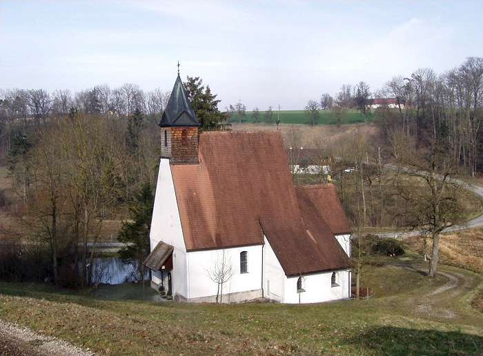
Bad Wimsbach-Neydharting, located in the Upper Austria region, is a charming area that offers wonderful opportunities for hiking enthusiasts. The landscape here is characterized by rolling hills, dense forests, and scenic views, making it an ideal spot for both leisurely walks and more challenging hikes.
Hiking Trails:
-
Local Trails: The region has a network of well-marked hiking trails that cater to various skill levels. You can find easy, family-friendly paths as well as more demanding routes for experienced hikers.
-
Nature Trails: Many trails wind through beautiful natural settings, allowing hikers to experience the rich flora and fauna of the area. Look for signs that provide information about local wildlife and plants.
-
Scenic Views: As you hike, be sure to take in the panoramic vistas that offer views of the surrounding mountains and valleys. Certain trails might lead to lookout points that provide particularly stunning scenery.
Best Time to Hike:
- Spring and Fall: These seasons are ideal due to mild temperatures and beautiful natural scenery. The foliage in autumn adds vibrant colors to your hike.
- Summer: While it can be warmer, early morning or late afternoon hikes are still enjoyable, as the area can be quite inviting with the right preparation.
- Winter: While hiking is possible, it's crucial to check trail conditions and be prepared for potential snow and ice.
Amenities and Facilities:
- Visitor Centers: There may be local visitor centers that provide maps, information on trails, and tips for hikers.
- Accommodation and Dining: If you're planning an extended stay, look for local inns or guesthouses. There are also cafes and restaurants where you can refuel after your hike.
Hiking Tips:
- Dress Appropriately: Wear suitable hiking boots and clothing based on the weather and trail conditions.
- Hydration: Always bring enough water and snacks, especially for longer hikes.
- Stay on Marked Trails: This helps preserve the environment and ensures your safety.
- Check Local Regulations: Be aware of any specific rules or guidelines for hikers in the area.
Whether you’re a novice or a seasoned hiker, Bad Wimsbach-Neydharting has something to offer. Enjoy your hiking experience in this beautiful part of Austria!
- Страна:

- Почтовый код: 4654
- Телефонный код: 07245
- Код автомобильного номера: WL
- Координаты: 48° 3' 50" N, 13° 54' 7" E


- GPS треки (wikiloc): [Ссылка]
- Высота над уровнем моря: 387 м m
- Площадь: 24 кв.км
- Население: 2533
- Веб сайт: http://www.bad-wimsbach.at/
- Википедия русская: wiki(ru)
- Википедия английская: wiki(en)
- Википедия национальная: wiki(de)
- Хранилище Wikidata: Wikidata: Q671021
- Катеория в википедии: [Ссылка]
- код Freebase: [/m/03gvgvx]
- код GeoNames: Альт: [7873273]
- код VIAF: Альт: [140596236]
- код GND: Альт: [4042030-9]
- код австрийского муниципалитета: [41803]
- код Цифрового атласа Римской империи: [38610]
Граничит с регионами:

Штайнеркирхен-на-Трауне
Hiking in Штайнеркирхен-на-Трауне
Steinerkirchen an der Traun is a picturesque village located in Upper Austria, surrounded by stunning natural landscapes that are ideal for hiking. Here are some highlights for hiking in the region:...
- Страна:
- Почтовый код: 4652
- Телефонный код: 07241
- Код автомобильного номера: WL
- Координаты: 48° 4' 43" N, 13° 57' 30" E
- GPS треки (wikiloc): [Ссылка]
- Высота над уровнем моря: 381 м m
- Площадь: 33.5 кв.км
- Население: 2371
- Веб сайт: [Ссылка]
Форхдорф
Hiking in Форхдорф
Vorchdorf, located in Austria, is surrounded by beautiful landscapes that offer a variety of hiking opportunities. The area is characterized by its picturesque countryside, forests, and hills, making it ideal for both beginners and experienced hikers....
- Страна:
- Почтовый код: 4655
- Телефонный код: 07614
- Код автомобильного номера: GM
- Координаты: 48° 0' 15" N, 13° 55' 27" E
- GPS треки (wikiloc): [Ссылка]
- Высота над уровнем моря: 414 м m
- Площадь: 47.7 кв.км
- Население: 7475
- Веб сайт: [Ссылка]

Фишльхам
Hiking in Фишльхам
Fischlham, located in Austria, is a charming area that offers several opportunities for hiking enthusiasts. The region is characterized by beautiful landscapes, rolling hills, and lush greenery, making it ideal for outdoor activities....
- Страна:
- Почтовый код: 4652
- Телефонный код: 0 72 41
- Код автомобильного номера: WL
- Координаты: 48° 5' 11" N, 13° 56' 55" E
- GPS треки (wikiloc): [Ссылка]
- Высота над уровнем моря: 353 м m
- Площадь: 16 кв.км
- Население: 1328
- Веб сайт: [Ссылка]

Ройтхам
Hiking in Ройтхам
Roitham am Traunfall is a picturesque village located in Austria, near the Traun River. It offers a variety of hiking options, providing beautiful views of the surrounding nature and the unique landscapes of the region. Here are some aspects to consider when hiking in this area:...
- Страна:
- Почтовый код: 4661
- Телефонный код: 07613
- Код автомобильного номера: GM
- Координаты: 48° 1' 31" N, 13° 49' 21" E
- GPS треки (wikiloc): [Ссылка]
- Высота над уровнем моря: 424 м m
- Площадь: 21.1 кв.км
- Население: 2001
- Веб сайт: [Ссылка]
Эдт-Ламбах
Hiking in Эдт-Ламбах
Edt bei Lambach is a picturesque village located in the Upper Austria region, surrounded by beautiful landscapes that offer excellent opportunities for hiking enthusiasts. The area features a combination of rolling hills, forests, and meandering rivers, making it ideal for both short and longer hikes....
- Страна:
- Почтовый код: 4650
- Телефонный код: 0 72 45
- Код автомобильного номера: WL
- Координаты: 48° 5' 24" N, 13° 54' 17" E
- GPS треки (wikiloc): [Ссылка]
- Высота над уровнем моря: 330 м m
- Площадь: 21 кв.км
- Население: 2197
- Веб сайт: [Ссылка]
Штадль-Паура
Hiking in Штадль-Паура
Stadl-Paura, located in Upper Austria, offers a variety of hiking opportunities that cater to different skill levels and interests. Nestled in a picturesque setting with beautiful landscapes, the area is perfect for nature lovers and outdoor enthusiasts....
- Страна:
- Почтовый код: 4651
- Телефонный код: 07245
- Код автомобильного номера: WL
- Координаты: 48° 5' 2" N, 13° 51' 50" E
- GPS треки (wikiloc): [Ссылка]
- Высота над уровнем моря: 360 м m
- Площадь: 15.05 кв.км
- Население: 5053
- Веб сайт: [Ссылка]