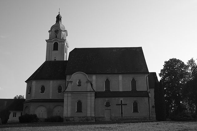
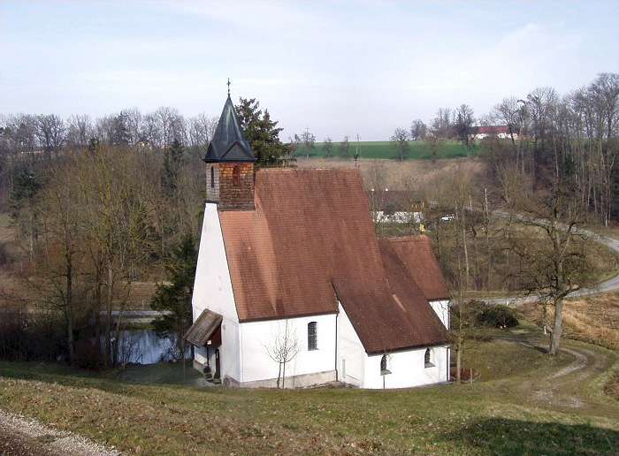
Штайнеркирхен-на-Трауне (Steinerkirchen an der Traun, Steinerkirchen an der Traun)
 Hiking in Штайнеркирхен-на-Трауне
Steinerkirchen an der Traun is a picturesque village located in Upper Austria, surrounded by stunning natural landscapes that are ideal for hiking. Here are some highlights for hiking in the region:
Trail Varieties
- Scenic Trails: The area features various hiking trails that cater to all skill levels, from easy strolls suitable for families to more challenging routes for experienced hikers.
- Nature Trails: Many paths lead you through beautiful forests, along rivers, and past quaint farms, offering opportunities to enjoy local flora and fauna.
Popular Hiking Routes
- Traun River Trails: Trails along the Traun River provide serene views and are perfect for those looking to enjoy a leisurely hike while taking in the scenic waterways.
- Mountain Trails: Nearby hills and mountains offer elevated trails that can provide stunning panoramic views of the surrounding landscape.
Difficulty Levels
- Easy Trails: Suitable for beginners and families; often well-marked and accessible.
- Moderate Trails: For those with some hiking experience; may include some elevation.
- Challenging Trails: For experienced hikers seeking a more strenuous workout.
Tips for Hiking in Steinerkirchen
- Seasonal Considerations: The best time for hiking is typically late spring through early autumn, when the weather is mild and the trails are accessible.
- Proper Gear: Ensure you have the appropriate footwear and gear, particularly if you plan to tackle more challenging trails.
- Stay Hydrated: Carry enough water, especially during warmer months.
- Local Maps: It's advisable to have a local hiking map or GPS device to navigate the trails effectively.
Additional Activities
When you’re not hiking, consider exploring local attractions, enjoying the quaint village atmosphere, or sampling regional cuisine in local restaurants.
Overall, hiking in Steinerkirchen an der Traun offers a delightful experience for nature lovers seeking to enjoy the beautiful Upper Austrian landscapes! Always check local trail conditions and regulations before heading out.
- Страна:

- Почтовый код: 4652
- Телефонный код: 07241
- Код автомобильного номера: WL
- Координаты: 48° 4' 43" N, 13° 57' 30" E


- GPS треки (wikiloc): [Ссылка]
- Высота над уровнем моря: 381 м m
- Площадь: 33.5 кв.км
- Население: 2371
- Веб сайт: http://www.steinerkirchen.at/
- Википедия русская: wiki(ru)
- Википедия английская: wiki(en)
- Википедия национальная: wiki(de)
- Хранилище Wikidata: Wikidata: Q643744
- Катеория в википедии: [Ссылка]
- код Freebase: [/m/03gvh4j]
- код GeoNames: Альт: [7872193]
- код VIAF: Альт: [234324147]
- код LCNAF: Альт: [no2011191282]
- код австрийского муниципалитета: [41821]
Граничит с регионами:


Эберстальцелль
Hiking in Эберстальцелль
Eberstalzell is a charming village located in the Innviertel region of Upper Austria. While it may not be as widely known as some hiking destinations, it offers beautiful landscapes and an array of trails suitable for various levels of hikers. Here are some key points to consider when hiking in Eberstalzell:...
- Страна:
- Почтовый код: 4653
- Телефонный код: 0 72 41
- Код автомобильного номера: WL
- Координаты: 48° 2' 41" N, 13° 58' 55" E
- GPS треки (wikiloc): [Ссылка]
- Высота над уровнем моря: 400 м m
- Площадь: 27.6 кв.км
- Население: 2627
- Веб сайт: [Ссылка]
Форхдорф
Hiking in Форхдорф
Vorchdorf, located in Austria, is surrounded by beautiful landscapes that offer a variety of hiking opportunities. The area is characterized by its picturesque countryside, forests, and hills, making it ideal for both beginners and experienced hikers....
- Страна:
- Почтовый код: 4655
- Телефонный код: 07614
- Код автомобильного номера: GM
- Координаты: 48° 0' 15" N, 13° 55' 27" E
- GPS треки (wikiloc): [Ссылка]
- Высота над уровнем моря: 414 м m
- Площадь: 47.7 кв.км
- Население: 7475
- Веб сайт: [Ссылка]
Заттледт
Hiking in Заттледт
Sattledt is a picturesque village located in Austria, nestled in the region of Upper Austria. While it may not be as widely known as some other hiking destinations in the Alps, it offers access to beautiful landscapes and outdoor experiences....
- Страна:
- Почтовый код: 4642
- Телефонный код: 07244
- Код автомобильного номера: WL
- Координаты: 48° 4' 24" N, 14° 3' 27" E
- GPS треки (wikiloc): [Ссылка]
- Высота над уровнем моря: 400 м m
- Площадь: 22 кв.км
- Население: 2668
- Веб сайт: [Ссылка]

Фишльхам
Hiking in Фишльхам
Fischlham, located in Austria, is a charming area that offers several opportunities for hiking enthusiasts. The region is characterized by beautiful landscapes, rolling hills, and lush greenery, making it ideal for outdoor activities....
- Страна:
- Почтовый код: 4652
- Телефонный код: 0 72 41
- Код автомобильного номера: WL
- Координаты: 48° 5' 11" N, 13° 56' 55" E
- GPS треки (wikiloc): [Ссылка]
- Высота над уровнем моря: 353 м m
- Площадь: 16 кв.км
- Население: 1328
- Веб сайт: [Ссылка]

Бад-Вимсбах-Найдхартинг
Hiking in Бад-Вимсбах-Найдхартинг
Bad Wimsbach-Neydharting, located in the Upper Austria region, is a charming area that offers wonderful opportunities for hiking enthusiasts. The landscape here is characterized by rolling hills, dense forests, and scenic views, making it an ideal spot for both leisurely walks and more challenging hikes....
- Страна:
- Почтовый код: 4654
- Телефонный код: 07245
- Код автомобильного номера: WL
- Координаты: 48° 3' 50" N, 13° 54' 7" E
- GPS треки (wikiloc): [Ссылка]
- Высота над уровнем моря: 387 м m
- Площадь: 24 кв.км
- Население: 2533
- Веб сайт: [Ссылка]

Штайнхаус
Hiking in Штайнхаус
Steinhaus is a charming village located in the Tyrol region of Austria, surrounded by stunning alpine landscapes, making it a great destination for hiking enthusiasts. Here are some highlights and tips for hiking in the area:...
- Страна:
- Почтовый код: 4641
- Телефонный код: 0 72 42
- Код автомобильного номера: WL
- Координаты: 48° 6' 58" N, 14° 1' 14" E
- GPS треки (wikiloc): [Ссылка]
- Высота над уровнем моря: 378 м m
- Площадь: 25 кв.км
- Население: 2187
- Веб сайт: [Ссылка]