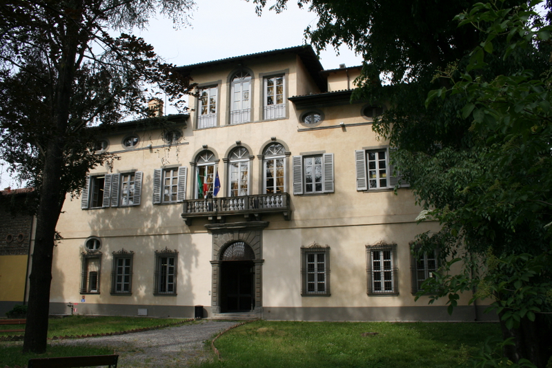
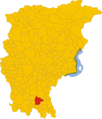
Бариано (Bariano, Bariano)
.svg)
- коммуна Италии
 Hiking in Бариано
Bariano is a small town located in the Lombardy region of Italy, which is characterized by a mix of rolling hills, agricultural landscapes, and nearby natural reserves. While Bariano itself may not be a major hiking destination, it can serve as a good base for exploring the surrounding area.
Here are some considerations for hiking around Bariano:
1.
- Parco Regionale della Valle del Lambro: Located a bit farther from Bariano but within a reasonable driving distance, this regional park offers various hiking trails that wind through scenic landscapes, forests, and along rivers.
- Parco Nazionale dello Stelvio: A bit farther afield, this national park is a hiker's paradise with stunning views of the Alps, glacial lakes, and diverse wildlife.
2.
- While Bariano may not have extensive local trails, you can find paths that lead through the countryside, offering great opportunities for leisurely walks. Look for trails that meander through vineyards and farmland, providing a taste of the local agricultural heritage.
3.
- Hiking in the area allows you to explore small villages, sample local cuisine, and experience the rich culture of Lombardy. Consider planning your hikes around local festivals or markets.
4.
- Always check the weather before heading out, as conditions can change. Carry sufficient water, snacks, a map or GPS device, and wear appropriate hiking gear.
- Be mindful of trail markings and local regulations regarding hiking, especially if you're venturing into less developed areas.
5.
- Spring and fall are generally the best seasons for hiking in Italy, with mild temperatures and beautiful scenery. Summer can be hot, and winter may bring snow, limiting accessibility to some trails.
Conclusion:
Though Bariano may not be the focal point for hiking, it provides a wonderful opportunity to explore the beauty of Lombardy and the Italian countryside. With some planning, you can experience enjoyable hikes in the surrounding areas. If you're visiting, make sure to take the time to enjoy the local culture and natural beauty that this region has to offer!
- Страна:

- Почтовый код: 24050
- Телефонный код: 0363
- Код автомобильного номера: BG
- Координаты: 45° 30' 45" N, 9° 42' 13" E


- GPS треки (wikiloc): [Ссылка]
- Высота над уровнем моря: 114 м m
- Площадь: 7.07 кв.км
- Население: 4270
- Веб сайт: http://www.comune.bariano.bg.it
- Википедия русская: wiki(ru)
- Википедия английская: wiki(en)
- Википедия национальная: wiki(it)
- Хранилище Wikidata: Wikidata: Q99963
- Галерея изображений в википедии: [Ссылка]
- Катеория в википедии: [Ссылка]
- код Freebase: [/m/0gj8nz]
- код GeoNames: Альт: [6543144]
- код VIAF: Альт: [311727436]
- ID отношения в OpenStreetMap: [45186]
- UN/LOCODE: [ITBR9]
- код ISTAT: 016020
- кадастровый код Италии: A664
Граничит с регионами:


Караваджо
- коммуна Италии
Hiking in Караваджо
Caravaggio, located in the Lombardy region of Italy, is not primarily known as a hiking destination, but it does offer some opportunities for outdoor enthusiasts looking to explore the surrounding areas. The town itself is steeped in history and art, being the namesake of the famous Caravaggio, the Baroque painter....
- Страна:
- Почтовый код: 24043
- Телефонный код: 0363
- Код автомобильного номера: BG
- Координаты: 45° 29' 52" N, 9° 38' 35" E
- GPS треки (wikiloc): [Ссылка]
- Высота над уровнем моря: 111 м m
- Площадь: 32.81 кв.км
- Население: 16261
- Веб сайт: [Ссылка]


Фара-Оливана-кон-Сола
- коммуна Италии
Hiking in Фара-Оливана-кон-Сола
Fara Olivana con Sola is a picturesque village located in the province of Bergamo, Italy, surrounded by the beautiful landscape of the Lombardy region. While it may not be as renowned as some other hiking destinations, it offers some lovely trails and opportunities to explore the natural beauty of the area....
- Страна:
- Почтовый код: 24058
- Телефонный код: 0363
- Код автомобильного номера: BG
- Координаты: 45° 29' 42" N, 9° 44' 57" E
- GPS треки (wikiloc): [Ссылка]
- Высота над уровнем моря: 107 м m
- Площадь: 5.04 кв.км
- Население: 1292
- Веб сайт: [Ссылка]


Форново-Сан-Джованни
- коммуна Италии
Hiking in Форново-Сан-Джованни
Fornovo San Giovanni, located in the Lombardy region of Italy, is not only known for its picturesque landscapes but also offers a variety of hiking opportunities amidst its natural beauty. Here’s an overview of what hiking in that area entails:...
- Страна:
- Почтовый код: 24040
- Телефонный код: 0363
- Код автомобильного номера: BG
- Координаты: 45° 29' 48" N, 9° 40' 38" E
- GPS треки (wikiloc): [Ссылка]
- Высота над уровнем моря: 109 м m
- Площадь: 7.04 кв.км
- Население: 3435
- Веб сайт: [Ссылка]

Моренго
- коммуна Италии
Hiking in Моренго
It seems like you may be referring to a specific hiking area, but "Morengo" isn't widely recognized as a popular hiking destination in the general hiking community. It’s possible you meant "Morrison," which is known for its hiking trails near Red Rocks in Colorado, or perhaps a location in another region altogether....
- Страна:
- Почтовый код: 24050
- Телефонный код: 0363
- Код автомобильного номера: BG
- Координаты: 45° 32' 0" N, 9° 42' 0" E
- GPS треки (wikiloc): [Ссылка]
- Высота над уровнем моря: 126 м m
- Площадь: 9.57 кв.км
- Население: 2535
- Веб сайт: [Ссылка]


Пагаццано
- коммуна Италии
Hiking in Пагаццано
Pagazzano is a charming town located in the Lombardy region of Italy, not far from the more well-known city of Bergamo. While Pagazzano itself may not be a major hiking destination, its surrounding areas offer a variety of trails and natural beauty suitable for hiking enthusiasts....
- Страна:
- Почтовый код: 24040
- Телефонный код: 0363
- Код автомобильного номера: BG
- Координаты: 45° 32' 3" N, 9° 40' 16" E
- GPS треки (wikiloc): [Ссылка]
- Высота над уровнем моря: 126 м m
- Площадь: 5.24 кв.км
- Население: 2083
- Веб сайт: [Ссылка]

Романо-ди-Ломбардия
- коммуна Италии
Hiking in Романо-ди-Ломбардия
Romano di Lombardia is a charming town located in the Lombardy region of northern Italy. While it may not be as famous for hiking as other areas in the Alps or Dolomites, there are still opportunities for outdoor enthusiasts to enjoy the beautiful scenery and natural landscapes in and around this area....
- Страна:
- Почтовый код: 24058
- Телефонный код: 0363
- Код автомобильного номера: BG
- Координаты: 45° 31' 0" N, 9° 45' 0" E
- GPS треки (wikiloc): [Ссылка]
- Высота над уровнем моря: 120 м m
- Площадь: 19.38 кв.км
- Население: 20486
- Веб сайт: [Ссылка]