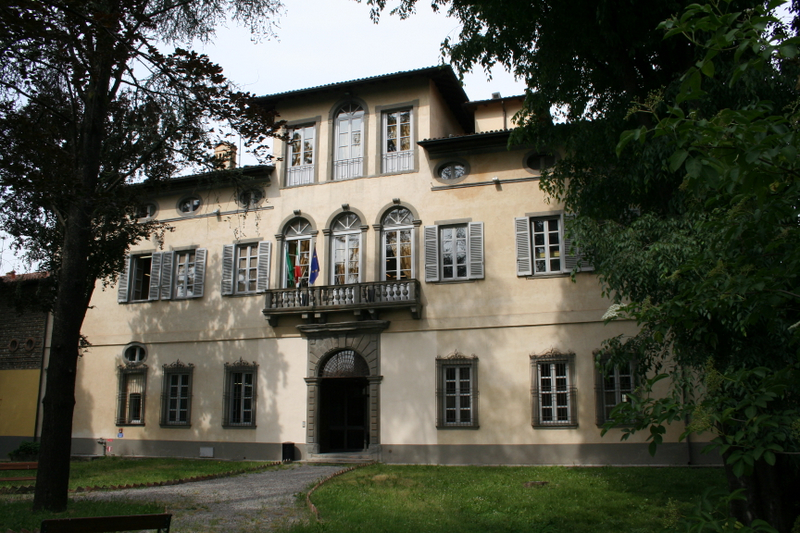
Пагаццано (Pagazzano, Pagazzano)
.svg)
- коммуна Италии
 Hiking in Пагаццано
Pagazzano is a charming town located in the Lombardy region of Italy, not far from the more well-known city of Bergamo. While Pagazzano itself may not be a major hiking destination, its surrounding areas offer a variety of trails and natural beauty suitable for hiking enthusiasts.
Hiking Opportunities near Pagazzano:
-
Orobie Alps: Just a short drive from Pagazzano, the Orobie Alps provide stunning landscapes, including mountains, valleys, and alpine meadows. There are numerous trails ranging from easy walks to more challenging hikes.
-
Parco Regionale delle Orobie Bergamasche: This regional park is a great spot for hiking, featuring a network of trails that explore its rich biodiversity, including forests, rivers, and panoramic viewpoints. It's ideal for both casual hikers and those seeking more strenuous routes.
-
Sentiero dei Parchi: This scenic trail connects various parks in the area and offers a unique way to experience the natural beauty of the Lombardy region. Various segments of this trail can be accessed from nearby towns.
Tips for Hiking in Pagazzano's Surroundings:
-
Preparation: Always check the weather forecast and trail conditions before setting out. Bring enough water, snacks, and protective gear based on the season.
-
Footwear: Wear sturdy hiking boots for better grip and support on uneven terrain.
-
Map/GPS: Familiarize yourself with the trail maps and consider downloading GPS maps to help navigate.
-
Local Culture: If time permits, explore Pagazzano’s rich history, including its medieval architecture and local cuisine after a day of hiking.
-
Wildlife Safety: Be aware of local wildlife and take necessary precautions to respect their habitat.
Best Time to Hike:
The best months for hiking in the Pagazzano area are typically late spring through early autumn (April to October) when the weather is milder and more conducive to outdoor activities.
If you're planning a hiking trip to Pagazzano, make sure to explore the natural surroundings while also enjoying the local culture and hospitality!
- Страна:

- Почтовый код: 24040
- Телефонный код: 0363
- Код автомобильного номера: BG
- Координаты: 45° 32' 3" N, 9° 40' 16" E


- GPS треки (wikiloc): [Ссылка]
- Высота над уровнем моря: 126 м m
- Площадь: 5.24 кв.км
- Население: 2083
- Веб сайт: http://www.comune.pagazzano.bg.it
- Википедия русская: wiki(ru)
- Википедия английская: wiki(en)
- Википедия национальная: wiki(it)
- Хранилище Wikidata: Wikidata: Q101346
- Галерея изображений в википедии: [Ссылка]
- Катеория в википедии: [Ссылка]
- код Freebase: [/m/0gjcg6]
- код GeoNames: Альт: [6543752]
- код VIAF: Альт: [245448891]
- ID отношения в OpenStreetMap: [45244]
- UN/LOCODE: [ITZZN]
- код ISTAT: 016154
- кадастровый код Италии: G233
Граничит с регионами:


Бриньяно-Джера-д'Адда
- коммуна Италии
Hiking in Бриньяно-Джера-д'Адда
Brignano Gera d'Adda is located in the Lombardy region of Italy and offers a unique landscape for hiking enthusiasts. While the area may not be as globally renowned as some of Italy's larger national parks, it boasts picturesque scenery and natural beauty that can provide a pleasant hiking experience....
- Страна:
- Почтовый код: 24053
- Телефонный код: 0363
- Код автомобильного номера: BG
- Координаты: 45° 32' 0" N, 9° 38' 0" E
- GPS треки (wikiloc): [Ссылка]
- Высота над уровнем моря: 131 м m
- Площадь: 12.11 кв.км
- Население: 6009
- Веб сайт: [Ссылка]


Караваджо
- коммуна Италии
Hiking in Караваджо
Caravaggio, located in the Lombardy region of Italy, is not primarily known as a hiking destination, but it does offer some opportunities for outdoor enthusiasts looking to explore the surrounding areas. The town itself is steeped in history and art, being the namesake of the famous Caravaggio, the Baroque painter....
- Страна:
- Почтовый код: 24043
- Телефонный код: 0363
- Код автомобильного номера: BG
- Координаты: 45° 29' 52" N, 9° 38' 35" E
- GPS треки (wikiloc): [Ссылка]
- Высота над уровнем моря: 111 м m
- Площадь: 32.81 кв.км
- Население: 16261
- Веб сайт: [Ссылка]


Колоньо-аль-Серио
- коммуна Италии
Hiking in Колоньо-аль-Серио
Cologno al Serio is a small town located in the Lombardy region of Italy, near the Adda River and not far from the beautiful landscapes of the Italian Alps. While Cologno al Serio itself might not be a major hiking destination, there are several hiking opportunities in the surrounding areas....
- Страна:
- Почтовый код: 24055
- Телефонный код: 035
- Код автомобильного номера: BG
- Координаты: 45° 35' 0" N, 9° 42' 0" E
- GPS треки (wikiloc): [Ссылка]
- Высота над уровнем моря: 156 м m
- Площадь: 18.52 кв.км
- Население: 11180
- Веб сайт: [Ссылка]

Моренго
- коммуна Италии
Hiking in Моренго
It seems like you may be referring to a specific hiking area, but "Morengo" isn't widely recognized as a popular hiking destination in the general hiking community. It’s possible you meant "Morrison," which is known for its hiking trails near Red Rocks in Colorado, or perhaps a location in another region altogether....
- Страна:
- Почтовый код: 24050
- Телефонный код: 0363
- Код автомобильного номера: BG
- Координаты: 45° 32' 0" N, 9° 42' 0" E
- GPS треки (wikiloc): [Ссылка]
- Высота над уровнем моря: 126 м m
- Площадь: 9.57 кв.км
- Население: 2535
- Веб сайт: [Ссылка]


Спирано
- коммуна Италии
Hiking in Спирано
Spirano, a small town located in the province of Bergamo in Lombardy, Italy, offers a serene environment and picturesque landscapes suitable for hiking enthusiasts. While it may not be as renowned for hiking as some larger areas in the Italian Alps, Spirano and its surrounding regions provide a variety of trails that cater to different experience levels....
- Страна:
- Почтовый код: 24050
- Телефонный код: 035
- Код автомобильного номера: BG
- Координаты: 45° 34' 58" N, 9° 40' 9" E
- GPS треки (wikiloc): [Ссылка]
- Высота над уровнем моря: 154 м m
- Площадь: 9.61 кв.км
- Население: 5730
- Веб сайт: [Ссылка]


Бариано
- коммуна Италии
Hiking in Бариано
Bariano is a small town located in the Lombardy region of Italy, which is characterized by a mix of rolling hills, agricultural landscapes, and nearby natural reserves. While Bariano itself may not be a major hiking destination, it can serve as a good base for exploring the surrounding area....
- Страна:
- Почтовый код: 24050
- Телефонный код: 0363
- Код автомобильного номера: BG
- Координаты: 45° 30' 45" N, 9° 42' 13" E
- GPS треки (wikiloc): [Ссылка]
- Высота над уровнем моря: 114 м m
- Площадь: 7.07 кв.км
- Население: 4270
- Веб сайт: [Ссылка]