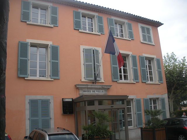
Бельжантье (Belgentier, Belgentier)

- коммуна во Франции
 Hiking in Бельжантье
Belgentier is a charming commune located in the Var department of the Provence-Alpes-Côte d'Azur region in southeastern France. It's nestled near the picturesque Sainte-Baume mountain range, providing access to several beautiful hiking trails that showcase the region's natural beauty and biodiversity.
Hiking Trails and Features
-
Colline de la Loube:
- This trail offers a moderately challenging hike with stunning panoramic views of the surrounding countryside. You'll find a mix of forested paths and open areas ideal for enjoying the scenery.
-
Sainte-Baume Mountain Range:
- Located a bit further from Belgentier, the Sainte-Baume is famous for its unique geological formations, lush forests, and rich wildlife. Several trails meander through the area, ideal for all skill levels. The trails often lead to scenic overlooks and spots for picnicking.
-
Flora and Fauna:
- As you hike, you'll encounter diverse plant species, from fragrant herbs to colorful wildflowers. Birdwatchers will also appreciate the variety of avian species that inhabit the area.
-
Cultural Sites:
- While hiking, you can discover historical sites, including chapels and remnants of ancient structures, which add cultural depth to your experience.
Tips for Hiking in Belgentier
- Weather: Check the weather conditions before heading out, as they can be unpredictable, especially in the mountains.
- Footwear: Wear sturdy hiking boots for comfort and stability on rocky paths.
- Water and Snacks: Carry enough water and some snacks to stay energized during your hike.
- Maps and Guides: Consider using a hiking map or a guide to navigate the trails, as some paths may not be well-marked.
- Local Regulations: Be aware of any local regulations regarding wildlife and conservation.
Best Time to Hike
The most favorable time for hiking in Belgentier is during the spring and fall when temperatures are mild and the flora is at its most vibrant. Summer can be quite hot, and winter trails may be less accessible due to snow or rain.
Hiking in Belgentier offers an excellent opportunity to explore the stunning landscapes of Provence while immersing yourself in nature and local culture. Whether you’re a beginner or an experienced hiker, there’s something for everyone in this beautiful region.
- Страна:

- Почтовый код: 83210
- Координаты: 43° 14' 43" N, 5° 59' 59" E


- GPS треки (wikiloc): [Ссылка]
- Площадь: 13.38 кв.км
- Население: 2435
- Википедия русская: wiki(ru)
- Википедия английская: wiki(en)
- Википедия национальная: wiki(fr)
- Хранилище Wikidata: Wikidata: Q687913
- Катеория в википедии: [Ссылка]
- код Freebase: [/m/03qcs4p]
- код GeoNames: Альт: [3033784]
- номер SIREN: [218300176]
- код BNF: [152778445]
- WOEID: [579045]
- EMLO location ID: [69260d3d-9bdb-4085-9fa0-a98cd17e8d9d]
- код муниципалитета INSEE: 83017
Граничит с регионами:
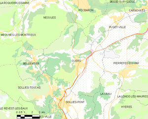
Кюэр
- коммуна во Франции
Hiking in Кюэр
Cuers, located in the Var department of the Provence-Alpes-Côte d'Azur region in France, offers a unique hiking experience that combines stunning landscapes with rich cultural heritage. Here are some highlights of hiking in Cuers:...
- Страна:
- Почтовый код: 83390
- Координаты: 43° 14' 15" N, 6° 4' 15" E
- GPS треки (wikiloc): [Ссылка]
- Площадь: 50.53 кв.км
- Население: 10832


Меун-ле-Монтриё
- коммуна во Франции
Hiking in Меун-ле-Монтриё
Méounes-lès-Montrieux is a charming village located in the Var department of the Provence-Alpes-Côte d'Azur region in southeastern France. It is surrounded by beautiful landscapes, making it a great destination for hiking enthusiasts. Here are some important aspects to consider when hiking in and around Méounes-lès-Montrieux:...
- Страна:
- Почтовый код: 83136
- Координаты: 43° 16' 52" N, 5° 58' 12" E
- GPS треки (wikiloc): [Ссылка]
- Площадь: 40.92 кв.км
- Население: 2152


Сольес-Тука
- коммуна во Франции
Hiking in Сольес-Тука
Solliès-Toucas is a picturesque village located in the Var department of the Provence-Alpes-Côte d'Azur region in southeastern France. Nestled in a valley surrounded by lush hills and vineyards, it offers a variety of hiking opportunities for both novice and experienced hikers....
- Страна:
- Почтовый код: 83210
- Координаты: 43° 12' 20" N, 6° 1' 30" E
- GPS треки (wikiloc): [Ссылка]
- Площадь: 30.09 кв.км
- Население: 5756
- Веб сайт: [Ссылка]