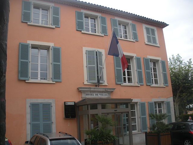
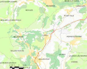
Сольес-Тука (Solliès-Toucas, Solliès-Toucas)

- коммуна во Франции
 Hiking in Сольес-Тука
Solliès-Toucas is a picturesque village located in the Var department of the Provence-Alpes-Côte d'Azur region in southeastern France. Nestled in a valley surrounded by lush hills and vineyards, it offers a variety of hiking opportunities for both novice and experienced hikers.
Hiking Highlights in Solliès-Toucas:
-
Scenic Trails: The surrounding countryside is characterized by beautiful landscapes, including rolling hills, lush forests, and vineyards. You can find several marked hiking trails that offer stunning views of the area.
-
Local Flora and Fauna: The region is rich in biodiversity; hikers might encounter various plants and animals native to Provence. Keep an eye out for wildflowers, oak trees, and perhaps even some local wildlife.
-
Cultural Landmarks: Hiking in Solliès-Toucas can also allow you to explore historical landmarks and cultural sites, such as old chapels and traditional Provençal architecture, while on the trail.
-
Wine and Gastronomy: After a long hike, you can relax in the local vineyards and taste some of the region's renowned wines. There are also opportunities to enjoy traditional Provençal cuisine in the village.
-
Nearby Hiking Areas: The village is also a convenient base for accessing nearby natural parks and more extensive hiking trails, such as those in the Massif des Maures or the surrounding hills of Toulon and Hyères.
Tips for Hiking in Solliès-Toucas:
-
Trail Maps: If you're new to the area, it's a good idea to have a trail map or a hiking app for navigation. Some trails may not be well-marked.
-
Weather Considerations: The weather can change quickly, especially in the mountains. Check the forecast and dress in layers.
-
Hydration and Snacks: Always carry enough water and some snacks to keep your energy up while hiking.
-
Respect Nature: Stay on marked trails to protect the local environment and wildlife.
Hiking in Solliès-Toucas provides a wonderful opportunity to enjoy nature, culture, and the beauty of Provence. Whether you're looking for an easy stroll or a challenging hike, this region has something to offer for everyone.
- Страна:

- Почтовый код: 83210
- Координаты: 43° 12' 20" N, 6° 1' 30" E


- GPS треки (wikiloc): [Ссылка]
- Площадь: 30.09 кв.км
- Население: 5756
- Веб сайт: http://www.ville-solliestoucas.fr/
- Википедия русская: wiki(ru)
- Википедия английская: wiki(en)
- Википедия национальная: wiki(fr)
- Хранилище Wikidata: Wikidata: Q816102
- Катеория в википедии: [Ссылка]
- код Freebase: [/m/03x_wtr]
- код GeoNames: Альт: [6445072]
- номер SIREN: [218301315]
- код BNF: [152779584]
- код VIAF: Альт: [147879881]
- код LCNAF: Альт: [n90699435]
- код тезауруса PACTOLS: [pcrtWBlmq6Pffb]
- код муниципалитета INSEE: 83131
Граничит с регионами:
Кюэр
- коммуна во Франции
Hiking in Кюэр
Cuers, located in the Var department of the Provence-Alpes-Côte d'Azur region in France, offers a unique hiking experience that combines stunning landscapes with rich cultural heritage. Here are some highlights of hiking in Cuers:...
- Страна:
- Почтовый код: 83390
- Координаты: 43° 14' 15" N, 6° 4' 15" E
- GPS треки (wikiloc): [Ссылка]
- Площадь: 50.53 кв.км
- Население: 10832


Меун-ле-Монтриё
- коммуна во Франции
Hiking in Меун-ле-Монтриё
Méounes-lès-Montrieux is a charming village located in the Var department of the Provence-Alpes-Côte d'Azur region in southeastern France. It is surrounded by beautiful landscapes, making it a great destination for hiking enthusiasts. Here are some important aspects to consider when hiking in and around Méounes-lès-Montrieux:...
- Страна:
- Почтовый код: 83136
- Координаты: 43° 16' 52" N, 5° 58' 12" E
- GPS треки (wikiloc): [Ссылка]
- Площадь: 40.92 кв.км
- Население: 2152


Бельжантье
- коммуна во Франции
Hiking in Бельжантье
Belgentier is a charming commune located in the Var department of the Provence-Alpes-Côte d'Azur region in southeastern France. It's nestled near the picturesque Sainte-Baume mountain range, providing access to several beautiful hiking trails that showcase the region's natural beauty and biodiversity....
- Страна:
- Почтовый код: 83210
- Координаты: 43° 14' 43" N, 5° 59' 59" E
- GPS треки (wikiloc): [Ссылка]
- Площадь: 13.38 кв.км
- Население: 2435


Синь
- коммуна департамента Вар,Франция
Hiking in Синь
Signes is a charming village located in the Var department of the Provence-Alpes-Côte d'Azur region in southeastern France. It offers a variety of hiking opportunities, showcasing the region's stunning natural landscapes, rich flora, and diverse fauna....
- Страна:
- Почтовый код: 83870
- Координаты: 43° 17' 29" N, 5° 51' 46" E
- GPS треки (wikiloc): [Ссылка]
- Площадь: 133.1 кв.км
- Население: 2779


Сольес-Виль
- коммуна во Франции
- Страна:
- Почтовый код: 83210
- Координаты: 43° 10' 56" N, 6° 2' 18" E
- GPS треки (wikiloc): [Ссылка]
- Площадь: 14.1 кв.км
- Население: 2391


Сольес-Пон
- коммуна во Франции
Hiking in Сольес-Пон
Solliès-Pont is a charming commune in the Var department of the Provence-Alpes-Côte d'Azur region in southeastern France. Nestled near the foothills of the Maures mountains, it offers a variety of hiking opportunities that allow you to explore the beautiful landscapes, vineyards, and olive groves characteristic of the region....
- Страна:
- Почтовый код: 83210
- Координаты: 43° 11' 24" N, 6° 2' 28" E
- GPS треки (wikiloc): [Ссылка]
- Площадь: 17.73 кв.км
- Население: 10951


Ле-Ревест-лез-О
- коммуна во Франции
- Страна:
- Почтовый код: 83200
- Координаты: 43° 10' 35" N, 5° 55' 35" E
- GPS треки (wikiloc): [Ссылка]
- Площадь: 24.07 кв.км
- Население: 3794
- Веб сайт: [Ссылка]