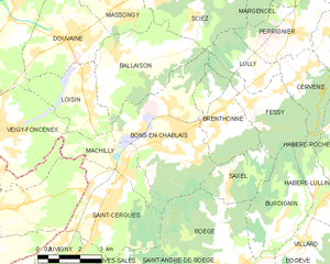
Brenthonne (Brenthonne)

- коммуна во Франции
 Hiking in Brenthonne
Brenthonne is a charming village located in the Haute-Savoie region of France, close to the shores of Lake Geneva. It is surrounded by stunning natural landscapes, making it a great area for hiking enthusiasts.
Hiking Trails in Brenthonne
-
Lac de la Case: This hike offers beautiful views of the surrounding mountains and the lake. The trail is moderately easy and suitable for families.
-
Mont Billiat: A more challenging trek that rewards hikers with panoramic views of Lake Geneva and the surrounding Alps. The trail features a mix of forest paths and rocky terrain.
-
Les Voirons: This area features various trails suitable for different skill levels. You can hike through lush forests with opportunities to spot local wildlife.
Tips for Hiking in Brenthonne
-
Preparation: Always check the weather forecast before heading out. The weather can change quickly in the mountains.
-
Footwear: Wear sturdy hiking boots with good grip, as trails can be rocky and uneven.
-
Hydration: Carry enough water, especially during warmer months, as some trails may not have water sources.
-
Local Maps: Use local hiking maps or GPS applications to guide you along the trails.
-
Respect Nature: Stick to marked paths to preserve the local flora and fauna.
Best Times to Hike
The best time for hiking in the region is from late spring to early autumn (May to September), when the weather is generally mild and trails are accessible.
Enjoy your hiking adventure in Brenthonne, and make sure to take in the breathtaking views along the way!
- Страна:

- Почтовый код: 74890
- Координаты: 46° 16' 24" N, 6° 23' 38" E


- GPS треки (wikiloc): [Ссылка]
- Площадь: 8.38 кв.км
- Население: 991
- Википедия английская: wiki(en)
- Википедия национальная: wiki(fr)
- Хранилище Wikidata: Wikidata: Q501984
- Катеория в википедии: [Ссылка]
- код Freebase: [/m/03nty7w]
- код GeoNames: Альт: [6451026]
- номер SIREN: [217400480]
- код BNF: [15274307v]
- код муниципалитета INSEE: 74048
Граничит с регионами:
Bons-en-Chablais
- коммуна во Франции
Hiking in Bons-en-Chablais
Bons-en-Chablais is a charming commune located in the Haute-Savoie region of the French Alps. Its proximity to both the mountains and Lake Geneva makes it an excellent location for hiking enthusiasts. Here are some highlights and tips for hiking in the area:...
- Страна:
- Почтовый код: 74890
- Координаты: 46° 15' 52" N, 6° 22' 13" E
- GPS треки (wikiloc): [Ссылка]
- Площадь: 19.09 кв.км
- Население: 5456
- Веб сайт: [Ссылка]


Fessy
- коммуна во Франции
Hiking in Fessy
Fessy, located in the Haute-Savoie region of France, offers beautiful hiking opportunities with stunning views of the surrounding Alpine landscape. Here are some key points to know before you head out for hiking in this area:...
- Страна:
- Почтовый код: 74890
- Координаты: 46° 16' 32" N, 6° 24' 41" E
- GPS треки (wikiloc): [Ссылка]
- Площадь: 8.53 кв.км
- Население: 890
Saxel
- коммуна во Франции
Hiking in Saxel
Saxel is a picturesque village located in the Haute-Savoie region of France, near Lake Geneva, and is known for its stunning landscapes and outdoor activities, including hiking. The surrounding area offers numerous trails that cater to various skill levels, making it a great destination for hikers of all abilities....
- Страна:
- Почтовый код: 74420
- Координаты: 46° 14' 35" N, 6° 23' 43" E
- GPS треки (wikiloc): [Ссылка]
- Площадь: 5.63 кв.км
- Население: 460