
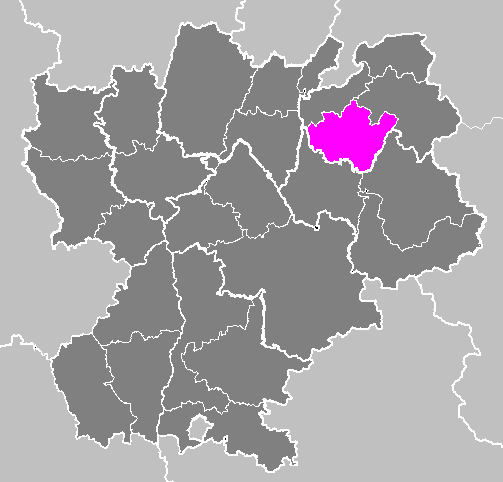
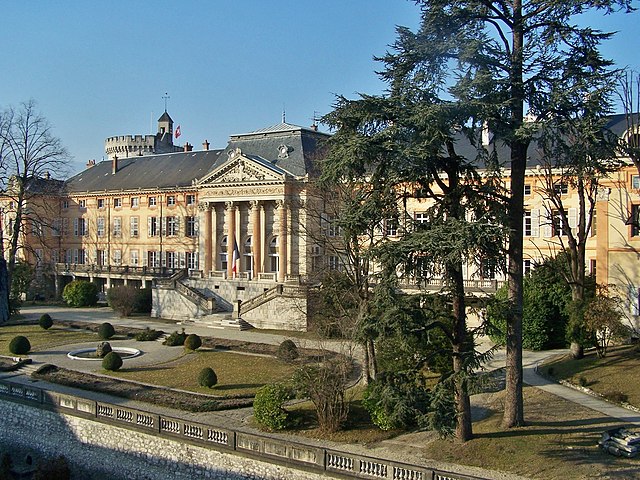
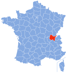
Верхняя Савойя (Haute-Savoie, Haute-Savoie)


- департамент Франции
 Hiking in Верхняя Савойя
Haute-Savoie, located in the southeastern part of France, is a stunning region of the French Alps known for its breathtaking landscapes, picturesque villages, and a plethora of outdoor activities. Hiking is one of the most popular pursuits in this area, offering trails that cater to all experience levels and showcasing everything from serene lakes to rugged mountain peaks.
Popular Hiking Areas in Haute-Savoie:
-
Chamonix-Mont-Blanc:
- Mont Blanc Massif: One of the most iconic hiking regions, with trails ranging from easy walks to challenging backcountry routes. The Tour du Mont Blanc is a famous multi-day hike that circumnavigates the Mont Blanc massif.
- Lac Blanc: An accessible hike that offers panoramic views of the peaks and a beautiful alpine lake.
-
Annecy:
- The area around Lake Annecy offers scenic trails with stunning lake views. The Semnoz Mountain and the Talloires area provide routes with varying difficulty and breathtaking landscapes.
-
Aravis Range:
- Known for its dramatic limestone cliffs and beautiful pastures, it has fantastic hiking paths. The Col des Aravis is a well-known spot for hikers, and the area is filled with charming mountain huts.
-
Le Granier:
- A popular hike for its relatively moderate difficulty and rewarding views, it offers alpine panoramas and a chance to see local wildlife.
-
Les Gets and Morzine:
- These charming towns are great starting points for hikes in the Portes du Soleil area, renowned for its extensive trail network. The hikes here range from gentle paths suitable for families to more challenging mountain routes.
Things to Consider:
- Season: The best time for hiking in Haute-Savoie is generally from late spring to early autumn (May to September), when the trails are clear of snow, and the weather is milder.
- Equipment: Depending on the trails you choose, basic hiking gear such as sturdy boots, a backpack, hydration systems, and weather-appropriate clothing is essential. In colder months, proper gear for snow and ice may be necessary.
- Safety: It's always crucial to check weather conditions before heading out and to take note of trail markings and signs. Some trails can be steep or remote, so navigation skills or tools (like a GPS or detailed map) can help.
Local Culture:
Be sure to take the opportunity to enjoy local Savoyard specialties, such as fondue, raclette, and tartiflette, after a day of hiking. The region's rich culture, including traditional music and customs, can enhance the overall experience.
Hiking in Haute-Savoie is a fantastic way to immerse yourself in nature while exploring the beauty of the French Alps. Whether you’re an experienced hiker or a beginner, this region has something for everyone!
- Страна:

- Столица: Анси
- Координаты: 46° 0' 0" N, 6° 20' 0" E


- GPS треки (wikiloc): [Ссылка]
- Высота над уровнем моря: 1160 м m
- Площадь: 4388 кв.км
- Население: 793938
- Веб сайт: http://www.haute-savoie.pref.gouv.fr/
- Википедия русская: wiki(ru)
- Википедия английская: wiki(en)
- Википедия национальная: wiki(fr)
- Хранилище Wikidata: Wikidata: Q12751
- Галерея изображений в википедии: [Ссылка]
- Катеория в википедии: [Ссылка]
- Карты в википедии: [Ссылка]
- код Freebase: [/m/0mhl6]
- код GeoNames: Альт: [3013736]
- номер SIREN: [227400017]
- код BNF: [11881908t]
- код VIAF: Альт: [140311233]
- ID отношения в OpenStreetMap: [7407]
- код GND: Альт: [4089179-3]
- идентификатор местоположения ArchINFORM: [2723]
- код LCNAF: Альт: [n80149001]
- место в MusicBrainz: [9b0f2c8c-722a-4991-bb12-e1817bb933b9]
- код темы Quora: [Haute-Savoie]
- код SUDOC: [026603063]
- код в энциклопедии «Британника онлайн»: [place/Haute-Savoie]
- код в Большой каталанской энциклопедии: [0003098]
- учётная запись в Твиттере: Альт: [Dep_74]
- dmoz: Альт: [Regional/Europe/France/Regions/Rhone-Alpes/Haute-Savoie/]
- код NUTS: [FR718]
- код департамента Франции INSEE: [74]
- ISO 3166-2: FR-74
Включает регионы:


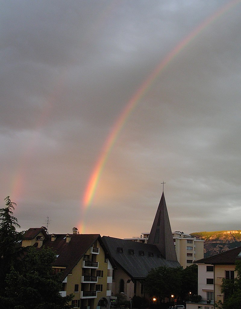
Тонон-ле-Бен
- коммуна во Франции
Hiking in Тонон-ле-Бен
Thonon-les-Bains, located on the shores of Lake Geneva in the Haute-Savoie region of France, offers a stunning backdrop for hiking enthusiasts. The area is characterized by its beautiful landscapes, which range from lakeside trails to the dramatic slopes of the nearby Alps. Here are some key highlights for hiking in and around Thonon-les-Bains:...
- Страна:
- Почтовый код: 74200
- Координаты: 46° 22' 14" N, 6° 28' 47" E
- GPS треки (wikiloc): [Ссылка]
- Высота над уровнем моря: 425 м m
- Площадь: 16.21 кв.км
- Население: 34895
- Веб сайт: [Ссылка]


Аннмасс
- коммуна во Франции
Hiking in Аннмасс
Annemasse, located in the Haute-Savoie region of France, near the border with Switzerland, offers a variety of hiking opportunities that showcase its beautiful alpine scenery. Here are some highlights and considerations for hiking in and around Annemasse:...
- Страна:
- Почтовый код: 74100
- Координаты: 46° 11' 42" N, 6° 14' 8" E
- GPS треки (wikiloc): [Ссылка]
- Площадь: 4.98 кв.км
- Население: 35234
- Веб сайт: [Ссылка]


Анси
- коммуна Франции
Hiking in Анси
Hiking in Annecy, a picturesque town located in the French Alps, offers stunning landscapes, beautiful lakes, and a variety of trails suitable for different levels of experience. The area is renowned for its natural beauty, charming views, and outdoor activities....
- Страна:
- Почтовый код: 74960; 74940; 74600; 74370; 74000
- Координаты: 45° 53' 57" N, 6° 7' 46" E
- GPS треки (wikiloc): [Ссылка]
- Высота над уровнем моря: 448 м m
- Площадь: 66.94 кв.км
- Население: 125694
- Веб сайт: [Ссылка]
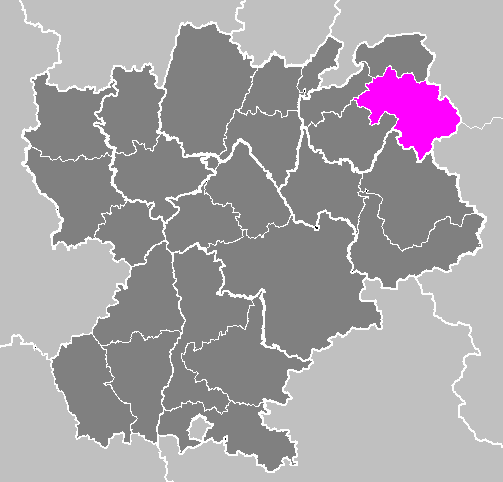
Тонон-ле-Бен
- округ Франции
Hiking in Тонон-ле-Бен
The Arrondissement of Thonon-les-Bains, located in the Haute-Savoie department in the Auvergne-Rhône-Alpes region of France, offers a variety of stunning hiking opportunities. Nestled by the shores of Lake Geneva and surrounded by the majestic Alps, this area provides breathtaking landscapes, diverse trails, and a rich natural environment....
- Страна:
- Столица: Тонон-ле-Бен
- Координаты: 46° 15' 0" N, 6° 30' 0" E
- GPS треки (wikiloc): [Ссылка]
- Площадь: 908 кв.км
- Население: 143678

Бонвиль
- округ Франции
Hiking in Бонвиль
The Arrondissement of Bonneville, located in the Haute-Savoie department of the Auvergne-Rhône-Alpes region in southeastern France, offers some stunning hiking opportunities for outdoor enthusiasts. Nestled in the heart of the French Alps, this area is known for its breathtaking landscapes, diverse terrain, and beautiful alpine scenery. Here are a few highlights of hiking in the region:...
- Страна:
- Столица: Бонвиль
- Координаты: 46° 0' 0" N, 6° 40' 0" E
- GPS треки (wikiloc): [Ссылка]
- Площадь: 1656.11 кв.км
- Население: 186134

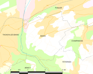
Марин
- коммуна и город во Франции, департамент Верхняя Савойя, регион Рона-Альпы
Hiking in Марин
Hiking in Marin, Haute-Savoie, France, offers breathtaking views and a variety of trails for outdoor enthusiasts. This region, nestled in the French Alps, is renowned for its stunning natural landscapes, including mountains, lakes, and valleys....
- Страна:
- Почтовый код: 74200
- Координаты: 46° 22' 35" N, 6° 31' 45" E
- GPS треки (wikiloc): [Ссылка]
- Площадь: 5.57 кв.км
- Население: 1727
- Веб сайт: [Ссылка]
Анси
- округ Франции
Hiking in Анси
The Arrondissement of Annecy, located in the Haute-Savoie region of the French Alps, is a fantastic destination for hiking enthusiasts. Known for its breathtaking landscapes, picturesque lakes, and charming villages, the area offers a variety of hiking trails suitable for all levels of hikers. Here are some highlights:...
- Страна:
- Столица: Анси
- Координаты: 45° 55' 0" N, 6° 10' 0" E
- GPS треки (wikiloc): [Ссылка]
- Площадь: 1259.2 кв.км
- Население: 279623
Сен-Жюльен-ан-Женевуа
- округ Франции
Hiking in Сен-Жюльен-ан-Женевуа
The Arrondissement of Saint-Julien-en-Genevois, located in the Haute-Savoie department in the Auvergne-Rhône-Alpes region of southeastern France, offers a wealth of hiking opportunities amid stunning Alpine scenery. Here are some key aspects to consider when exploring this area:...
- Страна:
- Столица: Сен-Жюльен-ан-Женевуа
- Координаты: 46° 5' 0" N, 6° 5' 0" E
- GPS треки (wikiloc): [Ссылка]
- Площадь: 659 кв.км
- Население: 184503


Monnetier-Mornex
- коммуна во Франции
Hiking in Monnetier-Mornex
Monnetier-Mornex is a charming commune located in the Haute-Savoie region of France, nestled in the foothills of the French Alps. It offers numerous hiking opportunities, featuring stunning views of the surrounding mountains and beautiful landscapes....
- Страна:
- Почтовый код: 74560
- Координаты: 46° 9' 42" N, 6° 13' 52" E
- GPS треки (wikiloc): [Ссылка]
- Площадь: 11.4 кв.км
- Население: 2310
- Веб сайт: [Ссылка]
Граничит с регионами:


Женева
- кантон в Швейцарии
Hiking in Женева
Hiking in the Canton of Geneva offers a unique blend of urban accessibility and stunning natural landscapes. While Geneva itself is well-known for its cosmopolitan atmosphere, the surrounding areas provide numerous opportunities for outdoor enthusiasts....
- Страна:

- Столица: Женева
- Код автомобильного номера: GE
- Координаты: 46° 13' 5" N, 6° 9' 58" E
- GPS треки (wikiloc): [Ссылка]
- Высота над уровнем моря: 375 м m
- Площадь: 282.49 кв.км
- Веб сайт: [Ссылка]

Валле-д’Аоста
- автономная область и провинция в Италии
Hiking in Валле-д’Аоста
Aosta Valley, located in the northwest of Italy, is a mountainous region known for its stunning landscapes, rich history, and diverse outdoor activities, making it a paradise for hikers. Here’s a comprehensive overview of hiking in Aosta Valley:...
- Страна:

- Столица: Аоста
- Почтовый код: 11100, 11010-11029
- Код автомобильного номера: AO
- Координаты: 45° 43' 0" N, 7° 22' 0" E
- GPS треки (wikiloc): [Ссылка]
- Высота над уровнем моря: 951 м m
- Площадь: 3263.22 кв.км
- Население: 125901
- Веб сайт: [Ссылка]

Савойя
- департамент Франции
Hiking in Савойя
Savoie, located in the Auvergne-Rhône-Alpes region of France, is a stunning area known for its dramatic landscapes, alpine scenery, and rich cultural heritage. Hiking in Savoie offers a diverse range of trails suitable for all skill levels, from leisurely walks to challenging mountain treks....
- Страна:
- Столица: Шамбери
- Координаты: 45° 35' 0" N, 6° 20' 0" E
- GPS треки (wikiloc): [Ссылка]
- Высота над уровнем моря: 1595 м m
- Площадь: 6028 кв.км
- Население: 428204
- Веб сайт: [Ссылка]


Во
- кантон в Швейцарии
Hiking in Во
The Canton of Vaud, located in the French-speaking part of Switzerland, is a fantastic destination for hiking enthusiasts. It offers a diverse range of landscapes, from picturesque lakeside trails along Lake Geneva to challenging mountain hikes in the Alps. Here are some highlights of hiking in this beautiful region:...
- Страна:
- Столица: Лозанна
- Код автомобильного номера: VD
- Координаты: 46° 37' 0" N, 6° 33' 0" E
- GPS треки (wikiloc): [Ссылка]
- Высота над уровнем моря: 495 м m
- Площадь: 3212 кв.км
- Веб сайт: [Ссылка]

Эн
- департамент Франции
Hiking in Эн
Certainly! Ain, a department located in the Auvergne-Rhône-Alpes region of France, offers a diverse range of hiking opportunities, from gentle trails suited for families to more challenging hikes for experienced trekkers. Here are some highlights about hiking in Ain:...
- Страна:
- Столица: Бурк-ан-Брес
- Координаты: 46° 5' 0" N, 5° 20' 0" E
- GPS треки (wikiloc): [Ссылка]
- Площадь: 5762 кв.км
- Население: 631877
- Веб сайт: [Ссылка]


Вале
- кантон в Швейцарии
Hiking in Вале
The Canton of Valais, located in southwestern Switzerland, is a fantastic destination for hiking enthusiasts. Famous for its stunning landscapes dominated by the Alps, the region offers a wide variety of trails suitable for all levels of hikers. Here are some key points to know about hiking in Valais:...
- Страна:
- Столица: Сьон
- Код автомобильного номера: VS
- Координаты: 46° 4' 0" N, 7° 36' 0" E
- GPS треки (wikiloc): [Ссылка]
- Высота над уровнем моря: 512 м m
- Площадь: 5224.50 кв.км
- Веб сайт: [Ссылка]