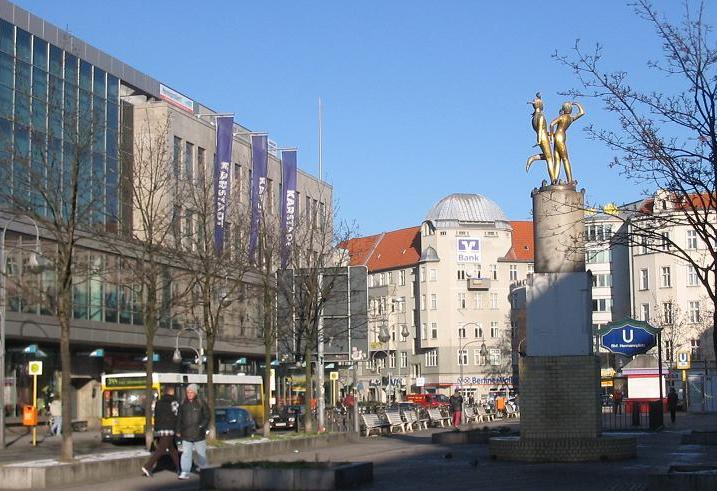
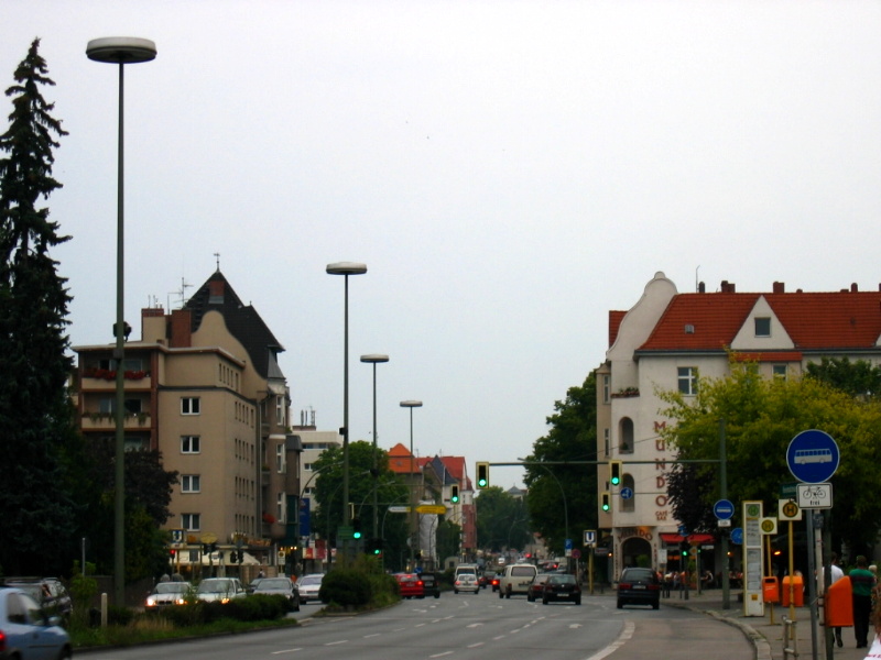
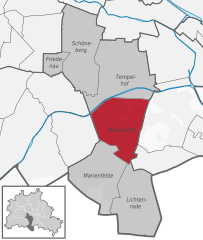
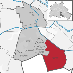
Бриц (Britz, Britz)

- район в Берлине
 Hiking in Бриц
Britz is a neighborhood located in the borough of Neukölln in Berlin, Germany. It is not particularly known for hiking in the traditional sense, as it is more urban and residential in nature. However, there are some fantastic parks and green areas nearby that offer opportunities for leisurely walks and nature exploration.
Parks and Green Spaces:
-
Britzer Garten: This is a large park and garden that spans over 90 hectares. It features beautiful landscapes, thematic gardens, lakes, and walking paths. It’s a great place for leisurely strolls, picnics, and enjoying nature.
-
Tempelhofer Feld: A former airport turned into a massive public park, it’s not far from Britz. It offers vast open spaces for walking, cycling, and skating, along with opportunities to enjoy outdoor recreational activities.
-
Schoeneberger Fliess: A natural stream that runs through the area, it's surrounded by green paths and is a peaceful place for walking or even bird-watching.
Hiking Near Berlin:
For more traditional hiking experiences, you may want to venture a bit outside of Britz into the surrounding areas:
-
Grunewald Forest: Located to the west of Berlin, this expansive forest offers numerous trails for hiking. You can explore wooded areas, hills, and lakes.
-
Müritz National Park: A bit further afield, this is the largest national park in Germany, located north of Berlin. It has a variety of trails winding through stunning lakes and forests.
Tips for Hiking in and around Britz:
- Dress Appropriately: Even urban hikes can involve varied terrain, so wear comfortable shoes and dress in layers.
- Stay Hydrated: Always bring water, especially if you plan on walking for an extended period.
- Explore Public Transport: Berlin’s public transport system makes it easy to reach other hiking areas outside of Britz.
- Check Local Regulations: If hiking in natural parks and reserves, be aware of any rules or regulations to protect wildlife and preserve natural habitats.
While Britz itself may not offer extensive hiking opportunities, its nearby parks and access to larger green spaces in and around Berlin make it a suitable place for enjoying the outdoors.
- Страна:

- Почтовый код: 12359; 12347
- Координаты: 52° 27' 0" N, 13° 26' 0" E


- GPS треки (wikiloc): [Ссылка]
- Высота над уровнем моря: 44 м m
- Площадь: 12.4 кв.км
- Население: 41613
- Википедия русская: wiki(ru)
- Википедия английская: wiki(en)
- Википедия национальная: wiki(de)
- Хранилище Wikidata: Wikidata: Q428846
- Галерея изображений в википедии: [Ссылка]
- Катеория в википедии: [Ссылка]
- Карты в википедии: [Ссылка]
- код Freebase: [/m/03j3td]
- код GeoNames: Альт: [2944027]
- код VIAF: Альт: [130978481]
- ID отношения в OpenStreetMap: [162901]
- идентификатор местоположения ArchINFORM: [43234]
Граничит с регионами:

Нойкёльн
- район Берлина
Hiking in Нойкёльн
Neukölln, a vibrant district in Berlin, Germany, is not typically known for traditional hiking trails like those found in mountainous regions. However, there are several spots within and around Neukölln where you can enjoy nature walks, green spaces, and urban hiking experiences....
- Страна:
- Почтовый код: 12059; 12057; 12055; 12053; 12051; 12049; 12047; 12045; 12043
- Координаты: 52° 28' 53" N, 13° 26' 7" E
- GPS треки (wikiloc): [Ссылка]
- Высота над уровнем моря: 55 м m
- Площадь: 11.7 кв.км
- Население: 167248


Темпельхоф
- район в Берлине
Hiking in Темпельхоф
Tempelhof, a district in Berlin, Germany, is known more for its urban atmosphere than for traditional hiking trails. However, it has unique outdoor spaces that can offer enjoyable walking and exploring experiences for those looking for a more urban hike....
- Страна:
- Почтовый код: 12279; 12099; 12109; 12105; 12103; 12101
- Координаты: 52° 28' 0" N, 13° 23' 0" E
- GPS треки (wikiloc): [Ссылка]
- Высота над уровнем моря: 47 м m
- Площадь: 12.2 кв.км
- Население: 59728
Мариендорф
Hiking in Мариендорф
Mariendorf is a district in the borough of Tempelhof-Schöneberg in Berlin, Germany. While it may not be known for traditional hiking trails like you might find in more mountainous regions, there are still opportunities for outdoor activities and walks in and around the area....
- Страна:
- Почтовый код: 12109; 12107; 12105
- Координаты: 52° 26' 24" N, 13° 23' 24" E
- GPS треки (wikiloc): [Ссылка]
- Высота над уровнем моря: 49 м m
- Площадь: 9.38 кв.км
- Население: 50956
Рудов
- район в Берлине
Hiking in Рудов
Rudow is a district in the borough of Neukölln in Berlin, Germany. Although it is primarily an urban area and not known for traditional hiking, there are opportunities for walks and exploring nature in and around the district. Here are some options and tips for hiking or walking in and around Rudow:...
- Страна:
- Почтовый код: 12357; 12355; 12353
- Координаты: 52° 25' 0" N, 13° 30' 0" E
- GPS треки (wikiloc): [Ссылка]
- Высота над уровнем моря: 38 м m
- Площадь: 11.8 кв.км
- Население: 41618


Баумшуленвег
- район в Берлине
Hiking in Баумшуленвег
Baumschulenweg is a neighborhood located in the Treptow-Köpenick district of Berlin, Germany. While it may not be well-known as a traditional hiking destination, there are several outdoor opportunities in and around the area for those looking to enjoy nature and scenic walks....
- Страна:
- Координаты: 52° 27' 54" N, 13° 29' 10" E
- GPS треки (wikiloc): [Ссылка]
- Высота над уровнем моря: 37 м m
- Площадь: 4.82 кв.км
- Население: 17186

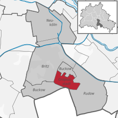
Букков
- район в Берлине
Hiking in Букков
Buckow is a charming district located in the borough of Neukölln in Berlin, Germany. While it may not be a traditional hiking hotspot, it does offer some lovely outdoor experiences, especially for those interested in walking, nature, and exploring the surrounding areas....
- Страна:
- Почтовый код: 12353; 12351; 12349
- Координаты: 52° 25' 55" N, 13° 27' 42" E
- GPS треки (wikiloc): [Ссылка]
- Высота над уровнем моря: 44 м m
- Площадь: 6.35 кв.км
- Население: 39184

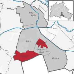
Гропиусштадт
- район в Берлине
Hiking in Гропиусштадт
Gropiusstadt is a district in Berlin, Germany, known primarily for its modernist architecture and urban planning, rather than traditional hiking trails. However, there are opportunities for walking and exploring green spaces in and around Gropiusstadt....
- Страна:
- Почтовый код: 12353; 12351
- Координаты: 52° 25' 33" N, 13° 27' 41" E
- GPS треки (wikiloc): [Ссылка]
- Высота над уровнем моря: 52 м m
- Площадь: 2.66 кв.км
- Население: 36542