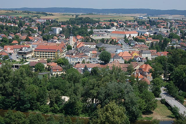
Бургшлайниц-Кюнринг (Burgschleinitz-Kühnring, Burgschleinitz-Kühnring)
 Hiking in Бургшлайниц-Кюнринг
Burgschleinitz-Kühnring, located in Lower Austria, is a picturesque area with varied terrain that offers a range of hiking opportunities. Here are some highlights to consider when planning a hike in this region:
Routes and Trails
- Scenic Views: The area features beautiful landscapes, including vineyards, forests, and rolling hills, providing stunning views, especially during sunrise and sunset.
- Trail Difficulty: There are trails suitable for all skill levels, from easy walks for families to more challenging routes for experienced hikers. Ensure you choose a trail that matches your experience level.
- Marked Trails: Look for well-marked hiking paths that may be indicated on local maps. Signage often includes information about trail length and estimated time to complete.
Flora and Fauna
- Biodiversity: The region hosts a variety of plant and animal species. If you're an enthusiast, keep an eye out for local wildlife such as birds and butterflies, as well as a multitude of plant species in the forests and open fields.
Best Time to Visit
- Seasonal Beauty: Each season offers a different experience. Spring brings blooming flowers, summer is lush and green, autumn showcases colorful foliage, and winter transforms the landscape into a serene, snowy wonderland.
Preparation Tips
- Footwear: Wear sturdy, comfortable hiking boots suitable for uneven terrain.
- Weather Awareness: Check the weather forecast before heading out, as conditions can change quickly, especially in mountainous regions.
- Water and Snacks: Carry enough water and some snacks to keep your energy up during your hike.
Additional Activities
- Cultural Sites: The region may host historical sites, vineyards for wine tasting, and small towns with local charm. Take some time to explore these areas after your hike.
Safety
- Always let someone know your hiking plans and expected return time.
- Keep a map or GPS device on hand, as some trails may not have consistent signage.
Whether you're looking for a peaceful walk or an adventurous trek, Burgschleinitz-Kühnring offers a great escape into nature. Happy hiking!
- Страна:

- Телефонный код: 02984
- Код автомобильного номера: HO
- Координаты: 48° 36' 27" N, 15° 49' 0" E


- GPS треки (wikiloc): [Ссылка]
- Высота над уровнем моря: 376 м m
- Площадь: 41.84 кв.км
- Население: 1360
- Веб сайт: http://www.burgschleinitz-kuehnring.at
- Википедия русская: wiki(ru)
- Википедия английская: wiki(en)
- Википедия национальная: wiki(de)
- Хранилище Wikidata: Wikidata: Q677074
- Катеория в википедии: [Ссылка]
- код Freebase: [/m/02qx84x]
- код GeoNames: Альт: [7872896]
- код VIAF: Альт: [149607940]
- место в MusicBrainz: [0d935dd7-3d87-43f4-b07c-d59f5442a215]
- код австрийского муниципалитета: [31103]
Граничит с регионами:
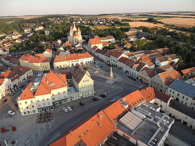
Гарс-ам-Камп
Hiking in Гарс-ам-Камп
Gars am Kamp is a picturesque village located in Lower Austria, known for its scenic landscapes and well-marked hiking trails. Nestled in the Kamp Valley, it offers a mix of cultural heritage and natural beauty, making it a great destination for hikers of all levels....
- Страна:
- Почтовый код: 3571
- Телефонный код: 02985
- Код автомобильного номера: HO
- Координаты: 48° 35' 57" N, 15° 39' 48" E
- GPS треки (wikiloc): [Ссылка]
- Высота над уровнем моря: 256 м m
- Площадь: 50.46 кв.км
- Население: 3534
- Веб сайт: [Ссылка]

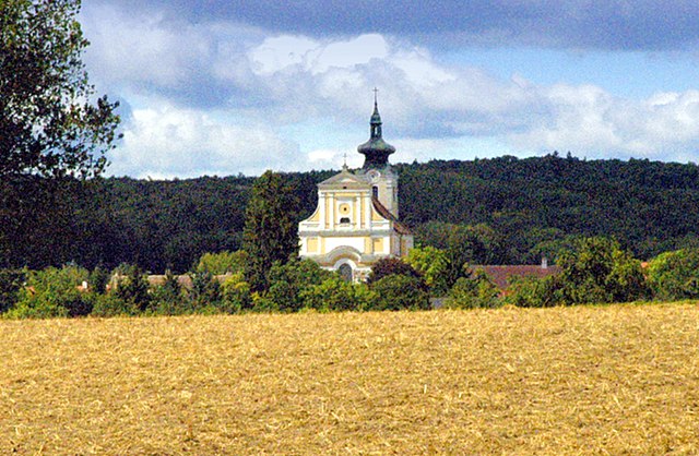
Майсау
Hiking in Майсау
Maissau is a charming town located in the Lower Austria region, offering a variety of hiking opportunities and scenic trails that showcase the beautiful landscapes of the area. Here are some highlights regarding hiking in Maissau:...
- Страна:
- Почтовый код: 3712
- Телефонный код: 02958
- Код автомобильного номера: HL
- Координаты: 48° 34' 0" N, 15° 49' 0" E
- GPS треки (wikiloc): [Ссылка]
- Высота над уровнем моря: 341 м m
- Площадь: 43.14 кв.км
- Население: 1946
- Веб сайт: [Ссылка]

Эггенбург
Hiking in Эггенбург
Eggenburg, located in Lower Austria, offers some beautiful hiking opportunities, nestled between rolling hills and lush landscapes. Here are a few highlights and tips for hiking in this region:...
- Страна:
- Почтовый код: 3730
- Телефонный код: 02984
- Код автомобильного номера: HO
- Координаты: 48° 38' 35" N, 15° 49' 7" E
- GPS треки (wikiloc): [Ссылка]
- Высота над уровнем моря: 329 м m
- Площадь: 23.52 кв.км
- Население: 3540
- Веб сайт: [Ссылка]

Розенбург-Мольд
Hiking in Розенбург-Мольд
Rosenburg-Mold, located in Austria's Lower Austria region, is an excellent destination for hiking enthusiasts. The area is known for its beautiful landscapes, rich biodiversity, and winding trails that cater to a range of hiking abilities....
- Страна:
- Почтовый код: 3573
- Телефонный код: 02982
- Код автомобильного номера: HO
- Координаты: 48° 38' 24" N, 15° 42' 0" E
- GPS треки (wikiloc): [Ссылка]
- Высота над уровнем моря: 268 м m
- Площадь: 30.66 кв.км
- Население: 856
- Веб сайт: [Ссылка]
Штранинг-Графенберг
Hiking in Штранинг-Графенберг
Straning-Grafenberg is located in Austria and offers beautiful hiking opportunities, particularly in the surrounding areas of the Austrian Alps. Here are some highlights and tips for hiking in this region:...
- Страна:
- Почтовый код: 3722
- Телефонный код: 02984
- Код автомобильного номера: HO
- Координаты: 48° 37' 14" N, 15° 51' 24" E
- GPS треки (wikiloc): [Ссылка]
- Высота над уровнем моря: 292 м m
- Площадь: 26.47 кв.км
- Население: 781
- Веб сайт: [Ссылка]

Майзельдорф
Hiking in Майзельдорф
Meiseldorf is a beautiful village located in the Lower Austria region of Austria. While it may not be as widely recognized as some of the larger hiking areas in the Alps, it offers serene trails and scenic views that are perfect for outdoor enthusiasts....
- Страна:
- Почтовый код: 3744
- Телефонный код: 02983
- Код автомобильного номера: HO
- Координаты: 48° 39' 53" N, 15° 45' 6" E
- GPS треки (wikiloc): [Ссылка]
- Высота над уровнем моря: 398 м m
- Площадь: 35.45 кв.км
- Население: 876
- Веб сайт: [Ссылка]

Шёнберг-ам-Камп
Hiking in Шёнберг-ам-Камп
Schönberg am Kamp, located in Lower Austria, is a charming destination for hiking enthusiasts. The area is characterized by its beautiful natural landscapes, rolling hills, and lush vineyards, making it an ideal spot for outdoor activities....
- Страна:
- Телефонный код: 02733
- Код автомобильного номера: KR
- Координаты: 48° 31' 0" N, 15° 42' 0" E
- GPS треки (wikiloc): [Ссылка]
- Высота над уровнем моря: 226 м m
- Площадь: 53.28 кв.км
- Население: 1903
- Веб сайт: [Ссылка]