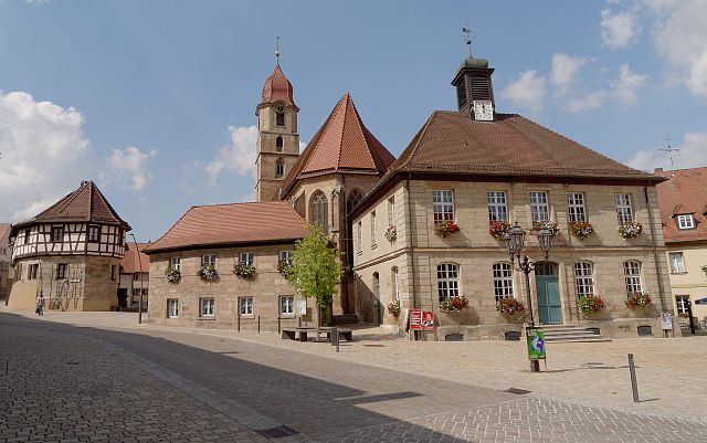
Кадольцбург (Cadolzburg, Cadolzburg)

 Hiking in Кадольцбург
Cadolzburg, located in Bavaria, Germany, offers some lovely hiking opportunities with scenic views and a rich historical backdrop. Here are some aspects to consider for a hiking trip in and around Cadolzburg:
Hiking Trails
-
Kaiserweg (Emperor's Way): This well-marked trail takes you through beautiful landscapes and offers cultural insights into the region's history. Parts of the trail may follow old trade routes and connect to historical sites.
-
Local Nature Walks: Explore local nature reserves and forests surrounding Cadolzburg. The areas are often rich in flora and fauna, providing a calming experience in nature.
-
Steigerwald Nature Park: Nearby, you can explore this larger area that is known for its diverse ecosystems, offering a variety of trails suitable for different skill levels. Here, you might encounter wildlife and old-growth forests.
Points of Interest
-
Cadolzburg Castle: While not a hiking destination per se, the castle is worth a visit. You can explore its historical significance and enjoy stunning views of the surrounding countryside. Many trails in the area might start or end near the castle.
-
Local Culture: Engage with the local communities during your hikes, perhaps stopping by a traditional Bavarian inn for food and drinks to recharge.
Hiking Preparation
-
Weather: Check the weather forecast ahead of your hike, as conditions can change quickly in Bavaria. Dress in layers and consider waterproof gear.
-
Trail Maps: It's advisable to either have a physical map or a smartphone app for navigation, as not all trails may be well-signed.
-
Safety: Make sure to carry enough water, snacks, and a first aid kit. Mobile reception can be limited in some areas, so inform someone of your hiking plans.
Additional Tips
- If you’re new to hiking or not familiar with the terrain, consider joining a local guided tour.
- Join local hiking groups or clubs that may organize regular hikes in the area, providing a chance to meet fellow outdoor enthusiasts.
Overall, hiking in Cadolzburg can be a delightful experience, combining nature, history, and community spirit. Whether you’re an experienced hiker or a beginner, there are paths that can accommodate your abilities. Enjoy your adventure!
- Страна:

- Почтовый код: 90556
- Телефонный код: 09103
- Координаты: 49° 27' 0" N, 10° 52' 0" E


- GPS треки (wikiloc): [Ссылка]
- Высота над уровнем моря: 352 м m
- Площадь: 45.39 кв.км
- Население: 8003
- Веб сайт: http://www.cadolzburg.de/
- Википедия русская: wiki(ru)
- Википедия английская: wiki(en)
- Википедия национальная: wiki(de)
- Хранилище Wikidata: Wikidata: Q522025
- Галерея изображений в википедии: [Ссылка]
- Катеория в википедии: [Ссылка]
- код Freebase: [/m/0f5dyh]
- код GeoNames: Альт: [2940428]
- код VIAF: Альт: [156099133]
- ID отношения в OpenStreetMap: [1016404]
- код GND: Альт: [4129267-4]
- идентификатор местоположения ArchINFORM: [11773]
- код LCNAF: Альт: [n95079748]
- место в MusicBrainz: [45dc8a45-75c4-41f1-a2b5-da341f361d1d]
- код Historical Gazetteer: [CADURGJN59KK]
- Bavarikon ID: [ODB_A00000099]
- код NKC: [ge917011]
- идентификатор муниципалитетов в Германии: 09573114
Граничит с регионами:

Лангенценн
- город в Германии, в земле Бавария
Hiking in Лангенценн
Langenzenn, located in Bavaria, Germany, offers a charming experience for hiking enthusiasts. The area is characterized by its picturesque landscapes, rolling hills, lush forests, and quaint rural scenery. Here are some highlights and tips for hiking in Langenzenn:...
- Страна:
- Почтовый код: 90579
- Телефонный код: 09101
- Координаты: 49° 29' 40" N, 10° 47' 41" E
- GPS треки (wikiloc): [Ссылка]
- Высота над уровнем моря: 313 м m
- Площадь: 46.31 кв.км
- Население: 8193
- Веб сайт: [Ссылка]

Фюрт
- город в Баварии, Германия
Hiking in Фюрт
Fürth, located in Bavaria, Germany, offers several hiking opportunities that cater to various fitness levels and preferences. While it may not be as well-known as some of the larger cities for hiking, it has its charms and beautiful landscapes....
- Страна:
- Почтовый код: 90768; 90766; 90765; 90763; 90762
- Телефонный код: 0911
- Код автомобильного номера: FÜ
- Координаты: 49° 28' 42" N, 10° 59' 25" E
- GPS треки (wikiloc): [Ссылка]
- Высота над уровнем моря: 296 м m
- Площадь: 63.35 кв.км
- Население: 125403
- Веб сайт: [Ссылка]