
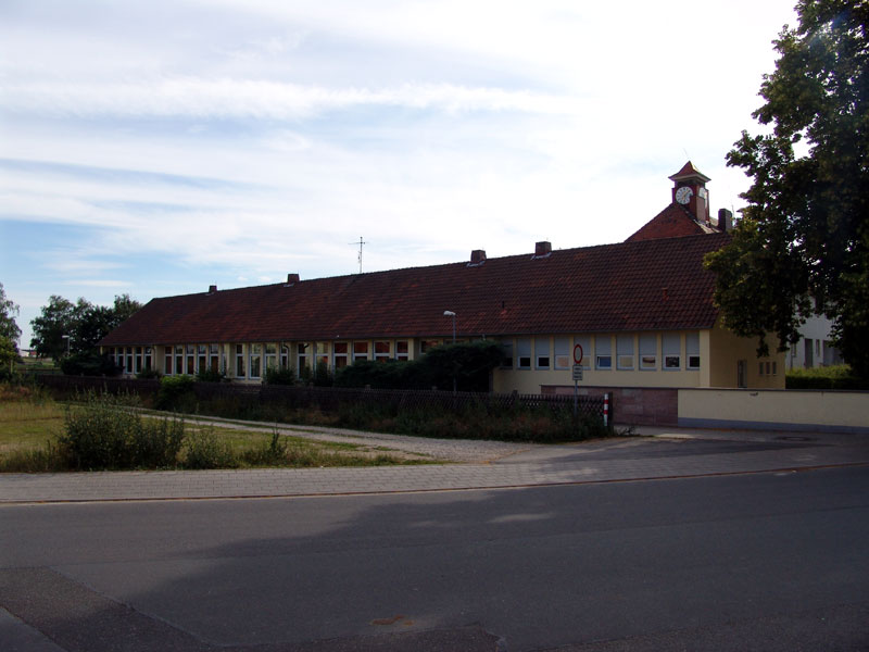
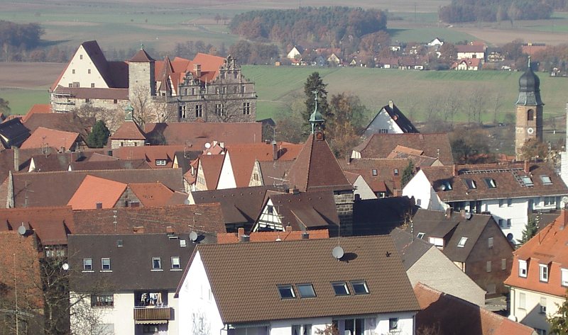
Фюрт (Fürth, Fürth)
.svg)
- город в Баварии, Германия
 Hiking in Фюрт
Fürth, located in Bavaria, Germany, offers several hiking opportunities that cater to various fitness levels and preferences. While it may not be as well-known as some of the larger cities for hiking, it has its charms and beautiful landscapes.
Hiking in and around Fürth:
-
Locations and Trails:
- Stadtwald Fürth (City Forest): This large forest area is perfect for leisurely hikes. It has well-marked trails and is an excellent spot for families and those looking for a tranquil environment.
- Fürther Stadtpark: A beautiful park with walking paths that can be part of a longer hike. It's great for a casual stroll and enjoying nature.
- Valley of the Rednitz River: You can follow the riverbanks for flat, scenic walks that are manageable for hikers of all ages.
-
Nearby Hiking Areas:
- Frankenjura: A short drive from Fürth, this stunning region is renowned for its limestone cliffs and picturesque trails. It offers more challenging hikes for those looking for something more demanding.
- Nuremberg’s Luitpoldhain and Wöhrder See: Close by, these areas provide additional options for hiking and walking, particularly around the lake with beautiful views.
-
Nature and Scenery:
- Visitors can enjoy a variety of natural environments, including dense forests, riverbanks, and parks. The area is known for its lush greenery and beautiful autumn colors.
-
Wildlife and Flora:
- Depending on the season, hikers may encounter diverse wildlife including birds, deer, and various plant species native to the region.
-
Tips for Hiking in Fürth:
- Trail Maps: Ensure you have a good map or a hiking app to help you navigate the trails.
- Equipment: Wear sturdy shoes and bring water, especially if you plan on longer hikes.
- Weather: Check the weather conditions before heading out. Bavaria can experience quick weather changes.
- Local Guides: For those new to the area or looking for a more in-depth experience, consider joining a guided hiking tour.
Overall, hiking in Fürth can be a delightful experience, especially for those who enjoy blending city exploration with nature. Whether you're out for a short walk or planning a more extensive hike, you’ll find beautiful spots to enjoy.
- Страна:

- Почтовый код: 90768; 90766; 90765; 90763; 90762
- Телефонный код: 0911
- Код автомобильного номера: FÜ
- Координаты: 49° 28' 42" N, 10° 59' 25" E


- GPS треки (wikiloc): [Ссылка]
- Высота над уровнем моря: 296 м m
- Площадь: 63.35 кв.км
- Население: 125403
- Веб сайт: http://www.fuerth.de
- Википедия русская: wiki(ru)
- Википедия английская: wiki(en)
- Википедия национальная: wiki(de)
- Хранилище Wikidata: Wikidata: Q3075
- Галерея изображений в википедии: [Ссылка]
- Катеория в википедии: [Ссылка]
- Карты в википедии: [Ссылка]
- код Freebase: [/m/02wb2t]
- код GeoNames: Альт: [2923544]
- код VIAF: Альт: [125498663]
- ID отношения в OpenStreetMap: [62374]
- код GND: Альт: [4018827-9]
- идентификатор местоположения ArchINFORM: [4235]
- код LCNAF: Альт: [n81062642]
- место в MusicBrainz: [593244e5-a86c-4ec9-b746-7a1ef8ddf98b]
- код места в Facebook: [110437775652176]
- Bavarikon ID: [ODB_A00000007]
- код NKC: [ge1014318]
- код NUTS: [DE253]
- Nomisma ID: [fuerth]
- код BabelNet: [03444834n]
- идентификатор муниципалитетов в Германии: 09563000
- код района Германии: 09563
Включает регионы:
Burgfarrnbach
Hiking in Burgfarrnbach
Burgfarrnbach, a district of the town of Fürth in Bavaria, Germany, may not be the first place that comes to mind for hiking, but it offers a great opportunity for outdoor activities, particularly for those looking for a more rural and scenic experience. Here are a few insights into hiking in and around Burgfarrnbach:...
- Страна:
- Почтовый код: 90768
- Телефонный код: 0911
- Координаты: 49° 29' 18" N, 10° 55' 30" E
- GPS треки (wikiloc): [Ссылка]
- Высота над уровнем моря: 312 м m
Dambach
Hiking in Dambach
Dambach, a district of Fürth in Bavaria, Germany, is located near the scenic Franconian Switzerland, which is known for its beautiful landscapes, hiking trails, and charming villages. When hiking in this area, you'll find a mix of nature, history, and stunning views. Here are some key highlights for hiking in and around Dambach:...
- Страна:
- Почтовый код: 90765
- Телефонный код: 0911
- Координаты: 49° 27' 45" N, 10° 58' 22" E
- GPS треки (wikiloc): [Ссылка]
- Высота над уровнем моря: 306 м m
Oberfürberg
Hiking in Oberfürberg
Hiking in Oberfürberg, a beautiful location often associated with stunning natural landscapes, offers a variety of trails suitable for different skill levels. Nestled in the region, you can expect lush greenery, scenic views, and a chance to experience the local flora and fauna....
- Страна:
- Почтовый код: 90765
- Телефонный код: 0911
- Координаты: 49° 28' 17" N, 10° 56' 29" E
- GPS треки (wikiloc): [Ссылка]
- Высота над уровнем моря: 319 м m
Stadeln
- страница значений
Hiking in Stadeln
Stadeln is not a widely recognized hiking destination, so information may be limited or pertains to a specific region or area. However, the term "Stadeln" is associated with a few places, mainly in Germany, particularly in regions like Bavaria. If you are looking for hiking opportunities in a specific Stadeln, it would help to have more context....

Ronhof
Hiking in Ronhof
Ronhof is a district located in the city of Erlangen, Germany. While it may not be widely recognized as a prime hiking destination, there are opportunities for outdoor activities in and around the area. Here are some suggestions and information for hiking enthusiasts considering this region:...
- Страна:
- Почтовый код: 90768
- Координаты: 49° 29' 48" N, 11° 0' 25" E
- GPS треки (wikiloc): [Ссылка]
- Высота над уровнем моря: 299 м m

Vach
Hiking in Vach
Vach is a lesser-known hiking destination, but it offers a variety of picturesque trails and scenic landscapes ideal for outdoor enthusiasts. While there might not be extensive information on Vach specifically due to its relatively low profile compared to more popular hiking spots, many regions known as Vach may feature opportunities for exploration....
- Страна:
- Почтовый код: 90768
- Телефонный код: 0911
- Координаты: 49° 31' 34" N, 10° 57' 55" E
- GPS треки (wikiloc): [Ссылка]
- Высота над уровнем моря: 285 м m
Steinach
Hiking in Steinach
Steinach, located in the district of Fürth, Bavaria, Germany, offers a variety of hiking opportunities surrounded by beautiful landscapes, charming villages, and rich natural biodiversity. Here are some highlights and tips for hiking in this area:...
- Страна:
- Почтовый код: 90765
- Телефонный код: 0911
- Координаты: 49° 30' 54" N, 10° 59' 42" E
- GPS треки (wikiloc): [Ссылка]
- Высота над уровнем моря: 297 м m

Flexdorf
Hiking in Flexdorf
Flexdorf is a picturesque area that offers various trails suited for hikers of all levels. When planning your hike in Flexdorf, consider the following:...
- Страна:
- Почтовый код: 90768
- Координаты: 49° 30' 42" N, 10° 57' 19" E
- GPS треки (wikiloc): [Ссылка]
- Высота над уровнем моря: 295 м m
Herboldshof
Hiking in Herboldshof
Herboldshof is a small neighborhood in Fürth, Germany, situated near several natural areas, making it a great starting point for hiking. While the neighborhood itself may not have extensive hiking trails, you can easily access nearby parks and nature reserves for various hiking opportunities....
- Страна:
- Почтовый код: 90765
- Координаты: 49° 31' 16" N, 10° 59' 24" E
- GPS треки (wikiloc): [Ссылка]
- Высота над уровнем моря: 290 м m
Kronach
Hiking in Kronach
Kronach, located in Bavaria, Germany, offers a variety of hiking opportunities set against a backdrop of beautiful landscapes, historical sites, and natural beauty. Here are some highlights:...
- Страна:
- Почтовый код: 90765
- Телефонный код: 0911
- Координаты: 49° 30' 1" N, 10° 59' 56" E
- GPS треки (wikiloc): [Ссылка]
- Высота над уровнем моря: 296 м m
Рицмансдорф
- район Фюрта, Бавария
Hiking in Рицмансдорф
Ritzmannshof, located in the vicinity of Fürth, Germany, offers a variety of hiking opportunities that cater to outdoor enthusiasts. While the region is not as widely recognized as some of Germany's other hiking hotspots, it features scenic landscapes, quiet woodlands, and trails that provide a chance to explore the natural beauty of the area....
- Страна:
- Почтовый код: 90768
- Координаты: 49° 30' 31" N, 10° 56' 18" E
- GPS треки (wikiloc): [Ссылка]
- Высота над уровнем моря: 286 м m
Unterfürberg
Hiking in Unterfürberg
Unterfürberg is a beautiful area for hiking, situated in Austria, specifically in the state of Salzburg. The region is known for its stunning landscapes, lush forests, and panoramic views of the surrounding mountains. Here are some key points to keep in mind when planning a hike in Unterfürberg:...
- Страна:
- Почтовый код: 90768
- Телефонный код: 0911
- Координаты: 49° 28' 20" N, 10° 57' 28" E
- GPS треки (wikiloc): [Ссылка]
- Высота над уровнем моря: 309 м m

Mannhof
Hiking in Mannhof
Hiking in Mannhof, which is a district of Fürth in Bavaria, Germany, offers a charming experience, as the area is characterized by its lush green landscapes, scenic views, and a mix of natural and urban environments. While Mannhof itself may have limited dedicated hiking trails, it is conveniently located near several natural areas and parks that are great for hiking....
- Страна:
- Почтовый код: 90765
- Телефонный код: 0911
- Высота над уровнем моря: 287 м m
Poppenreuth
Hiking in Poppenreuth
Poppenreuth is a small district located in Fürth, Germany, and while it's not primarily known as a hiking destination, there are still opportunities for walking and enjoying nature in the surrounding areas. Here are some points to consider when hiking around Poppenreuth:...
- Страна:
- Почтовый код: 90765
- Телефонный код: 0911
- Координаты: 49° 28' 56" N, 11° 0' 52" E
- GPS треки (wikiloc): [Ссылка]
- Высота над уровнем моря: 302 м m
Sack
Hiking in Sack
Sack is a district in the city of Fürth, located in Bavaria, Germany. While it might not be a major hiking destination like some national parks or mountainous areas, there are still opportunities for local walks and hikes in and around the area....
- Страна:
- Почтовый код: 90768
- Телефонный код: 0911
- Координаты: 49° 30' 12" N, 11° 0' 45" E
- GPS треки (wikiloc): [Ссылка]
- Высота над уровнем моря: 300 м m

Unterfarrnbach
Hiking in Unterfarrnbach
Unterfarrnbach, a charming area located in Germany, offers a range of hiking opportunities that cater to different skill levels. While it may not be as famous as some larger hiking destinations in the country, it provides lovely trails surrounded by lush greenery and beautiful landscapes....
- Страна:
- Почтовый код: 90766
- Телефонный код: 0911
- Координаты: 49° 29' 26" N, 10° 57' 6" E
- GPS треки (wikiloc): [Ссылка]
- Высота над уровнем моря: 300 м m
Weikershof
Hiking in Weikershof
Weikershof is a picturesque area, often recognized for its beautiful landscapes and outdoor experiences. While it may not be as well-known as some other hiking destinations, it offers a unique charm for hikers looking for a tranquil experience....
- Страна:
- Почтовый код: 90763
- Телефонный код: 0911
- Координаты: 49° 26' 44" N, 10° 59' 13" E
- GPS треки (wikiloc): [Ссылка]
- Высота над уровнем моря: 292 м m
Atzenhof
Hiking in Atzenhof
Atzenhof, a district in Fürth, Germany, is surrounded by scenic landscapes that can offer enjoyable hiking opportunities. While Atzenhof itself may not be a well-known hiking destination, it is close to several trails and parks suitable for outdoor activities....
- Страна:
- Почтовый код: 90768
- Телефонный код: 0911
- Координаты: 49° 30' 15" N, 10° 57' 10" E
- GPS треки (wikiloc): [Ссылка]
- Высота над уровнем моря: 295 м m
Bislohe
Hiking in Bislohe
Hiking in Bislohe, a small community located in Germany, can offer an intimate experience with nature, though specific trail information can vary based on local developments. The area is known for its scenic countryside and lush landscapes, making it a great destination for those seeking a peaceful outdoor experience....
- Страна:
- Почтовый код: 90765
- Телефонный код: 0911
- Координаты: 49° 30' 38" N, 11° 0' 30" E
- GPS треки (wikiloc): [Ссылка]
- Высота над уровнем моря: 299 м m
Braunsbach (Fürth)
Hiking in Braunsbach (Fürth)
Braunsbach is a picturesque village located in the district of Fürth, Germany. Nestled in a region characterized by rolling hills, wooded areas, and beautiful landscapes, Braunsbach offers great opportunities for hiking enthusiasts. Here’s an overview of what you can expect when hiking in Braunsbach:...
- Страна:
- Почтовый код: 90765
- Телефонный код: 0911
- Координаты: 49° 30' 0" N, 11° 1' 10" E
- GPS треки (wikiloc): [Ссылка]
- Высота над уровнем моря: 301 м m
Граничит с регионами:

Фюрт
Hiking in Фюрт
Fürth, located in Bavaria, Germany, offers a variety of hiking opportunities that cater to different skill levels and preferences. The area is characterized by beautiful hills, forests, and rivers, making it a great spot for outdoor enthusiasts....
- Страна:
- Столица: Цирндорф
- Код автомобильного номера: FÜ
- Координаты: 49° 25' 0" N, 10° 50' 0" E
- GPS треки (wikiloc): [Ссылка]
- Высота над уровнем моря: 397 м m
- Площадь: 308.00 кв.км
- Население: 116193
- Веб сайт: [Ссылка]

Нюрнберг
- город в Германии
Hiking in Нюрнберг
Hiking in and around Nuremberg can offer a remarkable blend of urban exploration and natural beauty. Though Nuremberg itself is a city with a rich history, it is surrounded by picturesque landscapes that are perfect for hiking enthusiasts. Here are some highlights and tips for hiking in the region:...
- Страна:
- Почтовый код: 90402–90491
- Телефонный код: 0911
- Код автомобильного номера: N
- Координаты: 49° 27' 10" N, 11° 4' 40" E
- GPS треки (wikiloc): [Ссылка]
- Высота над уровнем моря: 209 м m
- Площадь: 186.45 кв.км
- Население: 515201
- Веб сайт: [Ссылка]

Эрланген
- город в Германии
Hiking in Эрланген
Erlangen, located in Bavaria, Germany, is surrounded by beautiful landscapes that offer various hiking opportunities. While the city itself is relatively flat, the nearby Franconian Switzerland region and the hills of the Fichtelgebirge provide excellent trails for hikers of all skill levels....
- Страна:
- Почтовый код: 91001; 91058; 91057; 91056; 91055; 91054; 91053; 91052
- Телефонный код: 09132; 09135; 0911; 09131
- Код автомобильного номера: ER
- Координаты: 49° 35' 47" N, 11° 0' 16" E
- GPS треки (wikiloc): [Ссылка]
- Высота над уровнем моря: 279 м m
- Площадь: 76900000 кв.км
- Население: 108336
- Веб сайт: [Ссылка]


Зойкендорф
Hiking in Зойкендорф
Seukendorf, located in Bavaria, Germany, is a small town that offers a peaceful and scenic environment for hiking enthusiasts. While it may not be as well-known as some of the larger hiking destinations in the region, it provides a quaint and charming backdrop for walking and exploring nature....
- Страна:
- Почтовый код: 90556
- Телефонный код: 0911
- Координаты: 49° 29' 0" N, 10° 53' 0" E
- GPS треки (wikiloc): [Ссылка]
- Высота над уровнем моря: 328 м m
- Площадь: 8.48 кв.км
- Население: 2103
- Веб сайт: [Ссылка]


Оберасбах
Hiking in Оберасбах
Oberasbach, located in Bavaria, Germany, offers a variety of hiking opportunities set against the backdrop of the beautiful Franconian landscapes. While it might not be as well-known for hiking as some other areas in Bavaria, it still provides access to scenic trails and paths that appeal to nature lovers....
- Страна:
- Почтовый код: 90522
- Телефонный код: 0911
- Координаты: 49° 25' 19" N, 10° 57' 30" E
- GPS треки (wikiloc): [Ссылка]
- Высота над уровнем моря: 316 м m
- Площадь: 12.08 кв.км
- Население: 14833
- Веб сайт: [Ссылка]


Обермихельбах
Hiking in Обермихельбах
Obermichelbach, a charming village located in Bavaria, Germany, offers beautiful hiking opportunities amidst picturesque landscapes, rolling hills, and scenic trails. Here are some highlights for hiking in the area:...
- Страна:
- Почтовый код: 90587
- Телефонный код: 0911
- Координаты: 49° 31' 51" N, 10° 54' 36" E
- GPS треки (wikiloc): [Ссылка]
- Высота над уровнем моря: 327 м m
- Площадь: 9.27 кв.км
- Население: 1795
- Веб сайт: [Ссылка]

Кадольцбург
Hiking in Кадольцбург
Cadolzburg, located in Bavaria, Germany, offers some lovely hiking opportunities with scenic views and a rich historical backdrop. Here are some aspects to consider for a hiking trip in and around Cadolzburg:...
- Страна:
- Почтовый код: 90556
- Телефонный код: 09103
- Координаты: 49° 27' 0" N, 10° 52' 0" E
- GPS треки (wikiloc): [Ссылка]
- Высота над уровнем моря: 352 м m
- Площадь: 45.39 кв.км
- Население: 8003
- Веб сайт: [Ссылка]

Файтсбронн
Hiking in Файтсбронн
Veitsbronn is a small municipality located in Bavaria, Germany, known for its picturesque landscapes and nature trails that are excellent for hiking. Here’s what you should know about hiking in the area:...
- Страна:
- Почтовый код: 90587
- Телефонный код: 0911
- Координаты: 49° 30' 45" N, 10° 53' 17" E
- GPS треки (wikiloc): [Ссылка]
- Высота над уровнем моря: 300 м m
- Площадь: 16.16 кв.км
- Население: 5461
- Веб сайт: [Ссылка]

Цирндорф
Hiking in Цирндорф
Zirndorf, located in Bavaria, Germany, is known for its picturesque landscapes and proximity to Franconian Switzerland, making it an attractive destination for hikers. Here are some details about hiking in Zirndorf and the surrounding area:...
- Страна:
- Почтовый код: 90513
- Телефонный код: 0911
- Координаты: 49° 27' 0" N, 10° 57' 0" E
- GPS треки (wikiloc): [Ссылка]
- Высота над уровнем моря: 306 м m
- Площадь: 28780000 кв.км
- Население: 21022
- Веб сайт: [Ссылка]