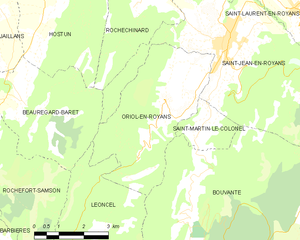
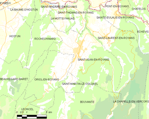
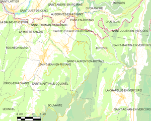
canton of Saint-Jean-en-Royans (canton de Saint-Jean-en-Royans)
 Hiking in canton of Saint-Jean-en-Royans
Canton de Saint-Jean-en-Royans, located in the Drôme department of the Auvergne-Rhône-Alpes region in southeastern France, is a beautiful area that offers a variety of hiking opportunities. Nestled at the edge of the Vercors Regional Natural Park, this region is characterized by its stunning landscapes, including limestone cliffs, lush forests, and picturesque villages.
Hiking Highlights:
-
Scenic Trails: The area boasts numerous well-marked trails that cater to hikers of all levels. Whether you're looking for an easy walk or a challenging trek, you'll find routes that provide breathtaking views of the surrounding valleys and mountains.
-
Natural Attractions:
- The Vercors Plateau provides diverse terrains and unique flora and fauna.
- The Gorges de la Bourne offer dramatic cliffs and a chance to see the river's natural beauty.
-
Cultural and Historical Sites: As you hike, you'll come across charming villages like Saint-Jean-en-Royans, where you can explore local culture, architecture, and traditions. Many trails also lead to historical landmarks such as ancient villages, chapels, and ruins.
-
Wildlife Spotting: The region is great for wildlife watching. Keep an eye out for various bird species, deer, and other wildlife as you traverse the trails.
-
Seasonal Hiking: Spring and fall are particularly beautiful times to hike in this region, with wildflowers blooming and autumn foliage providing stunning backdrops. Summer can be warm, while winter may offer opportunities for snowshoeing in certain areas of the Vercors.
Preparation Tips:
- Maps and Information: It's wise to get a hiking map or use a navigation app to stay on the right path, as trails can vary in difficulty.
- Gear: Wear sturdy hiking shoes and appropriate clothing for the weather conditions. Carry plenty of water and snacks.
- Safety: Be aware of your surroundings, inform someone of your hiking plans, and check local weather conditions before heading out.
Local Resources:
You may also want to check with local tourist offices for updated information on trails, guided tours, and other resources that can enhance your hiking experience in Canton de Saint-Jean-en-Royans! Enjoy your hiking adventure in this beautiful region!
- Страна:

- Столица: Saint-Jean-en-Royans
- Координаты: 45° 0' 55" N, 5° 17' 1" E


- GPS треки (wikiloc): [Ссылка]
- Хранилище Wikidata: Wikidata: Q1727218
- код кантона INSEE: [2624]
Включает регионы:
Oriol-en-Royans
- коммуна во Франции
Hiking in Oriol-en-Royans
Oriol-en-Royans is a charming village located in the Auvergne-Rhône-Alpes region of southeastern France, nestled in the stunning Vercors Massif. This area offers a wide array of hiking opportunities, ranging from easy scenic strolls to more challenging ascents. Here are some highlights for hiking in the region:...
- Страна:
- Почтовый код: 26190
- Координаты: 44° 59' 54" N, 5° 16' 27" E
- GPS треки (wikiloc): [Ссылка]
- Площадь: 16.01 кв.км
- Население: 538


La Motte-Fanjas
- коммуна во Франции
Hiking in La Motte-Fanjas
La Motte-Fanjas is a picturesque commune located in the Drôme department of southeastern France. Nestled in the heart of the Rhône-Alpes region, it offers beautiful landscapes and a variety of hiking opportunities....
- Страна:
- Почтовый код: 26190
- Координаты: 45° 3' 3" N, 5° 16' 2" E
- GPS треки (wikiloc): [Ссылка]
- Площадь: 4.78 кв.км
- Население: 189

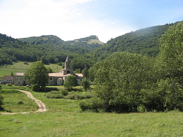
Rochechinard
- коммуна во Франции
Hiking in Rochechinard
Rochechinard is a beautiful area located in the French Alps, known for its stunning landscapes, diverse flora and fauna, and a variety of hiking routes that cater to different skill levels. Here are some key points to consider if you’re planning a hiking trip in Rochechinard:...
- Страна:
- Почтовый код: 26190
- Координаты: 45° 2' 3" N, 5° 15' 12" E
- GPS треки (wikiloc): [Ссылка]
- Площадь: 9.78 кв.км
- Население: 110


Sainte-Eulalie-en-Royans
- коммуна во Франции
Hiking in Sainte-Eulalie-en-Royans
Sainte-Eulalie-en-Royans is a beautiful village located in the Vercors Regional Natural Park in the Auvergne-Rhône-Alpes region of France. It's an excellent starting point for hikers seeking a blend of stunning natural landscapes, diverse trails, and local culture....
- Страна:
- Почтовый код: 26190
- Координаты: 45° 2' 51" N, 5° 20' 29" E
- GPS треки (wikiloc): [Ссылка]
- Высота над уровнем моря: 286 м m
- Площадь: 6.14 кв.км
- Население: 548

Saint-Thomas-en-Royans
- коммуна во Франции
Hiking in Saint-Thomas-en-Royans
Saint-Thomas-en-Royans is a picturesque village located in the Drôme department of southeastern France, nestled within the stunning Vercors Regional Natural Park. This region offers a variety of hiking opportunities suitable for all levels of experience, making it a wonderful destination for outdoor enthusiasts....
- Страна:
- Почтовый код: 26190
- Координаты: 45° 2' 57" N, 5° 17' 40" E
- GPS треки (wikiloc): [Ссылка]
- Площадь: 5.15 кв.км
- Население: 585


Saint-Nazaire-en-Royans
- коммуна во Франции
Hiking in Saint-Nazaire-en-Royans
Saint-Nazaire-en-Royans is a charming village located in the Drôme department of France, nestled in the stunning Vercors Regional Natural Park. This area is known for its breathtaking landscapes, diverse ecosystems, and rich cultural heritage, making it an attractive destination for hikers....
- Страна:
- Почтовый код: 26190
- Координаты: 45° 3' 33" N, 5° 14' 56" E
- GPS треки (wikiloc): [Ссылка]
- Площадь: 3.54 кв.км
- Население: 794
Saint-Martin-le-Colonel
- коммуна во Франции
Hiking in Saint-Martin-le-Colonel
Saint-Martin-le-Colonel, located in the picturesque Vaucluse department of the Provence region in southeastern France, offers some fantastic hiking opportunities. The area is renowned for its stunning landscapes, including vineyards, olive groves, and dramatic rocky outcrops....
- Страна:
- Почтовый код: 26190
- Координаты: 44° 59' 12" N, 5° 16' 21" E
- GPS треки (wikiloc): [Ссылка]
- Площадь: 3.18 кв.км
- Население: 187

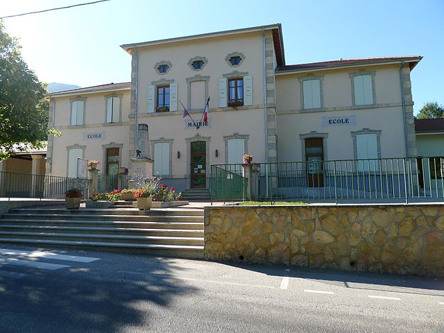
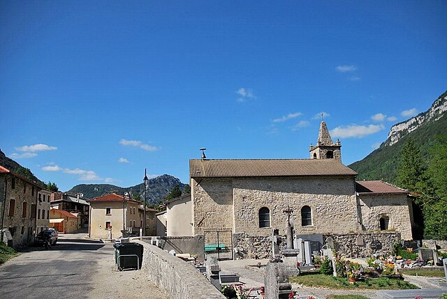
Saint-Jean-en-Royans
- коммуна во Франции
Hiking in Saint-Jean-en-Royans
Saint-Jean-en-Royans is a picturesque village located in the Drôme department in the Auvergne-Rhône-Alpes region of southeastern France. Nestled at the foothills of the Vercors Massif, it offers a variety of hiking opportunities that cater to different skill levels and interests....
- Страна:
- Почтовый код: 26190
- Координаты: 45° 1' 7" N, 5° 17' 32" E
- GPS треки (wikiloc): [Ссылка]
- Площадь: 27.86 кв.км
- Население: 2967

Saint-Laurent-en-Royans
- коммуна во Франции
Hiking in Saint-Laurent-en-Royans
Saint-Laurent-en-Royans is a charming village located in the Drôme department of the Auvergne-Rhône-Alpes region in southeastern France. It's an excellent starting point for hikers due to its stunning natural surroundings, featuring limestone cliffs, lush forests, and the scenic Royans region....
- Страна:
- Почтовый код: 26190
- Координаты: 45° 1' 40" N, 5° 19' 36" E
- GPS треки (wikiloc): [Ссылка]
- Площадь: 27.39 кв.км
- Население: 1376
- Веб сайт: [Ссылка]


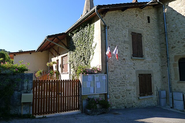
Échevis
- коммуна во Франции
Hiking in Échevis
Échevis is a charming village located in the Auvergne-Rhône-Alpes region of France. It's known for its natural beauty, with scenic landscapes that make it an attractive destination for hiking enthusiasts. Here are some key points to consider when hiking in Échevis:...
- Страна:
- Почтовый код: 26190
- Координаты: 45° 1' 38" N, 5° 23' 3" E
- GPS треки (wikiloc): [Ссылка]
- Площадь: 11.11 кв.км
- Население: 49

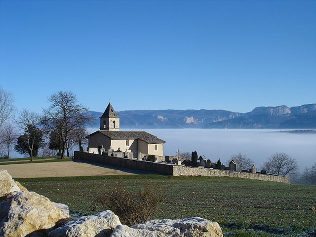
Léoncel
- коммуна во Франции
Hiking in Léoncel
Léoncel is a beautiful village located in the Drôme department of the Auvergne-Rhône-Alpes region in southeastern France. It is situated in the Vercors Massif, which offers diverse landscapes and rich natural beauty, making it an excellent destination for hiking enthusiasts....
- Страна:
- Почтовый код: 26190
- Координаты: 44° 54' 39" N, 5° 11' 34" E
- GPS треки (wikiloc): [Ссылка]
- Площадь: 43.01 кв.км
- Население: 58

Bouvante
- коммуна во Франции
Hiking in Bouvante
Bouvante is a charming commune located in the Isère department of the Auvergne-Rhône-Alpes region in southeastern France. It is surrounded by breathtaking landscapes, characterized by rolling hills, forests, and mountainous terrain, which makes it a great destination for hiking enthusiasts....
- Страна:
- Почтовый код: 26190
- Координаты: 44° 57' 52" N, 5° 16' 14" E
- GPS треки (wikiloc): [Ссылка]
- Высота над уровнем моря: 585 м m
- Площадь: 83.88 кв.км
- Население: 252