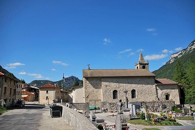
Léoncel (Léoncel)

- коммуна во Франции
 Hiking in Léoncel
Léoncel is a beautiful village located in the Drôme department of the Auvergne-Rhône-Alpes region in southeastern France. It is situated in the Vercors Massif, which offers diverse landscapes and rich natural beauty, making it an excellent destination for hiking enthusiasts.
Hiking Features in Léoncel:
-
Scenic Trails: Léoncel is surrounded by a variety of hiking trails that cater to different skill levels, from easy walks to more challenging hikes. The trails often provide stunning views of the surrounding valleys, mountains, and forests.
-
Flora and Fauna: The region is known for its rich biodiversity. While hiking, you may encounter a variety of plant species, wildlife, and breathtaking natural formations. Keep an eye out for local flora, including rare alpine plants, and fauna such as deer, foxes, and various bird species.
-
Cultural Heritage: The area has historical significance, and while hiking, you may come across ancient ruins, chapels, and the picturesque architecture of Léoncel itself, including the 12th-century Cistercian Abbey.
-
Connecting with Nature: The peaceful environment, combined with the sounds of nature, makes hiking in Léoncel a rejuvenating experience. Many hikers find the area perfect for relaxation and reflection away from the hustle and bustle of everyday life.
-
Seasonal Hiking: Each season provides a different experience in Léoncel. Spring and summer offer lush greenery and blooming flowers, while autumn treats hikers to vibrant foliage. Winter can offer snow-covered landscapes for those interested in snowshoeing or winter hiking.
Recommended Hiking Routes:
-
Circuit de Léoncel: This is a popular loop that offers a moderate hike with a mix of forest and open views. It’s about a couple of hours long and suitable for families.
-
Montagne de la Sêche: For those looking for a challenge, this trail leads upwards to a peak with rewarding panoramic views of the Vercors.
-
Abbey Trek: A cultural hike that allows you to explore the area around the Cistercian Abbey and learn about its history.
Tips for Hiking in Léoncel:
-
Preparation: Always check the weather conditions before heading out, and dress appropriately. Waterproof gear can be useful, especially in spring and fall.
-
Hydration and Nutrition: Bring enough water and snacks, especially if you're planning on longer hikes.
-
Respect Nature: Follow Leave No Trace principles to help preserve the natural beauty of the area for generations to come.
-
Local Guides: Consider hiring a local guide or joining a group to learn more about the area’s ecology and history while ensuring safety on the trails.
Overall, hiking in Léoncel offers an enriching experience beautifully balanced between nature and history, making it a great destination for both novice and experienced hikers alike.
- Страна:

- Почтовый код: 26190
- Координаты: 44° 54' 39" N, 5° 11' 34" E


- GPS треки (wikiloc): [Ссылка]
- Площадь: 43.01 кв.км
- Население: 58
- Википедия английская: wiki(en)
- Википедия национальная: wiki(fr)
- Хранилище Wikidata: Wikidata: Q649328
- Катеория в википедии: [Ссылка]
- код Freebase: [/m/03mhhv7]
- код GeoNames: Альт: [6430110]
- номер SIREN: [212601637]
- код BNF: [15253024z]
- код VIAF: Альт: [244739972]
- WOEID: [605170]
- код муниципалитета INSEE: 26163
Граничит с регионами:

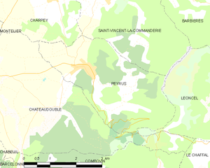
Peyrus
- коммуна во Франции
Hiking in Peyrus
Peyrus is a charming town located in the Auvergne-Rhône-Alpes region of France, near the foothills of the Vercors Massif. It offers a variety of hiking opportunities that cater to different skill levels, showcasing beautiful landscapes, rich biodiversity, and cultural heritage....
- Страна:
- Почтовый код: 26120
- Координаты: 44° 54' 46" N, 5° 6' 30" E
- GPS треки (wikiloc): [Ссылка]
- Площадь: 10.48 кв.км
- Население: 607
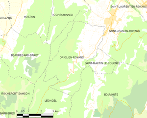
Oriol-en-Royans
- коммуна во Франции
Hiking in Oriol-en-Royans
Oriol-en-Royans is a charming village located in the Auvergne-Rhône-Alpes region of southeastern France, nestled in the stunning Vercors Massif. This area offers a wide array of hiking opportunities, ranging from easy scenic strolls to more challenging ascents. Here are some highlights for hiking in the region:...
- Страна:
- Почтовый код: 26190
- Координаты: 44° 59' 54" N, 5° 16' 27" E
- GPS треки (wikiloc): [Ссылка]
- Площадь: 16.01 кв.км
- Население: 538


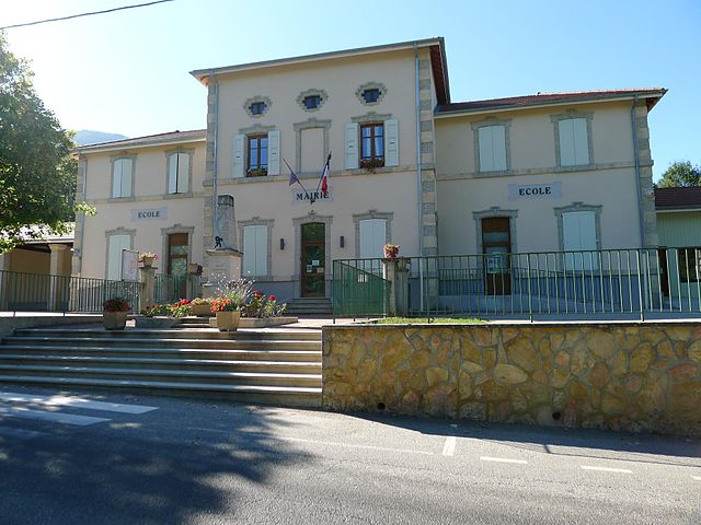
Saint-Vincent-la-Commanderie
- коммуна во Франции
Hiking in Saint-Vincent-la-Commanderie
Saint-Vincent-la-Commanderie is a picturesque village located in the Drôme department of southeastern France. It's known for its charming medieval architecture and natural beauty, making it an excellent destination for hiking enthusiasts....
- Страна:
- Почтовый код: 26300
- Координаты: 44° 56' 18" N, 5° 7' 7" E
- GPS треки (wikiloc): [Ссылка]
- Высота над уровнем моря: 390 м m
- Площадь: 13.34 кв.км
- Население: 510
- Веб сайт: [Ссылка]


Barbières
- коммуна во Франции
Hiking in Barbières
Barbières is a charming village located in the Drôme department of the Auvergne-Rhône-Alpes region in France. It offers beautiful landscapes and a variety of hiking trails suitable for different levels of hikers. Here are some key points to consider for hiking in Barbières:...
- Страна:
- Почтовый код: 26300
- Координаты: 44° 57' 23" N, 5° 8' 27" E
- GPS треки (wikiloc): [Ссылка]
- Площадь: 14.4 кв.км
- Население: 1013


Beauregard-Baret
- коммуна во Франции
Hiking in Beauregard-Baret
Beauregard-Baret is a picturesque region located in the Drôme department of southeastern France. Known for its beautiful landscapes, it's a fantastic destination for hiking enthusiasts of all levels....
- Страна:
- Почтовый код: 26300
- Координаты: 45° 0' 57" N, 5° 9' 5" E
- GPS треки (wikiloc): [Ссылка]
- Площадь: 23.44 кв.км
- Население: 808
- Веб сайт: [Ссылка]


Omblèze
- коммуна во Франции
Hiking in Omblèze
Omblèze is a picturesque destination located in the Drôme region of southeastern France, known for its stunning landscapes, diverse flora, and fauna, as well as its excellent hiking trails. Here are some key points about hiking in Omblèze:...
- Страна:
- Почтовый код: 26400
- Координаты: 44° 51' 8" N, 5° 13' 7" E
- GPS треки (wikiloc): [Ссылка]
- Площадь: 44.92 кв.км
- Население: 70


Rochefort-Samson
- коммуна во Франции
Hiking in Rochefort-Samson
Rochefort-Samson, located in the Drôme department of the Auvergne-Rhône-Alpes region in southeastern France, is known for its beautiful landscapes, diverse flora and fauna, and welcoming hiking trails. Here are some key highlights for hiking in this area:...
- Страна:
- Почтовый код: 26300
- Координаты: 44° 58' 23" N, 5° 9' 6" E
- GPS треки (wikiloc): [Ссылка]
- Площадь: 24.59 кв.км
- Население: 994


Le Chaffal
- коммуна во Франции
Hiking in Le Chaffal
Le Chaffal is a picturesque region located in the French Alps, known for its stunning landscapes, diverse terrain, and rich natural beauty. While it may not be as famous as some of the larger national parks or summits in the Alps, it offers a range of hiking opportunities suitable for various skill levels....
- Страна:
- Почтовый код: 26190
- Координаты: 44° 53' 13" N, 5° 10' 57" E
- GPS треки (wikiloc): [Ссылка]
- Площадь: 11.58 кв.км
- Население: 44


Châteaudouble
Hiking in Châteaudouble
Châteaudouble, located in the Drôme department of southeastern France, is an excellent destination for hiking enthusiasts. This charming village is nestled amidst stunning natural scenery, characterized by picturesque hills and sweeping valleys....
- Страна:
- Почтовый код: 26120
- Координаты: 44° 53' 59" N, 5° 5' 43" E
- GPS треки (wikiloc): [Ссылка]
- Площадь: 17.37 кв.км
- Население: 583

Bouvante
- коммуна во Франции
Hiking in Bouvante
Bouvante is a charming commune located in the Isère department of the Auvergne-Rhône-Alpes region in southeastern France. It is surrounded by breathtaking landscapes, characterized by rolling hills, forests, and mountainous terrain, which makes it a great destination for hiking enthusiasts....
- Страна:
- Почтовый код: 26190
- Координаты: 44° 57' 52" N, 5° 16' 14" E
- GPS треки (wikiloc): [Ссылка]
- Высота над уровнем моря: 585 м m
- Площадь: 83.88 кв.км
- Население: 252