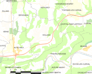
Бом-ле-Дам (canton of Baume-les-Dames, canton de Baume-les-Dames)

- кантон Франции
 Hiking in Бом-ле-Дам
The Canton of Baume-les-Dames, located in the Doubs department in the Bourgogne-Franche-Comté region of France, offers a scenic environment for hiking enthusiasts. The area features lush landscapes, rolling hills, and picturesque villages surrounded by nature. Here’s a guide to help you explore the hiking options in this area:
Hiking Trails and Areas
-
Les Gorges de la Loue: A popular destination nearby, this area offers stunning cliffs and paths along the Loue River. The trails provide breathtaking views and are suitable for various hiking skill levels.
-
Ballons des Vosges Nature Park: While a bit further out, this nature park offers multiple trails with diverse landscapes, including forests, meadows, and craggy hills. The trails can range from easy walks to more strenuous hikes.
-
Local Trails: In and around Baume-les-Dames itself, you can find well-marked walking paths that provide a chance to explore the area's natural beauty and quaint villages. The Sentier des Forges is a notable trail that showcases the local industrial heritage and its integration into the landscape.
Hiking Considerations
- Trail Difficulty: Trails in the region cater to all levels, from easy family-friendly walks to challenging routes for seasoned hikers.
- Weather: The best time to hike is during spring and autumn when temperatures are mild and the scenery is particularly beautiful. Summer can be hot, and winter hikes may require special gear due to snow and ice.
- Equipment: Good hiking shoes, appropriate clothing for changing weather conditions, and plenty of water are essential. A map or GPS app can be useful as trails are well-marked but knowing your exact location is always safe.
Local Flora and Fauna
Expect to encounter diverse wildlife, including deer, birds, and various plant species, especially in nature reserves. The area's biodiversity makes hiking here a rewarding experience for nature lovers.
Cultural Attractions
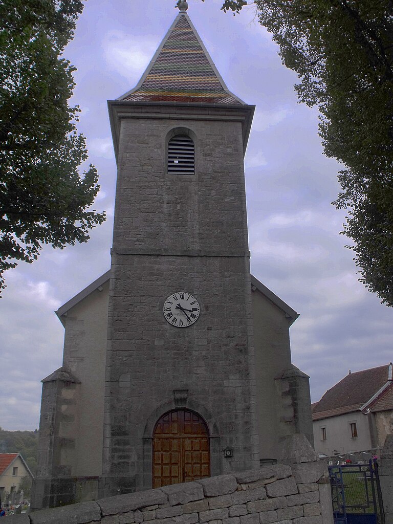
While hiking, take the time to explore local villages and historical sites. The town of Baume-les-Dames itself is known for its historical architecture, including charming old houses and the beautiful church of St. Pierre.
Safety Tips
- Always check trail conditions before heading out.
- Inform someone of your hiking plans if you’re going solo.
- Respect nature and follow Leave No Trace principles.
In conclusion, the Canton of Baume-les-Dames is a beautiful and welcoming destination for hikers, combining nature, history, and stunning landscapes. Enjoy your hiking adventure in this lovely region of France!
- Страна:

- Столица: Бом-ле-Дам
- Координаты: 47° 19' 56" N, 6° 22' 35" E


- GPS треки (wikiloc): [Ссылка]
- Население: 29092
- Википедия английская: wiki(en)
- Википедия национальная: wiki(fr)
- Хранилище Wikidata: Wikidata: Q732983
- код кантона INSEE: [2502]
Включает регионы:
Voillans
- коммуна во Франции
Hiking in Voillans
Voillans is a picturesque village located in the Franche-Comté region of eastern France, known for its beautiful landscapes and serene natural surroundings. Hiking in and around Voillans offers a great opportunity to explore the scenic beauty of the area, including rolling hills, forests, and small rivers....
- Страна:
- Почтовый код: 25110
- Координаты: 47° 23' 12" N, 6° 24' 47" E
- GPS треки (wikiloc): [Ссылка]
- Площадь: 10.12 кв.км
- Население: 207


Villers-Saint-Martin
- коммуна во Франции
Hiking in Villers-Saint-Martin
Villers-Saint-Martin is a charming area located in the Walloon region of Belgium, which offers various opportunities for hiking enthusiasts. While it may not be as widely known as some major hiking destinations, it has its own unique allure with scenic landscapes, charming rural paths, and a peaceful atmosphere....
- Страна:
- Почтовый код: 25110
- Координаты: 47° 20' 35" N, 6° 24' 34" E
- GPS треки (wikiloc): [Ссылка]
- Площадь: 8.9 кв.км
- Население: 222
- Веб сайт: [Ссылка]


Vergranne
- коммуна во Франции
Hiking in Vergranne
Vergranne does not appear to be a well-known hiking destination, and it is possible that you may be referring to a specific location that is less widely recognized or that the name may be a misspelling. However, if you are interested in hiking in a particular region or natural area with a similar name or if you have a specific destination in mind, please provide more details....
- Страна:
- Почтовый код: 25110
- Координаты: 47° 24' 32" N, 6° 23' 27" E
- GPS треки (wikiloc): [Ссылка]
- Площадь: 5.18 кв.км
- Население: 107


Verne
- коммуна во Франции
Hiking in Verne
Verne, located in the Doubs department of the Bourgogne-Franche-Comté region in eastern France, offers a variety of hiking opportunities for outdoor enthusiasts. The area is characterized by its beautiful natural landscapes, with rolling hills, lush forests, and picturesque valleys....
- Страна:
- Почтовый код: 25110
- Координаты: 47° 23' 53" N, 6° 21' 14" E
- GPS треки (wikiloc): [Ссылка]
- Площадь: 7.82 кв.км
- Население: 130
- Веб сайт: [Ссылка]


Servin
Hiking in Servin
It appears there might be a slight confusion with the name "Servin." If you are referring to a specific location known for hiking, such as a national park or area that I am unaware of, please clarify....
- Страна:
- Почтовый код: 25430
- Координаты: 47° 18' 27" N, 6° 27' 47" E
- GPS треки (wikiloc): [Ссылка]
- Площадь: 10.03 кв.км
- Население: 199

Silley-Bléfond
- коммуна во Франции
Hiking in Silley-Bléfond
Silley-Bléfond, located in the Doubs department of France, offers a beautiful natural setting for hiking enthusiasts. The area is characterized by its lush forests, rolling hills, and stunning landscapes, ideal for both casual walkers and more experienced hikers....
- Страна:
- Почтовый код: 25110
- Координаты: 47° 19' 24" N, 6° 19' 34" E
- GPS треки (wikiloc): [Ссылка]
- Площадь: 4.34 кв.км
- Население: 49


Vaudrivillers
- коммуна во Франции
Hiking in Vaudrivillers
Vaudrivillers is a small commune located in the Jura region of France, known for its beautiful natural landscapes, rolling hills, and charming rural scenery. While it may not be a traditional hiking hotspot, there are opportunities for enjoyable walks and hikes in the surrounding areas....
- Страна:
- Почтовый код: 25360
- Координаты: 47° 16' 53" N, 6° 25' 33" E
- GPS треки (wikiloc): [Ссылка]
- Площадь: 3.65 кв.км
- Население: 90