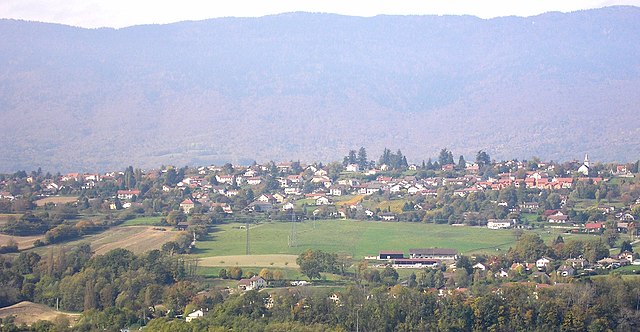
Коллонж (canton of Collonges, canton de Collonges)
 Hiking in Коллонж
The Canton of Collonges, located in Switzerland, offers a variety of hiking opportunities with stunning views and diverse landscapes. Here are some key features and tips for hiking in this region:
Scenic Trails
- Alpine Trails: The area is home to numerous alpine trails, giving hikers the chance to explore lush meadows, rocky terrains, and picturesque mountain scenery.
- River Trails: Many trails follow rivers and streams, providing a serene environment with the sounds of nature.
Difficulty Levels
- Beginner to Advanced: There are hikes suitable for all levels, from easy walks to more challenging ascents. Be sure to check the trail difficulty before setting out.
Highlights
- Breathtaking Views: The high vantage points often provide panoramic views of the surrounding mountains and valleys.
- Flora and Fauna: Look out for diverse plant species and wildlife. The region is rich in biodiversity, especially in spring and summer.
Practical Tips
- Maps and Navigation: Bring a detailed map of the area or download a hiking app for GPS navigation.
- Weather Conditions: Be aware of the local weather forecast, as conditions can change rapidly in mountainous areas.
- Trail Markings: Follow the trail markers carefully to stay on designated paths.
Safety
- Always carry enough water, snacks, and appropriate clothing. Depending on the season, layers may be necessary.
- Inform someone about your hiking plans, especially if you are heading into remote areas.
Local Regulations
- Be mindful of local regulations regarding campfires, littering, and wildlife encounters to preserve the natural beauty of the region.
Accessibility
- Some trails may be more accessible from nearby towns or public transport. Plan your route accordingly.
Whether you're a seasoned hiker or a beginner, the Canton of Collonges has something to offer everyone. Enjoy your hike and take the time to appreciate the beautiful Swiss landscapes!
- Страна:

- Столица: Коллонж
- Координаты: 46° 8' 21" N, 5° 54' 18" E


- GPS треки (wikiloc): [Ссылка]
- Площадь: 164.63 кв.км
- Население: 8431
- Википедия русская: wiki(ru)
- Википедия английская: wiki(en)
- Википедия национальная: wiki(fr)
- Хранилище Wikidata: Wikidata: Q187759
- код Freebase: [/m/04097rp]
Включает регионы:

Леа
- коммуна во Франции
Hiking in Леа
Léaz is a charming commune located in the Ain department of the Auvergne-Rhône-Alpes region in southeastern France. While it may not be as widely known as some larger hiking destinations, it offers some beautiful opportunities for outdoor enthusiasts....
- Страна:
- Почтовый код: 01200
- Координаты: 46° 5' 53" N, 5° 53' 12" E
- GPS треки (wikiloc): [Ссылка]
- Площадь: 11.4 кв.км
- Население: 700
- Веб сайт: [Ссылка]
Шалле
- коммуна во Франции
Hiking in Шалле
Challex is a charming village located in the Ain department of the Auvergne-Rhône-Alpes region in southeastern France, close to the Swiss border. While it may not be as widely known as some of the major hiking destinations in the French Alps, it offers ample opportunities for hiking enthusiasts who enjoy beautiful scenery, tranquil environments, and less crowded trails....
- Страна:
- Почтовый код: 01630
- Координаты: 46° 10' 53" N, 5° 58' 33" E
- GPS треки (wikiloc): [Ссылка]
- Площадь: 8.67 кв.км
- Население: 1370
- Веб сайт: [Ссылка]