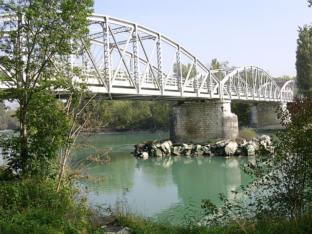
Коллонж (Collonges, Collonges)
- коммуна во Франции
 Hiking in Коллонж
Collonges, located in the Ain department of France, offers beautiful landscapes and a variety of hiking opportunities. The region is characterized by its diverse terrain, including rolling hills, forests, and rural countryside, making it ideal for both casual walkers and more experienced hikers.
Hiking Trails
-
Sentier du Mont Salève: Although slightly further from Collonges, trails around Mont Salève provide stunning panoramic views of Lake Geneva and the surrounding Alps. The trails range from easy to challenging.
-
Local Trails: Within Collonges and the surrounding areas, you can find several marked trails that lead through beautiful countryside, past traditional farms, and along the banks of local rivers. The trails usually vary from easy to moderate in difficulty.
-
Forests and Nature Reserves: The area around Collonges is rich in forests where you can explore hiking tracks, often lined with diverse flora and fauna. Look for local nature reserves where hiking is permitted and enjoy the tranquility of nature.
Tips for Hiking in Collonges
-
Weather Conditions: Always check the weather forecast before heading out, as conditions can change quickly, especially in the higher elevations.
-
Safety: Use appropriate gear for the terrain, including sturdy footwear and a first-aid kit. It’s also advisable to hike with a buddy or inform someone of your planned route.
-
Navigation: Carry a detailed map or a GPS device, as some trails may not be well marked.
-
Respect Nature: Stick to marked trails, observe wildlife from a distance, and carry out any trash you bring with you to preserve the natural beauty of the area.
-
Local Resources: Visit local tourist information centers for updated trail maps, recommendations, and advice on specific trails suitable for your skill level.
Conclusion
Hiking in Collonges, Ain offers an excellent opportunity to immerse yourself in the natural beauty of rural France. With a variety of trails and stunning scenery, it's a perfect destination for hikers looking for both tranquility and adventure.
- Страна:

- Почтовый код: 01550
- Координаты: 46° 8' 19" N, 5° 54' 15" E


- GPS треки (wikiloc): [Ссылка]
- Площадь: 16.25 кв.км
- Население: 2195
- Веб сайт: https://www.collonges.fr
- Википедия русская: wiki(ru)
- Википедия английская: wiki(en)
- Википедия национальная: wiki(fr)
- Хранилище Wikidata: Wikidata: Q244714
- Катеория в википедии: [Ссылка]
- Карты в википедии: [Ссылка]
- код Freebase: [/m/0814xm]
- код Freebase: [/m/0814xm]
- код GeoNames: Альт: [6453498]
- код GeoNames: Альт: [6453498]
- номер SIREN: [210101093]
- номер SIREN: [210101093]
- код VIAF: Альт: [127487331]
- код VIAF: Альт: [127487331]
- код LCNAF: Альт: [no2012080298]
- код LCNAF: Альт: [no2012080298]
- код тезауруса PACTOLS: [pcrt03v7A7bQTs]
- код тезауруса PACTOLS: [pcrt03v7A7bQTs]
- код муниципалитета INSEE: 01109
- код муниципалитета INSEE: 01109
Граничит с регионами:

Леа
- коммуна во Франции
Hiking in Леа
Léaz is a charming commune located in the Ain department of the Auvergne-Rhône-Alpes region in southeastern France. While it may not be as widely known as some larger hiking destinations, it offers some beautiful opportunities for outdoor enthusiasts....
- Страна:
- Почтовый код: 01200
- Координаты: 46° 5' 53" N, 5° 53' 12" E
- GPS треки (wikiloc): [Ссылка]
- Площадь: 11.4 кв.км
- Население: 700
- Веб сайт: [Ссылка]

Бельгард-сюр-Вальсерин
- коммуна во Франции
Hiking in Бельгард-сюр-Вальсерин
Bellegarde-sur-Valserine, located in the Auvergne-Rhône-Alpes region of France, is a beautiful area for hiking, set against the backdrop of the Jura Mountains. The region offers a variety of trails suitable for different skill levels, from beginner walks to more challenging hikes that reward adventurers with stunning views....
- Страна:
- Почтовый код: 01200
- Координаты: 46° 6' 27" N, 5° 49' 33" E
- GPS треки (wikiloc): [Ссылка]
- Площадь: 15.25 кв.км
- Население: 11809
- Веб сайт: [Ссылка]
Пуньи
- коммуна во Франции, департамент Эн
Hiking in Пуньи
Pougny is a small commune located in the Ain department in the Auvergne-Rhône-Alpes region of southeastern France. While not as widely known as some other hiking destinations in the region, it still offers opportunities for outdoor enthusiasts and hikers looking to explore the scenic countryside of the area....
- Страна:
- Почтовый код: 01550
- Координаты: 46° 8' 23" N, 5° 56' 58" E
- GPS треки (wikiloc): [Ссылка]
- Площадь: 7.77 кв.км
- Население: 817
- Веб сайт: [Ссылка]

Ланкран
- коммуна во Франции
Hiking in Ланкран
Lancrans is a beautiful destination for hiking, located in the Ain department of France, near the Swiss border and the Jura mountains. The area is rich in natural beauty, offering a range of landscapes from rolling hills to dense forests, and even stunning viewpoints of the surrounding Alps. Here are some key points about hiking in Lancrans:...
- Страна:
- Почтовый код: 01200
- Координаты: 46° 7' 28" N, 5° 50' 0" E
- GPS треки (wikiloc): [Ссылка]
- Площадь: 9.66 кв.км
- Население: 1046
- Веб сайт: [Ссылка]

Конфор
- коммуна во Франции
Hiking in Конфор
Confort is a charming village located in the Rhône-Alpes region of France, known for its picturesque landscapes and outdoor activities, including hiking. Here are some highlights and tips for hiking in and around Confort:...
- Страна:
- Почтовый код: 01200
- Координаты: 46° 9' 0" N, 5° 49' 23" E
- GPS треки (wikiloc): [Ссылка]
- Площадь: 11.66 кв.км
- Население: 591
- Веб сайт: [Ссылка]

Фарж
- коммуна во Франции
Hiking in Фарж
Farges, located in the Auvergne-Rhône-Alpes region of France, offers beautiful hiking opportunities for outdoor enthusiasts. The region is characterized by rolling hills, lush forests, and scenic landscapes, making it an excellent destination for both novice and experienced hikers....
- Страна:
- Почтовый код: 01550
- Координаты: 46° 10' 4" N, 5° 54' 19" E
- GPS треки (wikiloc): [Ссылка]
- Площадь: 14.28 кв.км
- Население: 999
- Веб сайт: [Ссылка]


Вюльбан
- коммуна во Франции
Hiking in Вюльбан
Vulbens is a charming village located in the Haute-Savoie region of southeastern France, near the border with Switzerland. The region is known for its beautiful landscapes, including the surrounding alpine scenery, making it an excellent destination for hiking enthusiasts. Here are some aspects to consider when hiking in and around Vulbens:...
- Страна:
- Почтовый код: 74520
- Координаты: 46° 6' 5" N, 5° 55' 50" E
- GPS треки (wikiloc): [Ссылка]
- Площадь: 12.53 кв.км
- Население: 1521
- Веб сайт: [Ссылка]


Шеврие
- коммуна в кантоне Сен-Жюльен-ан-Женевуа департамента Верхняя Савойя региона Овернь — Рона — Альпы во Франции
Hiking in Шеврие
Chevrier, located in the Auvergne-Rhône-Alpes region of France, offers beautiful landscapes for hiking enthusiasts. The area is often appreciated for its scenic views, natural beauty, and a variety of trails suitable for different skill levels. Here are some aspects to consider when planning a hiking trip to Chevrier:...
- Страна:
- Почтовый код: 74520
- Координаты: 46° 6' 31" N, 5° 54' 58" E
- GPS треки (wikiloc): [Ссылка]
- Площадь: 5.35 кв.км
- Население: 489
- Веб сайт: [Ссылка]