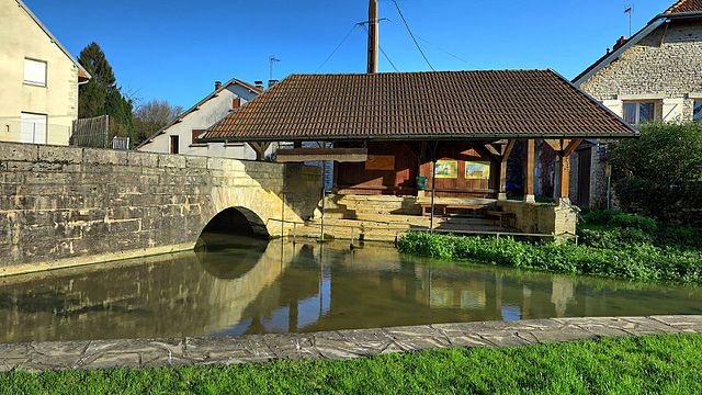
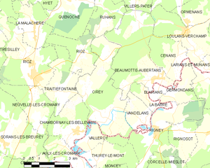
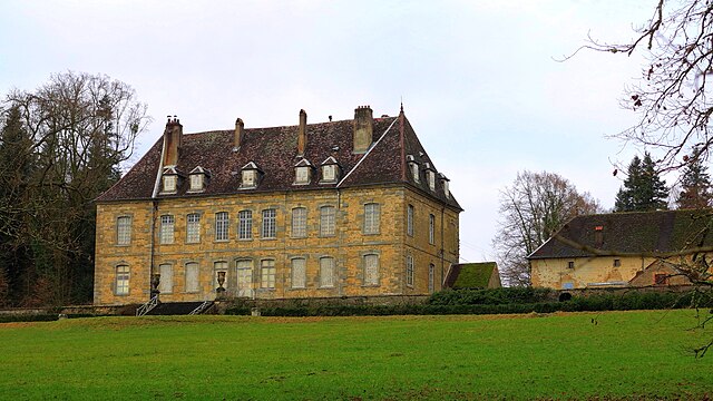
Рьоз (canton of Rioz, canton de Rioz)

- кантон во Франции
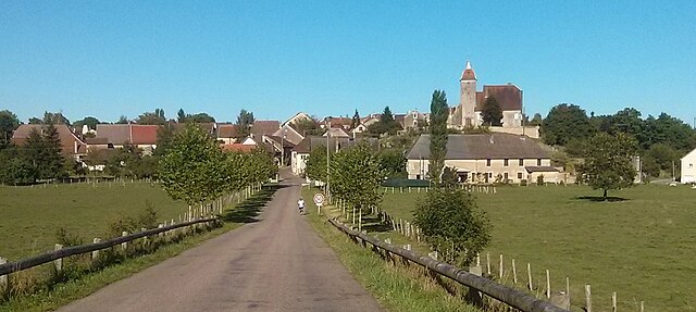
 Hiking in Рьоз
The Canton of Rioz, located in the region of Bourgogne-Franche-Comté in eastern France, offers a variety of scenic landscapes and hiking opportunities. Nestled between the Jura Mountains and the Vosges, this area is characterized by rolling hills, forests, rivers, and charming villages, making it an inviting destination for outdoor enthusiasts.
Key Highlights for Hiking in Canton of Rioz:
-
Scenic Trails: The region provides a number of well-marked trails ranging from easy walks to more challenging hikes. Trails often include panoramic views of the surrounding countryside, historical sites, and natural landmarks.
-
Flora and Fauna: While hiking, you might encounter a diverse range of plant species and wildlife. The mixture of forests and open fields creates an excellent habitat for various animals, so keep an eye out for local wildlife.
-
Local Culture: Hiking in the Canton of Rioz isn't just about the scenery; it's also an opportunity to experience local culture. Many trails pass through quaint villages where hikers can explore traditional architecture, local markets, and regional cuisine.
-
Historical Sites: Some hiking routes include visits to historical landmarks, such as châteaus and ancient churches, allowing for a blend of outdoor activity and cultural enrichment.
-
Accessibility: Many trails are accessible to different skill levels, making it a great destination for families, beginners, and experienced hikers alike. Always check local guides or maps for trail difficulty and length before setting out.
-
Seasonal Considerations: The best times for hiking in this region are typically spring and fall when the weather is mild, and the landscape is particularly beautiful. Summer can also be pleasant, though it's advisable to start hikes early in the day to avoid the heat.
Tips for Hiking in Canton of Rioz:
- Stay Hydrated: Always carry enough water, especially on warmer days.
- Proper Footwear: Wear sturdy hiking shoes or boots to navigate the varied terrain.
- Check the Weather: Weather can change quickly in mountainous regions, so it's good to be prepared.
- Maps and Navigation: Having a map or a GPS device is advisable as some trails may not be well-marked.
- Leave No Trace: Respect nature by adhering to Leave No Trace principles, ensuring that the natural beauty of the area is preserved.
Whether you're looking for a leisurely day hike or a more challenging trek, the Canton of Rioz has something to offer every hiker. Happy hiking!
- Страна:

- Столица: Рьоз
- Координаты: 47° 25' 28" N, 6° 4' 15" E


- GPS треки (wikiloc): [Ссылка]
- Население: 16004
- Википедия русская: wiki(ru)
- Википедия английская: wiki(en)
- Википедия национальная: wiki(fr)
- Хранилище Wikidata: Wikidata: Q338675
- код кантона INSEE: [7012]
Включает регионы:


Бу
- коммуна во Франции
- Страна:
- Почтовый код: 70190
- Координаты: 47° 22' 53" N, 6° 0' 6" E
- GPS треки (wikiloc): [Ссылка]
- Площадь: 14.62 кв.км
- Население: 600


О-ле-Кромари
- коммуна во Франции
Hiking in О-ле-Кромари
Aulx-lès-Cromary is a quaint commune located in the Haute-Saône department of the Bourgogne-Franche-Comté region in eastern France. While it may not be a mainstream hiking destination, it offers various opportunities for those looking to enjoy the natural beauty and tranquility of the French countryside....
- Страна:
- Почтовый код: 70190
- Координаты: 47° 22' 26" N, 6° 6' 37" E
- GPS треки (wikiloc): [Ссылка]
- Площадь: 4.33 кв.км
- Население: 160


Ванделан
- коммуна во Франции
Hiking in Ванделан
It seems there might be a small misunderstanding, as "Vandelans" doesn’t appear to refer to a well-known hiking destination or location that I am aware of as of my last knowledge update in October 2023. However, if you meant a different location or if "Vandelans" is a local term or a lesser-known area, I’d be happy to provide general hiking information or tips, or discuss hikes in popular areas....
- Страна:
- Почтовый код: 70190
- Координаты: 47° 23' 41" N, 6° 9' 53" E
- GPS треки (wikiloc): [Ссылка]
- Площадь: 3.08 кв.км
- Население: 118

Кенош
- коммуна во Франции
- Страна:
- Почтовый код: 70190
- Координаты: 47° 28' 7" N, 6° 6' 16" E
- GPS треки (wikiloc): [Ссылка]
- Площадь: 9.71 кв.км
- Население: 250
Реколонь-ле-Рьоз
- коммуна во Франции
- Страна:
- Почтовый код: 70190
- Координаты: 47° 28' 28" N, 5° 59' 13" E
- GPS треки (wikiloc): [Ссылка]
- Площадь: 10.18 кв.км
- Население: 250


Ла-Малашер
- коммуна во Франции
- Страна:
- Почтовый код: 70190
- Координаты: 47° 27' 3" N, 6° 4' 25" E
- GPS треки (wikiloc): [Ссылка]
- Площадь: 5.46 кв.км
- Население: 306


Нёвель-ле-Кромари
- коммуна во Франции
- Страна:
- Почтовый код: 70190
- Координаты: 47° 23' 42" N, 6° 4' 30" E
- GPS треки (wikiloc): [Ссылка]
- Площадь: 6.29 кв.км
- Население: 375

Сире
- коммуна во Франции
Hiking in Сире
Cirey is a small commune located in the Haute-Marne department in northeastern France. While it may not be as widely recognized as larger hiking destinations, it offers beautiful landscapes and opportunities for outdoor activities, especially for those who enjoy peaceful rural settings....
- Страна:
- Почтовый код: 70190
- Координаты: 47° 23' 47" N, 6° 7' 57" E
- GPS треки (wikiloc): [Ссылка]
- Площадь: 13.09 кв.км
- Население: 358
- Веб сайт: [Ссылка]

Було
- коммуна во Франции
- Страна:
- Почтовый код: 70190
- Координаты: 47° 20' 52" N, 5° 57' 36" E
- GPS треки (wikiloc): [Ссылка]
- Площадь: 7.08 кв.км
- Население: 670


Бютье
- коммуна во Франции, департамент Верхняя Сона
Hiking in Бютье
Buthiers, located in the Haute-Saône department of France, is a great destination for hiking enthusiasts looking to explore the natural beauty of the region. Here are some highlights and tips for hiking in and around Buthiers:...
- Страна:
- Почтовый код: 70190
- Координаты: 47° 20' 48" N, 6° 2' 0" E
- GPS треки (wikiloc): [Ссылка]
- Площадь: 5.69 кв.км
- Население: 302


Шо-ла-Лотьер
- коммуна во Франции
- Страна:
- Почтовый код: 70190
- Координаты: 47° 22' 56" N, 5° 58' 48" E
- GPS треки (wikiloc): [Ссылка]
- Площадь: 8.88 кв.км
- Население: 430


Кордонне
- коммуна во Франции
- Страна:
- Почтовый код: 70190
- Координаты: 47° 24' 59" N, 5° 58' 17" E
- GPS треки (wikiloc): [Ссылка]
- Высота над уровнем моря: 400 м m
- Площадь: 10.45 кв.км
- Население: 144


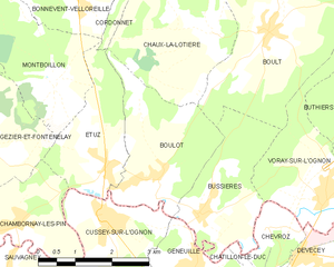
Кромари
- коммуна во Франции
Hiking in Кромари
Cromarty, located in Scotland, is known for its picturesque landscapes and stunning coastal views, making it a wonderful destination for hiking enthusiasts. Here are some highlights and tips for hiking in and around Cromarty:...
- Страна:
- Почтовый код: 70190
- Координаты: 47° 21' 43" N, 6° 4' 36" E
- GPS треки (wikiloc): [Ссылка]
- Площадь: 5.36 кв.км
- Население: 240


Шамборне-ле-Бельво
- коммуна во Франции
Hiking in Шамборне-ле-Бельво
Chambornay-lès-Bellevaux is a charming village located in the Haute-Saône department of France, known for its beautiful natural landscapes and outdoor activities, including hiking. Here are some key points to consider if you're planning a hiking trip in the area:...
- Страна:
- Почтовый код: 70190
- Координаты: 47° 23' 27" N, 6° 6' 23" E
- GPS треки (wikiloc): [Ссылка]
- Площадь: 5.89 кв.км
- Население: 181


Виллер-Бутон
- коммуна во Франции
- Страна:
- Почтовый код: 70190
- Координаты: 47° 27' 5" N, 5° 58' 44" E
- GPS треки (wikiloc): [Ссылка]
- Площадь: 5.26 кв.км
- Население: 159


Третьефонтен
- коммуна во Франции
- Страна:
- Почтовый код: 70190
- Координаты: 47° 24' 54" N, 6° 5' 25" E
- GPS треки (wikiloc): [Ссылка]
- Площадь: 5.92 кв.км
- Население: 161


Мезьер
- коммуна во Франции, департамент Верхняя Сона
- Страна:
- Почтовый код: 70190
- Координаты: 47° 29' 35" N, 6° 0' 42" E
- GPS треки (wikiloc): [Ссылка]
- Площадь: 11.68 кв.км
- Население: 336


Трезийе
- коммуна во Франции
- Страна:
- Почтовый код: 70190
- Координаты: 47° 27' 4" N, 6° 1' 51" E
- GPS треки (wikiloc): [Ссылка]
- Площадь: 11.08 кв.км
- Население: 229


Воре-сюр-л’Оньон
- коммуна во Франции
Hiking in Воре-сюр-л’Оньон
Voray-sur-l'Ognon is a small commune located in the Doubs department in the Bourgogne-Franche-Comté region of eastern France. While not as widely known as some larger hiking destinations, it offers a charming experience for those who enjoy exploring the outdoors....
- Страна:
- Почтовый код: 70190
- Координаты: 47° 20' 20" N, 6° 1' 5" E
- GPS треки (wikiloc): [Ссылка]
- Высота над уровнем моря: 222 м m
- Площадь: 6.9 кв.км
- Население: 818
Йе
- коммуна во Франции
- Страна:
- Почтовый код: 70190
- Координаты: 47° 28' 27" N, 6° 5' 42" E
- GPS треки (wikiloc): [Ссылка]
- Площадь: 6.47 кв.км
- Население: 120

Соран-ле-Брёре
- коммуна во Франции
- Страна:
- Почтовый код: 70190
- Координаты: 47° 23' 49" N, 6° 3' 3" E
- GPS треки (wikiloc): [Ссылка]
- Площадь: 14.37 кв.км
- Население: 432


Пензьер
- коммуна во Франции
- Страна:
- Почтовый код: 70190
- Координаты: 47° 29' 7" N, 6° 5' 51" E
- GPS треки (wikiloc): [Ссылка]
- Площадь: 9.07 кв.км
- Население: 186


Рьоз
- коммуна во Франции
- Страна:
- Почтовый код: 70190
- Координаты: 47° 25' 27" N, 6° 4' 12" E
- GPS треки (wikiloc): [Ссылка]
- Площадь: 17.2 кв.км
- Население: 2202
- Веб сайт: [Ссылка]


Фондреман
- коммуна во Франции
- Страна:
- Почтовый код: 70190
- Координаты: 47° 28' 30" N, 6° 1' 35" E
- GPS треки (wikiloc): [Ссылка]
- Площадь: 16.43 кв.км
- Население: 188


Монтарло-ле-Рьоз
- коммуна во Франции
- Страна:
- Почтовый код: 70190
- Координаты: 47° 25' 2" N, 5° 59' 47" E
- GPS треки (wikiloc): [Ссылка]
- Площадь: 9.66 кв.км
- Население: 283


Перруз
- коммуна во Франции
Hiking in Перруз
Perrouse appears to be a less widely known destination, and there may be some confusion regarding its location. If you meant a specific area, park, or region that's commonly associated with hiking, please clarify....
- Страна:
- Почтовый код: 70190
- Координаты: 47° 21' 42" N, 6° 3' 4" E
- GPS треки (wikiloc): [Ссылка]
- Площадь: 4.39 кв.км
- Население: 261

Бюсьер
- коммуна во Франции, департамент Верхняя Сона
Hiking in Бюсьер
Bussières, located in the Haute-Saône department in the Bourgogne-Franche-Comté region of France, offers a serene hiking experience that allows you to explore the natural beauty of rural France. While the region is less known than some of the larger national parks, it has its own charm, with varied landscapes including forests, hills, and rivers....
- Страна:
- Почтовый код: 70190
- Координаты: 47° 20' 15" N, 5° 58' 27" E
- GPS треки (wikiloc): [Ссылка]
- Площадь: 6.11 кв.км
- Население: 399