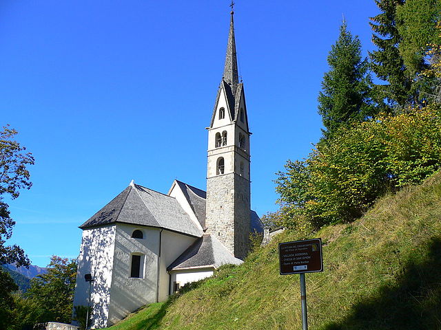
Ченчениге-Агордино (Cencenighe Agordino, Cencenighe Agordino)
.svg)
- коммуна Италии
 Hiking in Ченчениге-Агордино
Cencenighe Agordino is a picturesque village located in the Dolomites of Northern Italy, surrounded by stunning natural scenery and offering a variety of hiking opportunities. Here are some details to help you plan a hike in the area:
Hiking Trails
-
Val di Gares: This is a popular area for hiking, featuring well-marked trails that lead through lush forests and offer breathtaking views of the surrounding peaks. The trail can be tailored for different skill levels.
-
Lake Fedaia: A moderate hike around Lake Fedaia offers stunning views of the Marmolada mountain. The lake is a beautiful spot to relax and take photos, and the trail is accessible for families.
-
Cascate di Pissandolo: A shorter, scenic hike that leads to the beautiful Pissandolo waterfalls. This trail is suitable for families and provides an opportunity to enjoy the local flora and fauna.
-
Sentiero delle Fiaves: This trail showcases the local culture and history, featuring installations and interpretive signs along the way. It’s a great way to combine hiking with learning about the region.
Best Time to Hike
- Summer (June to September): This is the best time for hiking, as the weather is generally warm and trails are mostly dry. However, be aware that afternoons can bring thunderstorms, so early starts are advisable.
- Autumn (October): The fall foliage can create spectacular scenery, and the temperatures are usually still mild, though it’s important to prepare for variable weather.
Preparation
- Gear: Good hiking boots, layered clothing, and a daypack with water, snacks, a map or GPS, and a first-aid kit are essential.
- Weather: Always check the weather forecast before heading out, as conditions can change rapidly in the mountains.
- Safety: It's advisable to let someone know your hiking plans and expected return time. Hiking with a buddy is a great way to stay safe.
Local Facilities
Cencenighe Agordino offers various accommodations, restaurants, and local shops for supplies. Be sure to also explore the local culture, cuisine, and other outdoor activities available in the area, such as mountain biking or climbing.
With the stunning backdrop of the Dolomites and the rich natural environment, hiking in Cencenighe Agordino promises memorable experiences. Just remember to leave no trace and respect the natural beauty of the area!
- Страна:

- Почтовый код: 32020
- Телефонный код: 0437
- Код автомобильного номера: BL
- Координаты: 46° 20' 38" N, 11° 58' 28" E


- GPS треки (wikiloc): [Ссылка]
- Высота над уровнем моря: 773 м m
- Площадь: 18.13 кв.км
- Население: 1281
- Веб сайт: http://www.comune.cencenigheagordino.bl.it
- Википедия русская: wiki(ru)
- Википедия английская: wiki(en)
- Википедия национальная: wiki(it)
- Хранилище Wikidata: Wikidata: Q40914
- Катеория в википедии: [Ссылка]
- код Freebase: [/m/0gk1gj]
- код GeoNames: Альт: [6542249]
- код VIAF: Альт: [246994726]
- ID отношения в OpenStreetMap: [47142]
- код ISTAT: 025010
- кадастровый код Италии: C458
Граничит с регионами:

Валлада-Агордина
- коммуна Италии
Hiking in Валлада-Агордина
Vallada Agordina is a picturesque village located in the Dolomites region of northern Italy, making it an excellent destination for hiking enthusiasts. The surrounding area is characterized by dramatic mountain landscapes, lush valleys, and a rich variety of flora and fauna. Here's an overview of what you can expect when hiking in Vallada Agordina:...
- Страна:
- Почтовый код: 32020
- Телефонный код: 0437
- Код автомобильного номера: BL
- Координаты: 46° 22' 0" N, 11° 56' 0" E
- GPS треки (wikiloc): [Ссылка]
- Высота над уровнем моря: 1033 м m
- Площадь: 13 кв.км
- Население: 489
- Веб сайт: [Ссылка]


Сан-Томазо-Агордино
- коммуна Италии
Hiking in Сан-Томазо-Агордино
San Tomaso Agordino is a picturesque village located in the Dolomites region of northern Italy. It offers a wealth of hiking opportunities for both novice and experienced hikers. Here are some highlights and tips for hiking in and around San Tomaso Agordino....
- Страна:
- Почтовый код: 32020
- Телефонный код: 0437
- Код автомобильного номера: BL
- Координаты: 46° 23' 0" N, 11° 59' 0" E
- GPS треки (wikiloc): [Ссылка]
- Высота над уровнем моря: 1082 м m
- Площадь: 19.18 кв.км
- Население: 626
- Веб сайт: [Ссылка]


Канале-д'Агордо
- коммуна Италии
Hiking in Канале-д'Агордо
Canale d'Agordo is a picturesque village located in the Dolomites of northeastern Italy, known for its stunning landscapes, rich history, and diverse hiking opportunities. Here are some key aspects of hiking in this beautiful region:...
- Страна:
- Почтовый код: 32020
- Телефонный код: 0437
- Код автомобильного номера: BL
- Координаты: 46° 21' 38" N, 11° 54' 52" E
- GPS треки (wikiloc): [Ссылка]
- Высота над уровнем моря: 976 м m
- Площадь: 45.96 кв.км
- Население: 1117
- Веб сайт: [Ссылка]


Тайбон-Агордино
- коммуна Италии
Hiking in Тайбон-Агордино
Taibon Agordino is a charming village located in the Dolomites of northern Italy, within the province of Belluno. It's a fantastic area for hiking, offering a range of trails that cater to different levels of experience. Here are some highlights and tips for hiking in this beautiful region:...
- Страна:
- Почтовый код: 32027
- Телефонный код: 0437
- Код автомобильного номера: BL
- Координаты: 46° 18' 0" N, 12° 1' 0" E
- GPS треки (wikiloc): [Ссылка]
- Высота над уровнем моря: 618 м m
- Площадь: 90.06 кв.км
- Население: 1749
- Веб сайт: [Ссылка]