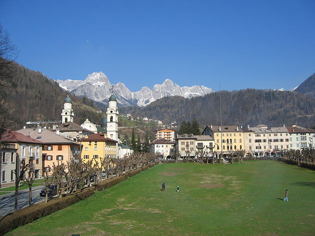
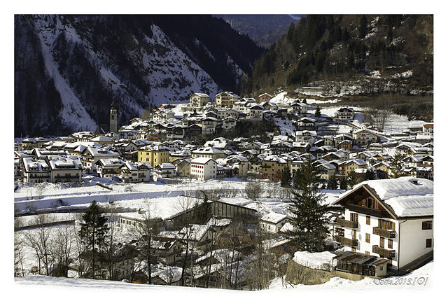
Тайбон-Агордино (Taibon Agordino, Taibon Agordino)
.svg)
- коммуна Италии
 Hiking in Тайбон-Агордино
Taibon Agordino is a charming village located in the Dolomites of northern Italy, within the province of Belluno. It's a fantastic area for hiking, offering a range of trails that cater to different levels of experience. Here are some highlights and tips for hiking in this beautiful region:
Trails and Routes
-
Sentiero dei Santi: This scenic trail takes you through picturesque landscapes, connecting various chapels and churches. It’s a relatively easy hike, perfect for families and those looking for a leisurely day out.
-
Forcella di Puez: For more experienced hikers, this trail offers stunning views of the surrounding Dolomitic peaks. The route can be challenging but rewards hikers with breathtaking panoramic vistas.
-
Civetta Mountain Trail: Ascending toward the Civetta massif provides a more demanding experience, featuring steep climbs and rocky terrain. The effort is well worth it for the incredible views at the summit.
-
Vallata di San Lucano: Explore the beautiful valley with moderate trails that run alongside streams and through lush forests. It’s an excellent spot for wildlife enthusiasts and those interested in nature photography.
Best Time to Hike
- Summer (June to September): The best time for hiking, with clear trails and accessible routes. The weather is generally warm and dry.
- Autumn (October): This can also be a lovely time for hikes, as the foliage changes color, though be prepared for cooler temperatures and possible early snow at higher elevations.
Practical Tips
- Gear: Wear sturdy hiking boots, and bring plenty of water, snacks, and a map or GPS device. Walking poles can also be helpful for uneven terrain.
- Weather: The weather in the mountains can change rapidly, so check forecasts and be prepared for sudden changes.
- Wildlife: Keep an eye out for local wildlife, such as deer, marmots, and a variety of birds. Respect their habitats and maintain a safe distance.
Accommodation and Local Amenities
Taibon Agordino offers a range of accommodation options, from hotels to guesthouses, often showcasing local cuisine. Be sure to try traditional dishes like polenta and speck after your hikes.
Accessibility
The village serves as a convenient base for exploring the surrounding Dolomites, with access to a number of trailheads. Public transportation options may be available, but having a vehicle can provide greater flexibility in your hiking plans.
Overall, hiking in Taibon Agordino is an unforgettable experience, with stunning natural beauty and diverse trails suitable for all skill levels. Always remember to practice Leave No Trace principles and enjoy your adventure in this magnificent part of the Dolomites!
- Страна:

- Почтовый код: 32027
- Телефонный код: 0437
- Код автомобильного номера: BL
- Координаты: 46° 18' 0" N, 12° 1' 0" E


- GPS треки (wikiloc): [Ссылка]
- Высота над уровнем моря: 618 м m
- Площадь: 90.06 кв.км
- Население: 1749
- Веб сайт: http://www.comune.taibonagordino.bl.it
- Википедия русская: wiki(ru)
- Википедия английская: wiki(en)
- Википедия национальная: wiki(it)
- Хранилище Wikidata: Wikidata: Q41017
- Катеория в википедии: [Ссылка]
- код Freebase: [/m/0gk2c8]
- код GeoNames: Альт: [6542191]
- код VIAF: Альт: [241876398]
- ID отношения в OpenStreetMap: [47062]
- код GND: Альт: [4677283-2]
- код темы Quora: [Taibon-Agordino]
- код ISTAT: 025059
- кадастровый код Италии: L030
Граничит с регионами:
Вольтаго-Агордино
- коммуна Италии
Hiking in Вольтаго-Агордино
Voltago Agordino is a picturesque village located in the Dolomites region of northern Italy, known for its stunning natural beauty and outdoor activities, particularly hiking. Here are some highlights and tips for hiking in and around Voltago Agordino:...
- Страна:
- Почтовый код: 32020
- Телефонный код: 0437
- Код автомобильного номера: BL
- Координаты: 46° 16' 0" N, 12° 2' 0" E
- GPS треки (wikiloc): [Ссылка]
- Высота над уровнем моря: 858 м m
- Площадь: 23.47 кв.км
- Население: 854
- Веб сайт: [Ссылка]


Сан-Томазо-Агордино
- коммуна Италии
Hiking in Сан-Томазо-Агордино
San Tomaso Agordino is a picturesque village located in the Dolomites region of northern Italy. It offers a wealth of hiking opportunities for both novice and experienced hikers. Here are some highlights and tips for hiking in and around San Tomaso Agordino....
- Страна:
- Почтовый код: 32020
- Телефонный код: 0437
- Код автомобильного номера: BL
- Координаты: 46° 23' 0" N, 11° 59' 0" E
- GPS треки (wikiloc): [Ссылка]
- Высота над уровнем моря: 1082 м m
- Площадь: 19.18 кв.км
- Население: 626
- Веб сайт: [Ссылка]


Аллеге
- коммуна Италии
Hiking in Аллеге
Alleghe, located in the heart of the Dolomites in northern Italy, offers stunning hiking opportunities amid breathtaking scenery. This charming town, situated on the shores of Lake Alleghe, provides access to a variety of trails suitable for hikers of all levels. Here are some highlights:...
- Страна:
- Почтовый код: 32022
- Телефонный код: 0437
- Код автомобильного номера: BL
- Координаты: 46° 24' 29" N, 12° 1' 33" E
- GPS треки (wikiloc): [Ссылка]
- Высота над уровнем моря: 1000 м m
- Площадь: 29.72 кв.км
- Население: 1194
- Веб сайт: [Ссылка]

Агордо
- коммуна Италии
Hiking in Агордо
Agordo is a picturesque town in the Veneto region of northern Italy, nestled in the Dolomites, making it an excellent base for hiking enthusiasts. The Dolomites are renowned for their stunning landscapes, unique rock formations, and a variety of trails suitable for all skill levels. Here’s what you need to know about hiking in and around Agordo:...
- Страна:
- Почтовый код: 32021
- Телефонный код: 0437
- Код автомобильного номера: BL
- Координаты: 46° 16' 56" N, 12° 2' 4" E
- GPS треки (wikiloc): [Ссылка]
- Высота над уровнем моря: 611 м m
- Площадь: 23.74 кв.км
- Население: 4089
- Веб сайт: [Ссылка]


Канале-д'Агордо
- коммуна Италии
Hiking in Канале-д'Агордо
Canale d'Agordo is a picturesque village located in the Dolomites of northeastern Italy, known for its stunning landscapes, rich history, and diverse hiking opportunities. Here are some key aspects of hiking in this beautiful region:...
- Страна:
- Почтовый код: 32020
- Телефонный код: 0437
- Код автомобильного номера: BL
- Координаты: 46° 21' 38" N, 11° 54' 52" E
- GPS треки (wikiloc): [Ссылка]
- Высота над уровнем моря: 976 м m
- Площадь: 45.96 кв.км
- Население: 1117
- Веб сайт: [Ссылка]

Ченчениге-Агордино
- коммуна Италии
Hiking in Ченчениге-Агордино
Cencenighe Agordino is a picturesque village located in the Dolomites of Northern Italy, surrounded by stunning natural scenery and offering a variety of hiking opportunities. Here are some details to help you plan a hike in the area:...
- Страна:
- Почтовый код: 32020
- Телефонный код: 0437
- Код автомобильного номера: BL
- Координаты: 46° 20' 38" N, 11° 58' 28" E
- GPS треки (wikiloc): [Ссылка]
- Высота над уровнем моря: 773 м m
- Площадь: 18.13 кв.км
- Население: 1281
- Веб сайт: [Ссылка]
Гозальдо
- коммуна Италии
Hiking in Гозальдо
Gosaldo is a charming area situated in the Dolomites of northern Italy, known for its stunning landscapes, rich culture, and excellent hiking opportunities. The region is characterized by its picturesque valleys, majestic mountains, and traditional alpine villages, making it a perfect destination for hikers of all skill levels. Here’s an overview to help you with your hiking plans in Gosaldo:...
- Страна:
- Почтовый код: 32020
- Телефонный код: 0437
- Код автомобильного номера: BL
- Координаты: 46° 13' 20" N, 11° 57' 24" E
- GPS треки (wikiloc): [Ссылка]
- Высота над уровнем моря: 1141 м m
- Площадь: 48.48 кв.км
- Население: 604
- Веб сайт: [Ссылка]