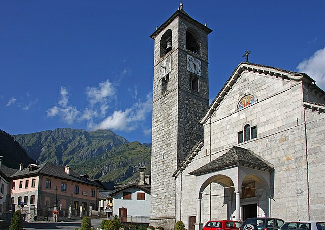
Чеппо-Морелли (Ceppo Morelli, Ceppo Morelli)
- коммуна Италии
 Hiking in Чеппо-Морелли
Ceppo Morelli is a charming destination for hiking enthusiasts located in the province of Verbano-Cusio-Ossola in the Piedmont region of northern Italy. Nestled in the foothills of the Alps, this area is known for its stunning natural landscapes, lush forests, and scenic views.
Hiking Opportunities
-
Trails and Routes:
- Ceppo Morelli offers a variety of hiking trails suitable for different skill levels, from beginners to more experienced hikers. Most trails are well-marked and provide access to beautiful viewpoints, alpine meadows, and dense woodlands.
- One popular route is the trail that leads to the nearby "Punto Panoramico," where hikers can enjoy stunning views of the surrounding mountains and valleys.
-
Flora and Fauna:
- The area is rich in biodiversity, with varied ecosystems that support a wide range of plants and wildlife. You may encounter various species of trees, wildflowers, and even some local fauna, such as deer or various bird species.
-
Seasonal Considerations:
- The best times to hike in Ceppo Morelli are during the spring and fall when the weather is mild and the landscapes are particularly beautiful. Summer can also be pleasant, but it's essential to stay hydrated and protected from the sun.
-
Recommended Gear:
- Suitable hiking boots or shoes, weather-appropriate clothing, a map or GPS device, plenty of water, and snacks are advisable for a safe and enjoyable hike.
-
Local Tips:
- It's a good idea to check in with local guides or visitor centers for updated trail conditions and safety information. They may also offer guided hikes that can enhance your experience and knowledge of the area.
Additional Activities
In addition to hiking, Ceppo Morelli is a great base for other outdoor activities like mountain biking, bird watching, and exploring nearby villages that reflect the local culture and traditions.
Overall, hiking in Ceppo Morelli offers a fantastic opportunity to immerse yourself in nature while enjoying the stunning scenery of the Italian Alps.
- Страна:

- Почтовый код: 28875
- Телефонный код: 0324
- Код автомобильного номера: VB
- Координаты: 45° 58' 0" N, 8° 4' 0" E


- GPS треки (wikiloc): [Ссылка]
- Высота над уровнем моря: 793 м m
- Площадь: 40.19 кв.км
- Население: 302
- Веб сайт: http://www.comune.ceppomorelli.vb.it/
- Википедия русская: wiki(ru)
- Википедия английская: wiki(en)
- Википедия национальная: wiki(it)
- Хранилище Wikidata: Wikidata: Q23304
- Катеория в википедии: [Ссылка]
- код Freebase: [/m/0gr81r]
- код GeoNames: Альт: [6543703]
- ID отношения в OpenStreetMap: [46549]
- код ISTAT: 103021
- кадастровый код Италии: C478
Граничит с регионами:
Антрона-Скьеранко
- коммуна Италии
Hiking in Антрона-Скьеранко
Antrona Schieranco is a beautiful area located in the Ossola Valley in the Piedmont region of northern Italy. It’s known for its stunning natural landscapes, featuring mountains, valleys, waterfalls, and lakes, making it a fantastic destination for hiking enthusiasts. Here are some highlights and tips for hiking in Antrona Schieranco:...
- Страна:
- Почтовый код: 28030
- Телефонный код: 0324
- Код автомобильного номера: VB
- Координаты: 46° 4' 0" N, 8° 7' 0" E
- GPS треки (wikiloc): [Ссылка]
- Высота над уровнем моря: 902 м m
- Площадь: 100.18 кв.км
- Население: 426
- Веб сайт: [Ссылка]
Баннио-Анцино
- коммуна Италии
Hiking in Баннио-Анцино
Bannio Anzino is a picturesque municipality located in the Piedmont region of northern Italy, nestled in the Anzasca Valley and surrounded by stunning mountainous landscapes. It’s a fantastic destination for hiking enthusiasts due to its varied terrain, beautiful views, and rich natural environment....
- Страна:
- Почтовый код: 28071
- Телефонный код: 0324
- Код автомобильного номера: VB
- Координаты: 45° 54' 0" N, 8° 3' 0" E
- GPS треки (wikiloc): [Ссылка]
- Высота над уровнем моря: 669 м m
- Площадь: 39.47 кв.км
- Население: 483
- Веб сайт: [Ссылка]

Макуньяга
- коммуна Италии
Hiking in Макуньяга
Macugnaga is a beautiful village located in the Italian Alps, specifically in the Piedmont region. It sits at the foot of the impressive Monte Rosa massif, which offers a stunning backdrop for hiking enthusiasts. Here are some key points to consider about hiking in Macugnaga:...
- Страна:
- Почтовый код: 28876
- Телефонный код: 0324
- Код автомобильного номера: VB
- Координаты: 45° 58' 0" N, 7° 58' 0" E
- GPS треки (wikiloc): [Ссылка]
- Высота над уровнем моря: 1327 м m
- Площадь: 99.57 кв.км
- Население: 548
- Веб сайт: [Ссылка]
Ванцоне-кон-Сан-Карло
- коммуна Италии
Hiking in Ванцоне-кон-Сан-Карло
Vanzone con San Carlo is a charming mountain village located in the Ossola Valley in the Piedmont region of northern Italy. This area is known for its stunning natural beauty, characterized by towering peaks, lush forests, and scenic trails that attract hiking enthusiasts from all over....
- Страна:
- Почтовый код: 28879
- Телефонный код: 0324
- Код автомобильного номера: VB
- Координаты: 45° 59' 17" N, 8° 7' 53" E
- GPS треки (wikiloc): [Ссылка]
- Высота над уровнем моря: 677 м m
- Площадь: 15.73 кв.км
- Население: 386
- Веб сайт: [Ссылка]

Каркофоро
- коммуна Италии
Hiking in Каркофоро
Carcoforo is a quaint village located in the Valsesia region of northern Italy, renowned for its stunning natural landscapes and hiking opportunities. Nestled at the foot of the Monterosa massif, this area is perfect for both beginner and experienced hikers. Here are some highlights for hiking in and around Carcoforo:...
- Страна:
- Почтовый код: 13026
- Телефонный код: 0163
- Код автомобильного номера: VC
- Координаты: 45° 54' 0" N, 8° 3' 0" E
- GPS треки (wikiloc): [Ссылка]
- Высота над уровнем моря: 1304 м m
- Площадь: 22.8 кв.км
- Население: 73
- Веб сайт: [Ссылка]


Saas-Almagell
Hiking in Saas-Almagell
Saas-Almagell is a picturesque village in the Swiss Alps, situated in the Valais region, and is part of the larger Saas Valley. It's known for its stunning landscapes, diverse hiking trails, and a wide range of outdoor activities. Here are some key highlights and tips for hiking in Saas-Almagell:...
- Страна:

- Почтовый код: 3905
- Телефонный код: 027
- Код автомобильного номера: VS
- Координаты: 46° 5' 40" N, 7° 57' 26" E
- GPS треки (wikiloc): [Ссылка]
- Высота над уровнем моря: 1672 м m
- Площадь: 110.28 кв.км
- Население: 377
- Веб сайт: [Ссылка]