Saas-Almagell (Saas-Almagell)

 Hiking in Saas-Almagell
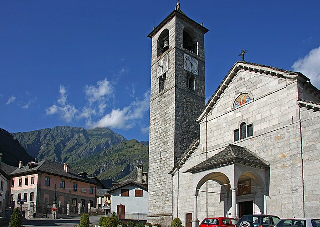
Saas-Almagell is a picturesque village in the Swiss Alps, situated in the Valais region, and is part of the larger Saas Valley. It's known for its stunning landscapes, diverse hiking trails, and a wide range of outdoor activities. Here are some key highlights and tips for hiking in Saas-Almagell:
Trails and Routes
-
Variety of Trails: Saas-Almagell offers a variety of hiking trails suitable for all skill levels, from leisurely strolls to more challenging treks. The trails are well-marked and maintained.
-
Panoramic Views: Many hiking paths lead to breathtaking views of the surrounding alpine scenery, including the majestic 4,000-meter peaks like the Dom and Weissmies. Don't forget your camera!
-
The Almagelleralp Trail: This moderate hike takes you to Almagelleralp, where you can enjoy magnificent views and immerse yourself in the serene atmosphere of the alpine meadows.
-
Furggstalden to Saas Fee: A great hike that connects the village of Saas-Almagell to Saas Fee. This trail offers beautiful alpine landscapes and panoramic viewpoints.
-
Theme Trails: There are also themed trails available, including nature trails and educational hikes that provide insights into the local flora and fauna.
Accessibility and Transport
- Public Transport: Saas-Almagell is accessible via public transport, with regular bus services connecting it to nearby towns and other parts of the Saas Valley.
- Cable Cars: Utilize the cable cars for access to higher altitudes, which can make for shorter, more manageable hikes or give you a head start on more challenging routes.
Tips for Hiking
- Weather: Always check the weather conditions before heading out. Mountain weather can change rapidly, so be prepared for different conditions.
- Gear: Wear appropriate hiking boots and bring layers to accommodate fluctuating temperatures. A good backpack, water, snacks, and a map or GPS device are also essential.
- Safety: Inform someone about your hiking plans and expected return time, and consider hiking with a buddy or group, especially on longer or more challenging trails.
- Leave No Trace: Respect the environment by following Leave No Trace principles—take your trash with you and stay on marked trails.
Additional Activities
If you're looking to enhance your experience, many travel agencies in the area offer guided hikes, climbing stuff, or even mountain biking routes. The Saas Valley also provides opportunities for additional outdoor sports, including skiing in winter.
Whether you are an experienced hiker or just starting, the charm of the Saas-Almagell area is sure to provide a memorable hiking experience in the stunning Swiss Alps!
- Страна:

- Почтовый код: 3905
- Телефонный код: 027
- Код автомобильного номера: VS
- Координаты: 46° 5' 40" N, 7° 57' 26" E


- GPS треки (wikiloc): [Ссылка]
- Высота над уровнем моря: 1672 м m
- Площадь: 110.28 кв.км
- Население: 377
- Веб сайт: http://www.saas-almagell.ch
- Википедия английская: wiki(en)
- Википедия национальная: wiki(de)
- Хранилище Wikidata: Wikidata: Q68037
- Катеория в википедии: [Ссылка]
- код Freebase: [/m/0kvrh5]
- код GeoNames: Альт: [2658901]
- код VIAF: Альт: [235214894]
- ID отношения в OpenStreetMap: [1685360]
- код темы Quora: [Saas-Almagell]
- код TGN: [1064350]
- идентификатор HDS: [2810]
- код швейцарского муниципалитета: [6288]
- код BabelNet: [02436130n]
Граничит с регионами:
Антрона-Скьеранко
- коммуна Италии
Hiking in Антрона-Скьеранко
Antrona Schieranco is a beautiful area located in the Ossola Valley in the Piedmont region of northern Italy. It’s known for its stunning natural landscapes, featuring mountains, valleys, waterfalls, and lakes, making it a fantastic destination for hiking enthusiasts. Here are some highlights and tips for hiking in Antrona Schieranco:...
- Страна:

- Почтовый код: 28030
- Телефонный код: 0324
- Код автомобильного номера: VB
- Координаты: 46° 4' 0" N, 8° 7' 0" E
- GPS треки (wikiloc): [Ссылка]
- Высота над уровнем моря: 902 м m
- Площадь: 100.18 кв.км
- Население: 426
- Веб сайт: [Ссылка]
Чеппо-Морелли
- коммуна Италии
Hiking in Чеппо-Морелли
Ceppo Morelli is a charming destination for hiking enthusiasts located in the province of Verbano-Cusio-Ossola in the Piedmont region of northern Italy. Nestled in the foothills of the Alps, this area is known for its stunning natural landscapes, lush forests, and scenic views....
- Страна:
- Почтовый код: 28875
- Телефонный код: 0324
- Код автомобильного номера: VB
- Координаты: 45° 58' 0" N, 8° 4' 0" E
- GPS треки (wikiloc): [Ссылка]
- Высота над уровнем моря: 793 м m
- Площадь: 40.19 кв.км
- Население: 302
- Веб сайт: [Ссылка]

Макуньяга
- коммуна Италии
Hiking in Макуньяга
Macugnaga is a beautiful village located in the Italian Alps, specifically in the Piedmont region. It sits at the foot of the impressive Monte Rosa massif, which offers a stunning backdrop for hiking enthusiasts. Here are some key points to consider about hiking in Macugnaga:...
- Страна:
- Почтовый код: 28876
- Телефонный код: 0324
- Код автомобильного номера: VB
- Координаты: 45° 58' 0" N, 7° 58' 0" E
- GPS треки (wikiloc): [Ссылка]
- Высота над уровнем моря: 1327 м m
- Площадь: 99.57 кв.км
- Население: 548
- Веб сайт: [Ссылка]