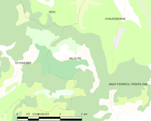
Chaudebonne (Chaudebonne)

- коммуна во Франции
 Hiking in Chaudebonne
Chaudebonne, located in the picturesque region of the French Alps, offers some stunning hiking opportunities. The area is known for its breathtaking mountain scenery, lush valleys, and diverse wildlife. Here are a few highlights to consider when planning a hike in this region:
Trails
-
Beginner Trails: If you're new to hiking, there are several easy trails that offer beautiful views without the strenuous effort. Look for pathways that run along the valley floors or gentle slopes.
-
Intermediate Trails: For those with some hiking experience, there are moderately challenging trails that may include elevation gain and varied terrain. These typically include circular routes that connect to scenic viewpoints.
-
Advanced Trails: Experienced hikers will find demanding trails that involve steep ascents, rocky terrain, and potentially even scrambles. These routes may lead to higher peaks and offer dramatic panoramic views.
Scenic Spots
- Lakes: Many trails lead to serene alpine lakes where you can take a break and enjoy the tranquil surroundings.
- Panoramic Views: Make sure to take advantage of viewpoints along the trails, especially at higher elevations, where you can see the breathtaking landscapes of the Alps.
Wildlife
The region is home to diverse flora and fauna. Keep an eye out for local wildlife such as chamois, ibex, or various bird species. Always maintain a respectful distance from wildlife.
Best Time to Hike
- Late Spring to Early Fall: The best months for hiking in Chaudebonne typically range from June to September, when the weather is milder and trails are usually clear of snow.
Safety Tips
- Stay Hydrated: Carry enough water and snacks.
- Wear Appropriate Gear: Good hiking boots, weather-appropriate clothing, and a reliable backpack are essential.
- Check Weather Conditions: The weather can change rapidly in the mountains, so always check the forecast before heading out.
Local Resources
Consider stopping by local visitor centers or websites for updated information on trail conditions, maps, and any guided hikes that may be available.
Remember to practice Leave No Trace principles to help keep the trails in good condition for future hikers. Enjoy your hike in Chaudebonne!
- Страна:

- Почтовый код: 26110
- Координаты: 44° 28' 36" N, 5° 13' 7" E


- GPS треки (wikiloc): [Ссылка]
- Площадь: 20.77 кв.км
- Население: 53
- Википедия английская: wiki(en)
- Википедия национальная: wiki(fr)
- Хранилище Wikidata: Wikidata: Q383165
- Катеория в википедии: [Ссылка]
- код Freebase: [/m/03mhft8]
- код GeoNames: Альт: [6447919]
- номер SIREN: [212600894]
- код BNF: [15252950r]
- код муниципалитета INSEE: 26089
Граничит с регионами:

Valouse
- коммуна во Франции
Hiking in Valouse
Valouse is not widely recognized as a hiking destination, and there may be a chance that you meant another location. However, if you're referring to a specific region or trail that might be lesser-known, I can provide general hiking tips and considerations....
- Страна:
- Почтовый код: 26110
- Координаты: 44° 27' 47" N, 5° 11' 32" E
- GPS треки (wikiloc): [Ссылка]
- Площадь: 6.33 кв.км
- Население: 33


Vesc
- коммуна во Франции
Hiking in Vesc
Vesc, a charming village in the Drôme region of southeastern France, is surrounded by beautiful landscapes that offer excellent hiking opportunities. The area is known for its picturesque hills, forests, and vibrant agricultural lands, making it perfect for outdoor enthusiasts....
- Страна:
- Почтовый код: 26220
- Координаты: 44° 31' 19" N, 5° 9' 3" E
- GPS треки (wikiloc): [Ссылка]
- Площадь: 40.48 кв.км
- Население: 283


Villeperdrix
- коммуна во Франции
Hiking in Villeperdrix
Villeperdrix is a charming village located in the southern part of France, in the Drôme department within the Auvergne-Rhône-Alpes region. Nestled in the foothills of the Vercors mountain range, it offers stunning landscapes and excellent hiking opportunities for outdoor enthusiasts....
- Страна:
- Почтовый код: 26510
- Координаты: 44° 26' 31" N, 5° 17' 17" E
- GPS треки (wikiloc): [Ссылка]
- Площадь: 26.15 кв.км
- Население: 116
- Веб сайт: [Ссылка]


Bouvières
- коммуна во Франции
Hiking in Bouvières
Bouvières is a picturesque area located in the Alpes-Maritimes department of France. It's part of the scenic region of Provence-Alpes-Côte d'Azur, known for its diverse landscapes, including mountains, forests, and stunning views. Hiking in Bouvières offers a variety of trails suitable for all skill levels, from gentle walks to more challenging hikes....
- Страна:
- Почтовый код: 26460
- Координаты: 44° 30' 58" N, 5° 12' 56" E
- GPS треки (wikiloc): [Ссылка]
- Площадь: 25.05 кв.км
- Население: 145


Arnayon
- коммуна во Франции
Hiking in Arnayon
Arnayon is a picturesque village located in the Provence-Alpes-Côte d'Azur region of southeastern France. It's situated on the slopes of the Vercors Massif, offering stunning views and a diverse landscape that makes it a great destination for hiking enthusiasts....
- Страна:
- Почтовый код: 26470
- Координаты: 44° 29' 21" N, 5° 19' 4" E
- GPS треки (wikiloc): [Ссылка]
- Площадь: 19.45 кв.км
- Население: 27

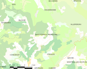
Saint-Ferréol-Trente-Pas
- коммуна во Франции
Hiking in Saint-Ferréol-Trente-Pas
Saint-Ferréol-Trente-Pas is located in the beautiful region of Occitanie in France, nestled in the foothills of the Pyrenees. The area offers a variety of hiking opportunities for both beginners and experienced hikers. Here's what you can expect when hiking in and around Saint-Ferréol-Trente-Pas:...
- Страна:
- Почтовый код: 26110
- Координаты: 44° 25' 37" N, 5° 13' 3" E
- GPS треки (wikiloc): [Ссылка]
- Площадь: 21.48 кв.км
- Население: 236

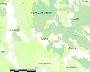
Gumiane
- коммуна во Франции
Hiking in Gumiane
Gumiane is a lesser-known yet beautiful hiking destination located in a scenic area that showcases diverse landscapes, rich flora, and fauna. While specific trails and conditions can vary, here are some general tips and insights for hiking in Gumiane:...
- Страна:
- Почтовый код: 26470
- Координаты: 44° 30' 36" N, 5° 16' 34" E
- GPS треки (wikiloc): [Ссылка]
- Площадь: 8.92 кв.км
- Население: 21