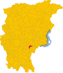
Кьюдуно (Chiuduno, Chiuduno)
.svg)
- коммуна Италии
 Hiking in Кьюдуно
Chiuduno is a small town in the province of Bergamo in Lombardy, Italy. Surrounded by beautiful landscapes and located near the foothills of the Alps, it offers a variety of hiking opportunities for all levels of hikers. Here are some highlights and tips for hiking in and around Chiuduno:
Hiking Trails
-
Monte Campione: This nearby mountain offers several trails that cater to different hiking abilities. The views from the top are spectacular, providing panoramic perspectives of the surrounding valleys and mountains.
-
Valle Cavallina: Just a short distance from Chiuduno, this valley features numerous hiking paths along the river. It's great for a leisurely hike and also has opportunities for picnicking.
-
Sentiero dei Barchi: This scenic trail runs through natural parkland, allowing hikers to experience the local flora and fauna. It's particularly beautiful in spring and early summer when wildflowers are in bloom.
-
Trekking towards the Sebino Lake: You can explore the area leading to Lake Iseo, where various trails meander along the shore. This is a more relaxing hike, perfect for those who enjoy lake views and gentle paths.
Tips for Hiking in Chiuduno
- Preparation: Always check the weather conditions before heading out, as mountain weather can change rapidly.
- Footwear: Wear appropriate hiking shoes that provide good ankle support and traction, especially if you plan to tackle steeper trails.
- Hydration: Bring plenty of water to stay hydrated, particularly on warmer days.
- Maps and Guides: Consider carrying a map or using a hiking app to help navigate the trails, as signage can vary.
- Local Regulations: Be aware of local regulations regarding wildlife and flora preservation. Stick to marked trails to minimize your impact.
Best Time to Hike
The best hiking months are typically from late spring to early autumn (May to September), when the weather is mild and the trails are more accessible. Always be mindful of seasonal changes and potential snowfall in higher elevations.
Amenities
Chiuduno has local accommodations, restaurants, and shops where you can fuel up before or after your hike. It's a good idea to sample some local cuisine, such as polenta or other Bergamasque specialities.
Overall, hiking in and around Chiuduno provides an excellent way to enjoy the natural beauty of the Lombardy region while taking in the charm of its small towns. Happy hiking!
- Страна:

- Почтовый код: 24060
- Телефонный код: 035
- Код автомобильного номера: BG
- Координаты: 45° 39' 0" N, 9° 51' 0" E


- GPS треки (wikiloc): [Ссылка]
- Высота над уровнем моря: 218 м m
- Площадь: 6.88 кв.км
- Население: 6037
- Веб сайт: http://www.comune.chiuduno.bg.it
- Википедия русская: wiki(ru)
- Википедия английская: wiki(en)
- Википедия национальная: wiki(it)
- Хранилище Wikidata: Wikidata: Q100365
- Галерея изображений в википедии: [Ссылка]
- Катеория в википедии: [Ссылка]
- код Freebase: [/m/0gj9qp]
- код GeoNames: Альт: [6543149]
- код VIAF: Альт: [234844630]
- ID отношения в OpenStreetMap: [45580]
- код GND: Альт: [7711035-3]
- UN/LOCODE: [ITCHD]
- код ISTAT: 016073
- кадастровый код Италии: C649
Граничит с регионами:

Кароббьо-дельи-Анджели
- коммуна Италии
Hiking in Кароббьо-дельи-Анджели
Carobbio degli Angeli is a quaint municipality located in the province of Bergamo, in the Lombardy region of Italy. While it may not be as well-known for hiking as other areas in Italy, it offers some beautiful natural surroundings and trails that can appeal to outdoor enthusiasts....
- Страна:
- Почтовый код: 24060
- Телефонный код: 035
- Код автомобильного номера: BG
- Координаты: 45° 40' 0" N, 9° 50' 0" E
- GPS треки (wikiloc): [Ссылка]
- Высота над уровнем моря: 232 м m
- Площадь: 6.82 кв.км
- Население: 4700
- Веб сайт: [Ссылка]


Грумелло-дель-Монте
- коммуна Италии
Hiking in Грумелло-дель-Монте
Grumello del Monte, located in Lombardy, Italy, is a great destination for hiking enthusiasts. Nestled between the city of Bergamo and the lush hills, it offers a mix of scenic trails, beautiful landscapes, and a chance to experience the local culture. Here’s what you need to know about hiking in the area:...
- Страна:
- Почтовый код: 24064
- Телефонный код: 035
- Код автомобильного номера: BG
- Координаты: 45° 38' 0" N, 9° 52' 0" E
- GPS треки (wikiloc): [Ссылка]
- Высота над уровнем моря: 208 м m
- Площадь: 9.94 кв.км
- Население: 7427
- Веб сайт: [Ссылка]


Тельгате
- коммуна Италии
Hiking in Тельгате
Telgate is a charming town located in the Lombardy region of Italy, nestled in the hills near Lake Iseo and the Orobian Alps. While it may not be as widely known as some larger hiking destinations, it offers a variety of outdoor activities, including hiking trails that cater to different skill levels....
- Страна:
- Почтовый код: 24060
- Телефонный код: 035
- Код автомобильного номера: BG
- Координаты: 45° 38' 0" N, 9° 51' 0" E
- GPS треки (wikiloc): [Ссылка]
- Высота над уровнем моря: 191 м m
- Площадь: 8.3 кв.км
- Население: 5040
- Веб сайт: [Ссылка]


Больгаре
- коммуна Италии
Hiking in Больгаре
Bolgare is a small town in the province of Bergamo, Lombardy, Italy. Nestled in a beautiful region that offers access to the stunning landscapes of the Italian Alps, Bolgare is a great starting point for various hiking adventures....
- Страна:
- Почтовый код: 24060
- Телефонный код: 035
- Код автомобильного номера: BG
- Координаты: 45° 38' 3" N, 9° 49' 1" E
- GPS треки (wikiloc): [Ссылка]
- Высота над уровнем моря: 199 м m
- Площадь: 8.59 кв.км
- Население: 6183
- Веб сайт: [Ссылка]