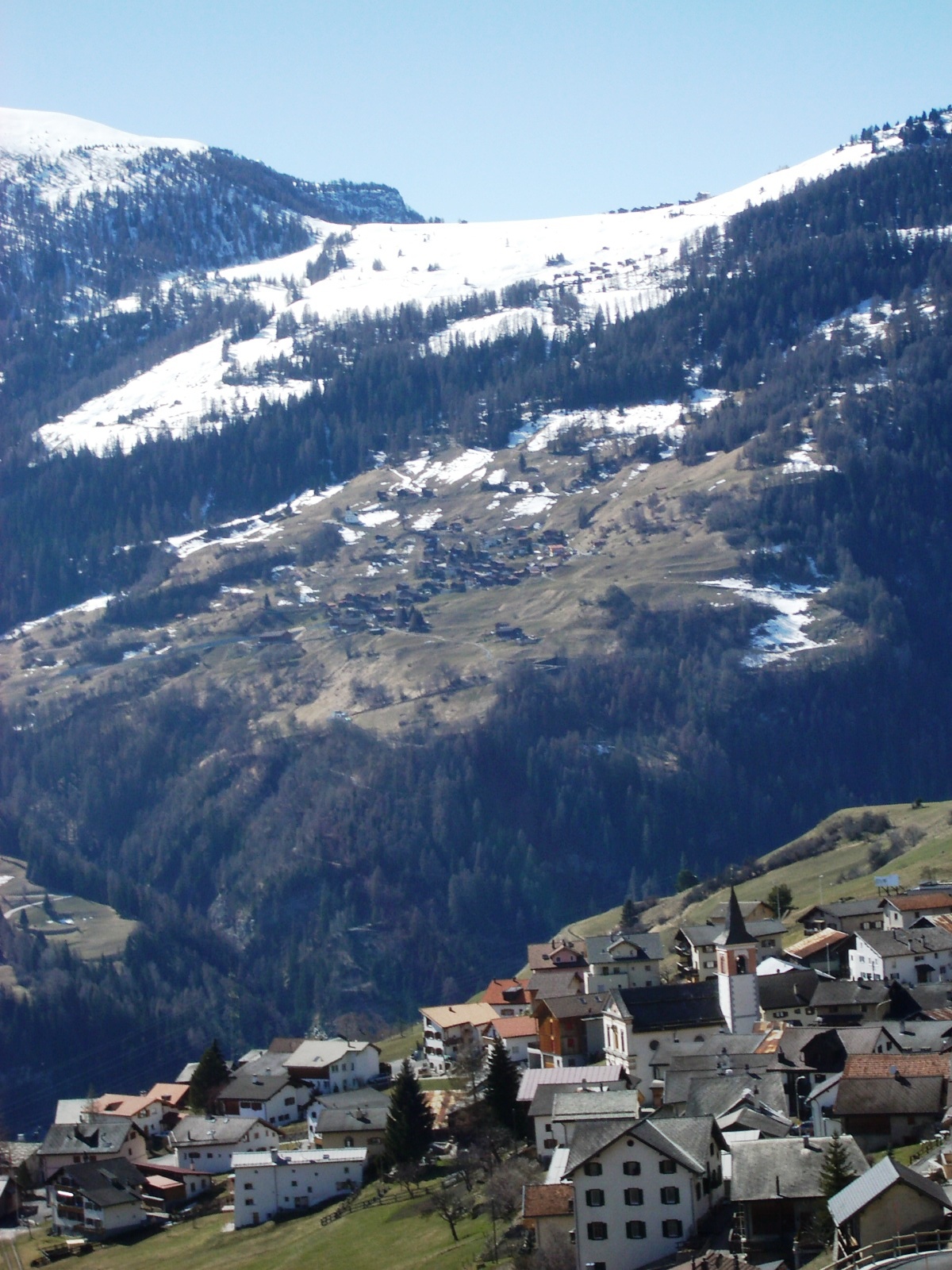
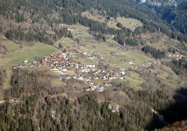
Курвальден (Churwalden, Churwalden)

 Hiking in Курвальден
Churwalden, located in the Prättigau Valley of Switzerland, is a fantastic destination for hiking enthusiasts. Nestled in the picturesque Graubünden region, it offers a variety of scenic trails suitable for different skill levels and preferences. Here are some details to help you plan your hiking experience in Churwalden:
Trails and Routes:
-
Panorama Trail: This moderately difficult trail rewards hikers with stunning panoramic views of the surrounding Alps, including the famous Piz Beverin and Piz Gorm. The trail is well-marked and suitable for families.
-
Brambrüesch to Churwalden: A popular hike that can start from the Brambrüesch mountain area and descend to Churwalden. This route is characterized by beautiful flora, rocky landscapes, and impressive mountain views.
-
Lake Obersee Hike: A serene hike leading to the Obersee Lake where you can relax, enjoy a picnic, or simply take in the natural beauty. This is a great option for a leisurely day out.
-
Alpine Trail to the Weisshorn: For more experienced hikers, this trail ascends to higher altitudes, offering incredible views and opportunities to spot local wildlife, including ibex and marmots.
Best Time to Hike:
The hiking season in Churwalden generally runs from late spring to early autumn (May to October). Summer is particularly popular due to the pleasant weather, though late spring and early autumn can also provide a quieter experience with beautiful landscapes.
Accessibility:
Churwalden is accessible by public transport, with connections from larger cities such as Chur. The area is well marked, and trail maps are available at tourist information centers. Many trails have starting points that can be reached via local cable cars, adding an element of adventure to your hike.
Additional Activities:
Aside from hiking, Churwalden also offers opportunities for mountain biking, paragliding, and winter sports during the colder months. The nearby Lenzerheide ski area is famous for skiing and snowboarding, adding to the allure of visiting the region year-round.
Safety Tips:
- Always inform someone of your hiking plans.
- Check the weather before heading out, as it can change rapidly in the mountains.
- Bring plenty of water, snacks, and a first-aid kit.
- Wear proper hiking boots and gear.
Hiking in Churwalden presents an excellent way to immerse yourself in Switzerland’s stunning Alpine scenery, with a variety of trails suited for everyone from casual walkers to seasoned hikers. Enjoy your adventure!
- Страна:

- Почтовый код: 7075
- Телефонный код: 081
- Код автомобильного номера: GR
- Координаты: 46° 47' 21" N, 9° 32' 20" E


- GPS треки (wikiloc): [Ссылка]
- Высота над уровнем моря: 1159 м m
- Площадь: 48.54 кв.км
- Население: 2012
- Веб сайт: https://churwalden.ch/
- Википедия русская: wiki(ru)
- Википедия английская: wiki(en)
- Википедия национальная: wiki(de)
- Хранилище Wikidata: Wikidata: Q64363
- Катеория в википедии: [Ссылка]
- код Freebase: [/m/0dkgwx]
- код GeoNames: Альт: [7285516]
- код BNF: [16051146v]
- код VIAF: Альт: [145501552]
- ID отношения в OpenStreetMap: [1684064]
- идентификатор местоположения ArchINFORM: [1542]
- код LCNAF: Альт: [n86082391]
- идентификатор HDS: [1582]
- код швейцарского муниципалитета: [3911]
Граничит с регионами:


Альменс
Hiking in Альменс
Almens, a small village in the scenic region of Graubünden in Switzerland, offers beautiful hiking opportunities set against a backdrop of stunning Alpine landscapes. The area is characterized by its picturesque views, lush valleys, and pristine nature, making it a desirable destination for hikers of all skill levels....
- Страна:
- Почтовый код: 7416
- Телефонный код: 081
- Код автомобильного номера: GR
- Координаты: 46° 44' 20" N, 9° 27' 19" E
- GPS треки (wikiloc): [Ссылка]
- Высота над уровнем моря: 787 м m
- Площадь: 8.34 кв.км
- Веб сайт: [Ссылка]

Вац
- коммуна в кантоне Граубюнден (Швейцария)
Hiking in Вац
Vaz Obervaz, also known simply as Vaz, is a charming municipality located in the Grisons (Graubünden) region of Switzerland. It's a great destination for hiking enthusiasts due to its stunning landscapes, diverse trails, and access to the surrounding mountains....
- Страна:
- Почтовый код: 7082
- Телефонный код: 081
- Код автомобильного номера: GR
- Координаты: 46° 42' 59" N, 9° 33' 0" E
- GPS треки (wikiloc): [Ссылка]
- Высота над уровнем моря: 1300 м m
- Площадь: 42.51 кв.км
- Население: 2630
- Веб сайт: [Ссылка]

Маладерс
Hiking in Маладерс
Maladers, located near the beautiful region of Graubünden in Switzerland, is an excellent destination for hiking enthusiasts. The area offers stunning views of the surrounding mountains, lush valleys, and a variety of trails suitable for different skill levels....
- Страна:
- Почтовый код: 7026
- Телефонный код: 081
- Код автомобильного номера: GR
- Координаты: 46° 50' 41" N, 9° 34' 20" E
- GPS треки (wikiloc): [Ссылка]
- Высота над уровнем моря: 1353 м m
- Площадь: 7.59 кв.км
- Население: 505
- Веб сайт: [Ссылка]


Кур
- община в Швейцарии, Граубюнден
Hiking in Кур
Chur, the capital of the Graubünden canton in Switzerland, offers a fantastic array of hiking opportunities. Nestled in the heart of the Alps, it boasts stunning landscapes that attract both beginner and experienced hikers. Here are some key highlights about hiking in and around Chur:...
- Страна:
- Почтовый код: 6969
- Телефонный код: 081
- Код автомобильного номера: GR
- Координаты: 46° 51' 8" N, 9° 31' 47" E
- GPS треки (wikiloc): [Ссылка]
- Высота над уровнем моря: 593 м m
- Площадь: 28.09 кв.км
- Население: 35038
- Веб сайт: [Ссылка]