
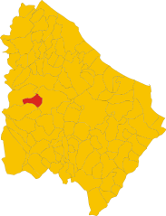
Чивителла-Мессер-Раймондо (Civitella Messer Raimondo, Civitella Messer Raimondo)
.svg)
- коммуна Италии
 Hiking in Чивителла-Мессер-Раймондо
Civitella Messer Raimondo is a beautiful village located in the Abruzzo region of Italy, surrounded by scenic landscapes, rolling hills, and rugged mountains. Hiking in this area offers a variety of trails suitable for different experience levels, making it a great destination for outdoor enthusiasts.
Key Highlights for Hiking in Civitella Messer Raimondo:
-
Scenic Trails: The region boasts picturesque views, with trails that often lead to panoramic vistas, dense forests, and charming rural landscapes. The mixed terrain provides diverse hiking experiences.
-
Nature and Wildlife: The area is rich in biodiversity, and hikers may encounter various flora and fauna, including endemic species unique to the Abruzzo region. Keep an eye out for wildlife like deer, foxes, and various bird species.
-
Historic Sites: Some trails may lead you to ancient ruins or historical landmarks, enhancing the hiking experience by providing cultural insights into the region's past.
-
Accessibility: Many trails are accessible from Civitella Messer Raimondo itself or nearby towns, allowing for convenient day hikes.
-
Hiking Difficulty: The trails vary in difficulty, from easy walks suitable for families to more challenging hikes for seasoned trekkers. It's important to choose a trail that matches your fitness level and experience.
-
Local Guidance: If you're unfamiliar with the area, consider hiring a local guide or joining a guided hiking group. They can provide valuable information about the trails, local history, and ensure your safety.
-
Best Time to Hike: Spring and early autumn are generally the best times for hiking in this region. During these seasons, the weather is typically mild, and the landscape is lush and vibrant.
-
Preparation: Always carry enough water, appropriate clothing, and gear (including sturdy footwear and possibly trekking poles), as well as a map or GPS device, as trails may not always be well-marked.
If you're planning a hike, make sure to check local resources or visitor centers for trail maps, conditions, and any safety advisories. Enjoy your hiking adventure in Civitella Messer Raimondo!
- Страна:

- Почтовый код: 66010
- Телефонный код: 0872
- Код автомобильного номера: CH
- Координаты: 42° 5' 0" N, 14° 13' 0" E


- GPS треки (wikiloc): [Ссылка]
- Высота над уровнем моря: 613 м m
- Площадь: 12.72 кв.км
- Население: 818
- Веб сайт: http://www.civitellamesserraimondo.net/
- Википедия русская: wiki(ru)
- Википедия английская: wiki(en)
- Википедия национальная: wiki(it)
- Хранилище Wikidata: Wikidata: Q51207
- Катеория в википедии: [Ссылка]
- код Freebase: [/m/0fg33h]
- код GeoNames: Альт: [6541928]
- ID отношения в OpenStreetMap: [41758]
- код ISTAT: 069024
- кадастровый код Италии: C776
Граничит с регионами:


Казоли
- коммуна Италии
Hiking in Казоли
Casoli, located in the Abruzzo region of Italy, offers a variety of hiking opportunities for enthusiasts of all levels. The area is rich in natural beauty, including rolling hills, ancient forests, and stunning views of the surrounding mountains and valleys. Here are some highlights and tips for hiking in Casoli:...
- Страна:
- Почтовый код: 66043
- Телефонный код: 0872
- Код автомобильного номера: CH
- Координаты: 42° 6' 54" N, 14° 17' 26" E
- GPS треки (wikiloc): [Ссылка]
- Высота над уровнем моря: 378 м m
- Площадь: 67.04 кв.км
- Население: 5585
- Веб сайт: [Ссылка]


Фара-Сан-Мартино
- коммуна Италии
Hiking in Фара-Сан-Мартино
Fara San Martino, located in the Abruzzo region of Italy, is a beautiful destination for hiking enthusiasts. Nestled in the Majella National Park, this area is characterized by stunning natural landscapes, dramatic mountains, and a rich array of flora and fauna. Here are some key points about hiking in Fara San Martino:...
- Страна:
- Почтовый код: 66015
- Телефонный код: 0872
- Код автомобильного номера: CH
- Координаты: 42° 5' 28" N, 14° 12' 22" E
- GPS треки (wikiloc): [Ссылка]
- Высота над уровнем моря: 440 м m
- Площадь: 44.69 кв.км
- Население: 1379
- Веб сайт: [Ссылка]


Джессопалена
- коммуна Италии
Hiking in Джессопалена
Gessopalena is a charming village located in the Abruzzo region of Italy, known for its stunning natural landscapes and outdoor activities, including hiking. The area offers a range of trails that cater to different skill levels, making it an excellent destination for both novice and experienced hikers....
- Страна:
- Почтовый код: 66010
- Телефонный код: 0872
- Код автомобильного номера: CH
- Координаты: 42° 3' 0" N, 14° 16' 0" E
- GPS треки (wikiloc): [Ссылка]
- Высота над уровнем моря: 654 м m
- Площадь: 31.47 кв.км
- Население: 1360
- Веб сайт: [Ссылка]


Лама-дей-Пелиньи
- коммуна Италии
Hiking in Лама-дей-Пелиньи
Lama dei Peligni is a picturesque village located in the mountains of the Abruzzo region in Italy. It's an excellent destination for hikers due to its stunning natural landscapes, varied terrain, and beautiful views of the surrounding Apennine mountains. Here are some highlights of hiking in this area:...
- Страна:
- Почтовый код: 66010
- Телефонный код: 0872
- Код автомобильного номера: CH
- Координаты: 42° 3' 0" N, 14° 11' 0" E
- GPS треки (wikiloc): [Ссылка]
- Высота над уровнем моря: 669 м m
- Площадь: 31.37 кв.км
- Население: 1200
- Веб сайт: [Ссылка]

Паломбаро
- коммуна Италии
Hiking in Паломбаро
Palombaro is a charming village located in the Abruzzo region of Italy. Nestled in the Apennine Mountains, it offers a variety of hiking opportunities characterized by beautiful landscapes, dense forests, and picturesque views. Here are some highlights and tips for hiking in and around Palombaro:...
- Страна:
- Почтовый код: 66010
- Телефонный код: 0871
- Код автомобильного номера: CH
- Координаты: 42° 7' 24" N, 14° 13' 48" E
- GPS треки (wikiloc): [Ссылка]
- Высота над уровнем моря: 536 м m
- Площадь: 17.19 кв.км
- Население: 1001
- Веб сайт: [Ссылка]