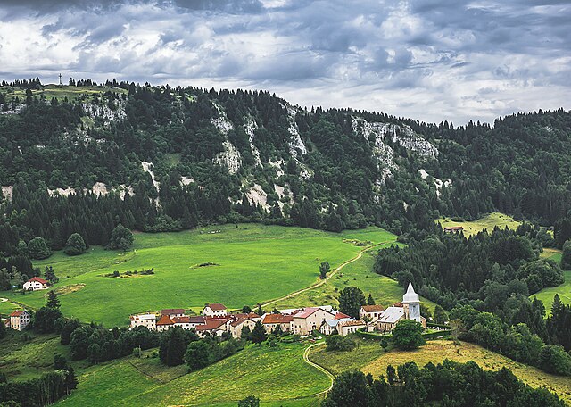
Coiserette (Coiserette)

- коммуна во Франции
 Hiking in Coiserette
Coiserette is not a widely recognized hiking destination, and it could refer to a specific local area or park that is not extensively documented in popular hiking resources. It's possible it's a small village or area, potentially in France, as similar names hint toward that.
For hiking in any local area, here are some general tips you can follow:
-
Research Trails: Check local maps or hiking guides to find established trails. Websites like AllTrails often provide user-generated information on hiking routes.
-
Assess Terrain and Difficulty: Understand the difficulty level of the trails available—easy, moderate, or strenuous—so you can choose ones suitable for your fitness level and experience.
-
Weather Considerations: Look up the weather forecast for the day of your hike. Obey any warnings about changing weather conditions.
-
Packing Essentials: Bring enough water, snacks, a first-aid kit, trail map, compass, or GPS device. Good hiking boots are essential, and a comfortable backpack will help carry your gear.
-
Leave No Trace: Follow principles of responsible hiking: pack out what you pack in, respect wildlife, stick to trails, and avoid disturbing natural habitats.
-
Local Regulations: Check if any permits are needed for hiking in the area, and be aware of local wildlife and plants.
If Coiserette has specific trails or parks, I'd recommend reaching out to local hiking groups or visitor centers for the best recommendations. If you would like information on a specific trail or destination, please provide more details!
- Страна:

- Почтовый код: 39200
- Координаты: 46° 20' 31" N, 5° 50' 2" E


- GPS треки (wikiloc): [Ссылка]
- Площадь: 5.91 кв.км
- Население: 53
- Википедия английская: wiki(en)
- Википедия национальная: wiki(fr)
- Хранилище Wikidata: Wikidata: Q819093
- Катеория в википедии: [Ссылка]
- код Freebase: [/m/03np3m4]
- код GeoNames: Альт: [6433509]
- номер SIREN: [213901572]
- код BNF: [15258521h]
- код VIAF: Альт: [236981790]
- код муниципалитета INSEE: 39157
Граничит с регионами:


Сен-Клод
- коммуна во Франции
Hiking in Сен-Клод
Saint-Claude, located in the Jura region of France, is a fantastic destination for hiking enthusiasts. Nestled in the mountains, it offers a variety of trails that cater to different skill levels, from leisurely walks to challenging treks. Here are some highlights about hiking in Saint-Claude:...
- Страна:
- Почтовый код: 39200
- Координаты: 46° 23' 14" N, 5° 51' 48" E
- GPS треки (wikiloc): [Ссылка]
- Площадь: 70.19 кв.км
- Население: 9732
- Веб сайт: [Ссылка]

Les Bouchoux
- коммуна во Франции
Hiking in Les Bouchoux
Les Bouchoux, a picturesque village located in the Jura region of France, offers a unique hiking experience marked by stunning landscapes, rich biodiversity, and a charming rural atmosphere. Here are some key points to know about hiking in this area:...
- Страна:
- Почтовый код: 39370
- Координаты: 46° 17' 49" N, 5° 49' 9" E
- GPS треки (wikiloc): [Ссылка]
- Площадь: 21.71 кв.км
- Население: 316


La Pesse
- коммуна во Франции
Hiking in La Pesse
La Pesse is a charming village located in the Jura Mountains of France, known for its scenic landscapes and natural beauty, making it a great destination for hiking enthusiasts. Here are some details you might find helpful if you're considering hiking in this area:...
- Страна:
- Почтовый код: 39370
- Координаты: 46° 17' 8" N, 5° 50' 52" E
- GPS треки (wikiloc): [Ссылка]
- Площадь: 24.26 кв.км
- Население: 356
- Веб сайт: [Ссылка]


Villard-Saint-Sauveur
- коммуна во Франции
Hiking in Villard-Saint-Sauveur
Villard-Saint-Sauveur, located in the French Alps, is a fantastic destination for hiking enthusiasts. The area is known for its stunning landscapes, diverse flora and fauna, and a variety of trails that cater to different skill levels. Here are some highlights for hiking in Villard-Saint-Sauveur:...
- Страна:
- Почтовый код: 39200
- Координаты: 46° 22' 18" N, 5° 52' 28" E
- GPS треки (wikiloc): [Ссылка]
- Площадь: 9.05 кв.км
- Население: 614


Coyrière
- коммуна во Франции
Hiking in Coyrière
Coyrière is a lesser-known hiking destination that typically offers beautiful landscapes and a chance to connect with nature. While I don't have specifics on Coyrière, I can provide you with general information that often applies to hiking in similar regions....
- Страна:
- Почтовый код: 39200
- Координаты: 46° 20' 34" N, 5° 50' 37" E
- GPS треки (wikiloc): [Ссылка]
- Площадь: 4.11 кв.км
- Население: 66


Les Moussières
- коммуна во Франции
Hiking in Les Moussières
Les Moussières is a beautiful hiking destination situated in the French Jura Mountains, renowned for its stunning landscapes, rich biodiversity, and charming rural atmosphere. Here are some key points to consider if you're planning to hike in the area:...
- Страна:
- Почтовый код: 39310
- Координаты: 46° 19' 33" N, 5° 53' 24" E
- GPS треки (wikiloc): [Ссылка]
- Площадь: 16.95 кв.км
- Население: 168


Larrivoire
- коммуна во Франции
Hiking in Larrivoire
Larrivoire, often referred to as a picturesque region in the French Alps, offers a range of hiking opportunities for enthusiasts of all experience levels. The scenic beauty, featuring stunning mountain vistas, lush valleys, and flowing streams, makes it an attractive destination for nature lovers....
- Страна:
- Почтовый код: 39360
- Координаты: 46° 20' 37" N, 5° 47' 16" E
- GPS треки (wikiloc): [Ссылка]
- Площадь: 6.5 кв.км
- Население: 116