Комун-Нуово (Comun Nuovo, Comun Nuovo)
.svg)
- коммуна Италии
 Hiking in Комун-Нуово
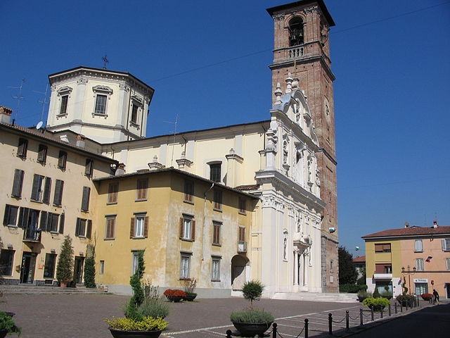
Comun Nuovo, located in the Lombardy region of Italy, offers a picturesque setting for hiking enthusiasts. Although it’s a small town, it's surrounded by a beautiful landscape that features a mix of urban and natural environments. Here are some highlights for hiking in and around Comun Nuovo:
Trails and Nature
-
Local Paths: Explore the rural paths that wind through the fields and hills around Comun Nuovo. These trails provide opportunities to enjoy the local flora and fauna.
-
Parco dell'Adda Nord: A short drive away, this park features several trails along the Adda River. Hiking here lets you experience diverse ecosystems and stunning river views.
-
Hills of Bergamo: Just a stone's throw from Comun Nuovo, you can venture into the hills of Bergamo. The hiking trails vary in difficulty and can offer breathtaking panoramas over the valley and towards the city of Bergamo.
Hiking Preparation
-
Weather: Always check the weather conditions before heading out, as they can change rapidly in this region.
-
Gear: Wear comfortable hiking boots, dress in layers, and consider bringing a map or GPS device for navigating trails.
-
Supplies: Carry enough water, snacks, and a first-aid kit, especially if you plan to hike for several hours.
Additional Activities
-
Cultural Exploration: After hiking, take some time to explore the town of Comun Nuovo and the nearby city of Bergamo, known for its rich history and beautiful architecture.
-
Photography: The natural scenery and charming landscapes make for excellent photography opportunities, so don’t forget your camera.
Safety Tips
- Always hike with a partner or let someone know your plans.
- Follow marked trails to avoid getting lost.
- Be mindful of wildlife and maintain a respectful distance.
Conclusion
Hiking in Comun Nuovo offers a blend of tranquility, natural beauty, and the opportunity to immerse yourself in the Italian countryside. Whether you’re looking for a peaceful stroll or a more challenging hike, there are options available for all levels of hikers. Enjoy your adventure!
- Страна:

- Почтовый код: 24040
- Телефонный код: 035
- Код автомобильного номера: BG
- Координаты: 45° 37' 22" N, 9° 39' 49" E


- GPS треки (wikiloc): [Ссылка]
- Высота над уровнем моря: 188 м m
- Площадь: 6.45 кв.км
- Население: 4389
- Веб сайт: http://www.comune.comunnuovo.bg.it/
- Википедия русская: wiki(ru)
- Википедия английская: wiki(en)
- Википедия национальная: wiki(it)
- Хранилище Wikidata: Wikidata: Q100404
- Галерея изображений в википедии: [Ссылка]
- Катеория в википедии: [Ссылка]
- код Freebase: [/m/0gj9vm]
- код GeoNames: Альт: [6542038]
- ID отношения в OpenStreetMap: [45465]
- WOEID: [12678847]
- UN/LOCODE: [ITCMU]
- код ISTAT: 016081
- кадастровый код Италии: C937
Граничит с регионами:


Левате
- коммуна Италии
Hiking in Левате
Levate, located in the province of Bergamo in Northern Italy, offers beautiful landscapes and diverse hiking opportunities. The area is characterized by picturesque rolling hills, charming villages, and lush nature, making it an excellent place for outdoor enthusiasts....
- Страна:
- Почтовый код: 24040
- Телефонный код: 035
- Код автомобильного номера: BG
- Координаты: 45° 38' 0" N, 9° 37' 0" E
- GPS треки (wikiloc): [Ссылка]
- Высота над уровнем моря: 185 м m
- Площадь: 5.53 кв.км
- Население: 3780
- Веб сайт: [Ссылка]


Спирано
- коммуна Италии
Hiking in Спирано
Spirano, a small town located in the province of Bergamo in Lombardy, Italy, offers a serene environment and picturesque landscapes suitable for hiking enthusiasts. While it may not be as renowned for hiking as some larger areas in the Italian Alps, Spirano and its surrounding regions provide a variety of trails that cater to different experience levels....
- Страна:
- Почтовый код: 24050
- Телефонный код: 035
- Код автомобильного номера: BG
- Координаты: 45° 34' 58" N, 9° 40' 9" E
- GPS треки (wikiloc): [Ссылка]
- Высота над уровнем моря: 154 м m
- Площадь: 9.61 кв.км
- Население: 5730
- Веб сайт: [Ссылка]


Стеццано
- коммуна Италии
Hiking in Стеццано
Stezzano is a small town located in the Lombardy region of Italy, near Bergamo. While it may not be as widely recognized for hiking compared to more mountainous areas, there are several outdoor opportunities and nearby areas that you can explore....
- Страна:
- Почтовый код: 24040
- Телефонный код: 035
- Код автомобильного номера: BG
- Координаты: 45° 35' 0" N, 9° 40' 0" E
- GPS треки (wikiloc): [Ссылка]
- Высота над уровнем моря: 211 м m
- Площадь: 9.37 кв.км
- Население: 13112
- Веб сайт: [Ссылка]


Урньяно
- коммуна Италии
Hiking in Урньяно
Urgnano is a small town located in Lombardy, Italy, close to Bergamo. While Urgnano itself may not be a prominent hiking destination, it is surrounded by beautiful landscapes and trails that appeal to hiking enthusiasts....
- Страна:
- Почтовый код: 24059
- Телефонный код: 035
- Код автомобильного номера: BG
- Координаты: 45° 35' 50" N, 9° 41' 42" E
- GPS треки (wikiloc): [Ссылка]
- Высота над уровнем моря: 173 м m
- Площадь: 14.78 кв.км
- Население: 9908
- Веб сайт: [Ссылка]

Верделло
- коммуна Италии
Hiking in Верделло
Verdello is a small town in Italy, located in the Lombardy region, close to the city of Bergamo. While it may not be as famous for hiking as the larger nearby mountain ranges, such as the Orobie Alps, there are still some opportunities for outdoor activities and exploring the natural beauty of the region....
- Страна:
- Почтовый код: 24049
- Телефонный код: 035
- Код автомобильного номера: BG
- Координаты: 45° 36' 18" N, 9° 37' 47" E
- GPS треки (wikiloc): [Ссылка]
- Высота над уровнем моря: 173 м m
- Площадь: 7.34 кв.км
- Население: 8082
- Веб сайт: [Ссылка]


Цаника
- коммуна Италии
Hiking in Цаника
Zanica is a charming town located in the Lombardy region of Italy, close to the city of Bergamo. While it may not be as widely known for its hiking as some larger destinations, there are several trails and natural areas nearby that offer beautiful scenery and opportunities for outdoor activities....
- Страна:
- Почтовый код: 24050
- Телефонный код: 035
- Код автомобильного номера: BG
- Координаты: 45° 38' 22" N, 9° 41' 3" E
- GPS треки (wikiloc): [Ссылка]
- Высота над уровнем моря: 208 м m
- Площадь: 14.66 кв.км
- Население: 8744
- Веб сайт: [Ссылка]