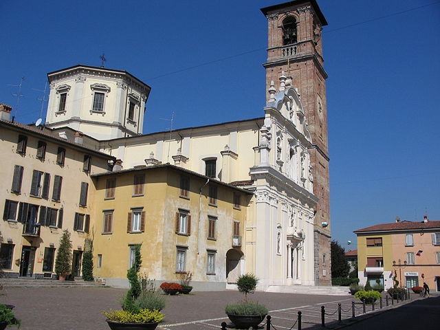
Спирано (Spirano, Spirano)
.svg)
- коммуна Италии
 Hiking in Спирано
Spirano, a small town located in the province of Bergamo in Lombardy, Italy, offers a serene environment and picturesque landscapes suitable for hiking enthusiasts. While it may not be as renowned for hiking as some larger areas in the Italian Alps, Spirano and its surrounding regions provide a variety of trails that cater to different experience levels.
Key Highlights for Hiking in Spirano:
-
Scenic Views: The area around Spirano features beautiful countryside, rolling hills, and views of the Alps in the distance. Hikers can enjoy the tranquility and natural beauty of the Lombard landscape.
-
Local Trails: Although specific hiking trails in Spirano may not be extensively documented, nearby areas, such as the Adda River Park (Parco Adda Nord), offer well-marked paths along the river, providing excellent opportunities for leisurely hikes.
-
Cultural Exploration: Hiking in the area can also provide a chance to explore local culture and history by visiting nearby villages and historic sites along the trails.
-
Accessibility: Spirano is well-connected by public transport, making it easy for hikers to reach the region from major cities like Bergamo or Milan. The proximity to urban centers allows for both day hikes and extended stays.
-
Suitable for All Levels: Whether you're a beginner looking for an easy walk or an experienced hiker seeking more challenging terrain, there are various routes to choose from.
-
Seasonal Considerations: Best times to hike in the region are late spring, summer, and early autumn when the weather is more favorable. Always check the weather conditions before heading out, and dress appropriately.
-
Local Guidance: Consider using local guides or joining hiking groups to explore the area safely and meet fellow outdoor enthusiasts.
-
Environmentally Conscious: Always practice Leave No Trace principles, ensuring that natural spaces remain protected and enjoyable for future hikers.
Before you set off, it's a good idea to plan your route, ensure you have adequate supplies, and familiarize yourself with the area’s trails and regulations. Enjoy your hiking adventures in Spirano!
- Страна:

- Почтовый код: 24050
- Телефонный код: 035
- Код автомобильного номера: BG
- Координаты: 45° 34' 58" N, 9° 40' 9" E


- GPS треки (wikiloc): [Ссылка]
- Высота над уровнем моря: 154 м m
- Площадь: 9.61 кв.км
- Население: 5730
- Веб сайт: http://www.comune.spirano.bg.it/
- Википедия русская: wiki(ru)
- Википедия английская: wiki(en)
- Википедия национальная: wiki(it)
- Хранилище Wikidata: Wikidata: Q101628
- Галерея изображений в википедии: [Ссылка]
- Катеория в википедии: [Ссылка]
- код Freebase: [/m/0gjf19]
- код GeoNames: Альт: [6541670]
- код VIAF: Альт: [234774272]
- ID отношения в OpenStreetMap: [45350]
- идентификатор местоположения ArchINFORM: [16414]
- код TGN: [7038867]
- UN/LOCODE: [ITESP]
- код ISTAT: 016206
- кадастровый код Италии: I919
Граничит с регионами:


Бриньяно-Джера-д'Адда
- коммуна Италии
Hiking in Бриньяно-Джера-д'Адда
Brignano Gera d'Adda is located in the Lombardy region of Italy and offers a unique landscape for hiking enthusiasts. While the area may not be as globally renowned as some of Italy's larger national parks, it boasts picturesque scenery and natural beauty that can provide a pleasant hiking experience....
- Страна:
- Почтовый код: 24053
- Телефонный код: 0363
- Код автомобильного номера: BG
- Координаты: 45° 32' 0" N, 9° 38' 0" E
- GPS треки (wikiloc): [Ссылка]
- Высота над уровнем моря: 131 м m
- Площадь: 12.11 кв.км
- Население: 6009
- Веб сайт: [Ссылка]


Колоньо-аль-Серио
- коммуна Италии
Hiking in Колоньо-аль-Серио
Cologno al Serio is a small town located in the Lombardy region of Italy, near the Adda River and not far from the beautiful landscapes of the Italian Alps. While Cologno al Serio itself might not be a major hiking destination, there are several hiking opportunities in the surrounding areas....
- Страна:
- Почтовый код: 24055
- Телефонный код: 035
- Код автомобильного номера: BG
- Координаты: 45° 35' 0" N, 9° 42' 0" E
- GPS треки (wikiloc): [Ссылка]
- Высота над уровнем моря: 156 м m
- Площадь: 18.52 кв.км
- Население: 11180
- Веб сайт: [Ссылка]


Комун-Нуово
- коммуна Италии
Hiking in Комун-Нуово
Comun Nuovo, located in the Lombardy region of Italy, offers a picturesque setting for hiking enthusiasts. Although it’s a small town, it's surrounded by a beautiful landscape that features a mix of urban and natural environments. Here are some highlights for hiking in and around Comun Nuovo:...
- Страна:
- Почтовый код: 24040
- Телефонный код: 035
- Код автомобильного номера: BG
- Координаты: 45° 37' 22" N, 9° 39' 49" E
- GPS треки (wikiloc): [Ссылка]
- Высота над уровнем моря: 188 м m
- Площадь: 6.45 кв.км
- Население: 4389
- Веб сайт: [Ссылка]


Лурано
- коммуна Италии
Hiking in Лурано
Lurano, a small municipality in Italy, may not be widely known as a hiking destination compared to some of the more popular regions, but it can offer some serene and picturesque trails suitable for those looking to explore nature away from the crowds....
- Страна:
- Почтовый код: 24050
- Телефонный код: 035
- Код автомобильного номера: BG
- Координаты: 45° 34' 0" N, 9° 38' 0" E
- GPS треки (wikiloc): [Ссылка]
- Высота над уровнем моря: 147 м m
- Площадь: 4.05 кв.км
- Население: 2841
- Веб сайт: [Ссылка]


Пагаццано
- коммуна Италии
Hiking in Пагаццано
Pagazzano is a charming town located in the Lombardy region of Italy, not far from the more well-known city of Bergamo. While Pagazzano itself may not be a major hiking destination, its surrounding areas offer a variety of trails and natural beauty suitable for hiking enthusiasts....
- Страна:
- Почтовый код: 24040
- Телефонный код: 0363
- Код автомобильного номера: BG
- Координаты: 45° 32' 3" N, 9° 40' 16" E
- GPS треки (wikiloc): [Ссылка]
- Высота над уровнем моря: 126 м m
- Площадь: 5.24 кв.км
- Население: 2083
- Веб сайт: [Ссылка]


Поньяно
- коммуна Италии
Hiking in Поньяно
Pognano, located in the province of Bergamo in northern Italy, is a charming town that provides access to beautiful landscapes and hiking opportunities. While Pognano itself is not a major hiking destination, it is situated near scenic areas in the Lombardy region, which hosts numerous trails suitable for various skill levels....
- Страна:
- Почтовый код: 24040
- Телефонный код: 035
- Код автомобильного номера: BG
- Координаты: 45° 35' 13" N, 9° 38' 27" E
- GPS треки (wikiloc): [Ссылка]
- Высота над уровнем моря: 157 м m
- Площадь: 3.29 кв.км
- Население: 1625
- Веб сайт: [Ссылка]


Урньяно
- коммуна Италии
Hiking in Урньяно
Urgnano is a small town located in Lombardy, Italy, close to Bergamo. While Urgnano itself may not be a prominent hiking destination, it is surrounded by beautiful landscapes and trails that appeal to hiking enthusiasts....
- Страна:
- Почтовый код: 24059
- Телефонный код: 035
- Код автомобильного номера: BG
- Координаты: 45° 35' 50" N, 9° 41' 42" E
- GPS треки (wikiloc): [Ссылка]
- Высота над уровнем моря: 173 м m
- Площадь: 14.78 кв.км
- Население: 9908
- Веб сайт: [Ссылка]

Верделло
- коммуна Италии
Hiking in Верделло
Verdello is a small town in Italy, located in the Lombardy region, close to the city of Bergamo. While it may not be as famous for hiking as the larger nearby mountain ranges, such as the Orobie Alps, there are still some opportunities for outdoor activities and exploring the natural beauty of the region....
- Страна:
- Почтовый код: 24049
- Телефонный код: 035
- Код автомобильного номера: BG
- Координаты: 45° 36' 18" N, 9° 37' 47" E
- GPS треки (wikiloc): [Ссылка]
- Высота над уровнем моря: 173 м m
- Площадь: 7.34 кв.км
- Население: 8082
- Веб сайт: [Ссылка]