Courcelles-lès-Montbéliard (Courcelles-lès-Montbéliard)

- коммуна во Франции
 Hiking in Courcelles-lès-Montbéliard
Courcelles-lès-Montbéliard is a charming village located in the Doubs department in the Bourgogne-Franche-Comté region of France. This area offers various hiking opportunities that cater to different skill levels and preferences.
Hiking Highlights in Courcelles-lès-Montbéliard
-
Natural Landscapes: The region is characterized by beautiful landscapes, including rolling hills, forests, and meadows. The diverse terrain provides a picturesque backdrop for hiking.
-
Local Trails: While there may not be extensive well-marked hiking trails directly in Courcelles-lès-Montbéliard, you can access nearby paths that are part of larger networks. The surrounding countryside invites exploration, and small local paths may lead to enchanting views and experiences.
-
Nearby Parks: The Parc Naturel Régional du Doubs is relatively close, offering extensive hiking options. Trails within the park can take you through lush forests, alongside rivers, and up to scenic viewpoints.
-
Flora and Fauna: Hiking in this area often allows for encounters with diverse plant and animal life. The woodlands are home to a variety of species, and birdwatching can also be a rewarding experience.
-
Historical Elements: Hiking in the region can include visits to historical sites such as old churches, castles, and ruins, adding a cultural component to your outdoor experience.
Tips for Hiking in the Area
-
Map and Planning: It's helpful to have a detailed map of local trails and plan your route before heading out. GPS devices or hiking apps can also enhance your experience.
-
Weather Considerations: The weather in the region can fluctuate, so check forecasts and be prepared for changes. Dress in layers and bring rain gear if needed.
-
Stay Safe: Always carry enough water, snacks, and a basic first aid kit. Make sure to inform someone of your hiking plans, especially if you venture into less traveled areas.
-
Respect the Environment: Follow Leave No Trace principles to preserve the natural beauty of the area. Stick to marked trails and avoid disturbing wildlife.
Whether you’re a casual hiker or looking for more challenging trails, the surroundings of Courcelles-lès-Montbéliard offer a lovely escape into nature. Enjoy your hiking adventure!
- Страна:

- Почтовый код: 25420
- Координаты: 47° 30' 0" N, 6° 47' 10" E


- GPS треки (wikiloc): [Ссылка]
- Площадь: 2.4 кв.км
- Население: 1174
- Википедия английская: wiki(en)
- Википедия национальная: wiki(fr)
- Хранилище Wikidata: Wikidata: Q835899
- Катеория в википедии: [Ссылка]
- код Freebase: [/m/03mgsdw]
- код Freebase: [/m/03mgsdw]
- код GeoNames: Альт: [6429733]
- код GeoNames: Альт: [6429733]
- номер SIREN: [212501704]
- номер SIREN: [212501704]
- код BNF: [15252396d]
- код BNF: [15252396d]
- код муниципалитета INSEE: 25170
- код муниципалитета INSEE: 25170
Граничит с регионами:
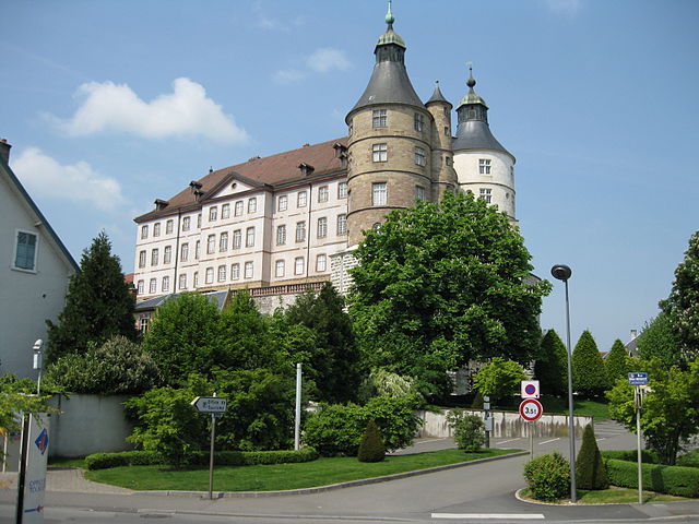

Монбельяр
- коммуна во Франции
Hiking in Монбельяр
Montbéliard, a picturesque town located in the Bourgogne-Franche-Comté region of eastern France, offers various hiking opportunities that allow you to explore the beautiful landscapes and rich history of the area....
- Страна:
- Почтовый код: 25200
- Координаты: 47° 30' 35" N, 6° 47' 54" E
- GPS треки (wikiloc): [Ссылка]
- Высота над уровнем моря: 337 м m
- Площадь: 15.01 кв.км
- Население: 25336
- Веб сайт: [Ссылка]


Sainte-Suzanne
- коммуна во Франции
Hiking in Sainte-Suzanne
Sainte-Suzanne, located in the Doubs department of France, is a beautiful area known for its stunning landscapes and rich natural heritage, making it a great destination for hiking enthusiasts. Here are some key highlights and tips for hiking in this region:...
- Страна:
- Почтовый код: 25630
- Координаты: 47° 30' 22" N, 6° 46' 21" E
- GPS треки (wikiloc): [Ссылка]
- Площадь: 1.59 кв.км
- Население: 1557


Voujeaucourt
- коммуна во Франции
Hiking in Voujeaucourt
Voujeaucourt is a small commune located in the Doubs department in the Bourgogne-Franche-Comté region of eastern France. While it may not be as widely known as some larger hiking destinations, the surrounding areas offer opportunities for outdoor activities, including hiking....
- Страна:
- Почтовый код: 25420
- Координаты: 47° 28' 32" N, 6° 46' 28" E
- GPS треки (wikiloc): [Ссылка]
- Площадь: 9.45 кв.км
- Население: 3320
- Веб сайт: [Ссылка]