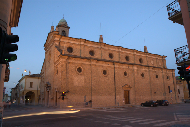
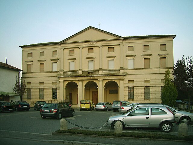
Сорезина (Soresina, Soresina)
.svg)
- коммуна Италии
 Hiking in Сорезина
Soresina, located in the Lombardy region of Italy, is primarily known for its agricultural landscape and historical significance rather than traditional hiking trails. However, there are several options for enjoying the outdoors and exploring the surrounding areas.
Hiking Opportunities Near Soresina:
-
Countryside Trails: The flat terrain around Soresina offers numerous paths that wind through fields and rural landscapes. These can be great for leisurely walks or cycling, allowing hikers to enjoy the serene countryside.
-
Parco Regionale del Serio: Located a bit farther from Soresina, this regional park offers well-marked trails through diverse natural environments. It's a fantastic place for hiking, with options that vary in difficulty and length.
-
Oglio Park: Situated along the Oglio River, this park offers beautiful trails for riders and hikers. There are several routes that allow you to enjoy river views and local wildlife.
-
Historical Walks: Exploring the town of Soresina itself can be a rewarding experience. The town features charming architecture, and you can create a walking route that includes historical sites such as churches and local monuments.
Tips for Hiking in the Area:
- Footwear: Wear comfortable hiking shoes or boots, as the terrain may vary from flat agricultural land to more uneven paths.
- Hydration: Always carry enough water, especially in warmer months.
- Maps and Navigation: Use a mapping app or a printed map, especially if you venture into less populated areas, as cell service can be spotty.
- Weather Awareness: Check the weather forecast before heading out, as conditions can change quickly.
Conclusion:
While Soresina may not be a hiking hotspot, its surrounding landscapes offer opportunities for leisurely walks and exploration. If you're looking for more extensive hiking experiences, consider venturing further into the regional parks and natural reserves nearby. Enjoy your time outdoors!
- Страна:

- Почтовый код: 26015
- Телефонный код: 0374
- Код автомобильного номера: CR
- Координаты: 45° 17' 17" N, 9° 51' 31" E


- GPS треки (wikiloc): [Ссылка]
- Высота над уровнем моря: 45 м m
- Площадь: 28.57 кв.км
- Население: 8948
- Веб сайт: http://www.comune.soresina.cr.it/
- Википедия русская: wiki(ru)
- Википедия английская: wiki(en)
- Википедия национальная: wiki(it)
- Хранилище Wikidata: Wikidata: Q42929
- Катеория в википедии: [Ссылка]
- код Freebase: [/m/0gj_20]
- код GeoNames: Альт: [6537224]
- код VIAF: Альт: [123599728]
- ID отношения в OpenStreetMap: [44603]
- место в MusicBrainz: [686e7b1e-613f-419c-bcc1-1e84df36586a]
- UN/LOCODE: [ITRIS]
- код ISTAT: 019098
- кадастровый код Италии: I849
Граничит с регионами:

Кастеллеоне
- коммуна Италии
Hiking in Кастеллеоне
Castelleone is a charming town located in the Lombardy region of Italy, and while it may not be the most well-known hiking destination, it offers access to some lovely spots worth exploring....
- Страна:
- Почтовый код: 26012
- Телефонный код: 0374
- Код автомобильного номера: CR
- Координаты: 45° 17' 45" N, 9° 45' 39" E
- GPS треки (wikiloc): [Ссылка]
- Высота над уровнем моря: 66 м m
- Площадь: 45.08 кв.км
- Население: 9374
- Веб сайт: [Ссылка]


Анникко
- коммуна Италии
Hiking in Анникко
Annicco is a small town located in the Lombardy region of Italy. While it may not be as widely known for hiking as some other areas in Italy, it can serve as a gateway for exploring nearby regions that offer beautiful hiking opportunities....
- Страна:
- Почтовый код: 26021
- Телефонный код: 0374
- Код автомобильного номера: CR
- Координаты: 45° 15' 0" N, 9° 53' 0" E
- GPS треки (wikiloc): [Ссылка]
- Высота над уровнем моря: 60 м m
- Площадь: 19.2 кв.км
- Население: 2053
- Веб сайт: [Ссылка]


Куминьяно-суль-Навильо
- коммуна Италии
Hiking in Куминьяно-суль-Навильо
Cumignano sul Naviglio is a small town located in the Lombardy region of Italy, near the Naviglio River. While it may not be as famous for hiking as some other Italian destinations, it offers a peaceful environment with charming landscapes that can still provide a pleasant experience for nature lovers and hikers....
- Страна:
- Почтовый код: 26020
- Телефонный код: 0374
- Код автомобильного номера: CR
- Координаты: 45° 21' 0" N, 9° 50' 0" E
- GPS треки (wikiloc): [Ссылка]
- Высота над уровнем моря: 73 м m
- Площадь: 6.77 кв.км
- Население: 448
- Веб сайт: [Ссылка]
Каппелла-Кантоне
- коммуна Италии
Hiking in Каппелла-Кантоне
Cappella Cantone is a charming town located in the province of Cremona in Italy. While it may not be as widely known for hiking as some of Italy's more famous regions, it is surrounded by beautiful landscapes and offers opportunities for outdoor activities....
- Страна:
- Почтовый код: 26020
- Телефонный код: 0374
- Код автомобильного номера: CR
- Координаты: 45° 15' 0" N, 9° 50' 0" E
- GPS треки (wikiloc): [Ссылка]
- Высота над уровнем моря: 60 м m
- Площадь: 13.15 кв.км
- Население: 576
- Веб сайт: [Ссылка]
Казальморано
- коммуна Италии
Hiking in Казальморано
Casalmorano is a charming municipality in the province of Cremona, Lombardy, Italy. While it may not be as widely known as some of the larger hiking destinations, the surrounding areas provide opportunities for enjoyable hikes and outdoor activities....
- Страна:
- Почтовый код: 26020
- Телефонный код: 0374
- Код автомобильного номера: CR
- Координаты: 45° 17' 0" N, 9° 53' 0" E
- GPS треки (wikiloc): [Ссылка]
- Высота над уровнем моря: 67 м m
- Площадь: 12.28 кв.км
- Население: 1635
- Веб сайт: [Ссылка]
Триголо
- коммуна Италии
Hiking in Триголо
Trigolo is a small town located in the Lombardy region of Italy, and while it may not be widely known as a hiking destination, the region around it offers beautiful landscapes and trails for outdoor enthusiasts. Here are some aspects to consider if you're interested in hiking in and around Trigolo:...
- Страна:
- Почтовый код: 26018
- Телефонный код: 0374
- Код автомобильного номера: CR
- Координаты: 45° 19' 39" N, 9° 49' 2" E
- GPS треки (wikiloc): [Ссылка]
- Высота над уровнем моря: 70 м m
- Площадь: 16.06 кв.км
- Население: 1731
- Веб сайт: [Ссылка]

Дженивольта
- коммуна Италии
Hiking in Дженивольта
Genivolta, located in Italy, is surrounded by beautiful landscapes ideal for hiking. The area boasts rolling hills, picturesque views, and various trails catering to different experience levels....
- Страна:
- Почтовый код: 26020
- Телефонный код: 0374
- Код автомобильного номера: CR
- Координаты: 45° 20' 0" N, 9° 53' 0" E
- GPS треки (wikiloc): [Ссылка]
- Высота над уровнем моря: 70 м m
- Площадь: 18.57 кв.км
- Население: 1196
- Веб сайт: [Ссылка]