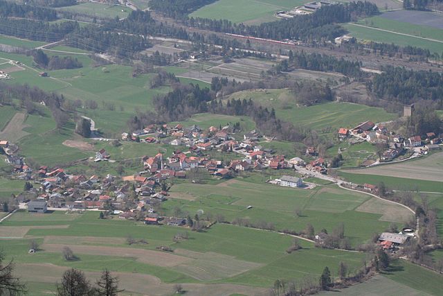
Domleschg (Kreis Domleschg)

 Hiking in Domleschg
Domleschg, located in the canton of Graubünden in Switzerland, is a fantastic region for hiking enthusiasts. The area is known for its beautiful landscapes, charming villages, and a network of well-marked trails that cater to various skill levels. Here are some highlights of hiking in Domleschg:
Scenic Trails
-
Ruinaulta Trail: This trail offers stunning views of the Rhine Gorge, often referred to as the Grand Canyon of Switzerland. The path provides impressive vistas over the gorge and leads through varied terrain.
-
Alp Flix: A hike to Alp Flix introduces you to beautiful alpine meadows and enchanting mountain scenery. This area is particularly beautiful in summer when wildflowers are in bloom.
-
Hiking to the Viamala Gorge: The Viamala Gorge is not only a hiking destination but also a natural wonder, featuring steep rock walls and impressive waterfalls. The trails in this area allow for both moderate and challenging hikes, depending on your preference.
Difficulty Levels
Hiking options in Domleschg range from easy, family-friendly trails to more challenging routes suited for experienced hikers. Maps and trail markers are readily available, making it easy to navigate the area.
Accessibility
The region is accessible by public transport, which can be very convenient for hikers. Many trails begin in or near villages with train stations, allowing you to plan your hikes efficiently.
Nature and Wildlife
Hikers in Domleschg may encounter diverse flora and fauna, including various bird species, butterflies, and occasionally marmots. The region's natural beauty is perfect for photography and enjoying nature.
Useful Tips
- Check Weather Conditions: The weather in the mountains can change rapidly; be sure to check forecasts before setting out.
- Proper Footwear: Invest in good hiking boots with adequate support, as some trails can be rocky and uneven.
- Stay Hydrated: Always carry enough water, especially on longer hikes.
- Trail Maps: Consider obtaining a local hiking map or using a hiking app for navigation.
Whether you're interested in a leisurely day hike or a more challenging trek, Domleschg offers a wonderful hiking experience surrounded by the stunning landscapes of the Swiss Alps.
- Страна:

- Координаты: 46° 43' 0" N, 9° 26' 0" E


- GPS треки (wikiloc): [Ссылка]
- Высота над уровнем моря: 844 м m
- Площадь: 73.94 кв.км
- Википедия английская: wiki(en)
- Википедия национальная: wiki(de)
- Хранилище Wikidata: Wikidata: Q664492
- Катеория в википедии: [Ссылка]
- код Freebase: [/m/0h7nhqj]
- код GeoNames: Альт: [2660998]
- идентификатор HDS: [8066]
Включает регионы:


Альменс
Hiking in Альменс
Almens, a small village in the scenic region of Graubünden in Switzerland, offers beautiful hiking opportunities set against a backdrop of stunning Alpine landscapes. The area is characterized by its picturesque views, lush valleys, and pristine nature, making it a desirable destination for hikers of all skill levels....
- Страна:
- Почтовый код: 7416
- Телефонный код: 081
- Код автомобильного номера: GR
- Координаты: 46° 44' 20" N, 9° 27' 19" E
- GPS треки (wikiloc): [Ссылка]
- Высота над уровнем моря: 787 м m
- Площадь: 8.34 кв.км
- Веб сайт: [Ссылка]


Шаранс
Hiking in Шаранс
Scharans is a picturesque village located in the Graubünden region of Switzerland, known for its stunning landscapes and variety of hiking opportunities. Here are some highlights and tips for hiking in and around Scharans:...
- Страна:
- Почтовый код: 7412
- Телефонный код: 081
- Код автомобильного номера: GR
- Координаты: 46° 43' 5" N, 9° 27' 32" E
- GPS треки (wikiloc): [Ссылка]
- Высота над уровнем моря: 1253 м m
- Площадь: 1459 кв.км
- Население: 807
- Веб сайт: [Ссылка]


Родельс
Hiking in Родельс
Rodels, a picturesque village located in the canton of Graubünden in Switzerland, offers stunning hiking opportunities amidst breathtaking Alpine scenery. Here are some highlights and tips for hiking in Rodels:...
- Страна:
- Почтовый код: 7415
- Телефонный код: 081
- Код автомобильного номера: GR
- Координаты: 46° 43' 59" N, 9° 26' 0" E
- GPS треки (wikiloc): [Ссылка]
- Высота над уровнем моря: 684 м m
- Площадь: 1.68 кв.км
- Веб сайт: [Ссылка]


Пратваль
Hiking in Пратваль
Pratval, located in the scenic valleys of the Himalayas, is an excellent destination for hiking enthusiasts. This area is celebrated for its stunning landscapes, diverse flora and fauna, and a variety of trails suitable for hikers of all experience levels....
- Страна:
- Почтовый код: 7415
- Телефонный код: 081
- Код автомобильного номера: GR
- Координаты: 46° 42' 59" N, 9° 26' 0" E
- GPS треки (wikiloc): [Ссылка]
- Высота над уровнем моря: 687 м m
- Площадь: 0.77 кв.км
- Веб сайт: [Ссылка]


Фюрстенау
Hiking in Фюрстенау
Fürstenau, located in the Swiss canton of Graubünden, is a charming village that offers a range of beautiful hiking opportunities amidst the stunning landscapes of the Swiss Alps. Here’s what you need to know about hiking in this area:...
- Страна:
- Почтовый код: 7414
- Телефонный код: 081
- Код автомобильного номера: GR
- Координаты: 46° 42' 59" N, 9° 26' 0" E
- GPS треки (wikiloc): [Ссылка]
- Высота над уровнем моря: 650 м m
- Площадь: 1.32 кв.км
- Население: 349
- Веб сайт: [Ссылка]

Паспельс
Hiking in Паспельс
Paspels is a charming village located in the canton of Grisons (Graubünden) in Switzerland. Nestled in the picturesque landscape, it serves as a great base for various hiking adventures. Here’s what you can expect when hiking in and around Paspels:...
- Страна:
- Почтовый код: 7417
- Телефонный код: 081
- Код автомобильного номера: GR
- Координаты: 46° 43' 59" N, 9° 26' 0" E
- GPS треки (wikiloc): [Ссылка]
- Высота над уровнем моря: 778 м m
- Площадь: 4.59 кв.км
- Веб сайт: [Ссылка]


Зильс-им-Домлешг
Hiking in Зильс-им-Домлешг
Sils im Domleschg is a picturesque village located in the Graubünden region of Switzerland, known for its stunning natural landscapes and outdoor activities, including hiking. Here are some highlights and considerations for hiking in this area:...
- Страна:
- Почтовый код: 7411
- Телефонный код: 081
- Код автомобильного номера: GR
- Координаты: 46° 42' 0" N, 9° 26' 59" E
- GPS треки (wikiloc): [Ссылка]
- Высота над уровнем моря: 1199 м m
- Площадь: 9.28 кв.км
- Население: 930
- Веб сайт: [Ссылка]


Ротенбруннен
Hiking in Ротенбруннен
Rothenbrunnen is a picturesque village situated in the beautiful Surselva region of Switzerland, known for its stunning landscapes, dramatic cliffs, and diverse hiking trails. Here are some highlights and tips for hiking in and around Rothenbrunnen:...
- Страна:
- Почтовый код: 7405
- Телефонный код: 081
- Код автомобильного номера: GR
- Координаты: 46° 46' 40" N, 9° 25' 16" E
- GPS треки (wikiloc): [Ссылка]
- Высота над уровнем моря: 736 м m
- Площадь: 3.11 кв.км
- Население: 311
- Веб сайт: [Ссылка]


Tomils
Hiking in Tomils
It appears that "Tomils" may be a typographical error or a lesser-known location, as there isn't a widely recognized hiking destination by that name in popular hiking literature or databases. However, if you meant "Teton" (as in the Teton Range) or another well-known hiking area, please clarify, and I can provide more specific information....
- Страна:
- Почтовый код: 7418
- Код автомобильного номера: GR
- Координаты: 46° 45' 0" N, 9° 26' 0" E
- GPS треки (wikiloc): [Ссылка]
- Высота над уровнем моря: 801 м m
- Площадь: 30.56 кв.км
- Веб сайт: [Ссылка]