Dompierre-les-Tilleuls (Dompierre-les-Tilleuls)

- коммуна во Франции
 Hiking in Dompierre-les-Tilleuls
Dompierre-les-Tilleuls is a charming village in the Jura region of France, known for its natural beauty and outdoor activities, including hiking. The area is characterized by rolling hills, forests, and scenic views, making it an excellent destination for hikers of all levels.
Hiking Trails
-
Local Trails: There are various marked trails around Dompierre-les-Tilleuls that allow hikers to explore the picturesque landscapes. Many of these trails wind through forests and past small streams, offering a peaceful hiking experience.
-
Grande Traversée du Jura (GTJ): Part of the Grand Traversée du Jura runs close to Dompierre-les-Tilleuls. This long-distance hiking trail covers a significant portion of the Jura Mountains, offering diverse terrains and stunning views.
-
Short Loop Trails: For those looking for shorter hikes, there are several loop trails that can be completed in a few hours, ideal for families or casual hikers.
Tips for Hiking in Dompierre-les-Tilleuls
- Weather: Be prepared for changing weather conditions. The Jura region can be unpredictable, so check the forecast before your hike and dress accordingly.
- Equipment: Good hiking shoes are essential, as trails can vary from well-maintained paths to more rugged terrain.
- Maps and Markers: While many trails are marked, having a map or a GPS device can be helpful, especially for longer hikes.
- Leave No Trace: As always, practice responsible hiking by respecting nature and following Leave No Trace principles.
Nearby Attractions
- Scenic Viewpoints: Look out for local viewpoints that offer breathtaking panoramas of the Jura landscape.
- Nature Reserves: The area is home to several natural reserves that can be explored alongside hiking, providing an opportunity to appreciate local flora and fauna.
Hiking in Dompierre-les-Tilleuls is a wonderful way to experience the natural beauty of the Jura region. Whether you're looking for a leisurely walk or a more challenging hike, there's something for everyone. Enjoy your adventure!
- Страна:

- Почтовый код: 25560
- Координаты: 46° 52' 18" N, 6° 11' 4" E


- GPS треки (wikiloc): [Ссылка]
- Площадь: 12.94 кв.км
- Население: 263
- Википедия английская: wiki(en)
- Википедия национальная: wiki(fr)
- Хранилище Wikidata: Wikidata: Q845584
- Катеория в википедии: [Ссылка]
- код Freebase: [/m/03mgbxw]
- код Freebase: [/m/03mgbxw]
- код GeoNames: Альт: [6429756]
- код GeoNames: Альт: [6429756]
- номер SIREN: [212502025]
- номер SIREN: [212502025]
- код BNF: [152524286]
- код BNF: [152524286]
- код муниципалитета INSEE: 25202
- код муниципалитета INSEE: 25202
Граничит с регионами:

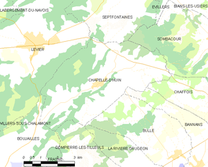
Chapelle-d'Huin
- коммуна во Франции
Hiking in Chapelle-d'Huin
Chapelle-d'Huin is a small commune located in the Doubs department of the Bourgogne-Franche-Comté region in eastern France. While it may not be as well-known as other hiking destinations, it offers beautiful landscapes and opportunities for outdoor activities, including hiking....
- Страна:
- Почтовый код: 25270
- Координаты: 46° 55' 57" N, 6° 10' 1" E
- GPS треки (wikiloc): [Ссылка]
- Площадь: 23.71 кв.км
- Население: 511

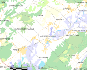
La Rivière-Drugeon
- коммуна во Франции
Hiking in La Rivière-Drugeon
La Rivière-Drugeon, located in the Doubs department of France, offers a beautiful setting for hiking enthusiasts. Nestled in the Jura Mountains, this area is characterized by stunning landscapes, lush forests, and scenic rivers. Here are some details about hiking in La Rivière-Drugeon:...
- Страна:
- Почтовый код: 25560
- Координаты: 46° 52' 3" N, 6° 12' 57" E
- GPS треки (wikiloc): [Ссылка]
- Площадь: 19.16 кв.км
- Население: 892