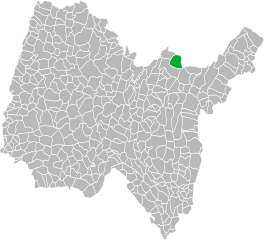
Дортан (Dortan, Dortan)
- коммуна во Франции
 Hiking in Дортан
Dortan, a small commune in the Ain department of France, is surrounded by beautiful landscapes, making it an excellent destination for hiking enthusiasts. Here are some insights about hiking in Dortan and its surroundings:
Scenic Trails
-
Local Nature Trails: There are several marked paths around Dortan that allow hikers to explore the local flora and fauna. These trails vary in difficulty, suitable for both beginners and more experienced hikers.
-
Grésivaudan Valley: Just a short trip from Dortan, you can access trails that lead through the picturesque Grésivaudan Valley, offering stunning views of the surrounding mountains.
Points of Interest
- Church of Saint-Laurent: While hiking, you might encounter historical sites like this church, which can add a cultural aspect to your outdoor adventure.
- Natural Reserves: The nearby natural reserves can also provide opportunities for observing wildlife and understanding local ecosystems.
Best Seasons for Hiking
- Spring and Autumn: These seasons are ideal for hiking in Dortan due to milder weather and less crowded trails. The spring blooms and autumn foliage enhance the beauty of the landscape.
Tips for Hikers
- Prepare: Always check weather conditions before heading out. The terrain can vary, so wearing appropriate footwear is crucial.
- Stay Hydrated: Bring enough water, especially if you plan on hiking for several hours.
- Local Guidance: Consider engaging with local hiking groups or guides who can provide insights into the best trails and hidden gems in the area.
Safety Precautions
- Always carry a map or use a GPS to navigate the trails.
- Inform someone about your hiking plans, especially if you’re heading out alone or to less-traveled paths.
- Be aware of wildlife and take precautions to enjoy your hike safely.
Overall, hiking in Dortan can be a refreshing and rejuvenating experience, whether you're looking for a leisurely stroll or a challenging trek. Be sure to enjoy the stunning landscapes and the peaceful atmosphere of this beautiful part of France!
- Страна:

- Почтовый код: 01590
- Координаты: 46° 19' 8" N, 5° 39' 33" E


- GPS треки (wikiloc): [Ссылка]
- Площадь: 18.11 кв.км
- Население: 1845
- Веб сайт: http://www.dortan.fr
- Википедия русская: wiki(ru)
- Википедия английская: wiki(en)
- Википедия национальная: wiki(fr)
- Хранилище Wikidata: Wikidata: Q271081
- Катеория в википедии: [Ссылка]
- Карты в википедии: [Ссылка]
- код Freebase: [/m/081596]
- код Freebase: [/m/081596]
- код GeoNames: Альт: [3021013]
- код GeoNames: Альт: [3021013]
- номер SIREN: [210101481]
- номер SIREN: [210101481]
- код BNF: [13568445p]
- код BNF: [13568445p]
- код VIAF: Альт: [155115499]
- код VIAF: Альт: [155115499]
- код LCNAF: Альт: [no2003073016]
- код LCNAF: Альт: [no2003073016]
- код муниципалитета INSEE: 01148
- код муниципалитета INSEE: 01148
Граничит с регионами:


Condes
Hiking in Condes
Hiking in the Jura region, particularly around the town of Condes, offers a fantastic opportunity to explore beautiful landscapes characterized by rolling hills, dense forests, and stunning vistas. The Jura Mountains stretch along the France-Switzerland border, featuring various trails suitable for all levels of hikers....
- Страна:
- Почтовый код: 39240
- Координаты: 46° 20' 15" N, 5° 37' 28" E
- GPS треки (wikiloc): [Ссылка]
- Площадь: 2.05 кв.км
- Население: 113

Ойонна
- коммуна во Франции
Hiking in Ойонна
Oyonnax, located in the Auvergne-Rhône-Alpes region of France, is well-known for its beautiful natural landscapes and outdoor recreational opportunities. The area is situated near the Jura Mountains, making it an excellent destination for hiking enthusiasts. Here are some insights and tips for hiking in Oyonnax:...
- Страна:
- Почтовый код: 01100
- Координаты: 46° 15' 20" N, 5° 39' 18" E
- GPS треки (wikiloc): [Ссылка]
- Площадь: 36.37 кв.км
- Население: 22392
- Веб сайт: [Ссылка]

Арбан
- коммуна в департаменте Эн, Франция
Hiking in Арбан
Arbent is a quaint commune located in the Ain department of southeastern France, surrounded by lush landscapes and the natural beauty of the Rhône-Alpes region. While it's not as well-known as some larger hiking destinations, Arbent offers opportunities for hiking enthusiasts to enjoy scenic trails and explore the picturesque countryside....
- Страна:
- Почтовый код: 01100
- Координаты: 46° 17' 44" N, 5° 40' 52" E
- GPS треки (wikiloc): [Ссылка]
- Площадь: 23.49 кв.км
- Население: 3392
- Веб сайт: [Ссылка]


Viry
Hiking in Viry
Viry, located in the Jura region of France, offers stunning landscapes and diverse hiking opportunities. The Jura is characterized by its rolling hills, forests, and picturesque valleys, making it an excellent destination for nature lovers and outdoor enthusiasts....
- Страна:
- Почтовый код: 39360
- Координаты: 46° 18' 0" N, 5° 44' 18" E
- GPS треки (wikiloc): [Ссылка]
- Высота над уровнем моря: 750 м m
- Площадь: 25.4 кв.км
- Население: 948
- Веб сайт: [Ссылка]
Самонья
- коммуна во Франции
Hiking in Самонья
It seems like there may be a misunderstanding in the name "Samognat," as it does not correspond to a well-known hiking destination or region. If you meant a different location or if Samognat is a lesser-known local area, I would recommend checking local hiking resources or tourism websites for that particular region....
- Страна:
- Почтовый код: 01580
- Координаты: 46° 15' 28" N, 5° 34' 34" E
- GPS треки (wikiloc): [Ссылка]
- Площадь: 14.01 кв.км
- Население: 660
- Веб сайт: [Ссылка]


Coisia
- коммуна во Франции
Hiking in Coisia
It seems there might be a typo in your request, as "Coisia" is not a recognized hiking destination. If you meant "Corsica," which is a beautiful island in the Mediterranean Sea, I can provide some information on hiking there....
- Страна:
- Почтовый код: 39240
- Координаты: 46° 18' 20" N, 5° 34' 51" E
- GPS треки (wikiloc): [Ссылка]
- Площадь: 6.73 кв.км
- Население: 193


Chancia
- коммуна во Франции
Hiking in Chancia
Chancia might not be widely recognized as a popular hiking destination, but if it were a fictional or lesser-known location, we could imagine a few things about hiking there. Here's a general guide based on common features of hiking in similar scenic areas:...
- Страна:
- Почтовый код: 01590
- Координаты: 46° 20' 46" N, 5° 38' 33" E
- GPS треки (wikiloc): [Ссылка]
- Площадь: 2.41 кв.км
- Население: 218
- Веб сайт: [Ссылка]


Lavancia-Epercy
- коммуна во Франции
Hiking in Lavancia-Epercy
Lavancia-Épercy is a beautiful village located in the Jura Mountains in eastern France. It offers scenic hiking opportunities amidst lush greenery, rolling hills, and stunning views. Here are some highlights for hiking in the area:...
- Страна:
- Почтовый код: 01590
- Координаты: 46° 19' 51" N, 5° 40' 46" E
- GPS треки (wikiloc): [Ссылка]
- Площадь: 10.56 кв.км
- Население: 665
- Веб сайт: [Ссылка]