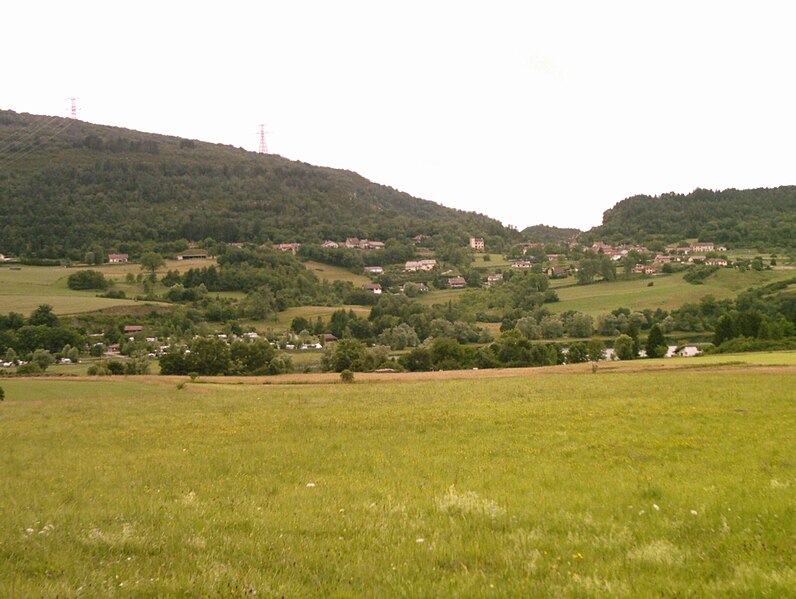
Самонья (Samognat, Samognat)
- коммуна во Франции
 Hiking in Самонья
It seems like there may be a misunderstanding in the name "Samognat," as it does not correspond to a well-known hiking destination or region. If you meant a different location or if Samognat is a lesser-known local area, I would recommend checking local hiking resources or tourism websites for that particular region.
If you're looking for general advice on hiking or information about a specific popular hiking destination, feel free to provide more context or the correct name, and I can assist you with details on trail recommendations, difficulty levels, preparation tips, and safety guidelines!
- Страна:

- Почтовый код: 01580
- Координаты: 46° 15' 28" N, 5° 34' 34" E


- GPS треки (wikiloc): [Ссылка]
- Площадь: 14.01 кв.км
- Население: 660
- Веб сайт: http://samognat.free.fr
- Википедия русская: wiki(ru)
- Википедия английская: wiki(en)
- Википедия национальная: wiki(fr)
- Хранилище Wikidata: Wikidata: Q326796
- Катеория в википедии: [Ссылка]
- Карты в википедии: [Ссылка]
- код Freebase: [/m/03m594_]
- код Freebase: [/m/03m594_]
- код GeoNames: Альт: [2976283]
- код GeoNames: Альт: [2976283]
- номер SIREN: [210103925]
- номер SIREN: [210103925]
- код муниципалитета INSEE: 01392
- код муниципалитета INSEE: 01392
Граничит с регионами:

Ойонна
- коммуна во Франции
Hiking in Ойонна
Oyonnax, located in the Auvergne-Rhône-Alpes region of France, is well-known for its beautiful natural landscapes and outdoor recreational opportunities. The area is situated near the Jura Mountains, making it an excellent destination for hiking enthusiasts. Here are some insights and tips for hiking in Oyonnax:...
- Страна:
- Почтовый код: 01100
- Координаты: 46° 15' 20" N, 5° 39' 18" E
- GPS треки (wikiloc): [Ссылка]
- Площадь: 36.37 кв.км
- Население: 22392
- Веб сайт: [Ссылка]

Изернор
- коммуна во Франции
Hiking in Изернор
Izernore, located in the Ain department of the Auvergne-Rhône-Alpes region in eastern France, offers a beautiful environment for hiking enthusiasts. The area is characterized by its stunning natural landscapes, including rolling hills, forests, and views of the surrounding mountains. Here are some key points for hiking in Izernore:...
- Страна:
- Почтовый код: 01580
- Координаты: 46° 13' 14" N, 5° 33' 14" E
- GPS треки (wikiloc): [Ссылка]
- Площадь: 20.86 кв.км
- Население: 2275
- Веб сайт: [Ссылка]

Дортан
- коммуна во Франции
Hiking in Дортан
Dortan, a small commune in the Ain department of France, is surrounded by beautiful landscapes, making it an excellent destination for hiking enthusiasts. Here are some insights about hiking in Dortan and its surroundings:...
- Страна:
- Почтовый код: 01590
- Координаты: 46° 19' 8" N, 5° 39' 33" E
- GPS треки (wikiloc): [Ссылка]
- Площадь: 18.11 кв.км
- Население: 1845
- Веб сайт: [Ссылка]
Матафлон-Гранж
- коммуна во Франции
Hiking in Матафлон-Гранж
Matafelon-Granges is a commune in the Ain department in the Auvergne-Rhône-Alpes region of France. Nestled in the beautiful countryside, it offers various hiking opportunities for nature enthusiasts, with picturesque landscapes and charming local scenery....
- Страна:
- Почтовый код: 01580
- Координаты: 46° 15' 40" N, 5° 33' 14" E
- GPS треки (wikiloc): [Ссылка]
- Площадь: 21.54 кв.км
- Население: 647

Жеоврессе
- коммуна во Франции
Hiking in Жеоврессе
Géovreisset is a charming commune located in the Jura department of France, known for its natural beauty and outdoor activities. Hiking in this area offers a variety of scenic trails that cater to different skill levels, ranging from easy walks to more challenging hikes....
- Страна:
- Почтовый код: 01100
- Координаты: 46° 15' 22" N, 5° 37' 4" E
- GPS треки (wikiloc): [Ссылка]
- Площадь: 3.31 кв.км
- Население: 909
- Веб сайт: [Ссылка]


Coisia
- коммуна во Франции
Hiking in Coisia
It seems there might be a typo in your request, as "Coisia" is not a recognized hiking destination. If you meant "Corsica," which is a beautiful island in the Mediterranean Sea, I can provide some information on hiking there....
- Страна:
- Почтовый код: 39240
- Координаты: 46° 18' 20" N, 5° 34' 51" E
- GPS треки (wikiloc): [Ссылка]
- Площадь: 6.73 кв.км
- Население: 193