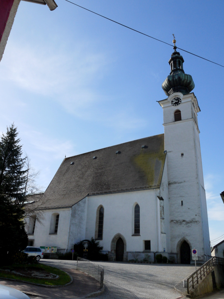
Эбершванг (Eberschwang, Eberschwang)
 Hiking in Эбершванг
Eberschwang, a charming municipality in the Upper Austria region, offers some picturesque hiking opportunities. The area features scenic landscapes, lush forests, and rolling hills that make it an attractive destination for outdoor enthusiasts. Here are some highlights of hiking in and around Eberschwang:
Hiking Trails
-
Local Trails: You can find several well-marked trails suitable for various skill levels. These trails often take you through wooded areas and past fields, offering a peaceful retreat into nature.
-
Natur- und Landschaftsschutzgebiete: Explore areas designated for nature and landscape protection, ensuring that you can enjoy unspoiled environments while hiking.
-
Themed Trails: Some trails may focus on specific themes, such as local flora and fauna, or cultural aspects of the region, adding educational value to your hike.
Points of Interest
- Wildlife Observation: Keep an eye out for local wildlife, including various bird species and other forest animals.
- Scenic Views: Higher elevations in the surrounding regions provide breathtaking views of the landscape, especially in the morning or during sunset.
- Cultural Sites: Along the trails, you might encounter historical landmarks and local cultural points of interest that add to the hiking experience.
Tips for Hiking in Eberschwang
- Weather Preparedness: Always check the weather before heading out and dress accordingly. The weather can change rapidly in mountainous or forested areas.
- Footwear: Wear appropriate hiking shoes or boots for comfort and safety, especially if you're tackling uneven terrain.
- Trail Maps: Bring a map or download a hiking app to ensure you stay on track.
- Hydration and Snacks: Carry enough water and some light snacks to keep your energy levels up during your hike.
Best Times to Hike
- Spring and Fall: These seasons offer mild temperatures and beautiful scenery with blooming flowers in spring and colorful foliage in fall.
- Summer: While great for long days and warm weather, be cautious of heat and carry enough water.
Conclusion
Hiking in Eberschwang provides a delightful way to connect with nature while exploring the beautiful Upper Austria region. With a variety of trails to choose from and the tranquil surroundings, it can be a fulfilling experience for hikers of all levels.
- Страна:

- Почтовый код: 4906
- Телефонный код: 07753
- Код автомобильного номера: RI
- Координаты: 48° 9' 25" N, 13° 33' 37" E


- GPS треки (wikiloc): [Ссылка]
- Высота над уровнем моря: 529 м m
- Площадь: 40.4 кв.км
- Население: 3351
- Веб сайт: http://www.eberschwang.at/
- Википедия русская: wiki(ru)
- Википедия английская: wiki(en)
- Википедия национальная: wiki(de)
- Хранилище Wikidata: Wikidata: Q684966
- Галерея изображений в википедии: [Ссылка]
- Катеория в википедии: [Ссылка]
- код Freebase: [/m/03gv86t]
- код GeoNames: Альт: [7873179]
- код VIAF: Альт: [246122321]
- код GND: Альт: [4104298-0]
- код австрийского муниципалитета: [41204]
Граничит с регионами:


Ампфльванг-им-Хаусрукквальд
- политическая община в Австрии
Hiking in Ампфльванг-им-Хаусрукквальд
Ampflwang im Hausruckwald is a beautiful destination for hiking enthusiasts, situated in the Upper Austria region of Austria. The area is known for its lush forests, rolling hills, and scenic landscapes that are ideal for outdoor activities, including hiking....
- Страна:
- Почтовый код: 4843
- Телефонный код: 07675
- Код автомобильного номера: VB
- Координаты: 48° 5' 34" N, 13° 34' 0" E
- GPS треки (wikiloc): [Ссылка]
- Высота над уровнем моря: 566 м m
- Площадь: 21 кв.км
- Население: 3376
- Веб сайт: [Ссылка]


Отнанг-на-Хаусруке
Hiking in Отнанг-на-Хаусруке
Ottnang am Hausruck, located in the Upper Austria region, is a picturesque village surrounded by beautiful natural landscapes, making it a great destination for hiking enthusiasts. The Hausruckwald region, where Ottnang is situated, features rolling hills, forests, and charming meadows that provide a variety of trails for different skill levels....
- Страна:
- Почтовый код: 4901
- Телефонный код: 07676
- Код автомобильного номера: VB
- Координаты: 48° 5' 44" N, 13° 39' 41" E
- GPS треки (wikiloc): [Ссылка]
- Высота над уровнем моря: 554 м m
- Площадь: 30 кв.км
- Население: 3990
- Веб сайт: [Ссылка]
Франкенбург-на-Хаусруке
Hiking in Франкенбург-на-Хаусруке
Frankenburg am Hausruck, located in Austria's Upper Austria region, is an excellent destination for hiking enthusiasts. The area is characterized by stunning natural landscapes, rolling hills, and picturesque views of the Hausruck mountain range. Here are some key highlights and tips for hiking in this region:...
- Страна:
- Почтовый код: 4873
- Телефонный код: 07683
- Код автомобильного номера: VB
- Координаты: 48° 4' 6" N, 13° 29' 31" E
- GPS треки (wikiloc): [Ссылка]
- Высота над уровнем моря: 519 м m
- Площадь: 49 кв.км
- Население: 4842
- Веб сайт: [Ссылка]

Хаг-ам-Хаусрукк
Hiking in Хаг-ам-Хаусрукк
Haag am Hausruck is a charming town located in Upper Austria, surrounded by beautiful natural landscapes that are perfect for hiking enthusiasts. The area features a mix of rolling hills, forests, and meadows, making it ideal for outdoor activities....
- Страна:
- Почтовый код: 4680
- Телефонный код: 07732
- Код автомобильного номера: GR
- Координаты: 48° 11' 8" N, 13° 38' 32" E
- GPS треки (wikiloc): [Ссылка]
- Высота над уровнем моря: 505 м m
- Площадь: 17.01 кв.км
- Население: 2176
- Веб сайт: [Ссылка]

Гебольтскирхен
Hiking in Гебольтскирхен
Geboltskirchen is a picturesque village located in Austria's Upper Austria region, surrounded by beautiful landscapes and rolling hills, making it a great destination for hiking enthusiasts. While specific trails may not always be detailed in common hiking guides, the area typically offers several scenic routes for hikers of various skill levels....
- Страна:
- Почтовый код: 4682
- Телефонный код: 07732
- Код автомобильного номера: GR
- Координаты: 48° 9' 14" N, 13° 38' 5" E
- GPS треки (wikiloc): [Ссылка]
- Высота над уровнем моря: 555 м m
- Площадь: 17.3 кв.км
- Население: 1421
- Веб сайт: [Ссылка]

Прамет
Hiking in Прамет
Pramet, a picturesque region in Austria, offers a variety of hiking opportunities for outdoor enthusiasts. Nestled within the stunning landscapes of the Salzkammergut region, it boasts scenic trails that cater to different skill levels. Here are some key highlights to consider when hiking in Pramet:...
- Страна:
- Почтовый код: 4925
- Телефонный код: 0 77 54
- Код автомобильного номера: RI
- Координаты: 48° 8' 32" N, 13° 29' 12" E
- GPS треки (wikiloc): [Ссылка]
- Высота над уровнем моря: 512 м m
- Площадь: 13.95 кв.км
- Население: 1030
- Веб сайт: [Ссылка]
Хоэнцелль
Hiking in Хоэнцелль
Hohenzell is a small village located in the state of Bavaria, Germany, known for its picturesque landscapes and access to beautiful natural areas. Hiking in and around Hohenzell offers a variety of trails that cater to different skill levels and preferences....
- Страна:
- Почтовый код: 4921
- Телефонный код: 07752
- Код автомобильного номера: RI
- Координаты: 48° 11' 39" N, 13° 32' 40" E
- GPS треки (wikiloc): [Ссылка]
- Высота над уровнем моря: 478 м m
- Площадь: 22.53 кв.км
- Население: 2246
- Веб сайт: [Ссылка]

Паттигхам
Hiking in Паттигхам
Pattigham is a charming village located in Austria, surrounded by beautiful natural landscapes that offer excellent opportunities for hiking enthusiasts. The region is characterized by picturesque meadows, rolling hills, and stunning views of the nearby mountains, making it an attractive destination for outdoor activities....
- Страна:
- Почтовый код: 4910
- Телефонный код: 07754
- Код автомобильного номера: RI
- Координаты: 48° 9' 19" N, 13° 29' 5" E
- GPS треки (wikiloc): [Ссылка]
- Высота над уровнем моря: 512 м m
- Площадь: 11.22 кв.км
- Население: 928
- Веб сайт: [Ссылка]

Санкт-Мариенкирхен-на-Хаусруке
Hiking in Санкт-Мариенкирхен-на-Хаусруке
Sankt Marienkirchen am Hausruck is a charming area located in Austria, known for its beautiful natural landscapes and outdoor activities, including hiking. Here's a guide to hiking in and around this picturesque region:...
- Страна:
- Почтовый код: 4926
- Телефонный код: 07753
- Код автомобильного номера: RI
- Координаты: 48° 10' 55" N, 13° 34' 50" E
- GPS треки (wikiloc): [Ссылка]
- Высота над уровнем моря: 523 м m
- Площадь: 11 кв.км
- Население: 888
- Веб сайт: [Ссылка]