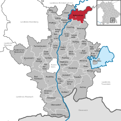
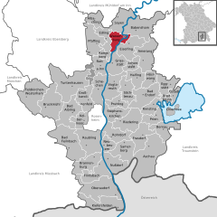
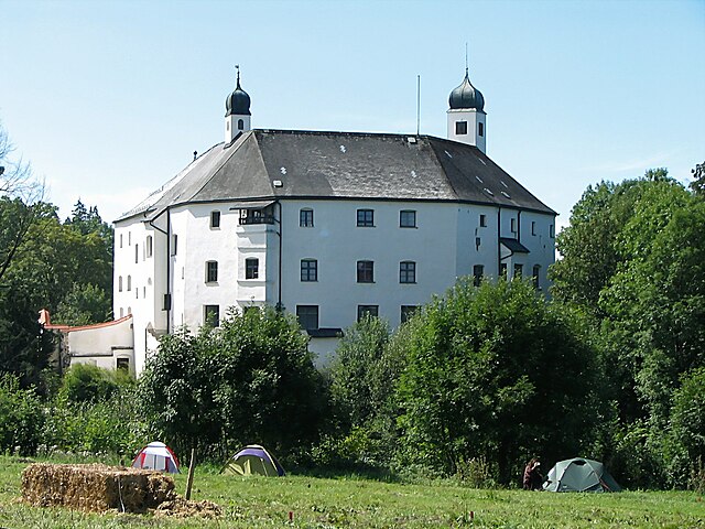
Айзельфинг (Eiselfing, Eiselfing)

 Hiking in Айзельфинг
Eiselfing is a charming municipality located in Bavaria, Germany, known for its picturesque landscapes and proximity to several hiking opportunities in the surrounding areas. While Eiselfing itself might not be a major hiking destination with extensive trails, it serves as an excellent base for exploring the nearby regions, including the foothills of the Alps.
Hiking Opportunities Near Eiselfing:
-
Alpenvorland (Alpine Foreland): This area offers a variety of trails suitable for all skill levels. The gentle rolling hills and beautiful meadows are perfect for leisurely hikes.
-
Chiemgau Alps: A short drive from Eiselfing, the Chiemgau region provides access to stunning mountain trails. Popular destinations include places like the Priener Hütte and Kampenwand, which offer breathtaking views of the Alps.
-
Lake Chiemsee: Known as the "Bavarian Sea," Lake Chiemsee has scenic trails along its shores. You can enjoy walks or bike rides with the backdrop of the mountains, and visit the Herrenchiemsee Palace on Herreninsel island.
-
Nature Reserves: Explore nearby nature reserves like the Simssee or the Waginger See, which have marked trails for enjoying the diverse local flora and fauna.
Tips for Hiking in the Area:
- Local Maps: Before heading out, check for local hiking maps or apps that can guide you on the best trails and their difficulty levels.
- Seasonal Considerations: Be mindful of the weather and trail conditions, especially in winter when snow can affect accessibility.
- Safety: As always, ensure you have the right gear, sufficient water, snacks, and first aid supplies. Inform someone of your plans as a safety precaution.
Conclusion:
Eiselfing may not be a renowned hiking hub, but it offers easy access to some of Bavaria's most beautiful outdoor experiences. Enjoy the tranquility and stunning scenery this lovely region has to offer!
- Страна:

- Почтовый код: 83549
- Телефонный код: 08071
- Код автомобильного номера: RO
- Координаты: 48° 3' 0" N, 12° 14' 0" E


- GPS треки (wikiloc): [Ссылка]
- Высота над уровнем моря: 470 м m
- Площадь: 34.89 кв.км
- Население: 2429
- Веб сайт: http://www.eiselfing.eu/
- Википедия русская: wiki(ru)
- Википедия английская: wiki(en)
- Википедия национальная: wiki(de)
- Хранилище Wikidata: Wikidata: Q545191
- Катеория в википедии: [Ссылка]
- код Freebase: [/m/02q7cx3]
- код GeoNames: Альт: [2890590]
- код VIAF: Альт: [246958829]
- ID отношения в OpenStreetMap: [2186919]
- код GND: Альт: [4566016-5]
- WOEID: [22528041]
- Bavarikon ID: [ODB_A00001304]
- код Trismegistos: [28329]
- идентификатор муниципалитетов в Германии: 09187126
Граничит с регионами:

Бабенсхам
Hiking in Бабенсхам
Babensham is a village in the scenic surroundings of the North Yorkshire Moors in England, making it a lovely spot for hiking enthusiasts. The region typically offers beautiful walking trails, including routes that traverse through woodlands, along river valleys, and up to hilltops with breathtaking views....
- Страна:
- Почтовый код: 83547
- Телефонный код: 08071
- Код автомобильного номера: RO
- Координаты: 48° 5' 0" N, 12° 16' 0" E
- GPS треки (wikiloc): [Ссылка]
- Высота над уровнем моря: 488 м m
- Площадь: 54.31 кв.км
- Население: 2349
- Веб сайт: [Ссылка]

Вассербург-на-Инне
Hiking in Вассербург-на-Инне
Wasserburg am Inn is a picturesque town in Bavaria, Germany, located on a peninsula surrounded by the Inn River. The region offers stunning landscapes and a rich history, making it a delightful location for hiking enthusiasts. Here are some highlights about hiking in and around Wasserburg am Inn:...
- Страна:
- Почтовый код: 83512
- Телефонный код: 08071
- Код автомобильного номера: AIB; WS; RO
- Координаты: 48° 3' 39" N, 12° 14' 0" E
- GPS треки (wikiloc): [Ссылка]
- Высота над уровнем моря: 427 м m
- Площадь: 18.80 кв.км
- Население: 12759
- Веб сайт: [Ссылка]

Амеранг
Hiking in Амеранг
Amerang, located in Bavaria, Germany, is a picturesque area that offers various hiking opportunities. The region is characterized by its beautiful landscapes, rolling hills, and lush green forests, making it an ideal spot for nature lovers and outdoor enthusiasts....
- Страна:
- Почтовый код: 83123
- Телефонный код: 08075
- Код автомобильного номера: RO
- Координаты: 47° 59' 30" N, 12° 18' 34" E
- GPS треки (wikiloc): [Ссылка]
- Высота над уровнем моря: 537 м m
- Площадь: 39.80 кв.км
- Население: 2727
- Веб сайт: [Ссылка]
Шонштетт
Hiking in Шонштетт
Schönstett is a small town in Bavaria, Germany, known for its picturesque landscapes, lush greenery, and proximity to various hiking trails. Here are some key points to consider if you're planning to hike in and around Schönstett:...
- Страна:
- Почтовый код: 83137
- Телефонный код: 08055
- Код автомобильного номера: RO
- Координаты: 47° 59' 0" N, 12° 15' 0" E
- GPS треки (wikiloc): [Ссылка]
- Высота над уровнем моря: 492 м m
- Площадь: 13.6 кв.км
- Население: 1006
- Веб сайт: [Ссылка]


Грисштетт
Hiking in Грисштетт
Griesstätt, a small village located in Bavaria, Germany, near the scenic Chiemsee lake, offers a variety of hiking opportunities. The region is characterized by its picturesque landscapes, rolling hills, and views of the Alps, making it an attractive destination for hikers of all levels....
- Страна:
- Почтовый код: 83556
- Телефонный код: 08039
- Код автомобильного номера: RO
- Координаты: 48° 0' 0" N, 12° 11' 0" E
- GPS треки (wikiloc): [Ссылка]
- Высота над уровнем моря: 492 м m
- Площадь: 29.52 кв.км
- Население: 1902
- Веб сайт: [Ссылка]